Kolhapur
Kolhapur, (![]() Kolhapur.ogg ) is a city in the Indian state of Maharashtra.[4] It is the district headquarters of Kolhapur district. Prior to Indian Independence, Kolhapur was a nineteen gun salute, princely state known as Kolhapur State and was ruled by the Bhosale Chhatrapati (Bhosale royal clan) of the Maratha Empire.
Kolhapur.ogg ) is a city in the Indian state of Maharashtra.[4] It is the district headquarters of Kolhapur district. Prior to Indian Independence, Kolhapur was a nineteen gun salute, princely state known as Kolhapur State and was ruled by the Bhosale Chhatrapati (Bhosale royal clan) of the Maratha Empire.
Kolhapur | |
|---|---|
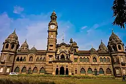 New Palace at Kolhapur | |
 Kolhapur Location in Maharashtra, India  Kolhapur Kolhapur (India) | |
| Coordinates: 16°41′30″N 74°14′00″E | |
| Country | |
| State | Maharashtra |
| District | Kolhapur |
| Founded by | Shilahara |
| Government | |
| • Type | Municipal Corporation |
| • Body | KMC |
| • Mayor | Mrs Nilofer Ajarekar |
| Area | |
| • City Corporation | 66.82 km2 (25.80 sq mi) |
| Elevation | 545.6 m (1,790.0 ft) |
| Population (2011)[2] | |
| • City Corporation | 549,236 |
| • Rank | India : 80th Maharashtra : 11th |
| • Density | 8,200/km2 (21,000/sq mi) |
| • Metro | 561,837 |
| Demonym(s) | Kolhapurkar, Kolhapuri |
| Official | |
| • Language | Marathi |
| Time zone | UTC+5:30 (IST) |
| PIN | 416001-15 |
| Telephone code | 0231 |
| Vehicle registration | MH-09 |
| Website | Official site |
History
Scriptural records
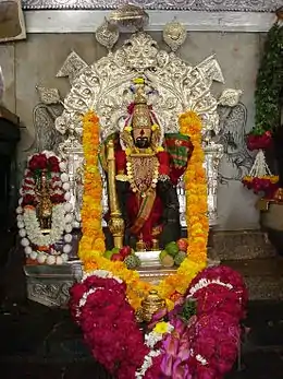
Kolhapur is mentioned in the Devi Gita, the final and key chapter of the Devi-Bhagavata Purana, a special text of Shaktism. Kolhapur is noted as a place of Kollamma worship. In the text, Devi says,
- "O King of Mountains! Still I am now telling something out of My affection to My Bhaktas. Hear. There is a great place of pilgrimage named Kollapura in the southern country. Here the Devi Ambabai always dwells."[5]
- The famous Jyotiba temple is also located in the Kolhapur.
Kolhapur is famous in west Maharashtra for religious accounts.
Medieval era
The Shilahara family at Kolhapur was the latest of the three and was founded about the time of the downfall of the Rashtrakuta Empire. They ruled over southern Maharashtra; the modern districts of Satara, Kolhapur and Belagav (Karnataka) . Their family deity was the goddess Ambabai, whose blessing they claimed to have secured in their copperplate grants (Mahalakshmi-labdha-vara-prasada). Like their relatives of the northern branch of Konkan, the Shilaharas of Kolhapur claimed to be of the lineage of the Vidyadhara Jimutavahana,a Jain scholar. They carried the banner of golden Garuda. One of the many titles used by the Shilaharas was Tagarapuravaradhisvara, supreme sovereign ruler of Tagara.
The first capital of the Shilaharas was probably at Karad during the reign of Jatiga-II as known from their copper plate grant of Miraj and 'Vikramankadevacharita' of Bilhana. Hence sometimes they are referred as 'Shilaharas of Karad'. Later, although the capital was shifted to Kolhapur, some of their grants mention Valavada, and the hill fort of Pranalaka or Padmanala,(Panhala) as the places of royal residence. Even though the capital was shifted to Kolhapur, Karhad retained its significance during the Shilahara period. This branch rose to power the latter part of the Rashtrakuta rule and so, unlike the kings of the other two branches, those of this branch do not mention the genealogy of the Rashtrakutas even in their early grants. Later they acknowledged the suzerainty of the later Chalukya for some time. They had used Kannada as the official language as can seen from their inscriptions. This branch continued to hold the Southern Maharashtra from circa 940 to 1220.
From 940 to 1212 CE, Kolhapur was the centre of power of the Shilahara dynasty.[6] An inscription at Teradal states that the king Gonka (1020 - 1050 CE) was bitten by a snake then healed by a Jain monk. Gonka then built a temple to Lord Neminath, the twenty-second Jain tirthankara (enlightened being). Jain temples in and around Kolhapur from this era are called Gonka-Jinalya, after the king.
Around 1055 CE, during the reign of Bhoja I (Shilahara dynasty), a dynamic Acharya (spiritual guide) named Maghanandi (Kolapuriya), founded a religious institute at the Rupanarayana Jain temple (basadi). Maghanandi is also known as Siddhanta-chakravarti, that is, the great master of the scriptures. Kings and nobles of the Shilahara dynasty such as Gandaraditya I who succeeded Bhoja I, were disciples of Maghanandi.
Kolhapur was the site of intense confrontation between rulers of the Western Chalukya Empire and the rulers of the Chola empire, Rajadhiraja Chola and his younger brother Rajendra Chola II. In 1052 CE, following the Battle of Koppam, the victor, Rajendra Chola II, marched on to Kolhapur and there he erected a jayastambha (victory pillar).[7]
Between 1109 and 1178 CE, the Kopeshwar temple to Lord Shiva was built by the Shilahara kings, Gandaraditya Chola, Vijayaditya and Bhoja II in Khidrapur, Kolhapur.
Kolhapur State
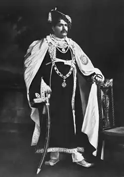
The state of Kolhapur was established by Tarabai in 1707 because of the succession dispute over the Maratha kingship. The Maratha throne was then governed by descendants of Tarabai. One of the prominent Kings was Rajarshi Shahu Maharaj (Shahu of Kolhapur). In his reign he promoted cost free education to people of all castes and fought against untouchability. The state was annexed by the British in the 19th century. After India's independence in 1947, the Maharaja of Kolhapur acceded to the Dominion of India on 14 August 1947 and merged with Bombay State on 1 March 1949. Kolhapur is sometimes found spelled as Colapore.[8] Often, Kolhapur is also referred as Dakshin Kashi (Dakshin in Marathi/Hindi/Sanskrit means South, Kashi is a holy city in Northern India) due to its rich religious history.
Origin of name
According to the myth, Kolhapur (कोल्हापूर) was named after the demon Kolhasur. There are different stories behind the reason he was killed by the Goddess, but it was his dying wish to name the place where he was killed after him. Thus, Kolhapur comes from the name Kolhasur and, Pur which means a city.[9] Shilahara ancient stone inscriptions mentions kolhapur as 'Kalapuri' or 'Kshullakpur' (Kshullaka- first stage of Jain monkhood).
Geography
Kolhapur is an inland city located in south-west Maharashtra state, 373 km (232 mi) south of Mumbai & 228 km (142 mi) south of Pune, 615 km (382 mi) north-west of Bengaluru and 530 km (330 mi) west of Hyderabad. Within Maharashtra, Kolhapur's nearest cities and towns are Ichalkaranji 27 km (17 mi), Kodoli 35 km (22 mi), Peth Vadgaon 15 km (9.3 mi) Kagal 21 km (13 mi), Kasaba Walva 30 km (19 mi) Sangli 19 km (12 mi), Satara 115 km (71 mi). Kolhapur has an elevation of 569 m (1,867 ft). It lies in the Sahayadri mountains in the Western Ghats.[10] Chandgad is the coolest place in the Kolhapur district. Tambraparni river dam is the spectacular place near Umgaon village. Also nearby dams are Radhanagari and kalambawadi. Panhala 21.5 km (13.4 mi) and Jyotiba Temple 21.7 km (13.5 mi) are close by.
Climate
Kolhapur's climate is a blend of coastal and inland elements common to Maharashtra. The temperature has a relatively narrow range between 10 to 35 °C (50 to 95 °F). Summer in Kolhapur is comparatively cooler, but much more humid, than neighbouring inland cities. Maximum temperatures rarely exceed 40 °C (104 °F) and typically range between 33 and 3,540 °C (91 and 6,404 °F). Lows during this season are around 24 to 26 °C (75 to 79 °F).
The city receives abundant rainfall from June to September due to its proximity to the Western Ghats. The heavy rains often lead to severe flooding during these months. 2005, 2006 and 2019 were years when floods occurred. Temperatures are low in the rainy season and range between 19 and 30 °C (66 and 86 °F).
Kolhapur experiences winter from November to February. The winter temperatures are warmer than other cities in Maharashtra such as Pune and Nashik. Lows range from 9 to 16 °C (48 to 61 °F) while highs are in the range of 24 to 32 °C (75 to 90 °F) due to its high elevation and being adjacent to the Western Ghats. Humidity is low in this season making the weather much more pleasant.
| Climate data for Kolhapur (1981–2010, extremes 1946–2012) | |||||||||||||
|---|---|---|---|---|---|---|---|---|---|---|---|---|---|
| Month | Jan | Feb | Mar | Apr | May | Jun | Jul | Aug | Sep | Oct | Nov | Dec | Year |
| Record high °C (°F) | 35.4 (95.7) |
37.8 (100.0) |
40.4 (104.7) |
41.7 (107.1) |
42.3 (108.1) |
40.0 (104.0) |
33.3 (91.9) |
32.2 (90.0) |
35.7 (96.3) |
36.5 (97.7) |
34.6 (94.3) |
35.0 (95.0) |
42.3 (108.1) |
| Average high °C (°F) | 30.5 (86.9) |
32.9 (91.2) |
35.6 (96.1) |
39.9 (103.8) |
35.5 (95.9) |
30.0 (86.0) |
26.9 (80.4) |
26.6 (79.9) |
28.8 (83.8) |
30.9 (87.6) |
30.6 (87.1) |
29.8 (85.6) |
31.2 (88.2) |
| Average low °C (°F) | 15.2 (59.4) |
16.6 (61.9) |
19.6 (67.3) |
21.7 (71.1) |
22.5 (72.5) |
22.1 (71.8) |
21.4 (70.5) |
21.0 (69.8) |
20.8 (69.4) |
20.3 (68.5) |
17.9 (64.2) |
15.5 (59.9) |
19.5 (67.1) |
| Record low °C (°F) | 8.7 (47.7) |
8.8 (47.8) |
12.4 (54.3) |
13.8 (56.8) |
16.2 (61.2) |
17.6 (63.7) |
18.1 (64.6) |
18.0 (64.4) |
16.4 (61.5) |
13.9 (57.0) |
9.6 (49.3) |
8.6 (47.5) |
8.6 (47.5) |
| Average rainfall mm (inches) | 1.1 (0.04) |
0.4 (0.02) |
5.8 (0.23) |
18.5 (0.73) |
38.8 (1.53) |
213.5 (8.41) |
280.0 (11.02) |
208.6 (8.21) |
124.3 (4.89) |
113.4 (4.46) |
24.6 (0.97) |
5.4 (0.21) |
1,034.4 (40.72) |
| Average rainy days | 0.2 | 0.1 | 0.3 | 1.4 | 2.8 | 11.6 | 17.1 | 16.8 | 8.5 | 6.0 | 1.6 | 0.4 | 66.9 |
| Average relative humidity (%) (at 17:30 IST) | 38 | 31 | 31 | 40 | 51 | 74 | 83 | 84 | 76 | 61 | 48 | 43 | 55 |
| Source 1: India Meteorological Department[11][12] | |||||||||||||
| Source 2: Government of Maharashtra[13] | |||||||||||||
Hydrology
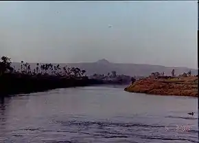
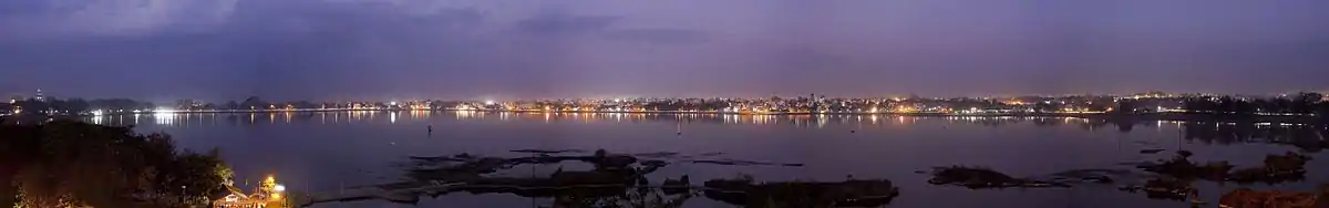
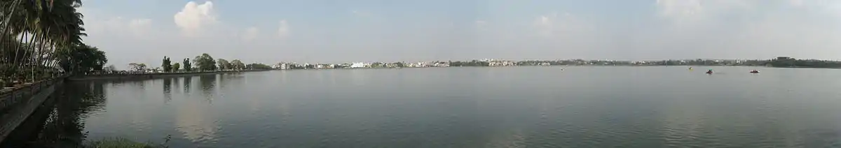
The Panchaganga river originates in the Western Ghats. It has five tributaries which supply the city and surrounds: the Bhogavati, Tulsi, Kumbhi, Kasari and the Dhamani rivers. Kolhapur has a number of lakes. The Rankala lake was once a stone quarry
The Kalamba lake was built in 1873. These two lakes provide the city with domestic potable water.
Governance
Kolhapur is governed by the Kolhapur Municipal Corporation (KMC). The city is divided into five wards, named with the letters A to E. The corporation provides services such as sewrage treatment and free cremation for residents and has made a number of improvements, for example, the Kolhapur Road Project;[14] the Anti-Encroachment Drive to stop unwanted building activity encroaching on the city's open space; and the Suvarna Jayanti Nagarotthan Project for improvement of roads and storm water management.[15] However KMC faces problems like expansion of civic limits of Kolhapur city which are not increased from 1972, due to the same this city fails to avail the benefits of various government schemes.
On 16 August 2017, Kolhapur Municipal and Regional Development Authority has been established. This authority is operating in Kolhapur city and 42 villages around Kolhapur city. This authority formed for the balanced development of Kolhapur city and the surrounding 42 villages.[16]
Demographics
As per the reports of 2011 Census of India, population of Kolhapur city is 549,236 and population of 'Kolhapur Municipal and Regional Development Authority' is 561,837.[17]
Religion
- Hindu – 460,774 (83.89%)
- Muslims – 59,760 (10.88%)
- Jain – 18,420 (3.35%)
- Christian – 5,251 (0.96%)
- Buddhist – 2,929 (0.53%)
- Not Stated – 1,289 (0.23%)
- Sikh – 581 (0.11%)
- Others – 232 (0.04%)
According to 2011 India census, Hinduism is majority religion in Kolhapur city with 83.89% followers. Islam is second most popular religion in city of Kolhapur with approximately 10.88% following it. In Kolhapur city, Jainism by 3.35%, Christianity is followed by 0.96%, Buddhism by 0.53%, and Sikhism by 0.11%. Around 0.04% stated 'Other Religion', approximately 0.23% stated 'No Particular Religion'.[18]
Economy
Manufacturing Industry
The city particularly known for the Kolhapuri chappal, a hand-crafted buffalo leather slipper that is locally tanned using vegetable dyes. Kolhapuri slippers are sold on Mahadwar road.[19][20][21] Other handicrafts include: hand block printing of textiles; silver, bead and paste jewellery crafting; pottery; wood carving and lacquerware; brass sheet work and oxidised silver artwork;and lace and embroidery making.[22]
Kolhapur is also an industrial city with approximately 300 foundries producing exports with a value of 15 billion rupees per year.[23] A manufacturing plant of Kirloskar Oil Engines [KOEL] is set up in 5 star MIDC at Kagal near Kolhapur, besides this Raymond clothes plant is also located in the same industrial area. Kolhapur has two more industrial areas wiz. Gokul-Shirgaon MIDC, Shiroli MIDC & Udyamnagar is an industrial area in the city.
Tourism
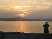
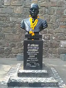
Tourism is another source of revenue with about three million visitors to the city per year.[24] Kolhapur's attractions include:New Palace, world's first statue of Babasaheb Ambedkar at Bindu chowk, inaugurated on 7 December 1950, Rankala lake,the Tara Rani equestrian statue which stands on two of the horse's legs an 85 feet (26 m) idol of the Lord Ganesh at the Chinmaya mission (Top-Sambhapur). At the annual Dusshera procession, the Kolhapur Maybach car of the chhatrapatis of Kolhapur is displayed to the public. The rankala lake is place to visit in kolhapur.
Film industry
On December 1, 1917, the Maharashtra Film Company was established in Kolhapur by Baburao Painter. The city has become the primary centre for the Marathi film industry. Kolhapur plays host to many film festivals, including the Kolhapur International Film Festival. Kolhapur has film city which is spread over 75-acre in Morewadi and was set up in 1984 by the state government. The objective of setting up film city was to provide infrastructural set-up to the Marathi film industry and provide all facilities, from shooting to post production, under one roof. The work of renovation and new locations of Kolhapur film city is going on. [25]
Malls
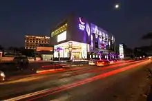
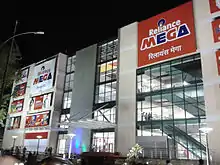
In Kolhapur, two malls are present which are DYP city shopping mall located near Kawala Naka and Reliance mall in Laxmipuri.
Cuisine
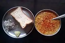
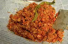
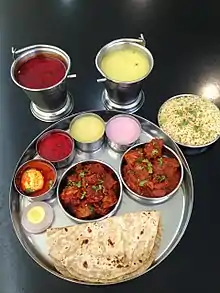
Kolhapur cuisine is especially noted for its mutton dishes, Kolhapuri Misal, and Kolhapuri Bhel.[26] The city also lends its name to certain types of food and ingredients, such as Kolhapuri Lavangi (chili peppers), Kolhapuri jaggery (cane juice concentrate), and Kolhapuri masala (spice mixture).
Kolhapur is famous for its unique soup-like curries called "Pandhara Rassa" and "Tambda Rassa" which are served as a part of a Thali. "Pandhara Rassa", which can be loosely translated to white curry, is a soup-like dish made from mutton stock and coconut milk infused with spices like cinnamon, coriander, ginger, and garlic. It is served as an appetizer, and also as a part of the main course. It is noted for its medicinal uses against cough and throat ailments. "Tambda Rassa", red curry, is a spicier form of the dish made by substituting coconut milk with red chilies.[27]
International fast food chains have a presence as well, McDonald's and Domino's Pizza have a couple of outlets each, whereas Pizza Hut and Subway, each, have a single outlet. Numerous cafes are also spread throughout the city which serve local as well as other types of cuisines.
Recently, the online food-delivery startups, Zomato and Swiggy, have expanded their operations to Kolhapur, making the local cuisine even more accessible to the natives as well as visitors.
Media and telecommunication
Kolhapur's main newspaper is the Pudhari.[28] Other Marathi language newspapers include Sakal, Maharashtra Times (Kolhapur edition), Loksatta, Lokmat, Kesari, Saamna , Tarun Bharat, and Punyanagari.
The English language dailies include The Times of India (Kolhapur edition), The Indian Express, Business Standard and The Economic Times.
Kolhapur's FM radio services include Tomato FM (94.3 MHz), Radio Mirchi (98.3 MHz), Radio City (95 MHz), Big FM(92.7 MHz) and All India Radio FM (102.7 MHz).
Kolhapur Multiplexes And Theatre
- Kolhapur has three multiplexes - 03
PVR Cinemas in DYP city mall, Parvati Multiplex and INOX at Reliance Mega Mall and more. Other theatres are Ayodhya theatre, Padma theatre.
Sports
A number of sports are played in Kolhapur. Wrestling (known as Kusti in Marathi) and football are the most played sports in the city.[29][30]
In January 2013, the Indian women's football team hosted a training camp and played a demonstration game against representatives from the Netherlands in Kolhapur.[31]
Rajarshi Shahu Stadium is a football stadium in Kolhapur. Khasbag Wrestling Stadium is a national wrestling stadium in Kolhapur.
B.B. Nimbalkar (former Ranji cricketer), Suhas Khamkar (Mr. Asia, Winner), Virdhawal Khade (Indian Olympian in swimming), Jaysingrao Kusale (Indian shooter), Tejaswini Sawant (Indian shooter), Dadu Chowgule (Rustum-e-hind), Rucha Pujari (chess - Woman International Master) and many more. Aniket Jadhav who played the FIFA U-17 World Cup 2017 is from Kolhapur.
Volleyball is also played widely in places like Panhala, Kagal, Murgud, and Kurundwad.
Transport
Railway
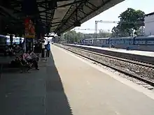
The Chhatrapati Shahu Maharaj Terminus links Kolhapur via rail to India's major cities with express services to Pune, Mumbai, Bengaluru and New Delhi. A daily shuttle service connects Kolhapur with the main rail hub of Miraj on the Central Railway main line. A new railway route from Miraj via Kolhapur till Vaibhavwadi has been confirmed, which will connect Kolhapur and many other towns with to the Western coastal region of India.[32]
Road
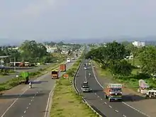
Kolhapur is located on National Highway 4 and National Highway 204. The city has three state transport bus stands: Central Bus Stand (CBS), Rankala Bus Stand and Sambhajinagar Bus Stand. Kolhapur Municipal Transport (KMT) provides local bus services. Central government granted 78 buses for KMT under Jnnurm. The CBS of Kolhapur is the busiest bus stand in western Maharashtra with more than 50,000 commutators a day.
Airport
Kolhapur's domestic airport, also known as Chhatrapati Rajaram Maharaj Airport, is located 9 kilometres (5.6 mi) south east of the city at Ujalaiwadi.
There are daily flights from Kolhapur to Hyderabad and Bengaluru operated by Alliance Air. Indigo operates daily flights to Hyderabad and Tirupati, & Trujet operates flights to Mumbai five days a week.
The nearest international airports to Kolhapur are Pune International Airport and Goa International Airport. Expansion of runway & construction of Airport Terminal Building is in progress.
Education
Kolhapur has educational institutions for Engineering, Medicine, Management Studies, Pharmaceutical Sciences and Agriculture. Shivaji University is located in Kolhapur city. There are international schools and a pre-IAS training centre. The pre-IAS training centre is in Rajaram college campus. The admissions to pre-IAS centre are allotted purely on merit in entrance exam. The city attracts students form all over India and Africa.
Languages
Kolhapur has a distinct way of using the Marathi language. This could be attributed to the princely rule over the population which has brought a certain masculinity to the language. For example, one will find that women will also use words which are normally used by men while speaking. Names are uniquely shortened to utter them faster. For example, शंकर becomes शंक्रोबा. Some phrases are unique to the local dialect, and especially popular among the youth, such as ‘काय भावा?’, ‘नाद नाही करायचा’, ‘काटा कीर्रर्र’, ‘खटक्यावर बोट, and 'जाग्यावर पल्टी'.[33]
See also
- Bhosale
- Maratha
- Maratha Empire
- Marathi people
- List of Maratha dynasties and states
- Kolhapur Municipal Corporation
- Notable people from Kolhapur
References
- "कोल्हापूरसाठी प्राधिकरण -Maharashtra Times". 17 August 2017.
- http://www.demographia.com/db-worldua.pdf
- "कोल्हापूरसाठी प्राधिकरण". 17 August 2017.
- "(About Kolhapur) Introduction". Kolhapur Municipal Corporation. Retrieved 13 January 2020.
- Chatterji H. P. "Devi Gita, the vow and the sacred places of the Devi." Archived 12 October 2013 at the Wayback Machine The Devi Gita (Song of the Goddess), excerpt from Srimad Devi Bhagawatam, translated by the Vijnanananda (Hari Prasanna Chatterji), 1921, chapter 38 verse 3 - 10. "O King of Mountains! Still I am now telling something out of My affection to My Bhaktas. Hear. There is a great place of pilgrimage named Kolhapura in the southern country. Here the Devi Ambabai always dwells. The second place is Mahur, Maharashtra|Matripura in the Sahyadri mountain; here the Devi Renuka dwells."
- Bhavan B. V. "Temples and legends of Maharashtra." 1962 volume 97.
- Sastri K. A. N. "The CōĻas." 1935 p256 - 257 (University of Madras, 2000).
- Hertslet's Commercial Treaties. Great Britain: Foreign Office, Great Britain. 1900. p. 1167. Retrieved 7 September 2015.
- "Mythology". Ambabai Mahalaxmi Kolhapur. Retrieved 19 February 2018.
- "Kolhapur" Google Maps.
- "Station: Kolhapur Climatological Table 1981–2010" (PDF). Climatological Normals 1981–2010. India Meteorological Department. January 2015. pp. 423–424. Archived from the original (PDF) on 5 February 2020. Retrieved 6 April 2020.
- "Extremes of Temperature & Rainfall for Indian Stations (Up to 2012)" (PDF). India Meteorological Department. December 2016. p. M144. Archived from the original (PDF) on 5 February 2020. Retrieved 6 April 2020.
- "Climate". Government of Maharashtra. Retrieved 6 April 2020.
- "Kolhapur Road Project." Government of India website. Retrieved 12 September 2017.
- "Kolhapur Nagarothan Abhiya." Kolhapur Municipal Corporation website. Retrieved 12 September 2017.
- "कोल्हापूरसाठी प्राधिकरण". Maharashtra Times. 17 August 2017. Retrieved 12 September 2017.
- "Kolhapur Regional Development Authority". 17 August 2017.
- "Kolapur City Population Census 2011 - Maharashtra". www.census2011.co.in. Retrieved 12 September 2017.
- "Kolhapuri chappal to set foot in new markets". Indian Express. 13 June 2000. Retrieved 12 September 2017.
- "Kolhapuri chappals come easy on the pocket now." IBN Live website 17 July 2007. Accessed 21 October 2013.
- "Government unveils new trade policy". Indian Express. 5 June 2012. Retrieved 12 September 2017.
- "Maharashtra development report." Government of India Planning Commission report. Academic Foundation, 2007 ISBN 8171885403, 9788171885404 Accessed 8 April 2014.
- "MIDC to acquire 1,000 acres for Kagal park." Business Standard, 20 December 2006.
- "Kolhapur Municipal Corporation draft." Archived 4 October 2013 at the Wayback Machine Urban India government website, PDF document p10.
- Piyush Bhusari (7 February 2017). "Phase 1 work of Kolhapur Chitranagari to be completed by April end". The Times of India. TNN. Retrieved 12 September 2017.
- Bhandare S.G. (2014) Ethnic Meat Products: India and Pakistan. In: Carrick Devine & Michael Dikeman, editors-in-chief. Encyclopedia of Meat Sciences 2e, Vol. 1, Oxford: Elsevier; pp. 538-542. ISBN 1741791553, 9781741791556 p183. Accessed at Google Books 7 April 2014.
- Devine C. and Dikeman M. "Encyclopaedia of meat sciences." Elsevier, 2014. second edition in three volumes. p540. ISBN 0123847346, 9780123847348.
- "Pudhari." E papers land.com. Retrieved 12 September 2017.
- "Hanuman's Army: Kushti Wrestlers." Reportage at Getty Images website. 2013. Retrieved 12 September 2017.
- Sainath, P. (31 October 2013). "The culture and crisis of kushti". The Hindu. ISSN 0971-751X. Retrieved 21 October 2019.
- "Indian women to play exhibition games against Netherlands". Press Trust of India. 16 January 2013. Retrieved 12 September 2017.
- "Centre sanctions Rs 250 crore for Kolhapur-Vaibhavwadi rail route". The Times of India. TNN. 12 February 2017. Retrieved 12 September 2017.
- "बेधडक वळणाची कोल्हापुरी बोली". Maharashtra Times. 1 April 2017. Retrieved 12 September 2017.
Further reading
"The Imperial Gazetteer of India." Oxford at Clarendon Press, 1909 Volume 15. p380 - 387. Accessed at Digital South Asia Library at University of Chicago, Illinois, 7 April 2014.
External links
| Wikimedia Commons has media related to Kolhapur. |
 Kolhapur travel guide from Wikivoyage
- Kolhapur Municipal Corporation
- Kolhapur Tourism Information
| Topics | |||||||||||||
|---|---|---|---|---|---|---|---|---|---|---|---|---|---|
| Regions | |||||||||||||
| Divisions and Districts |
| ||||||||||||
| Million-plus cities in Maharashtra | |||||||||||||
| Other cities with municipal corporations | |||||||||||||
Portal:India | |||||||||||||
Kolhapur district topics | |||||
|---|---|---|---|---|---|
| History |  | ||||
| Geography | |||||
| Cities and towns | |||||
| Transport | |||||
| Visitor attractions | |||||
| Culture | |||||
| Education | |||||
| Lok Sabha constituencies | |||||
| Vidhan Sabha constituencies |
| ||||
| Taluka/Tehsil | |||||
| Stadiums | |||||
‡ This constituency also has portions in Sangli district
| |||||
