Marin County, California
Marin County /məˈrɪn/ is located in the northwestern part of the San Francisco Bay Area of the U.S. state of California. As of the 2010 census, the population was 252,409.[5] Its county seat is San Rafael.[6] Marin County is across the Golden Gate Bridge from San Francisco, and is included in the San Francisco–Oakland–Berkeley, CA Metropolitan Statistical Area.
Marin County, California | |
|---|---|
| County of Marin | |
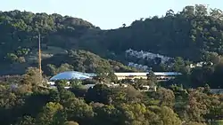 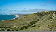 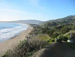 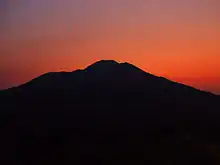 Images, from top down, left to right: Marin County Civic Center, Point Reyes National Seashore, Stinson Beach, Mount Tamalpais at sunset | |
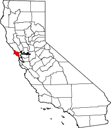 Location in the State of California | |
 California's location in the United States | |
| Coordinates: 38.04°N 122.74°W | |
| Country | United States |
| State | California |
| Area | San Francisco Bay |
| Incorporated | February 18, 1850 |
| Named for | Chief Marin, "great chief of the tribe Licatiut" |
| County seat | San Rafael |
| Largest city | San Rafael (population) Novato (area) |
| Government | |
| • Board of Supervisors | Supervisors[1]
|
| Area | |
| • Total | 828 sq mi (2,140 km2) |
| • Land | 520 sq mi (1,300 km2) |
| • Water | 308 sq mi (800 km2) |
| Highest elevation | 2,574 ft (785 m) |
| Population | |
| • Total | 252,409 |
| • Estimate (2019)[4] | 258,826 |
| • Density | 300/sq mi (120/km2) |
| Time zone | UTC−8 (Pacific) |
| • Summer (DST) | UTC−7 (PDT) |
| Area codes | 415, 707 (Tomales and Dillon Beach only) |
| FIPS code | 06-041 |
| GNIS feature ID | 277285 |
| Website | www |
As of 2010, Marin County had the fifth highest income per capita in the United States at $91,483.[7] The county is governed by the Marin County Board of Supervisors.
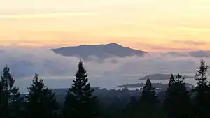
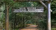
San Quentin State Prison is in the county, as is George Lucas' Skywalker Ranch. Autodesk, the publisher of AutoCAD, is also there, as well as numerous other high-tech companies. The Marin County Civic Center was designed by Frank Lloyd Wright and draws thousands of visitors a year to guided tours of its arch and atrium design. In 1994, a new county jail facility was embedded into the hillside nearby.[8] Marin County's natural sites include the Muir Woods redwood forest, the Marin Headlands, Stinson Beach, the Point Reyes National Seashore, and Mount Tamalpais.
The United States' oldest cross country running event, the Dipsea Race, takes place annually in Marin County, attracting thousands of athletes. Mountain biking was invented on the slopes of Mount Tamalpais in Marin.[9]
History
Marin County is one of the original 27 counties of California, created February 18, 1850, following adoption of the California Constitution of 1849 and just months before the state was admitted to the Union.[10]
According to General Mariano Vallejo, who headed an 1850 committee to name California's counties, the county was named for "Marin," great chief of the tribe Licatiut." Marin had been named "Huicmuse" until he was baptized as "Marino" at about age 20. Marin / Marino was born into the Huimen people, a Coast Miwok tribe of Native Americans who inhabited the San Rafael area. Vallejo believed that "Chief Marin" had waged several fierce battles against the Spanish. Marino definitely did reside at Mission Dolores (in modern San Francisco) much of the time from his 1801 baptism and marriage until 1817, frequently serving as a baptism witness and godfather; he may have escaped and been recaptured at some point during that time. Starting in 1817, he served as an alcalde (in effect, an overseer) at the San Rafael Mission, where he lived from 1817 off and on until his death. In 1821, Marino served as an expedition guide for the Spanish for a couple of years before escaping and hiding out for some months in the tiny Marin Islands (also named after him); his recapture resulted in a yearlong incarceration at the Presidio before his return to the Mission San Rafael area for about 15 years until his death in 1839.[11] In 2009, a plaque commemorating Chief Marin was placed in Mill Valley.
Another version of the origin of the county name is that the bay between San Pedro Point and San Quentin Point was named Bahía de Nuestra Señora del Rosario la Marinera in 1775, and that Marin is simply an abbreviation of this name.[12]
The Coast Miwok Indians were hunters and gatherers whose ancestors had occupied the area for thousands of years. About 600 village sites have been identified in the county. The Coast Miwok numbered in the thousands. Today, there are few left and even fewer with any knowledge of their Coast Miwok lineage. Efforts are being made so that they are not forgotten.[13]
Francis Drake and the crew of the Golden Hind was thought to have landed on the Marin coast in 1579 claiming the land as Nova Albion. A bronze plaque inscribed with Drake's claim to the new lands, fitting the description in Drake's own account, was discovered in 1933. This so-called Drake's Plate of Brass was revealed as a hoax in 2003.[14]
In 1595, Sebastian Cermeno lost his ship, the San Agustin, while exploring the Marin Coast. The Spanish explorer Vizcaíno landed about twenty years after Drake in what is now called Drakes Bay. However the first Spanish settlement in Marin was not established until 1817 when Mission San Rafael Arcángel was founded partly in response to the Russian-built Fort Ross to the north in what is now Sonoma County. Mission San Rafael Arcángel was founded in what is now downtown San Rafael as the 20th Spanish mission in the colonial Mexican province of Alta California by four priests, Father Narciso Duran from Mission San Jose, Father Abella from Mission San Francisco de Asís, Father Gil y Taboada and Father Mariano Payeras, the President of the Missions, on December 14, 1817, four years before Mexico gained independence from Spain.
Geography
According to the U.S. Census Bureau, the county has a total area of 828 square miles (2,140 km2), of which 520 square miles (1,300 km2) is land and 308 square miles (800 km2) (37.2%) is water.[15] It is the fourth-smallest county in California by land area. According to the records at the County Assessor-Recorder's Office, as of June 2006, Marin had 91,065 acres (369 km2) of taxable land, consisting of 79,086 parcels with a total tax basis of $39.8 billion. These parcels are divided into the following classifications:
| Parcel Type | Tax ID | Quantity | Value |
|---|---|---|---|
| Vacant | 10 | 6,900 | $508.17 million |
| Single Family Residential | 11 | 61,264 | $30.13 billion |
| Mobile Home | 12 | 210 | $7.62 million |
| House Boat | 13 | 379 | $61.83 million |
| Multi Family Residential | 14 | 1,316 | $3,973.51 million |
| Industrial Unimproved | 40 | 113 | $12.24 million |
| Industrial Improved | 41 | 562 | $482.83 million |
| Commercial Unimproved | 50 | 431 | $97.89 million |
| Commercial Improved | 51 | 7,911 | $4.52 billion |
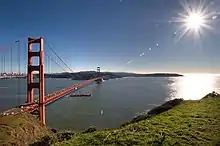
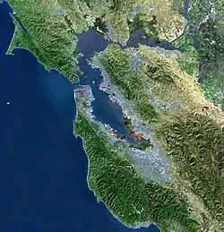
Geographically, the county forms a large, southward-facing peninsula, with the Pacific Ocean to the west, San Pablo Bay, and San Francisco Bay to the east, and – across the Golden Gate – the city of San Francisco to the south. Marin County's northern border is with Sonoma County.
Most of the county's population resides on the eastern side, with a string of communities running along San Francisco Bay, from Sausalito to Tiburon to Corte Madera to San Rafael. The interior contains large areas of agricultural and open space; West Marin, through which State Route 1 runs alongside the California coast, contains many small unincorporated communities whose economies depend on agriculture and tourism. West Marin has beaches which are popular destinations for surfers and tourists year-round.
Notable features of the shoreline along the San Francisco Bay include the Sausalito shoreline, Richardson Bay, the Tiburon Peninsula, Ring Mountain, and Triangle Marsh at Corte Madera. Further north lies San Quentin State Prison along the San Rafael shoreline.
Adjacent counties
- Sonoma County – north
- San Francisco – south
National protected areas
State and local protected areas
The Marin County Department of Parks and Open Space manages numerous county parks and open spaces, including Stafford Lake County Park. The Marin Municipal Water District has 130 mi (209 km) of trails.
State parks
Marine Protected Areas of Marin County
Like underwater parks, these marine-protected areas help conserve ocean wildlife and marine ecosystems:
- Estero Americano State Marine Recreational Management Area
- Estero de San Antonio State Marine Recreational Management Area
- Point Reyes State Marine Reserve & Point Reyes State Marine Conservation Area
- Estero de Limantour State Marine Reserve & Drakes Estero State Marine Conservation Area
- Duxbury Reef State Marine Conservation Area
Ecology
Marin County is considered in the California Floristic Province, a zone of extremely high biodiversity and endemism. There are numerous ecosystems present, including Coastal Strand, oak woodland, mixed evergreen forest, and Coast Redwood Forests chaparral and riparian zones. There are also a considerable number of protected plant and animal species present: Fauna include the California red-legged frog (Rana aurora draytonii) and California freshwater shrimp while flora include Marin Dwarf Flax, Hesperolinon congestum; Tiburon Jewelflower, Streptanthus niger; and Tiburon Indian paintbrush, Castilleja neglecta.
A number of watersheds exist in Marin County, including Walker Creek, Lagunitas Creek, Miller Creek, and Novato Creek.
Notably, the Lagunitas Creek Watershed is home to the largest remaining wild run of coho salmon (Oncorhynchus kisutch) in Central California. These coho are part of the "Central California Coast Evolutionarily Significant Unit,[16]" or CCC ESU, and are listed as "endangered" at both the state and federal level.
Significant efforts to protect and restore these fish[17] have been underway in the Watershed since the 1980s. Fifty percent of historical salmon habitat is now behind dams. Strong efforts are also being made to protect and restore undammed, headwater reaches of this Watershed in the San Geronimo Valley, where upwards of 40% of the Lagunitas salmon spawn each year and where as much as 1/3 of the juvenile salmon (or fry) spend their entire freshwater lives. The "Salmon Protection and Watershed Network"[18] leads winter tours for the public to learn about and view these spawning salmon, and also leads year-round opportunities for the public to get involved in stream restoration, monitoring spawning and smolt outmigration, juvenile fish rescue and relocation in the summer, and advocacy and policy development. Around 490 different species of birds have been observed in Marin County.[19]
Despite the lack of rain in the Marin County area due to historic drought levels,[20] in 2014, an estimated 20,000 juvenile Coho salmon made the migration from their spawning grounds in the Lagunitas Creek area to the Pacific Ocean. This increase in migration was significantly up from the previous historic record for the same migration measured in 2006 at 11,000.[21]
In 2010, all of the county's beaches were listed as the cleanest in the state.[22]
When Richard Henry Dana, Jr. visited San Francisco Bay in 1835, he wrote about vast tule elk (Cervus canadensis nannodes) herds near the Golden Gate on December 27: "...we came to anchor near the mouth of the bay, under a high and beautifully sloping hill, upon which herds of hundreds and hundreds of red deer [note: "red deer" is the European term for "elk"], and the stag, with his high branching antlers, were bounding about...," although it is not clear whether this was the Marin side or the San Francisco side.[23]
Demographics
2011
| Population, race, and income | |||||
|---|---|---|---|---|---|
| Total population[24] | 250,666 | ||||
| White[24] | 200,333 | 79.9% | |||
| Black or African American[24] | 7,481 | 3.0% | |||
| American Indian or Alaska Native[24] | 793 | 0.3% | |||
| Asian[24] | 13,992 | 5.6% | |||
| Native Hawaiian or other Pacific Islander[24] | 511 | 0.2% | |||
| Some other race[24] | 19,228 | 7.7% | |||
| Two or more races[24] | 8,328 | 3.3% | |||
| Hispanic or Latino (of any race)[25] | 37,344 | 14.9% | |||
| Per capita income[26] | $54,605 | ||||
| Median household income[27] | $89,605 | ||||
| Median family income[28] | $113,826 | ||||
Places by population, race, and income
| Places by population and race | ||||||||
|---|---|---|---|---|---|---|---|---|
| Place | Type[29] | Population[24] | White[24] | Other[24] [note 1] |
Asian[24] | Black or African American[24] |
Native American[24] [note 2] |
Hispanic or Latino (of any race)[25] |
| Alto | CDP | 741 | 96.8% | 3.2% | 0.0% | 0.0% | 0.0% | 16.5% |
| Belvedere | City | 2,118 | 95.0% | 3.4% | 1.2% | 0.4% | 0.0% | 7.6% |
| Black Point-Green Point | CDP | 1,204 | 93.4% | 5.8% | 0.8% | 0.0% | 0.0% | 7.8% |
| Bolinas | CDP | 1,117 | 89.3% | 1.7% | 3.8% | 5.2% | 0.0% | 4.7% |
| Corte Madera | Town | 9,191 | 82.5% | 3.7% | 12.6% | 1.2% | 0.0% | 3.7% |
| Dillon Beach | CDP | 132 | 100.0% | 0.0% | 0.0% | 0.0% | 0.0% | 0.0% |
| Fairfax | Town | 7,410 | 91.7% | 6.6% | 0.9% | 0.8% | 0.0% | 6.4% |
| Inverness | CDP | 1,335 | 97.1% | 1.1% | 0.0% | 1.8% | 0.0% | 3.7% |
| Kentfield | CDP | 6,669 | 90.4% | 3.7% | 3.0% | 1.2% | 1.8% | 5.5% |
| Lagunitas-Forest Knolls | CDP | 2,307 | 73.0% | 17.3% | 2.0% | 5.5% | 2.2% | 19.1% |
| Larkspur | City | 11,870 | 88.6% | 6.4% | 3.1% | 1.2% | 0.7% | 9.6% |
| Lucas Valley-Marinwood | CDP | 5,909 | 85.8% | 6.1% | 6.2% | 1.4% | 0.4% | 5.6% |
| Marin City | CDP | 2,711 | 37.1% | 13.4% | 4.2% | 45.0% | 0.4% | 14.8% |
| Mill Valley | City | 13,810 | 87.8% | 5.8% | 5.2% | 1.0% | 0.1% | 6.9% |
| Muir Beach | CDP | 306 | 93.8% | 0.0% | 2.9% | 3.3% | 0.0% | 0.0% |
| Nicasio | CDP | 15 | 100.0% | 0.0% | 0.0% | 0.0% | 0.0% | 0.0% |
| Novato | City | 51,206 | 76.8% | 13.5% | 6.4% | 2.8% | 0.4% | 16.9% |
| Point Reyes Station | CDP | 853 | 61.9% | 34.8% | 0.0% | 3.3% | 0.0% | 37.2% |
| Ross | Town | 2,079 | 95.5% | 2.6% | 1.5% | 0.0% | 0.4% | 4.7% |
| San Anselmo | Town | 12,273 | 86.4% | 7.0% | 5.1% | 1.3% | 0.1% | 6.6% |
| San Geronimo | CDP | 383 | 93.5% | 0.0% | 1.3% | 5.2% | 0.0% | 0.0% |
| San Rafael | City | 57,374 | 72.1% | 17.9% | 6.3% | 2.8% | 0.9% | 28.4% |
| Santa Venetia | CDP | 4,799 | 85.3% | 10.3% | 3.8% | 0.0% | 0.6% | 16.9% |
| Sausalito | City | 7,047 | 93.4% | 1.7% | 4.8% | 0.0% | 0.1% | 4.6% |
| Sleepy Hollow | CDP | 2,277 | 93.6% | 3.2% | 3.2% | 0.0% | 0.0% | 3.0% |
| Stinson Beach | CDP | 448 | 86.4% | 6.7% | 6.9% | 0.0% | 0.0% | 6.7% |
| Strawberry | CDP | 5,765 | 75.1% | 8.2% | 11.3% | 4.9% | 0.5% | 6.1% |
| Tamalpais-Homestead Valley | CDP | 10,538 | 85.4% | 5.0% | 8.7% | 0.8% | 0.1% | 3.9% |
| Tiburon | Town | 8,895 | 91.5% | 3.3% | 4.4% | 0.4% | 0.3% | 7.0% |
| Tomales | CDP | 271 | 70.1% | 18.5% | 11.4% | 0.0% | 0.0% | 11.1% |
| Woodacre | CDP | 1,470 | 92.7% | 0.0% | 4.2% | 3.1% | 0.0% | 2.3% |
| Places by population and income | |||||
|---|---|---|---|---|---|
| Place | Type[29] | Population[30] | Per capita income[26] | Median household income[27] | Median family income[28] |
| Alto | CDP | 741 | $61,750 | $78,426 | $78,935 |
| Belvedere | City | 2,118 | $118,518 | $160,455 | $190,500 |
| Black Point-Green Point | CDP | 1,204 | $76,341 | $126,429 | $135,250 |
| Bolinas | CDP | 1,117 | $38,233 | $62,083 | $66,042 |
| Corte Madera | Town | 9,191 | $62,824 | $106,541 | $132,717 |
| Dillon Beach | CDP | 132 | $71,340 | $153,490 | $153,802 |
| Fairfax | Town | 7,410 | $49,486 | $97,992 | $125,795 |
| Inverness | CDP | 1,335 | $46,192 | $63,261 | $76,827 |
| Kentfield | CDP | 6,669 | $91,579 | $154,265 | $200,660 |
| Lagunitas-Forest Knolls | CDP | 2,307 | $33,631 | $86,111 | $88,250 |
| Larkspur | City | 11,870 | $64,646 | $86,046 | $118,836 |
| Lucas Valley-Marinwood | CDP | 5,909 | $61,644 | $123,239 | $158,047 |
| Marin City | CDP | 2,711 | $33,857 | $46,250 | $51,650 |
| Mill Valley | City | 13,810 | $77,315 | $109,759 | $167,561 |
| Muir Beach | CDP | 306 | $95,802 | $166,389 | $171,205 |
| Nicasio | CDP | 15 | $45,020 | $53,750 | $53,750 |
| Novato | City | 51,206 | $41,575 | $78,628 | $95,961 |
| Point Reyes Station | CDP | 853 | $49,520 | $84,405 | $84,583 |
| Ross | Town | 2,079 | $86,812 | $145,250 | $168,125 |
| San Anselmo | Town | 12,273 | $53,033 | $96,639 | $122,823 |
| San Geronimo | CDP | 383 | $57,226 | $113,558 | $145,393 |
| San Rafael | City | 57,374 | $42,499 | $71,343 | $90,146 |
| Santa Venetia | CDP | 4,799 | $35,544 | $64,200 | $77,804 |
| Sausalito | City | 7,047 | $84,618 | $110,040 | $153,807 |
| Sleepy Hollow | CDP | 2,277 | $81,611 | $159,259 | $165,441 |
| Stinson Beach | CDP | 448 | $62,105 | $104,583 | $137,321 |
| Strawberry | CDP | 5,765 | $61,937 | $84,050 | $130,750 |
| Tamalpais-Homestead Valley | CDP | 10,538 | $65,141 | $116,146 | $136,250 |
| Tiburon | Town | 8,895 | $97,434 | $136,250 | $185,909 |
| Tomales | CDP | 271 | $42,263 | $101,667 | $100,833 |
| Woodacre | CDP | 1,470 | $39,204 | $72,266 | $89,107 |
2010
| Historical population | |||
|---|---|---|---|
| Census | Pop. | %± | |
| 1850 | 323 | — | |
| 1860 | 3,334 | 932.2% | |
| 1870 | 6,903 | 107.0% | |
| 1880 | 11,324 | 64.0% | |
| 1890 | 13,072 | 15.4% | |
| 1900 | 15,702 | 20.1% | |
| 1910 | 25,114 | 59.9% | |
| 1920 | 27,342 | 8.9% | |
| 1930 | 41,648 | 52.3% | |
| 1940 | 52,907 | 27.0% | |
| 1950 | 85,619 | 61.8% | |
| 1960 | 146,820 | 71.5% | |
| 1970 | 206,038 | 40.3% | |
| 1980 | 222,568 | 8.0% | |
| 1990 | 230,096 | 3.4% | |
| 2000 | 247,289 | 7.5% | |
| 2010 | 252,409 | 2.1% | |
| 2019 (est.) | 258,826 | [4] | 2.5% |
| U.S. Decennial Census[31] 1790–1960[32] 1900–1990[33] 1990–2000[34] 2010–2015[3] | |||
The 2010 United States Census reported that Marin County had a population of 252,409. The racial makeup of Marin County was 201,963 (80.0%) White, 6,987 (2.8%) African American, 1,523 (0.6%) Native American, 13,761 (5.5%) Asian, 509 (0.2%) Pacific Islander, 16,973 (6.7%) from other races, and 10,693 (4.2%) from two or more races. Hispanic or Latino of any race were 39,069 persons (15.5%).[35]
| Demographic profile[36] | 2010 | 2000 | 1990 | 1980 |
|---|---|---|---|---|
| White | 80.0% | 84.0% | 88.9% | 92.8% |
| Asian | 5.5% | 4.5% | 4.0% | 3.0% |
| Black or African American | 2.8% | 2.9% | 3.5% | 2.5% |
| American Indian and Alaska Native | 0.6% | 0.4% | 0.4% | 0.4% |
| Native Hawaiian and Other Pacific Islander | 0.2% | 0.2% | ||
| Some other race | 6.7% | 4.5% | ||
| Two or more races | 4.2% | 3.5% | ||
| Hispanic or Latino (of any race) | 15.5% | 11.1% | 7.4% | 4.2% |
| White alone | 72.8% | 78.6% | 84.6% | 89.8% |
| Population reported at 2010 United States Census | |||||||||
|---|---|---|---|---|---|---|---|---|---|
Population | American | American | Islander | races | more races | or Latino (of any race) | |||
| Marin County | 252,409 | 201,963 | 6,987 | 1,523 | 13,761 | 509 | 16,973 | 10,693 | 39,069 |
cities and towns | Population | American | American | Islander | races | more races | or Latino (of any race) | ||
| Belvedere | 2,068 | 1,940 | 3 | 0 | 58 | 7 | 18 | 42 | 72 |
| Corte Madera | 9,253 | 7,808 | 87 | 15 | 625 | 29 | 262 | 427 | 772 |
| Fairfax | 7,441 | 6,617 | 110 | 36 | 204 | 4 | 174 | 296 | 504 |
| Larkspur | 11,926 | 10,311 | 186 | 26 | 563 | 13 | 343 | 484 | 918 |
| Mill Valley | 13,903 | 12,341 | 118 | 23 | 755 | 14 | 152 | 500 | 622 |
| Novato | 51,904 | 39,443 | 1,419 | 286 | 3,428 | 117 | 4,693 | 2,518 | 11,046 |
| Ross | 2,415 | 2,265 | 6 | 2 | 45 | 3 | 19 | 75 | 94 |
| San Anselmo | 12,336 | 11,134 | 106 | 40 | 437 | 26 | 164 | 429 | 717 |
| San Rafael | 57,713 | 40,734 | 1,154 | 709 | 3,513 | 126 | 8,513 | 2,964 | 17,302 |
| Sausalito | 7,061 | 6,400 | 65 | 16 | 342 | 10 | 53 | 175 | 287 |
| Tiburon | 8,962 | 7,899 | 83 | 16 | 505 | 8 | 80 | 371 | 410 |
place | Population | American | American | Islander | races | more races | or Latino (of any race) | ||
| Alto | 711 | 619 | 8 | 2 | 30 | 1 | 16 | 35 | 51 |
| Black Point-Green Point | 1,306 | 1,185 | 7 | 6 | 45 | 0 | 28 | 35 | 112 |
| Bolinas | 1,620 | 1,406 | 27 | 10 | 17 | 14 | 64 | 82 | 260 |
| Dillon Beach | 283 | 266 | 0 | 3 | 4 | 0 | 0 | 10 | 9 |
| Inverness | 1,304 | 1,212 | 15 | 8 | 16 | 2 | 19 | 32 | 79 |
| Kentfield | 6,485 | 5,908 | 35 | 10 | 224 | 7 | 95 | 206 | 299 |
| Lagunitas-Forest Knolls | 1,819 | 1,658 | 26 | 11 | 11 | 1 | 43 | 69 | 133 |
| Lucas Valley-Marinwood | 6,094 | 5,225 | 68 | 18 | 424 | 5 | 117 | 237 | 444 |
| Marin City | 2,666 | 1,037 | 1,017 | 15 | 287 | 21 | 120 | 169 | 365 |
| Muir Beach | 310 | 283 | 5 | 1 | 12 | 0 | 1 | 8 | 7 |
| Nicasio | 96 | 94 | 2 | 0 | 0 | 0 | 0 | 0 | 7 |
| Point Reyes Station | 848 | 725 | 7 | 3 | 10 | 0 | 73 | 30 | 155 |
| San Geronimo | 446 | 421 | 3 | 2 | 3 | 0 | 3 | 14 | 21 |
| Santa Venetia | 4,292 | 3,335 | 88 | 27 | 306 | 16 | 350 | 170 | 815 |
| Sleepy Hollow | 2,384 | 2,160 | 14 | 9 | 113 | 6 | 11 | 71 | 69 |
| Stinson Beach | 632 | 582 | 3 | 8 | 14 | 1 | 9 | 15 | 33 |
| Strawberry | 5,393 | 4,325 | 115 | 18 | 589 | 16 | 99 | 231 | 352 |
| Tamalpais-Homestead Valley | 10,735 | 9,449 | 91 | 24 | 592 | 28 | 121 | 430 | 499 |
| Tomales | 204 | 193 | 0 | 3 | 4 | 0 | 0 | 4 | 9 |
| Woodacre | 1,348 | 1,231 | 3 | 4 | 27 | 4 | 10 | 69 | 77 |
unincorporated areas | Population | American | American | Islander | races | more races | or Latino (of any race) | ||
| All others not CDPs (combined) | 18,451 | 13,757 | 2,116 | 172 | 558 | 30 | 1,323 | 495 | 2,529 |
2000
As of the census[37] of 2000, there were 247,289 people, 100,650 households, and 60,691 families residing in the county. The population density was 476 people per square mile (184/km2). There were 104,990 housing units at an average density of 202 per square mile (78/km2). The racial makeup of the county was 84.0% White, 2.9% Black or African American, 0.4% Native American, 4.5% Asian, 0.2% Pacific Islander, 4.5% from other races, and 3.5% from two or more races. 11.1% of the population were Hispanic or Latino of any race.
In 2000, there were 100,650 households, out of which 27.5% had children under the age of 18 living with them, 48.4% were married couples living together, 8.5% had a female householder with no husband present, and 39.7% were non-families. 29.8% of all households were made up of individuals, and 9.6% had someone living alone who was 65 years of age or older. The average household size was 2.34 and the average family size was 2.90.
In the county, the population was spread out, with 20.3% under the age of 18, 5.5% from 18 to 24, 31.0% from 25 to 44, 29.7% from 45 to 64, and 13.5% who were 65 years of age or older. The median age was 41 years. For every 100 females there were 98.2 males. For every 100 females age 18 and over, there were 96.4 males.
Life expectancy
According to the most recent data on U.S. life expectancy, published in 2010 by the Institute for Health Metrics and Evaluation, a female in Marin County could expect to live 85.0 years, the longest for any county in the United States. The national average is 80.8 years for a female.[38]
Race and ethnicity
According to the 2010 United States Census, the racial composition of Marin County was as follows:
- White: 72.8% (non-Hispanic)
- Hispanic or Latino (of any race): 15.5%
- Asian: 5.4%
- Two or more races: 2.9%
- Black: 2.6% (non-Hispanic)
- Native American: 0.2%
- Pacific Islander: 0.2%
- Other: 0.4%
Religion
- Roman Catholic: 31.16%
- Protestant: 6.38%
- Mormon: 1.04%
- Other Christian: 1.36%
- Judaism: 1.8%
- Eastern religions: 1.33%
- Islam: 0.44%
- No religion: 56.5%
Place of birth
According to the 2006–2008 American Community Survey, 81.3% of Marin County's residents were born in the United States. Approximately 80.0% of the county's residents were born in one of the fifty states or born abroad to American parents.
Foreign-born individuals made up the remaining 18.7% of the population. Latin America was the most common birthplace of foreign-born residents; those born in Latin America made up the plurality (42.2%) of Marin County's foreign population. Individuals born in Europe were the second largest foreign-born group; they made up 25.3% of Marin County's foreign population. Immigrants from Asia made up 23.7% of the county's foreign population. Those born in other parts of North America and Africa made up 3.9% and 3.8% of the foreign-born populace respectively. Lastly, residents born in Oceania made up a mere 1.2% of Marin County's foreign population.
Source:[40]
Language
According to the 2006–2008 American Community Survey, English was the most commonly spoken language at home by residents over five years of age; those who spoke only English at home made up 77.1% of Marin County's residents. Speakers of non-English languages accounted for the remaining 22.9% of the population. Speakers of Spanish made up 11.7% of the county's residents, while speakers of other Indo-European languages made up 7.1% of the populace. Speakers of Asian languages and indigenous languages of the Pacific islands made up 3.4% of the population. The remaining 0.7% spoke other languages. Source:[40]
Ancestry
According to the 2007–2009 American Community Survey, there were 16 ancestries in Marin County that made up over 0.9% of its population each. The 16 ancestries are listed below:
Source:[40]
Income
The median income for a household in the county was $71,306 and the median income for a family was $88,934. As of 2007, these figures had risen to $83,732 and $104,750.[41]
In May 2010, the county had the lowest unemployment rate in California.[42] According to the U.S. Bureau of Labor Statistics, however, in July 2010, Marin's unemployment rate rose to 8.3%.[43]
Government and infrastructure

San Quentin State Prison of the California Department of Corrections and Rehabilitation is in the county. San Quentin houses the male death row and the execution chamber of California.[44]
Politics
In the United States House of Representatives, Marin County is in California's 2nd congressional district, represented by Democrat Jared Huffman.[45] From 2008 to 2012, Huffman represented Marin County in the California State Assembly.
In the California State Legislature, Marin County is in:
- the 10th Assembly District, represented by Democrat Marc Levine[46]
- the 2nd Senate District, represented by Democrat Mike McGuire.
Voter registration statistics
| Population and registered voters | ||
|---|---|---|
| Total population[24] | 250,666 | |
| Registered voters[47][note 3] | 154,250 | 61.5% |
| Democratic[47] | 83,853 | 54.4% |
| Republican[47] | 28,116 | 18.2% |
| Democratic–Republican spread[47] | +55,737 | +36.2% |
| American Independent[47] | 3,303 | 2.1% |
| Green[47] | 2,206 | 1.4% |
| Libertarian[47] | 837 | 0.5% |
| Peace and Freedom[47] | 254 | 0.2% |
| Americans Elect[47] | 4 | 0.0% |
| Other[47] | 426 | 0.3% |
| No party preference[47] | 35,251 | 12.9% |
Cities by population and voter registration
| Cities by population and voter registration | |||||||
|---|---|---|---|---|---|---|---|
| City | Population[24] | Registered voters[47] [note 3] |
Democratic[47] | Republican[47] | D–R spread[47] | Other[47] | No party preference[47] |
| Belvedere | 2,118 | 72.0% | 38.2% | 34.1% | +4.1% | 6.6% | 23.9% |
| Corte Madera | 9,191 | 65.6% | 55.7% | 16.9% | +38.8% | 6.3% | 23.3% |
| Fairfax | 7,410 | 73.2% | 64.4% | 7.1% | +57.3% | 9.1% | 21.1% |
| Larkspur | 11,870 | 69.8% | 54.7% | 18.4% | +36.3% | 5.6% | 23.2% |
| Mill Valley | 13,810 | 71.1% | 61.5% | 12.3% | +49.2% | 5.3% | 22.6% |
| Novato | 51,206 | 57.9% | 49.6% | 23.3% | +26.3% | 7.7% | 22.3% |
| Ross | 2,079 | 80.3% | 42.9% | 30.1% | +12.8% | 5.8% | 23.5% |
| San Anselmo | 12,273 | 69.8% | 62.0% | 11.6% | +50.4% | 7.4% | 21.0% |
| San Rafael | 57,374 | 51.5% | 55.1% | 17.9% | +37.2% | 6.3% | 22.7% |
| Sausalito | 7,047 | 75.3% | 52.1% | 15.8% | +36.3% | 6.7% | 27.6% |
| Tiburon | 8,895 | 67.8% | 46.0% | 25.0% | +21.0% | 5.4% | 25.7% |
Overview
For most of the 20th century, Marin County was a Republican stronghold in presidential elections. From 1880 until 1984, the only Democrats to win there were Franklin Roosevelt and Lyndon Johnson. However, the brand of Republicanism prevailing in Marin County was historically a moderate one. Like most of the historically Republican suburbs of the Bay Area, it became friendlier to Democrats as the demographics of the area changed and the national party embraced social and religious conservatism. In 1984, it very narrowly voted for Walter Mondale and has supported the Democratic candidate in every presidential election since then. Since 1988, it has become solidly Democratic. Out of California counties, only San Francisco County voted more Democratic in the 2020 Presidential election.
| Year | GOP | DEM | Others |
|---|---|---|---|
| 2020 | 15.8% 24,612 | 82.3% 128,288 | 1.9% 2,930 |
| 2016 | 15.5% 21,771 | 77.3% 108,707 | 7.3% 10,205 |
| 2012 | 22.9% 30,880 | 74.1% 99,896 | 2.9% 3,955 |
| 2008 | 20.2% 28,384 | 77.8% 109,320 | 2.0% 2,866 |
| 2004 | 25.4% 34,378 | 73.2% 99,070 | 1.4% 1,877 |
| 2000 | 28.3% 34,872 | 64.3% 79,135 | 7.4% 9,148 |
| 1996 | 28.2% 32,714 | 58.0% 67,406 | 13.8% 16,020 |
| 1992 | 23.3% 30,479 | 58.3% 76,158 | 18.4% 24,070 |
| 1988 | 39.7% 46,855 | 58.9% 69,394 | 1.4% 1,671 |
| 1984 | 49.0% 56,887 | 49.6% 57,533 | 1.4% 1,630 |
| 1980 | 45.8% 49,678 | 36.2% 39,231 | 18.1% 19,598 |
| 1976 | 52.5% 53,425 | 42.9% 43,590 | 4.6% 4,700 |
| 1972 | 52.1% 54,123 | 45.6% 47,414 | 2.3% 2,346 |
| 1968 | 50.1% 41,422 | 43.8% 36,278 | 6.1% 5,055 |
| 1964 | 38.1% 28,682 | 61.7% 46,462 | 0.3% 220 |
| 1960 | 57.3% 37,620 | 42.5% 27,888 | 0.2% 157 |
| 1956 | 65.9% 33,792 | 33.8% 17,301 | 0.3% 151 |
| 1952 | 67.1% 31,178 | 31.9% 14,824 | 1.0% 475 |
| 1948 | 57.1% 18,747 | 38.2% 12,540 | 4.8% 1,568 |
| 1944 | 47.7% 13,304 | 52.0% 14,516 | 0.3% 76 |
| 1940 | 48.5% 10,974 | 50.2% 11,365 | 1.3% 301 |
| 1936 | 33.4% 6,211 | 65.4% 12,152 | 1.1% 209 |
| 1932 | 38.1% 6,480 | 57.5% 9,764 | 4.4% 752 |
| 1928 | 57.4% 7,862 | 41.5% 5,686 | 1.0% 140 |
| 1924 | 53.5% 5,780 | 6.1% 656 | 40.4% 4,364 |
| 1920 | 68.8% 5,375 | 21.6% 1,688 | 9.6% 750 |
| 1916 | 50.1% 4,328 | 43.8% 3,789 | 6.1% 530 |
| 1912 | 0.0% 0 | 44.5% 2,849 | 55.5% 3,551 |
| 1908 | 68.3% 2,732 | 24.6% 983 | 7.2% 288 |
| 1904 | 70.7% 2,199 | 24.8% 772 | 4.5% 139 |
| 1900 | 63.6% 1,681 | 34.2% 904 | 2.2% 59 |
| 1896 | 61.4% 1,448 | 37.1% 874 | 1.5% 36 |
| 1892 | 53.6% 1,186 | 42.9% 949 | 3.5% 78 |
| 1888 | 52.7% 936 | 45.2% 802 | 2.0% 36 |
| 1884 | 53.6% 851 | 45.8% 727 | 0.5% 9 |
| 1880 | 56.5% 761 | 41.7% 561 | 1.7% 23 |
Marin has voted for many gubernatorial candidates who went on to become high-profile national figures, including Richard Nixon, Ronald Reagan, Jerry Brown, and Dianne Feinstein.
On November 4, 2008, the citizens of Marin County voted strongly against Proposition 8, a constitutional amendment which eliminated the right of same-sex couples to marry, by a 75.1 percent to 24.9 percent margin. The official tally was 103,341 against and 34,324 in favor.[49] Only San Francisco County voted against the measure by a wider margin (75.2% against).[50]
According to the California Secretary of State, as of February 10, 2019, Marin County has 161,870 registered voters. Of those, 89,526 (55.31%) are registered Democrats, 23,380 (14.44%) are registered Republicans, 7,020 (4.35%) are registered with other political parties, and 41,908 (25.89%) have declined to state a political party.[51] Democrats hold wide voter-registration majorities in all political subdivisions in Marin County. Democrats' largest registration advantage in Marin is in the town of Fairfax, wherein there are only 344 Republicans (6.1%) out of 5,678 total voters compared to 3,758 Democrats (66.2%) and 1,276 voters who have declined to state a political party (22.5%).
The last time Marin elected a Republican to represent them in the United States House of Representatives was William S. Mailliard in 1972. The last competitive race for the U.S. House of Representatives in Marin was in 1982 when Barbara Boxer was first elected. The longest serving representative of Marin in congress was Clarence F. Lea who served in the House from 1917 to 1949.
Due to the rapidly expanding nature of California's population, Marin's congressional district has changed numerous times over the decades. The county has been part of the 2nd congressional district of California since 2012; the only other time it was part of the 2nd district was 1902–12. It has also been part of the 1st (1894–1902 and 1912–66), 3rd (1864–94), 5th (1974–82), and the 6th (1972–74 and 1982–2012). The only time the county has not been in a single congressional district was between 1966 and 1972, when it was divided between the northern half in the 1st district and the southern half in the 6th district.
"Marin County hot-tubber"
In 2002, former U.S. President George H.W. Bush denounced convicted American Taliban associate John Walker Lindh as "some misguided Marin County hot-tubber," as a reference to the county's liberal, "hippie" political culture, mispronouncing "Marin" as he did so. Outraged by the label, some local residents wrote scathing letters to the Marin Independent Journal, complaining of Bush's remarks. In response, Bush wrote a letter to readers in the same newspaper, admitting regret and promising to not use the phrases Marin County and hot tub "in the same sentence again."[52]
Transportation
Major highways
.svg.png.webp) Interstate 580
Interstate 580.svg.png.webp) U.S. Route 101 (Redwood Highway)
U.S. Route 101 (Redwood Highway) State Route 1
 State Route 37
 State Route 131 (Tiburon Boulevard)
Public transportation
Golden Gate Transit provides service primarily along the U.S. 101 corridor, serving cities in Marin County, as well as San Francisco and Sonoma County. Service is also provided to Contra Costa County via the Richmond-San Rafael Bridge. Ferries to San Francisco operate from Larkspur, Sausalito and Tiburon. Ferry service from Tiburon is provided by Golden Gate Ferry, Blue and Gold Fleet and by the Angel Island Ferry.
Local bus routes within Marin County are operated by Golden Gate Transit under contract with Marin Transit. Marin Transit also operates the West Marin Stage, serving communities in the western, rural areas of Marin County, the Muir Woods Shuttle, and 6 community shuttle routes.
The Sonoma–Marin Area Rail Transit system, which began service in August 2017, is a commuter rail service and bicycle-pedestrian pathway serving Sonoma and Marin counties. As of 2019 service operates from Sonoma County Airport to six stations in Marin ending near Larkspur Landing. Later phases of construction will extend service further north to Cloverdale in Sonoma County.
The Marin Airporter offers scheduled bus service to and from Marin County and the San Francisco Airport.
Greyhound Lines buses service San Rafael.
Airports
Marin County Airport or Gnoss Field (ICAO: KDVO) is a general aviation airport operated by the County Department of Public Works. The nearest airports with commercial flights are San Francisco International Airport and Oakland International Airport, as well as Charles M. Schulz - Sonoma County Airport north of Marin County.
Education
Marin County Free Library is the county library system. It is headquartered in San Rafael.[53] In addition, the Belvedere-Tiburon Library is in Tiburon.
College of Marin, established in 1926, includes two campuses. The Kentfield Campus is in Central Marin; the Indian Valley Campus is in North Marin. The college offers more than 40 degree programs leading to an Associate of Arts or Associate of Science degree and over 20 Certificates of Achievement with various specialties. The College serves approximately 9,000 students each term. Approximately 5,700 students enroll in COM's credit program. About 1,300 students enroll in English as a Second Language classes. Approximately 1,900 enroll in community education classes. The College employs about 300 permanent staff and faculty and many part-time employees.
Marin is also home to Dominican University of California, in San Rafael. Founded as a women's college in 1890 by the Dominican Sisters of San Rafael, it became the first Catholic institution in California to offer bachelor's degrees to women. The college became fully coeducational in 1971, and in 2000 became an independent liberal-arts university, changing from its original name of Dominican College of San Rafael.[54] There are about 1,400 undergraduate and 500 graduate students.[55]
Culture
- Marin Museum of the American Indian
- Marin Museum of Contemporary Art
- Marin Museum of Bicycling
- Museum of International Propaganda
- The Space Station Museum
Economy
As of 2011, the largest private-sector employers in Marin County were:[56]
- Kaiser Permanente (1,803 full-time employees in Marin County)
- Marin General Hospital (1,100)
- Fireman's Fund Insurance Company (950)
- Autodesk (878)
- BioMarin Pharmaceutical (871)
- Safeway Inc. (841)
- Comcast (620)
- Macy's (380)
- Bradley Real Estate (376)
- MHN (350)
- Dominican University of California (346)
- Wells Fargo (332)
- Kentfield Rehabilitation and Specialty Hospital (315)
- Community Action Marin (268)
- Costco (260)
- Brayton Purcell (256)
- CVS/pharmacy (232)
- Novato Community Hospital (227)
- Lucasfilm (220)
- FICO (200+)
- Mollie Stone's Markets (190)
- Guide Dogs for the Blind (189)
- W. Bradley Electric (185)
- Bank of Marin (178)
- Cagwin & Dorward (175)
- Ghilotti Bros. (145)
- West Bay Builders (133)
- Villa Marin (130)
The 2013 gross value of all agricultural production in Marin County was about $84 million; of this, more than $63 million was from the sale of livestock and their products (milk, eggs, wool, etc.).[57] Only 175 acres were planted to grapes.[58]
Media
Marin County receives media from the rest of the Bay Area.
The county also has several media outlets that serve the local community:
- Marin Magazine,[59] a monthly lifestyle magazine with headquarters in Sausalito.
- Marin Independent Journal, a daily newspaper with headquarters in San Rafael.
- Pacific Sun, a free weekly distributed throughout the county.
- Novato Advance, a weekly newspaper that serves Marin's second-largest city.
- The Point Reyes Light, a weekly newspaper.
- KWMR radio, West Marin Radio, in Point Reyes.
- Channel 26, public-access television cable TV in Marin.
- Marin Local Music,[60] Music listings for Marin's Restaurants & Venues who host live music.
- San Francisco Examiner, Rick Marianetti, Marin County Culture & Events.
- The Patch, a local newspaper that serves Mill Valley, Marin's third-largest city.
Communities
Cities and towns
Census-designated places
Unincorporated communities
Population ranking
The population ranking of the following table is based on the 2010 census of Marin County.[61]
† county seat
| Rank | City/Town/etc. | Municipal type | Population (2010 Census) |
|---|---|---|---|
| 1 | † San Rafael | City | 57,713 |
| 2 | Novato | City | 51,904 |
| 3 | Mill Valley | City | 13,903 |
| 4 | San Anselmo | Town | 12,336 |
| 5 | Larkspur | City | 11,926 |
| 6 | Tamalpais-Homestead Valley | CDP | 10,735 |
| 7 | Corte Madera | Town | 9,253 |
| 8 | Tiburon | Town | 8,962 |
| 9 | Fairfax | Town | 7,441 |
| 10 | Sausalito | City | 7,061 |
| 11 | Kentfield | CDP | 6,485 |
| 12 | Lucas Valley-Marinwood | CDP | 6,094 |
| 13 | Strawberry | CDP | 5,393 |
| 14 | Santa Venetia | CDP | 4,292 |
| 15 | Marin City | CDP | 2,666 |
| 16 | Ross | Town | 2,415 |
| 17 | Sleepy Hollow | CDP | 2,384 |
| 18 | Belvedere | City | 2,068 |
| 19 | Lagunitas-Forest Knolls | CDP | 1,819 |
| 20 | Bolinas | CDP | 1,620 |
| 21 | Woodacre | CDP | 1,348 |
| 22 | Black Point-Green Point | CDP | 1,306 |
| 23 | Inverness | CDP | 1,304 |
| 24 | Point Reyes Station | CDP | 848 |
| 25 | Alto | CDP | 711 |
| 26 | Stinson Beach | CDP | 632 |
| 27 | San Geronimo | CDP | 446 |
| 28 | Muir Beach | CDP | 310 |
| 29 | Dillon Beach | CDP | 283 |
| 30 | Tomales | CDP | 204 |
| 31 | Nicasio | CDP | 96 |
In popular culture
The song "Moon Over Marin" by hardcore punk band Dead Kennedys satirically depicts the pollution in Marin County.
See also
- Gnoss Field
- Harkleroad wind turbine
- List of California counties
- List of people from Marin County, California
- List of school districts in Marin County, California
- National Register of Historic Places listings in Marin County, California
- Skywalker Sound, a division of Lucasfilm in Marin County
Notes
- Other = Some other race + Two or more races
- Native American = Native Hawaiian or other Pacific Islander + American Indian or Alaska Native
- Percentage of registered voters with respect to total population. Percentages of party members with respect to registered voters follow.
References
- "Board of Supervisors". County of Marin. Retrieved January 5, 2015.
- "Mount Tamalpais". Peakbagger.com. Retrieved February 27, 2015.
- "Marin County QuickFacts". United States Census Bureau. Retrieved April 4, 2016.
- "American FactFinder". Archived from the original on February 14, 2020. Retrieved April 19, 2019.
- "State & County QuickFacts". United States Census Bureau. Retrieved May 26, 2014.
- "Find a County". National Association of Counties. Retrieved June 7, 2011.
- "N.J. has four of nation's 20 highest-income counties". Associated Press. May 20, 2009. Retrieved August 8, 2010.
- AECOM. "Marin County Jail". Archived from the original on January 31, 2010. Retrieved March 26, 2012.
- Liberatore, Paul (August 15, 2013). "Mountain Bike Hall of Fame moving to Fairfax, birthplace of the sport". Marin Independent Journal. Retrieved August 16, 2013.
- California's Legislature, "APPENDIX M, Origin and Meaning of the Names of the Counties of California With County Seats and Dates Counties Were Created," p. 302. Spring 2006 Archived December 1, 2007, at the Wayback Machine, Retrieved March 26, 2007
- Goerke, Betty. 2007. Chief Marin, Leader, Rebel, and Legend: A History of Marin County's Namesake and his People. Berkeley: Heyday Books. ISBN 978-1-59714-053-9
- Gudde, Erwin G. (1949). California Place Names: A Geographical Dictionary, p. 204. Berkeley and Los Angeles: University of California Press; Paperback edition (2004). ISBN 0-520-24217-3.
- Thomas, Robert C., Drake at Olompali
- Chen, Allan, Drake's Plate: the end of the mystery?, Science Beat, Berkeley Lab, April 4, 2003
- "US Gazetteer files: 2010, 2000, and 1990". United States Census Bureau. February 12, 2011. Retrieved April 23, 2011.
- http://www.westcoast.fisheries.noaa.gov/protected_species/salmon_steelhead/salmon_and_steelhead_listings/coho/central_california_coast_coho.html
- "Archived copy". Archived from the original on December 8, 2015. Retrieved November 28, 2015.CS1 maint: archived copy as title (link)
- "Salmon | Turtle Island Restoration Network". Spawnusa.org. Retrieved June 13, 2014.
- "Home | Marin Audubon Society". Marinaudubon.org. Retrieved June 13, 2014.
- https://www.marinwater.org/318/Drought-Information
- "Drought helps coho salmon set migration record". sfgateorg. Retrieved June 24, 2014.
- Bay Area beaches grade well for safe swimming, May 27, 2010 by Carolyn Jones, San Francisco Chronicle
- Richard Henry Dana, Jr. (1840). Two Years Before the Mast. A Personal Narrative. New York: Harper and Brothers. p. 270. ISBN 9781441405401.
- U.S. Census Bureau. American Community Survey, 2011 American Community Survey 5-Year Estimates, Table B02001. U.S. Census website. Retrieved October 26, 2013.
- U.S. Census Bureau. American Community Survey, 2011 American Community Survey 5-Year Estimates, Table B03003. U.S. Census website. Retrieved October 26, 2013.
- U.S. Census Bureau. American Community Survey, 2011 American Community Survey 5-Year Estimates, Table B19301. U.S. Census website. Retrieved October 21, 2013.
- U.S. Census Bureau. American Community Survey, 2011 American Community Survey 5-Year Estimates, Table B19013. U.S. Census website. Retrieved October 21, 2013.
- U.S. Census Bureau. American Community Survey, 2011 American Community Survey 5-Year Estimates, Table B19113. U.S. Census website. Retrieved October 21, 2013.
- U.S. Census Bureau. American Community Survey, 2011 American Community Survey 5-Year Estimates. U.S. Census website. Retrieved October 21, 2013.
- U.S. Census Bureau. American Community Survey, 2011 American Community Survey 5-Year Estimates, Table B01003. U.S. Census website. Retrieved October 21, 2013.
- "U.S. Decennial Census". United States Census Bureau. Retrieved May 26, 2014.
- "Historical Census Browser". University of Virginia Library. Retrieved May 26, 2014.
- "Population of Counties by Decennial Census: 1900 to 1990". United States Census Bureau. Retrieved May 26, 2014.
- "Census 2000 PHC-T-4. Ranking Tables for Counties: 1990 and 2000" (PDF). United States Census Bureau. Retrieved May 26, 2014.
- "2010 Census P.L. 94-171 Summary File Data". United States Census Bureau.
- "Demographic Profile Bay Area Census". Archived from the original on March 2, 2006.
- "U.S. Census website". United States Census Bureau. Retrieved May 14, 2011.
- "Life Expectancy, Obesity, and Physical Activity". Institute for Health Metrics and Evaluation. 2010.
- http://www.bestplaces.net/religion/county/california/marin
- "American FactFinder". Archived from the original on February 11, 2020. Retrieved February 16, 2010.
- "United States Census Bureau. 2005–2007 American Community Survey 3-Year Estimates. Data Profile Highlights". Archived from the original on February 11, 2020. Retrieved February 23, 2009.
- Bernstein-Wax, Jessica (June 18, 2010). "Marin regains title of lowest jobless rate in state". Marin Independent Journal. Retrieved June 19, 2010.
- 2010 Marin County Unemployment Rate. U.S. Bureau of Labor Statistics.
- "San Quentin State Prison." California Department of Corrections and Rehabilitation. Retrieved September 12, 2010.
- "California's 2nd Congressional District - Representatives & District Map". Civic Impulse, LLC. Retrieved March 1, 2013.
- "Members Assembly".
- California Secretary of State. February 10, 2013 – Report of Registration Archived July 27, 2013, at the Wayback Machine. Retrieved October 31, 2013.
- Leip, David. "Dave Leip's Atlas of U.S. Presidential Elections". uselectionatlas.org. Retrieved August 31, 2018.
- County of Marin. Registrar of Voters. November 4, 2008 General Election Results
- San Francisco Department of Elections. Election Summary: November 4, 2008. Archived February 19, 2009, at the Wayback Machine
- https://elections.cdn.sos.ca.gov/ror/ror-odd-year-2019/county.pdf
- Campbell, Duncan (July 16, 2002). "From hot tub to hot water". The Guardian. London. Retrieved May 12, 2010.
- "Contact Us." Marin County Free Library. Retrieved on May 4, 2009.
- "History of the University — Dominican University of California". www.dominican.edu. Retrieved March 23, 2017.
- "US News Best Colleges". Archived from the original on May 24, 2017.
- "Private-sector employers – Marin County". North Bay Business Journal. 2011.
- Marin County Department of Agriculture. "Livestock & Agricultural Report" (PDF). Retrieved October 19, 2014.
- Rebecca Gibb (July 3, 2013). "Madness in Marin County". wine-searcher.com. Retrieved October 19, 2014.
- "Marin Magazine | Best of Marin County – People, Restaurants, Events, Hotels, Recreation". www.marinmagazine.com. Retrieved March 13, 2019.
- "Marin Local Music". Marin Local Music. Archived from the original on August 19, 2018. Retrieved June 13, 2014.
- "2010 U.S. Census website". United States Census Bureau. Retrieved July 10, 2016.
External links
| Wikimedia Commons has media related to Marin County, California. |
| Wikivoyage has a travel guide for Marin County. |
Places adjacent to Marin County, California | ||||||||||
|---|---|---|---|---|---|---|---|---|---|---|
| ||||||||||
Municipalities and communities of Marin County, California, United States | ||
|---|---|---|
| Cities and towns | Marin County map | |
| CDPs | ||
| Unincorporated communities | ||
| Former settlements | ||
| ||
| Bodies of water |
|  |
|---|---|---|
| Counties | ||
| Major cities | ||
| Cities and towns 100k–250k | ||
| Cities and towns 50k–99k | ||
| Cities and towns 25k–50k | ||
| Cities and towns 10k–25k |
| |
| Sub-regions | ||
| Authority control |
|---|