Imperial County, California
Imperial County is a county in the U.S. state of California. As of the 2010 census, the population was 174,528, making it the least populous county in Southern California.[2] The county seat is El Centro.[4] Established in 1907 from a division of San Diego County, it was the last county to be formed in California.
Imperial County, California | |
|---|---|
| County of Imperial | |
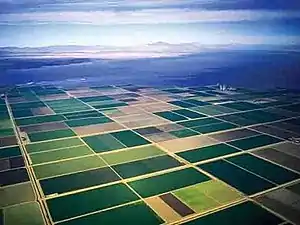   Images, from top down, left to right: The fields of Imperial Valley, Salton Sea, Imperial County Courthouse | |
 Flag  Seal | |
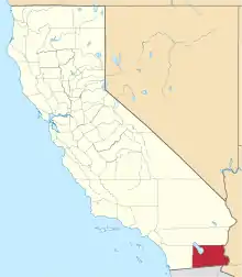 Location in the U.S. state of California | |
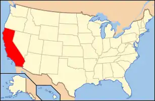 California's location in the United States | |
| Country | United States |
| State | California
|
| Region | Imperial Valley |
| Incorporated | August 7, 1907 |
| Named for | Imperial Valley, which was named after the Imperial Land Company |
| County seat | El Centro |
| Largest city | El Centro |
| Area | |
| • Total | 4,482 sq mi (11,610 km2) |
| • Land | 4,177 sq mi (10,820 km2) |
| • Water | 305 sq mi (790 km2) |
| Highest elevation | 4,551 ft (1,387 m) |
| Population | |
| • Total | 174,528 |
| • Estimate (2019)[3] | 181,215 |
| • Density | 39/sq mi (15/km2) |
| Time zone | UTC−8 (Pacific Time Zone) |
| • Summer (DST) | UTC−7 (Pacific Daylight Time) |
| Area codes | 442/760 |
| FIPS code | 06-025 |
| GNIS feature ID | 277277 |
| Website | www |
Imperial County includes the El Centro, California Metropolitan Statistical Area. It is also part of the Southern California border region, the smallest but most economically diverse region in the state.[5] It is located in the Imperial Valley, in the far southeast of California, bordering both Arizona and the Mexican state of Baja California.
Although this region is a desert, with high temperatures and low average rainfall of 3 inches (76 mm) per year, the economy is heavily based on agriculture due to irrigation, supplied wholly from the Colorado River via the All-American Canal.
The Imperial Valley is divided between the United States and Mexico, and Imperial County is heavily influenced by Mexican culture. Approximately 80% of the county's population is Hispanic, with the vast majority being of Mexican origin. The remainder of the population is predominantly non-Hispanic white as well as smaller African American, Native American and Asian minorities.
In 2016, Imperial County had the highest percentage of unemployed people of any county in the United States, at 23.5%.[6]
History

Spanish explorer Melchor Díaz was one of the first Europeans to visit the area around Imperial Valley in 1540. The explorer Juan Bautista de Anza also explored the area in 1776.[7] Years later, after the Mexican–American War, the northern half of the valley was annexed by the U.S., while the southern half remained under Mexican rule. Small scale settlement in natural aquifer areas occurred in the early 19th century (the present-day site of Mexicali), but most permanent settlement (Americans in the U.S. side, Mexicans in the other side) was after 1900.[8]
In 1905, torrential rainfall in the American Southwest caused the Colorado River (the only drainage for the region) to flood, including canals that had been built to irrigate the Imperial Valley. Since the valley is partially below sea level, the waters never fully receded, but collected in the Salton Sink in what is now called the Salton Sea.
Imperial County was formed in 1907 from the eastern portion of San Diego County. The county took its name from Imperial Valley, itself named for the Imperial Land Company, a subsidiary of the California Development Company, which at the turn of the 20th century had claimed the southern portion of the Colorado Desert for agriculture.[9] Much of the Imperial Land Company's land also existed in Mexico (Baja California). The objective of the company was commercial crop farming development.
By 1910, the land company had managed to settle and develop thousands of farms on both sides of the border. The Mexican Revolution soon after severely disrupted the company's plans. Nearly 10,000 farmers and their families in Mexico were ethnically cleansed by the rival Mexican armies. Not until the 1920s was the other side of California in America sufficiently peaceful and prosperous for the company to earn a return for a large percentage of Mexicans, but some chose to stay and lay down roots in newly sprouted communities in the valley.
The county experienced a period of migration of "Okies" from drought-trodden dust bowl farms by the need of migrant labor, and prosperous job-seekers alike from across the U.S. arrived in the 1930s and 1940s, especially in World War II and after the completion of the All American Canal from its source, the Colorado River, from 1948 to 1951. By the 1950 census, over 50,000 residents lived in Imperial County alone, about 40 times that of 1910. Most of the population was year-round but would increase every winter by migrant laborers from Mexico. Until the 1960s, the farms in Imperial County provided substantial economic returns to the company and the valley.
During the Great Recession of 2008–11, El Centro had one of the highest unemployment rates (above 30–34%) in the U.S. and ranks one of California's poorest counties or have a lower than state and national average annual household income.
Sites of interest
Fort Yuma
Fort Yuma is located on the banks of the Colorado River in Winterhaven, California. First established after the end of the Mexican–American War in 1848, it was originally located in the bottoms near the Colorado River, less than 1 mile (1.6 km) below the mouth of the Gila River. It was to defend the newly settled community of Yuma, Arizona on the other side of the Colorado River and the nearby Mexican border. In March 1851 the post was moved to a small elevation on the Colorado's west bank, opposite the present city of Yuma, Arizona, on the site of the former Mission Puerto de Purísima Concepción. This site had been occupied by Camp Calhoun, named for John C. Calhoun, established in 1849. Fort Yuma was established to protect the southern emigrant travel route to California and to attempt control of the Yuma Indians in the surrounding 100-mile (160 km) area.[10]

Blue Angels
NAF El Centro is the winter home of the U.S. Navy Flight Demonstration Squadron, The Blue Angels. NAF El Centro historically kicks off the Blue Angels' season with their first air show, traditionally held in March.[11]

Imperial Valley Expo & Fairgrounds
The city of Imperial is home to the California Mid-Winter Fair and Fiesta which is the local county fair, held in late February to early March.[12] It is also home to the Imperial Valley Speedway, a race track of 3⁄8 mile (600 m).[13]
Algodones Sand Dunes

The name Algodones Dunes refers to the entire geographic feature, while the administrative designation for that portion managed by the Bureau of Land Management is the "Imperial Sand Dunes Recreation Area" (sometimes called the "Glamis Dunes"). The Algodones Sand Dunes are the largest mass of sand dunes in California. This dune system extends for more than 40 miles (64 km) along the eastern edge of the Imperial Valley agricultural region in a band averaging 5 miles (8 km) in width. A major east–west route of the Union Pacific railroad skirts the eastern edge. The dune system is divided into three areas. The northernmost area is known as Mammoth Wash. South of Mammoth Wash is the North Algodones Dunes Wilderness established by the 1994 California Desert Protection Act. This area is closed to motorized use and access is by hiking and horseback. The largest and most heavily used area begins at Highway 78 and continues south just past Interstate 8. The expansive dune formations offer picturesque scenery, a chance to view rare plants and animals, and a playground for ATV and off-roading enthusiasts. The dunes are also popular in film making and have been the site for movies such as Return of the Jedi.[14]
Colorado River
The Colorado River streams through the southwestern United States and northwestern Mexico, approximately 1,450 miles (2,330 km) long, draining a part of the arid regions on the western slope of the Rocky Mountains. The natural course of the river flows from north of Grand Lake, Colorado, into the Gulf of California. For many months out of the year, however, no water actually flows from the United States to the gulf, due to human use. The river is a popular destination for water sports, including fishing, boating, water skiing, and jet skiing.[15]
Salvation Mountain
Salvation Mountain (location 33°15′14.9″N 115°28′21.4″W) is an artificial mountain north of Calipatria, California, near Slab City. It is made from adobe, straw, and thousands of gallons of paint. It was created by Leonard Knight to convey the message that "God Loves Everyone". Knight refused substantial donations of money and labor from supporters who wished to modify his message of universal love to favor or disfavor particular groups.
Anza-Borrego Desert State Park
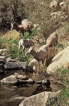
Anza-Borrego Desert State Park, portions of which are located in Imperial County, is the largest state park in California. 500 miles (800 km) of dirt roads and twelve wilderness areas and miles of hiking trails provide visitors with an unparalleled opportunity to experience the wonders of the Colorado Desert. The park is named after Spanish explorer Juan Bautista de Anza and the Spanish name borrego, or bighorn sheep. The park features washes, wildflowers, palm groves, cacti and sweeping vistas. Visitors may also have the chance to see roadrunner, golden eagles, kit foxes, mule deer and bighorn sheep as well as iguanas, chuckwallas and the red diamond rattlesnake.[16]
Fossil Canyon and Painted Gorge
Located near Ocotillo, California in the Coyote Mountains, Fossil Canyon and the surrounding area is a great place for rock hounding and fossil hunting. The fossils here are not dinosaurs, but ancient shells, coral, and oysters from the Miocene epoch when the area was underwater.[17]
The Painted Gorge, located on the eastern side of the Coyote Mountains, consists of sedimentary, metamorphic and igneous rocks. Heat and movement over time has created fantastic shapes and colors. Oranges, reds, purples, and mauves mixed with browns and blacks create a palette of color as the sun illuminates and plays shadows upon this geologic wonder.[17]
Imperial NWR
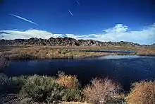
The Imperial National Wildlife Refuge protects wildlife habitat along 30 miles (50 km) of the lower Colorado River in Arizona and California, including the last un-channeled section before the river enters Mexico. The river and its associated backwater lakes and wetlands are a green oasis, contrasting with the surrounding desert mountains. It is a refuge and breeding area for migratory birds and local desert wildlife.[18]
Sonny Bono Salton Sea NWR
The Sonny Bono Salton Sea National Wildlife Refuge is located 40 miles (64 km) north of the Mexican border at the southern end of the Salton Sea in California's Imperial Valley. Situated along the Pacific Flyway, the refuge is the only one of its kind, located 227 feet (69 m) below sea level. Because of its southern latitude, elevation, and location in the Colorado Desert, the refuge experiences some of the highest temperatures in the nation. Daily temperatures from May to October generally exceed 100 °F (38 °C) with temperatures of 116–120 °F (47–49 °C) recorded yearly.[19]
Museum of History in Granite
A unique attraction of the town of Felicity is the Museum of History in Granite. The museum exhibits granite monuments made from Missouri Red Granite. Each is 100 feet (30 m) long. Subjects include a Korean War Memorial, History of Arizona, The Wall for the Ages, the eight monument History of Humanity, and the History of the United States of America. Smaller monuments include the Felicity Stone (sm), a Rosetta Stone for the future located at the center of the History of Humanity monuments.
Geography
According to the U.S. Census Bureau, the county has a total area of 4,482 square miles (11,610 km2), of which 4,177 square miles (10,820 km2) is land and 305 square miles (790 km2) (6.8%) is water.[20] Much of Imperial County is below sea level. Imperial County is roughly twice the size in total square miles as the State of Delaware.
The county is in the Colorado Desert, an extension of the larger Sonoran Desert.
The Colorado River forms the county's eastern boundary. Two notable geographic features are found in the county, the Salton Sea, at 235 feet (72 m) below sea level, and the Algodones Dunes, one of the largest dune fields in America.[21]
The Chocolate Mountains are located east of the Salton Sea, and extend in a northwest–southeast direction [21] for approximately c60 miles (97 km).
In this region, the geology is dominated by the transition of the tectonic plate boundary from rift to fault. The southernmost strands of the San Andreas Fault connect the northernmost extensions of the East Pacific Rise. Consequently, the region is subject to earthquakes, and the crust is being stretched, resulting in a sinking of the terrain over time. Related to the active geology are some interesting hydrothermal features.
National protected areas
Demographics
2011
| Population, race, and income | |||||
|---|---|---|---|---|---|
| Total population[22] | 171,343 | ||||
| White[22] | 115,496 | 67.4% | |||
| Black or African American[22] | 5,985 | 3.5% | |||
| American Indian or Alaska Native[22] | 3,020 | 1.8% | |||
| Asian[22] | 2,757 | 1.6% | |||
| Native Hawaiian or other Pacific Islander[22] | 83 | 0.0% | |||
| Some other race[22] | 38,604 | 22.5% | |||
| Two or more races[22] | 5,398 | 3.2% | |||
| Hispanic or Latino (of any race)[23] | 136,376 | 79.6% | |||
| Per capita income[24] | $16,593 | ||||
| Median household income[25] | $39,402 | ||||
| Median family income[26] | $43,769 | ||||
Places by population, race, and income
| Places by population and race | ||||||||
|---|---|---|---|---|---|---|---|---|
| Place | Type[27] | Population[22] | White[22] | Other[22] [note 1] |
Asian[22] | Black or African American[22] |
Native American[22] [note 2] |
Hispanic or Latino (of any race)[23] |
| Bombay Beach | CDP | 459 | 69.7% | 0.0% | 0.0% | 30.3% | 0.0% | 0.0% |
| Brawley | City | 26,645 | 78.0% | 16.2% | 0.9% | 4.2% | 0.7% | 80.1% |
| Calexico | City | 40,378 | 64.4% | 34.1% | 1.0% | 0.2% | 0.3% | 96.4% |
| Calipatria | City | 7,292 | 66.8% | 21.1% | 1.5% | 9.0% | 1.7% | 75.5% |
| Desert Shores | CDP | 1,104 | 94.4% | 5.6% | 0.0% | 0.0% | 0.0% | 86.3% |
| El Centro | City | 44,206 | 65.1% | 28.6% | 2.6% | 3.1% | 0.7% | 79.6% |
| Heber | CDP | 6,008 | 57.7% | 39.0% | 0.0% | 0.0% | 3.2% | 98.6% |
| Holtville | City | 6,088 | 68.0% | 29.0% | 1.0% | 0.4% | 1.6% | 80.5% |
| Imperial | City | 18,206 | 76.4% | 17.5% | 2.3% | 2.4% | 1.4% | 76.1% |
| Niland | CDP | 1,112 | 86.7% | 8.7% | 0.0% | 1.2% | 3.4% | 61.7% |
| Ocotillo | CDP | 253 | 98.8% | 0.0% | 0.0% | 0.0% | 1.2% | 7.1% |
| Palo Verde | CDP | 171 | 27.0% | 0.0% | 73.0% | 0.0% | 0.0% | 0.0% |
| Salton City | CDP | 3,768 | 77.2% | 20.0% | 0.0% | 2.8% | 0.0% | 47.9% |
| Salton Sea Beach | CDP | 598 | 63.0% | 10.2% | 1.8% | 0.0% | 24.9% | 53.8% |
| Seeley | CDP | 1,683 | 79.8% | 17.8% | 0.0% | 2.4% | 0.0% | 79.1% |
| Westmorland | City | 2,714 | 90.7% | 6.2% | 0.0% | 1.1% | 2.0% | 87.9% |
| Winterhaven | CDP | 493 | 50.9% | 5.9% | 10.8% | 0.0% | 32.5% | 81.5% |
| Places by population and income | |||||
|---|---|---|---|---|---|
| Place | Type[27] | Population[28] | Per capita income[24] | Median household income[25] | Median family income[26] |
| Bombay Beach | CDP | 459 | $12,439 | $19,375 | $24,063 |
| Brawley | City | 26,645 | $17,709 | $36,233 | $43,328 |
| Calexico | City | 40,378 | $14,317 | $35,988 | $39,129 |
| Calipatria | City | 7,292 | $11,559 | $35,030 | $37,381 |
| Desert Shores | CDP | 1,104 | $11,610 | $29,345 | $29,732 |
| El Centro | City | 44,206 | $18,273 | $38,297 | $42,417 |
| Heber | CDP | 6,008 | $13,540 | $45,044 | $44,444 |
| Holtville | City | 6,088 | $20,749 | $40,712 | $42,188 |
| Imperial | City | 18,017 | $21,378 | $57,152 | $57,548 |
| Niland | CDP | 1,112 | $9,750 | $14,883 | $15,170 |
| Ocotillo | CDP | 253 | $15,254 | $17,734 | $20,625 |
| Palo Verde | CDP | 171 | $44,003 | $59,676 | [29] |
| Salton City | CDP | 3,768 | $16,887 | $32,925 | $34,792 |
| Salton Sea Beach | CDP | 598 | $17,791 | $27,375 | $57,159 |
| Seeley | CDP | 1,683 | $14,126 | $33,977 | $44,063 |
| Westmorland | City | 2,714 | $13,179 | $28,375 | $30,804 |
| Winterhaven | CDP | 493 | $9,207 | $35,074 | $35,441 |
2010
| Historical population | |||
|---|---|---|---|
| Census | Pop. | %± | |
| 1910 | 12,591 | — | |
| 1920 | 43,453 | 245.1% | |
| 1930 | 60,903 | 40.2% | |
| 1940 | 55,740 | −8.5% | |
| 1950 | 61,175 | 9.8% | |
| 1960 | 71,105 | 16.2% | |
| 1970 | 74,492 | 4.8% | |
| 1980 | 93,110 | 25.0% | |
| 1990 | 109,303 | 17.4% | |
| 2000 | 143,361 | 31.2% | |
| 2010 | 174,528 | 21.7% | |
| 2019 (est.) | 181,215 | [3] | 3.8% |
| U.S. Decennial Census[30] 1790–1960[31] 1900–1990[32] 1990–2000[33] 2010–2015[2] | |||
The 2010 United States Census reported that Imperial County had a population of 174,528. The racial makeup of Imperial County was 102,553 (58.8%) White, 5,773 (3.3%) African American, 3,059 (1.8%) Native American, 2,843 (1.6%) Asian, 165 (0.1%) Pacific Islander, 52,413 (30.0%) from other races, and 7,722 (4.4%) from two or more races. Hispanic or Latino of any race were 140,271 persons (80.4%).[34]
| Population reported at 2010 United States Census | |||||||||
|---|---|---|---|---|---|---|---|---|---|
Population | American | American | Islander | races | more races | or Latino (of any race) | |||
| Imperial County | 174,528 | 102,553 | 5,773 | 3,059 | 2,843 | 165 | 52,413 | 7,722 | 140,271 |
city | Population | American | American | Islander | races | more races | or Latino (of any race) | ||
| Brawley | 24,953 | 13,570 | 510 | 241 | 349 | 32 | 9,258 | 993 | 20,344 |
| Calexico | 38,572 | 23,150 | 134 | 204 | 504 | 21 | 12,920 | 1,639 | 37,354 |
| Calipatria | 7,705 | 3,212 | 1,612 | 79 | 95 | 25 | 2,455 | 227 | 4,940 |
| El Centro | 42,598 | 25,376 | 1,081 | 554 | 965 | 34 | 12,356 | 2,232 | 34,751 |
| Holtville | 5,939 | 3,655 | 37 | 41 | 50 | 4 | 1,977 | 175 | 4,858 |
| Imperial | 14,758 | 9,298 | 331 | 154 | 370 | 13 | 3,783 | 809 | 11,046 |
| Westmorland | 2,225 | 1,038 | 21 | 38 | 11 | 0 | 1,042 | 75 | 1,938 |
place | Population | American | American | Islander | races | more races | or Latino (of any race) | ||
| Bombay Beach | 295 | 223 | 37 | 8 | 1 | 0 | 22 | 4 | 59 |
| Desert Shores | 1,104 | 709 | 8 | 26 | 4 | 1 | 307 | 49 | 848 |
| Heber | 4,275 | 2,174 | 5 | 33 | 15 | 0 | 1,758 | 290 | 4,197 |
| Niland | 1,006 | 539 | 36 | 20 | 36 | 0 | 315 | 60 | 618 |
| Ocotillo | 266 | 242 | 1 | 1 | 2 | 0 | 17 | 3 | 61 |
| Palo Verde | 171 | 124 | 2 | 5 | 1 | 0 | 26 | 13 | 33 |
| Salton City | 3,763 | 2,260 | 80 | 61 | 61 | 5 | 1,159 | 137 | 2,368 |
| Salton Sea Beach | 422 | 309 | 6 | 4 | 2 | 2 | 82 | 17 | 229 |
| Seeley | 1,739 | 746 | 19 | 7 | 21 | 2 | 793 | 151 | 1,489 |
| Winterhaven | 394 | 245 | 4 | 37 | 1 | 0 | 84 | 23 | 261 |
unincorporated areas | Population | American | American | Islander | races | more races | or Latino (of any race) | ||
| All others not CDPs (combined) | 24,343 | 15,683 | 1,849 | 1,546 | 355 | 26 | 4,059 | 825 | 14,877 |
2000
As of the census[35] of 2000, there were 142,361 people, 39,384 households, and 31,467 families residing in the county. The population density was 34 people per square mile (13/km2). There were 43,891 housing units at an average density of 10 per square mile (4/km2). The racial makeup of the county was 49.4% White, 4.0% Black or African American, 1.9% Native American, 2.0% Asian, 0.1% Pacific Islander, 39.1% from other races, and 3.7% from two or more races. 72.2% of the population were Hispanic or Latino of any race. 65.7% spoke Spanish at home, while 32.3% spoke only English.
There were 39,384 households, out of which 46.7% had children under the age of 18 living with them, 57.7% were married couples living together, 17.1% had a female householder with no husband present, and 20.1% were non-families. 17.1% of all households were made up of individuals, and 8.1% had someone living alone who was 65 years of age or older. The average household size was 3.33 and the average family size was 3.77.
In the county, the population was spread out, with 31.4% under the age of 18, 9.9% from 18 to 24, 30.4% from 25 to 44, 18.2% from 45 to 64, and 10.0% who were 65 years of age or older. The median age was 31 years. For every 100 females there were 109.3 males. For every 100 females age 18 and over, there were 111.4 males.
The median income for a household in the county was $31,870, and the median income for a family was $35,226. Males had a median income of $32,775 versus $23,974 for females. The per capita income for the county was $13,239. About 19.4% of families and 22.6% of the population were below the poverty line, including 28.7% of those under age 18 and 13.6% of those age 65 or over.
Imperial County has the lowest per capita income of any county in Southern California and among the bottom five counties in the state.
By 2006 the population had risen to 160,201, the population growth rate since the year 2000 was 30%, the highest in California and fifth highest in the United States in the time period. High levels of immigration, new residents search for affordable homes, and a search for retirement homes can explain the population increase.
Government
The county is governed by the Imperial County Board of Supervisors, a five-member board elected by districts.[36] Supervisors serve four-year terms. Other elected county officials include the Assessor,[37] Auditor-Controller,[38] District Attorney,[39] County Clerk-Recorder,[40] Public Administrator,[41] Sheriff-Coroner,[42] and Treasurer-Tax Collector.[43] The county is run on a day-to-day basis by the County Executive Officer, who is currently Robin Hodgkin, on an interim basis. The county is advised as to legal matters by the County Counsel, who is currently Katherine K. Turner.[44][45]
Politics
Voter registration statistics
| Population and registered voters | ||
|---|---|---|
| Total population[22] | 171,343 | |
| Registered voters[46][note 3] | 60,690 | 35.4% |
| Democratic[46] | 30,599 | 50.4% |
| Republican[46] | 14,413 | 23.7% |
| Democratic–Republican spread[46] | +16,186 | +26.7% |
| Independent[46] | 1,402 | 2.3% |
| Green[46] | 141 | 0.2% |
| Libertarian[46] | 215 | 0.4% |
| Peace and Freedom[46] | 255 | 0.4% |
| Americans Elect[46] | 8 | 0.0% |
| Other[46] | 358 | 0.6% |
| No party preference[46] | 13,299 | 21.9% |
Cities by population and voter registration
| City | Population[22] | Registered voters[46] [note 3] |
Democratic[46] | Republican[46] | D–R spread[46] | Other[46] | No party preference[46] |
|---|---|---|---|---|---|---|---|
| Brawley | 24,645 | 37.1% | 50.5% | 26.7% | +23.8% | 5.9% | 19.1% |
| Calexico | 37,378 | 39.0% | 61.8% | 9.7% | +52.1% | 4.2% | 25.6% |
| Calipatria | 7,292 | 16.0% | 53.7% | 18.7% | +35.0% | 6.5% | 23.4% |
| El Centro | 42,141 | 38.1% | 49.0% | 25.6% | +23.4% | 6.0% | 21.6% |
| Holtville | 5,908 | 35.3% | 45.0% | 28.4% | +16.6% | 8.2% | 21.5% |
| Imperial | 14,017 | 40.9% | 39.6% | 32.4% | +7.2% | 7.9% | 23.1% |
| Westmorland | 1,714 | 42.8% | 56.0% | 19.5% | +36.5% | 7.1% | 20.0% |
Overview
Previously strongly Republican, Imperial County is now a Democratic stronghold in presidential, congressional and local elections. The last Republican to win a majority in the county was George H. W. Bush in 1988.
| Year | GOP | DEM | Others |
|---|---|---|---|
| 2020 | 36.7% 20,847 | 61.1% 34,678 | 2.1% 1,218 |
| 2016 | 26.4% 12,704 | 67.9% 32,667 | 5.7% 2,720 |
| 2012 | 33.1% 12,777 | 65.2% 25,136 | 1.7% 652 |
| 2008 | 36.1% 14,008 | 62.2% 24,162 | 1.7% 650 |
| 2004 | 46.4% 15,890 | 52.4% 17,964 | 1.2% 420 |
| 2000 | 43.3% 12,524 | 53.5% 15,489 | 3.2% 924 |
| 1996 | 36.8% 9,705 | 55.3% 14,591 | 8.0% 2,104 |
| 1992 | 38.6% 9,759 | 43.9% 11,109 | 17.6% 4,450 |
| 1988 | 55.2% 12,889 | 43.8% 10,243 | 1.0% 233 |
| 1984 | 62.0% 13,829 | 36.9% 8,237 | 1.1% 235 |
| 1980 | 55.9% 12,068 | 36.9% 7,961 | 7.2% 1,550 |
| 1976 | 49.9% 10,618 | 48.2% 10,244 | 1.9% 400 |
| 1972 | 62.1% 14,178 | 34.9% 7,982 | 3.0% 689 |
| 1968 | 52.9% 10,818 | 36.6% 7,481 | 10.5% 2,147 |
| 1964 | 48.1% 10,330 | 51.9% 11,143 | 0.1% 19 |
| 1960 | 53.6% 10,606 | 46.0% 9,119 | 0.4% 81 |
| 1956 | 56.1% 10,526 | 43.7% 8,197 | 0.3% 58 |
| 1952 | 62.1% 11,044 | 37.2% 6,619 | 0.6% 112 |
| 1948 | 52.6% 6,217 | 44.9% 5,301 | 2.5% 292 |
| 1944 | 53.8% 5,979 | 45.8% 5,085 | 0.4% 48 |
| 1940 | 46.6% 6,854 | 52.5% 7,728 | 0.9% 130 |
| 1936 | 38.3% 4,771 | 60.8% 7,560 | 0.9% 113 |
| 1932 | 29.0% 3,783 | 67.3% 8,772 | 3.7% 484 |
| 1928 | 67.6% 5,417 | 31.0% 2,486 | 1.4% 109 |
| 1924 | 50.3% 3,455 | 11.0% 759 | 38.7% 2,658 |
| 1920 | 64.5% 4,699 | 27.8% 2,022 | 7.7% 563 |
| 1916 | 40.5% 2,694 | 49.2% 3,273 | 10.4% 692 |
| 1912 | 0.4% 13 | 38.5% 1,295 | 61.2% 2,059 |
| 1908 | 47.6% 909 | 35.4% 675 | 17.0% 324 |
On November 4, 2008, Imperial County voted 69.7% for Proposition 8, which amended the California Constitution to ban same-sex marriages, showing more support for the proposition than any other strongly Democratic county.[48][49] After Prop 8 was declared unconstitutional by a lower federal court, Imperial County continued to defend Proposition 8 in the federal judicial system.[50] However, on February 6, 2012, the United States Court of Appeals for the Ninth Circuit denied Imperial County legal standing in the case Hollingsworth v. Perry.[51]
Imperial County is in California's 51st congressional district, represented by Democrat Juan Vargas.[52] In the state legislature, the county is in the 56th Assembly District, represented by Democrat Eduardo Garcia,[53] and the 40th Senate District, represented by Democrat Ben Hueso.[54]
Crime
The following table includes the number of incidents reported and the rate per 1,000 persons for each type of offense.
| Population and crime rates | ||
|---|---|---|
| Population[22] | 171,343 | |
| Violent crime[55] | 590 | 3.44 |
| Homicide[55] | 3 | 0.02 |
| Forcible rape[55] | 18 | 0.11 |
| Robbery[55] | 99 | 0.58 |
| Aggravated assault[55] | 470 | 2.74 |
| Property crime[55] | 3,134 | 18.29 |
| Burglary[55] | 1,758 | 10.26 |
| Larceny-theft[55][56] | 2,944 | 17.18 |
| Motor vehicle theft[55] | 940 | 5.49 |
| Arson[55] | 44 | 0.26 |
Cities by population and crime rates
| Cities by population and crime rates | ||||||||
|---|---|---|---|---|---|---|---|---|
| City | Population[57] | Violent crimes[57] | Violent crime rate per 1,000 persons |
Property crimes[57] | Property crime rate per 1,000 persons | |||
| Brawley | 25,570 | 59 | 2.31 | 1,176 | 45.99 | |||
| Calexico | 39,527 | 108 | 2.73 | 1,538 | 38.91 | |||
| El Centro | 43,643 | 166 | 3.80 | 2,477 | 56.76 | |||
| Holtville | 6,088 | 11 | 1.81 | 98 | 16.10 | |||
| Imperial | 15,126 | 7 | 0.46 | 73 | 4.83 | |||
| Westmorland | 2,282 | 2 | 0.88 | 9 | 3.94 | |||
Economy
Thousands of acres of prime farmland have transformed the desert into one of the most productive farming regions in California with an annual crop production of over $1 billion. Agriculture is the largest industry in Imperial County and accounts for 48% of all employment.[58] Although this region is a desert, with high temperatures and low average rainfall of three inches (75 mm) per year, the economy is heavily based on agriculture due to irrigation, which is supplied wholly from the Colorado River via the All-American Canal. A vast system of canals, check dams, and pipelines carry the water all over the valley, a system which forms the Imperial Irrigation District, or IID. The water distribution system includes over 1,400 miles (2,300 km) of canal and with 1,100 miles (1,800 km) of pipeline. The number of canal and pipeline branches number roughly over a hundred. Imported water and a long growing season allow two crop cycles each year, and the Imperial Valley is a major source of winter fruits and vegetables, cotton, and grain for U.S. and international markets. Alfalfa is another major crop produced in the Imperial Valley. The agricultural lands are served by a constructed agricultural drain system, which conveys surface runoff and subsurface drainage from fields to the Salton Sea, which is a designated repository for agricultural runoff.[59] Imperial County produces nearly 2/3 of all vegetables consumed by Americans during the winter.[60]
El Centro is the commercial center of Imperial County. Fifty percent of the jobs in El Centro come from the service and retail sector.[58]
A recent growth in the interest of Imperial County as a filming location, has spurred growth in servicing this industry.[58] Because of the county's desert environment and proximity to Los Angeles, California, movies are sometimes filmed in the sand dunes outside the agricultural portions of the county. These have included Return of the Jedi, Stargate, The Scorpion King, and Into the Wild. Additionally, portions of the 2005 film Jarhead were filmed here because of its similarity to the desert terrain of Iraq.
Renewable energy source
Imperial Valley has become a hotbed of renewable energy projects, both solar and geothermal.[61] This is driven in part by California's mandate to generate 20% of its power from renewable sources by the end of 2010, the valley's excellent sun resources, the high unemployment, its proximity to large population centers on the coast, and large tracts of otherwise unusable desert land.[61] Much of the land suitable for green energy is owned by the federal government (Bureau of Land Management). As of April 2008, the BLM has received 163 applications to build renewable energy projects on 1,600,000 acres (6,500 km2) in California. Almost all of these are planned for the Imperial Valley and the desert region north of the valley.[61] Stirling Energy is currently building one of the world's largest solar thermal plants, 10 square miles (26 km2) with 38,000 "sun catchers," it will power up to 600,000 homes once it is fully operational by around 2015.[61] CalEnergy currently runs a geothermal plant that generates enough power for 300,000 homes and could tap into more for up to 2.5 million homes.[61]
Transportation
Major highways
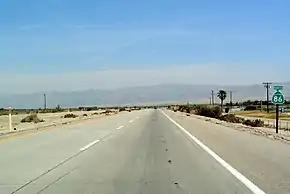
Imperial County is at the junction of one interstate, and three state highways. Radiating to the east and west are connections to the Arizona Sun Corridor and San Diego-Tijuana metropolitan area via Interstate 8, Blythe, and northern San Diego County via State Route 78, the Mexicali Valley via State Route 111, and the Coachella Valley, Inland Empire, and Los Angeles metropolitan area via State Route 86.
Public transportation
Imperial County is served by Greyhound Lines and Imperial Valley Transit buses. Through a partnership between Imperial County Transportation Commission (ICTC), the Yuma County Intergovernmental Public Transportation Authority (YCIPTA), and the Quechan Indian Tribe, Yuma County Area Transit buses serve portions of Imperial County and connects it to Yuma, Arizona.[62][63] Amtrak trains on the Sunset Limited and Texas Eagle route also travel through the county, but with no scheduled stops; the nearest stop is in Yuma, Arizona.
County owned
- Imperial County Airport, the county's main airport, is primarily a general aviation facility. It is located just north of El Centro, and has limited commercial flight service subsidized by the Essential Air Service program.
- Holtville Airport is a public use general aviation airport, owned by the county and located roughly 5 miles (8 km) east of Holtville.
Municipal ownership
- Brawley Municipal Airport is a public use general aviation airport, owned by and located in Brawley.
- Calexico Airport is a public use general aviation field, owned by and located in Calexico. It is located 15 miles (24 km) south of Interstate 8 on State Route 111. It used in part to service maquiladora factories in nearby Mexicali.
- Cliff Hatfield Memorial Airport is a public use general aviation airport, owned by and located in Calipatria.
Privately owned
- Salton Sea Airport is a public use general aviation airport located in Salton City.
- Douthitt Strip Airport is a private use facility in El Centro. It was formerly a military airfield.
Military
- Naval Air Facility El Centro is a U.S. Navy airfield in El Centro.
Communities
Cities
- Brawley
- Calexico
- Calipatria
- El Centro (county seat)
- Holtville
- Imperial
- Westmorland
Census-designated places
Unincorporated communities
Former settlements
Indian Reservations
- Fort Yuma Indian Reservation (partially in Yuma County, Arizona)
- Torres-Martinez Indian Reservation (partially in Riverside County)
Population ranking
The population ranking of the following table is based on the 2010 census of Imperial County.[64]
† county seat
| Rank | City/Town/etc. | Municipal type | Population (2010 Census) |
|---|---|---|---|
| 1 | † El Centro | City | 42,598 |
| 2 | Calexico | City | 38,572 |
| 3 | Brawley | City | 24,953 |
| 4 | Imperial | City | 14,758 |
| 5 | Calipatria | City | 7,705 |
| 6 | Holtville | City | 5,939 |
| 7 | Torres-Martinez Reservation[65] | AIAN | 5,594 |
| 8 | Heber | CDP | 4,275 |
| 9 | Salton City | CDP | 3,763 |
| 10 | Westmorland | City | 2,225 |
| 11 | Fort Yuma Indian Reservation[66] (partially in Yuma County, AZ) | AIAN | 2,189 |
| 12 | Seeley | CDP | 1,739 |
| 13 | Desert Shores | CDP | 1,104 |
| 14 | Niland | CDP | 1,006 |
| 15 | Salton Sea Beach | CDP | 422 |
| 16 | Winterhaven | CDP | 394 |
| 17 | Bombay Beach | CDP | 295 |
| 18 | Ocotillo | CDP | 266 |
| 19 | Palo Verde | CDP | 171 |
Area codes
442/760 – Covers all of the El Centro metropolitan area as well as Palm Springs, Oceanside, Bishop, Ridgecrest, Barstow, and Needles; northern San Diego County; and southeastern California, including much of the Mojave Desert and the Owens Valley. Area code 760 split from area code 619 on March 22, 1997 and was overlaid with area code 442 in 2009.
In popular culture
As a filming location
- Scenes for the 2006 film Borat: Cultural Learnings of America for Make Benefit Glorious Nation of Kazakhstan were filmed in Imperial County, but were not used in the finished film.
- The majority of Jarhead and The Salton Sea were filmed in the Imperial Valley.
- Scenes from Top Gun were filmed at Naval Air Facility El Centro
- American Sniper was filmed in El Centro in fall 2014.
- Scenes from Jumanji: The Next Level were filmed in Imperial Dunes the spring of 2019.
Cultural references
- Part of Independence Day takes place in the Imperial Valley.
- Tucson-based indie rock band Calexico is named after Calexico.
- The 2009 nonfiction book Imperial by William T. Vollmann documents the history and culture of Imperial County. A companion volume of photographs was published August 18, 2009.
- The Sons of Anarchy spin-off Mayans MC takes place in Santo Padre, a fictional town in Imperial County.
- The video game Grand Theft Auto V features a county named Blaine County, which is based on Imperial County.
- In the 1963 film, It's a Mad, Mad, Mad, Mad World, Ethel Merman's character is heard talking on a phone to her son, saying that she was "in some place called Plaster City." Plaster City is an unincorporated community in Imperial County.
See also
Notes
- Other = Some other race + Two or more races
- Native American = Native Hawaiian or other Pacific Islander + American Indian or Alaska Native
- Percentage of registered voters with respect to total population. Percentages of party members with respect to registered voters follow.
References
- "Blue Angels Peak". Peakbagger.com. Retrieved February 23, 2015.
- "State & County QuickFacts". United States Census Bureau. Archived from the original on July 11, 2011. Retrieved April 4, 2016.
- "American FactFinder". Archived from the original on February 14, 2020. Retrieved April 19, 2019.
- "Find a County". National Association of Counties. Archived from the original on May 31, 2011. Retrieved June 7, 2011.
- "Labor Force Data by County, 2016 Annual Averages". U.S. Bureau of Labor Statistics. Retrieved September 8, 2017.
- "De Anza Trail". Solideas.com. Retrieved August 3, 2009.
- "Tour Imperial Valley". CaliforniaResortLife. Retrieved December 15, 2015.
- https://www.latimes.com/local/california/la-me-imperial-county-unemployment-20190205-htmlstory.html
- "Fort Yuma". Militarymuseum.org. Retrieved August 5, 2009.
- "Blue Angels Official Website". Blueangels.navy.mil. Archived from the original on April 30, 2009. Retrieved August 5, 2009.
- "2019 California Mid-Winter Fair and Fiesta opens Friday". The Desert Review. February 25, 2019. Retrieved April 1, 2019.
- "Imperial Valley Expo". Ivexpo.com. Archived from the original on June 14, 2009. Retrieved August 5, 2009.
- "Algodones Sand Dunes". Retrieved August 5, 2009.
- "Things to Do in Yuma". Archived from the original on July 13, 2009. Retrieved August 5, 2009.
- "Tour Imperial Valley". CaliforniaResortLife. Retrieved December 15, 2015.
- "Fossil Canyon and Painted Gorge". Retrieved August 5, 2009.
- "Imperial NWR". Archived from the original on June 12, 2009. Retrieved August 4, 2009.
- "Sonny Bono Salton Sea National Wildlife Refuge". Retrieved August 4, 2009.
- "2010 Census Gazetteer Files". United States Census Bureau. August 22, 2012. Retrieved September 26, 2015.
- "Imperial County". Archived from the original on May 2, 2014. Retrieved August 3, 2009.
- U.S. Census Bureau. American Community Survey, 2011 American Community Survey 5-Year Estimates, Table B02001. U.S. Census website . Retrieved October 26, 2013.
- U.S. Census Bureau. American Community Survey, 2011 American Community Survey 5-Year Estimates, Table B03003. U.S. Census website . Retrieved October 26, 2013.
- U.S. Census Bureau. American Community Survey, 2011 American Community Survey 5-Year Estimates, Table B19301. U.S. Census website . Retrieved October 21, 2013.
- U.S. Census Bureau. American Community Survey, 2011 American Community Survey 5-Year Estimates, Table B19013. U.S. Census website . Retrieved October 21, 2013.
- U.S. Census Bureau. American Community Survey, 2011 American Community Survey 5-Year Estimates, Table B19113. U.S. Census website . Retrieved October 21, 2013.
- U.S. Census Bureau. American Community Survey, 2011 American Community Survey 5-Year Estimates. U.S. Census website . Retrieved October 21, 2013.
- U.S. Census Bureau. American Community Survey, 2011 American Community Survey 5-Year Estimates, Table B01003. U.S. Census website . Retrieved October 21, 2013.
- Data unavailable
- "U.S. Decennial Census". United States Census Bureau. Retrieved September 26, 2015.
- "Historical Census Browser". University of Virginia Library. Retrieved September 26, 2015.
- Forstall, Richard L., ed. (March 27, 1995). "Population of Counties by Decennial Census: 1900 to 1990". United States Census Bureau. Retrieved September 26, 2015.
- "Census 2000 PHC-T-4. Ranking Tables for Counties: 1990 and 2000" (PDF). United States Census Bureau. April 2, 2001. Retrieved September 26, 2015.
- "2010 Census P.L. 94-171 Summary File Data". United States Census Bureau.
- "U.S. Census website". United States Census Bureau. Retrieved May 14, 2011.
- "Board of Supervisors". Co.imperial.ca.us. Archived from the original on May 2, 2014. Retrieved November 17, 2013.
- "Archived copy". Archived from the original on May 29, 2016. Retrieved June 2, 2016.CS1 maint: archived copy as title (link)
- "Archived copy". Archived from the original on May 29, 2016. Retrieved June 2, 2016.CS1 maint: archived copy as title (link)
- "Home". Co.imperial.ca.us. Retrieved November 7, 2017.
- website, Designed by Leonel Ibarra for The County of Imperial based on ca.gov. "Imperial County Clerk / Recorder Department". Co.imperial.ca.us. Retrieved November 7, 2017.
- "Public AdministratorArea Agency on Aging". Public Administrator Area Agency on Aging. Retrieved November 7, 2017.
- "Imperial County Sheriffs's Office". Icso.org. Retrieved November 7, 2017.
- "County of Imperial – TC – TR". Co.imperial.ca.us. Archived from the original on October 31, 2017. Retrieved November 7, 2017.
- "County Counsel – County of Imperial". Co.imperial.ca.us. Archived from the original on October 17, 2017. Retrieved November 7, 2017.
- "Board selects first woman to County Counsel". Retrieved November 7, 2017.
- California Secretary of State. February 10, 2013 – Report of Registration Archived July 27, 2013, at the Wayback Machine. Retrieved October 31, 2013.
- Leip, David. "Dave Leip's Atlas of U.S. Presidential Elections". uselectionatlas.org. Retrieved November 7, 2017.
- "Proposition 8 Map – November 4, 2008, General Election – California Secretary of State". Sos.ca.gov. Archived from the original on August 8, 2009. Retrieved August 17, 2009.
- "Registration by County". Sos.ca.gov. Archived from the original on October 12, 2009. Retrieved August 17, 2009.
- Fagan, Kevin (August 26, 2010). "Imperial County steps up to defend Prop. 8". The San Francisco Chronicle. Archived from the original on August 25, 2010. Retrieved August 25, 2010.
- Denniston, Lyle (February 6, 2012). "Prop. 8: Final ruling due". SCOTUSblog. Retrieved June 18, 2013.
- "California's 51st Congressional District - Representatives & District Map". Civic Impulse, LLC. Retrieved April 7, 2013.
- "Members Assembly". State of California. Retrieved April 7, 2013.
- "Senators". State of California. Retrieved April 7, 2013.
- Office of the Attorney General, Department of Justice, State of California. Table 11: Crimes – 2009 Archived December 2, 2013, at the Wayback Machine. Retrieved November 14, 2013.
- Only larceny-theft cases involving property over $400 in value are reported as property crimes.
- United States Department of Justice, Federal Bureau of Investigation. Crime in the United States, 2012, Table 8 (California). Retrieved November 14, 2013.
- "El Centro Chamber of Commerce". Archived from the original on November 3, 2010. Retrieved August 3, 2009.
- "IID". Archived from the original on June 3, 2009. Retrieved August 3, 2009.
- "Quick Facts About Imperial County Agriculture" (PDF). Imperial County Farm Bureau. Archived from the original (PDF) on February 18, 2018. Retrieved March 22, 2018.
- "Calif. Desert Becomes Home For Renewable Energy", Rob Schmitz, Morning Edition, April 3, 2009, NPR
- "Route connects El Centro, Yuma". schurz-ivpressonline. Archived from the original on December 20, 2016. Retrieved December 18, 2016.
- "ICTC/YCIPTA/Quechan Transit Services" (PDF). Imperialctc.org. Retrieved November 7, 2017.
- "2010 U.S. Census website". United States Census Bureau. Retrieved February 10, 2013.
- "Archived copy". Archived from the original on January 18, 2017. Retrieved December 7, 2017.CS1 maint: archived copy as title (link)
External links
| Wikimedia Commons has media related to Imperial County, California. |
| Wikivoyage has a travel guide for Imperial County. |
- Official website

 Geographic data related to Imperial County, California at OpenStreetMap
- Imperial Irrigation District
- Imperial Valley Economic Development Corporation
- Statistical profile of Imperial County, California
Places adjacent to Imperial County, California | ||||||||||
|---|---|---|---|---|---|---|---|---|---|---|
| ||||||||||
Municipalities and communities of Imperial County, California, United States | ||
|---|---|---|
| Cities | Imperial County map | |
| CDPs | ||
| Unincorporated communities | ||
| Indian reservations | ||
| Ghost towns | ||
| ||

| Authority control |
|---|