Breckinridge County, Kentucky
Breckinridge County is a county located in the Commonwealth of Kentucky. As of the 2010 census, the population was 20,059.[1] Its county seat is Hardinsburg, Kentucky.[2] The county was named for John Breckinridge (1760–1806), a Kentucky Attorney General, state legislator, United States Senator, and United States Attorney General.[3][4] It was the 38th Kentucky county in order of formation.[5]
Breckinridge County | |
|---|---|
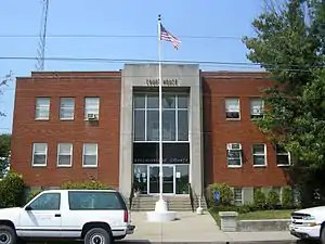 Breckinridge County, Kentucky courthouse in Hardinsburg | |
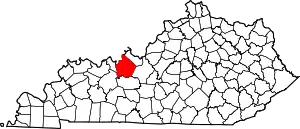 Location within the U.S. state of Kentucky | |
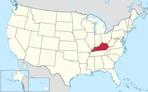 Kentucky's location within the U.S. | |
| Coordinates: 37°46′N 86°26′W | |
| Country | |
| State | |
| Founded | 1799 |
| Named for | John Breckinridge |
| Seat | Hardinsburg |
| Largest city | Hardinsburg |
| Area | |
| • Total | 586 sq mi (1,520 km2) |
| • Land | 567 sq mi (1,470 km2) |
| • Water | 18 sq mi (50 km2) 3.2%% |
| Population | |
| • Estimate (2018) | 20,388 |
| • Density | 35/sq mi (14/km2) |
| Time zone | UTC−6 (Central) |
| • Summer (DST) | UTC−5 (CDT) |
| Congressional district | 2nd |
| Website | www |
Breckinridge County is now a wet county, following a local option election on January 29, 2013, but it had been a dry county for the previous 105 years.
History
The area presently bounded by Kentucky state lines was a part of the U.S. State of Virginia, known as Kentucky County when the British colonies separated themselves in the American Revolutionary War. In 1780, the Virginia legislature divided the previous Kentucky County into three smaller units: Fayette, Jefferson, and Lincoln. In 1791, this area was separated into the State of Kentucky; it became effective on June 1, 1792. From that time, the original three counties were divided several times. A portion of Jefferson County was split off as Nelson County in 1784; a portion of Nelson was split off as Hardin County in 1792; the present Breckinridge County was split off from Hardin in 1799.
In August 1779, Sinclair Hardin (first cousin of Captain William Hardin, the founder of Hardin's Fort), was killed by Shawnee Indians while taking a drink at Big Springs. He was the first white settler in Breckinridge County to be killed by Native Americans.[6][7] The Indian threat continued for several years. However, the only sizable expedition against the Native Americans that Breckenridge County settlers took part in culminated in the Battle of Saline Creek in August 1786, in Illinois.[6][7] The battle only lasted a few minutes, with fierce hand-to-hand combat. Between 18 and 30 Shawnee warriors were killed, with six more wounded. The remainder of the Shawnee fled. Captain William Hardin had commanded the Kentucky volunteers, many of whom also were killed or wounded. Hardin's militia brought home 16 Shawnee scalps, nine captured horses, 17 muskets, and "a mighty nice sword".[7]
The Judge-Executive of Breckinridge County from 1801 to 1805 was William Comstock. Jo Allen was the county clerk, and Ben Huff was the sheriff.[8]
During the American Civil War, raiding Kentucky Confederate cavalry burned the courthouse, as it was being used by Union troops as a barracks, though most of the records were saved. On March 12, 1865, Jerome Clarke, a well known Confederate guerrilla, claimed by some to have been Sue Munday, was captured near the Breckinridge–Meade County line.[9] He was hanged three days later in Louisville.[10] Afterward, his trial drew heavy criticism.
During the nineteenth century, the Victoria Coal Mines, named in honor of British Queen Victoria, were the first to produce coal oil, and Cloverport exported it to Great Britain, where it was used to light Buckingham Palace.
United States Supreme Court Justice Wiley Blount Rutledge, Jr., who served on the High Court from 1943 to 1949, was born at Tar Springs in 1894, when his father was pastor of Cloverport Baptist Church.
On June 6, 1932, at Hardinsburg, Sam Jennings became the penultimate person to be publicly executed in the United States.
In the 1950s, Rough River Dam State Resort Park was developed at the southern border of the county.
A third courthouse fire nearly destroyed county records in 1958.
Breckinridge County High School won the 1965 and 1995 Kentucky High School Athletic Association's Boys' Basketball tournaments.
The Breckinridge County Archives, formed in 1984, was the first state-funded archival repository in the history of the United States and is known across the nation as an excellent resource for genealogical and historical research.
Geography
According to the U.S. Census Bureau, the county has a total area of 586 square miles (1,520 km2), of which 567 square miles (1,470 km2) is land and 18 square miles (47 km2) (3.2%) is water.[11]
Adjacent counties
- Perry County, Indiana (northwest)
- Meade County (northeast/EST Border)
- Hardin County (east/EST Border)
- Grayson County (south)
- Ohio County (southwest)
- Hancock County (west)
Demographics
| Historical population | |||
|---|---|---|---|
| Census | Pop. | %± | |
| 1810 | 3,430 | — | |
| 1820 | 7,485 | 118.2% | |
| 1830 | 7,345 | −1.9% | |
| 1840 | 8,944 | 21.8% | |
| 1850 | 10,593 | 18.4% | |
| 1860 | 13,236 | 25.0% | |
| 1870 | 13,440 | 1.5% | |
| 1880 | 17,486 | 30.1% | |
| 1890 | 21,034 | 20.3% | |
| 1900 | 20,534 | −2.4% | |
| 1910 | 21,034 | 2.4% | |
| 1920 | 19,652 | −6.6% | |
| 1930 | 17,368 | −11.6% | |
| 1940 | 17,744 | 2.2% | |
| 1950 | 15,528 | −12.5% | |
| 1960 | 14,734 | −5.1% | |
| 1970 | 14,789 | 0.4% | |
| 1980 | 16,861 | 14.0% | |
| 1990 | 16,312 | −3.3% | |
| 2000 | 18,648 | 14.3% | |
| 2010 | 20,059 | 7.6% | |
| 2018 (est.) | 20,388 | [12] | 1.6% |
| U.S. Decennial Census[13] 1790-1960[14] 1900-1990[15] 1990-2000[16] 2010-2013[1] | |||
As of the census[17] of 2000, there were 18,648 people, 7,324 households, and 5,309 families residing in the county. The population density was 33 per square mile (13/km2). There were 9,890 housing units at an average density of 17 per square mile (6.6/km2). The racial makeup of the county was 95.84% White, 2.86% Black or African American, 0.23% Native American, 0.08% Asian, 0.02% Pacific Islander, 0.09% from other races, and 0.90% from two or more races. 0.72% of the population were Hispanic or Latino of any race.
There were 7,324 households, out of which 31.00% had children under the age of 18 living with them, 59.60% were married couples living together, 8.90% had a female householder with no husband present, and 27.50% were non-families. 24.60% of all households were made up of individuals, and 11.60% had someone living alone who was 65 years of age or older. The average household size was 2.51 and the average family size was 2.97.
In the county, the population was spread out, with 24.90% under the age of 18, 8.20% from 18 to 24, 26.70% from 25 to 44, 26.00% from 45 to 64, and 14.20% who were 65 years of age or older. The median age was 38 years. For every 100 females there were 98.60 males. For every 100 females age 18 and over, there were 96.30 males.
The median income for a household in the county was $30,554, and the median income for a family was $36,575. Males had a median income of $31,004 versus $19,371 for females. The per capita income for the county was $15,402. About 11.80% of families and 15.80% of the population were below the poverty line, including 16.60% of those under age 18 and 19.00% of those age 65 or over.
Education
Breckinridge County has three school systems:
- Breckinridge County Public Schools
- Cloverport Independent Schools
- Saint Romuald Interparochial School
Library
Breckinridge County Public Library is located at 308 Old Highway 60 in Hardinsburg, Kentucky.
Communities
Incorporated Communities
- Cloverport
- Hardinsburg (county seat)
- Irvington
Unincorporated Communities A–L
- Addison
- Axtel
- Bewleyville
- Big Spring (partially)
- Cannons Point
- Clifton Mills
- Constantine
- Custer
- Dyer
- Fairfield
- Falls of Rough
- Fisher
- Frymire
- Garfield
- Glen Dean
- Harned
- Hinton Hills
- Holt
- Hudson
- Kingswood
- Kirk
- Locust Hill
- Lodiburg
Notable natives
- Alfred "Butch" Beard - professional basketball player and coach
- David "Big Dave" DeJernett - professional basketball player
- Philip Leget Edwards - American educator
- Joseph Holt - Judge Advocate General of the United States Army, Attorney General - Secretary of War, Commissioner of Patents, and Postmaster General.
- Bobbi Jordan - American actress
- John Alexander McClernand - Union General during the American Civil War
- Charles Harwood Moorman—Judge of the Kentucky Court of Appeals, Judge of the United States District Court for the Western District of Kentucky, and Judge of the United States Court of Appeals for the Sixth Circuit
- George W. Swink - businessman
- Tera Wray - pornographic actress
- Joe Wright - Majority floor leader in the Kentucky State Senate
Politics
| Year | Republican | Democratic | Third parties |
|---|---|---|---|
| 2016 | 73.9% 6,484 | 22.3% 1,960 | 3.8% 330 |
| 2012 | 63.1% 5,025 | 35.5% 2,825 | 1.5% 119 |
| 2008 | 62.0% 5,281 | 36.5% 3,110 | 1.5% 131 |
| 2004 | 65.5% 5,580 | 33.9% 2,884 | 0.7% 56 |
| 2000 | 63.9% 4,763 | 34.8% 2,595 | 1.3% 95 |
| 1996 | 46.4% 3,151 | 43.5% 2,956 | 10.2% 690 |
| 1992 | 41.9% 2,941 | 44.4% 3,113 | 13.7% 959 |
| 1988 | 58.0% 3,841 | 41.8% 2,765 | 0.3% 17 |
| 1984 | 62.1% 4,432 | 37.4% 2,669 | 0.4% 31 |
| 1980 | 52.7% 3,629 | 45.9% 3,163 | 1.4% 99 |
| 1976 | 44.2% 2,698 | 54.8% 3,347 | 1.1% 66 |
| 1972 | 64.3% 3,574 | 34.5% 1,921 | 1.2% 68 |
| 1968 | 47.3% 2,779 | 34.5% 2,024 | 18.2% 1,070 |
| 1964 | 36.7% 2,167 | 63.2% 3,733 | 0.2% 11 |
| 1960 | 55.9% 3,979 | 44.1% 3,136 | 0.0% 0 |
| 1956 | 56.7% 3,784 | 43.0% 2,867 | 0.3% 20 |
| 1952 | 52.0% 3,078 | 47.8% 2,828 | 0.3% 16 |
| 1948 | 46.4% 2,407 | 50.5% 2,623 | 3.1% 160 |
| 1944 | 52.9% 3,292 | 46.5% 2,889 | 0.6% 37 |
| 1940 | 49.4% 3,258 | 50.0% 3,296 | 0.6% 37 |
| 1936 | 46.6% 2,898 | 51.9% 3,233 | 1.5% 94 |
| 1932 | 45.7% 3,237 | 53.8% 3,814 | 0.5% 34 |
| 1928 | 61.5% 4,783 | 38.4% 2,987 | 0.0% 3 |
| 1924 | 53.4% 3,832 | 45.0% 3,230 | 1.6% 118 |
| 1920 | 53.9% 4,368 | 45.7% 3,702 | 0.4% 29 |
| 1916 | 53.2% 2,549 | 45.4% 2,172 | 1.4% 68 |
| 1912 | 25.9% 1,163 | 43.8% 1,967 | 30.3% 1,359 |
References
- "State & County QuickFacts". United States Census Bureau. Archived from the original on July 7, 2011. Retrieved March 5, 2014.
- "Find a County". National Association of Counties. Archived from the original on June 15, 2011. Retrieved June 7, 2011.
- The Register of the Kentucky State Historical Society, Vol. 1. Kentucky State Historical Society. 1903. p. 34.
- "Brekinridge County". The Kentucky Encyclopedia. 2000. Retrieved August 20, 2014.
- Collins, Lewis (1882). Collins' Historical Sketches of Kentucky: History of Kentucky, Vol. 2. Collins & Co. p. 26.
- Jolly, Henry C. April 25, 1902. "Interesting History of Indian Bill Hardin". The Breckinridge Democrat.
- Perrin, W.H. 1885. A History of the State of Kentucky. pp. 1039–1042; 1081, 1082. Retrieved from and
- Breckinridge Bicentennial Committee Program. Accessed from Breckinridge Historical Archives.
- Kentucky Historical Marker No. 536.
- Kentucky Historical Marker No. 540.
- "2010 Census Gazetteer Files". United States Census Bureau. August 22, 2012. Archived from the original on August 12, 2014. Retrieved August 12, 2014.
- "Population and Housing Unit Estimates". Retrieved July 26, 2019.
- "U.S. Decennial Census". United States Census Bureau. Retrieved August 12, 2014.
- "Historical Census Browser". University of Virginia Library. Retrieved August 12, 2014.
- "Population of Counties by Decennial Census: 1900 to 1990". United States Census Bureau. Retrieved August 12, 2014.
- "Census 2000 PHC-T-4. Ranking Tables for Counties: 1990 and 2000" (PDF). United States Census Bureau. Retrieved August 12, 2014.
- "U.S. Census website". United States Census Bureau. Retrieved January 31, 2008.
- Leip, David. "Dave Leip's Atlas of U.S. Presidential Elections". uselectionatlas.org. Retrieved June 29, 2018.
| Wikimedia Commons has media related to Breckinridge County, Kentucky. |
Municipalities and communities of Breckinridge County, Kentucky, United States | ||
|---|---|---|
| Cities | Location of Breckinridge County, Kentucky | |
| Unincorporated communities | ||
| Footnotes | ‡This populated place also has portions in an adjacent county or counties | |
| ||
| Authority control |
|---|