Wayne County, Kentucky
Wayne County is a county located in the U.S. state of Kentucky. As of the 2010 United States Census, the population was 20,813.[1] Its county seat is Monticello.[2] The county was named for Gen. Anthony Wayne. As of November 3, 2020 Wayne County is a Wet county with the measure passing by a margin of 4,901 for with 3,966 against.[3]
Wayne County | |
|---|---|
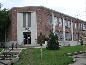 Wayne County courthouse in Monticello | |
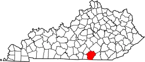 Location within the U.S. state of Kentucky | |
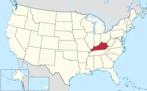 Kentucky's location within the U.S. | |
| Coordinates: 36°49′N 84°50′W | |
| Country | |
| State | |
| Founded | December 13, 1800 |
| Named for | Anthony Wayne |
| Seat | Monticello |
| Largest city | Monticello |
| Area | |
| • Total | 484 sq mi (1,250 km2) |
| • Land | 458 sq mi (1,190 km2) |
| • Water | 26 sq mi (70 km2) 5.4% |
| Population (2010) | |
| • Total | 20,813 |
| • Estimate (2018) | 20,468 |
| • Density | 45/sq mi (17/km2) |
| Time zone | UTC−5 (Eastern) |
| • Summer (DST) | UTC−4 (EDT) |
| Congressional district | 5th |
| Website | waynecounty |
History
The first European-American settlers to visit the area were longhunters who arrived in the 1770s, establishing a temporary camp near Mill Springs on the Cumberland River. Benjamin Price built a log cabin in 1775, and Price's Station became one of the earliest Kentucky settlements.[4]
Many Revolutionary War veterans soon arrived, including Joshua Jones, who arrived in 1794, Jonathan and James Ingram in 1796, Cornelius Phillips in 1798, and Isaac West in 1799, as they were given land grants in the area, in lieu of payments from the war.[5]
Wayne County was formed December 13, 1800 from Pulaski and Cumberland counties. It was the 43rd county and is named for General "Mad Anthony" Wayne, a hero of the American Revolution and the Northwest Indian War.[6] Wayne's victory at the Battle of Fallen Timbers virtually ended the Indian threat against Kentucky settlers.[7]
Early in the Civil War, Confederate Army General Felix Zollicoffer made his headquarters in the Brown-Lanier House at Mill Springs. He was killed at the Battle of Mill Springs on January 19, 1862, when he mistook some Union troops for his own and approached them. The Union men shot him dead, and without their leader the Confederate were defeated.[5] During the winter of 1861, an act was passed by the Confederate government of Kentucky to change the name of Wayne County to Zollicoffer County in honor of the general.
Geography
According to the US Census Bureau, the county has a total area of 484 square miles (1,250 km2), of which 458 square miles (1,190 km2) is land and 26 square miles (67 km2) (5.4%) is water.[8]
The county's elevation ranges from 656 feet (200 m) to 1,870 feet (570 m) ASL,[9] at the Monticello/Wayne County Airport the elevation is 963 feet (294 m). Wayne County is located in the Pennyrile Plateau (image) and Eastern Coal Field (image) regions of Kentucky.
Adjacent counties
- Russell County - northwest/CST Border
- Pulaski County - northeast
- McCreary County - east
- Scott County, Tennessee - southeast
- Pickett County, Tennessee - south/CST Border
- Clinton County - west/CST Border
National protected area
- Daniel Boone National Forest (part)
Time zone boundary
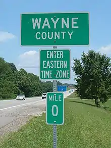
Wayne County is on Eastern Time; however, its western border, shared with Clinton and Russell Counties, is part of the Eastern/Central time zone boundary, as is its southern border with Pickett County, TN. Wayne County observed Central time until October 2000; an account of this change is documented in an article by Dr. Stanley Brunn of the University of Kentucky.[10]
The county has the tz database zone identifier America/Kentucky/Monticello.

Demographics
| Historical population | |||
|---|---|---|---|
| Census | Pop. | %± | |
| 1810 | 5,430 | — | |
| 1820 | 7,951 | 46.4% | |
| 1830 | 8,685 | 9.2% | |
| 1840 | 7,399 | −14.8% | |
| 1850 | 8,692 | 17.5% | |
| 1860 | 10,259 | 18.0% | |
| 1870 | 10,602 | 3.3% | |
| 1880 | 12,512 | 18.0% | |
| 1890 | 12,852 | 2.7% | |
| 1900 | 14,892 | 15.9% | |
| 1910 | 17,518 | 17.6% | |
| 1920 | 16,208 | −7.5% | |
| 1930 | 15,848 | −2.2% | |
| 1940 | 17,204 | 8.6% | |
| 1950 | 16,475 | −4.2% | |
| 1960 | 14,700 | −10.8% | |
| 1970 | 14,268 | −2.9% | |
| 1980 | 17,022 | 19.3% | |
| 1990 | 17,468 | 2.6% | |
| 2000 | 19,923 | 14.1% | |
| 2010 | 20,813 | 4.5% | |
| 2018 (est.) | 20,468 | [11] | −1.7% |
| US Decennial Census[12] 1790-1960[13] 1900-1990[14] 1990-2000[15] 2010-2013[1] | |||
As of the 2000 United States Census,[16] there were 19,923 people, 7,913 households, and 5,808 families in the county. The population density was 43 per square mile (17/km2). There were 9,789 housing units at an average density of 21 per square mile (8.1/km2). The racial makeup of the county was 96.98% White, 1.49% Black or African American, 0.18% Native American, 0.11% Asian, 0.47% from other races, and 0.78% from two or more races. 1.46% of the population were Hispanic or Latino any race.
There were 7,913 households, out of which 33.40% had children under the age of 18 living with them, 58.90% were married couples living together, 10.60% had a female householder with no husband present, and 26.60% were non-families. 23.90% of all households were made up of individuals, and 10.40% had someone living alone who was 65 years of age or older. The average household size was 2.49 and the average family size was 2.94.
The county population contained 25.30% under the age of 18, 8.90% from 18 to 24, 28.10% from 25 to 44, 24.00% from 45 to 64, and 13.60% who were 65 years of age or older. The median age was 37 years. For every 100 females there were 97.80 males. For every 100 females age 18 and over, there were 94.90 males.
The median income for a household in the county was $20,863, and the median income for a family was $24,869. Males had a median income of $24,021 versus $18,102 for females. The per capita income for the county was $12,601. About 24.60% of families and 29.40% of the population were below the poverty line, including 34.90% of those under age 18 and 31.50% of those over age 64.
Notable people
- Polly Berry, an enslaved woman in St. Louis, Missouri, who gained freedom for both herself and her daughter through two freedom suits in court. She had lived as a child in Wayne County before her master took her to Illinois (a free state) and Missouri.
- Lettice Bryan, author of The Kentucky Housewife (1839), a popular cookbook, lived in Wayne County in the 1830s and 1840s when her cookbook was published.[17]
- Shelby M. Cullom (1829-1914), Governor of Illinois (1877-1883); U. S. Senator (1883-1913)
- Preston H. Leslie (1819-1907) - Governor of Kentucky (1871-1875); Governor of Montana (1887-1889)
Tourist attractions
- William Crenshaw Kennedy, Jr. Memorial Museum and Genealogy Library
- The Quilte Shoppe, 24 North Main, and Linda's Quilt Shop, 627 Michigan Avenue, both in Monticello
- Doughboy Monument, located on the Monticello town square, in honor of World War I soldiers
- Conley Bottom Resort and Marina on Lake Cumberland
- Mill Springs Mill (1877) and Park, a water-powered overshot gristmill that is still operating
- Brown-Lanier House - Historic home associated with the Civil War Battle of Mill Springs/Logan's Crossroads
Politics
| Year | Republican | Democratic | Third parties |
|---|---|---|---|
| 2016 | 79.7% 6,371 | 17.9% 1,431 | 2.4% 190 |
| 2012 | 73.4% 5,289 | 25.7% 1,855 | 0.9% 66 |
| 2008 | 67.7% 4,868 | 30.6% 2,201 | 1.8% 127 |
| 2004 | 65.4% 5,027 | 34.0% 2,616 | 0.6% 42 |
| 2000 | 62.9% 4,069 | 35.7% 2,312 | 1.4% 93 |
| 1996 | 51.6% 3,122 | 40.0% 2,422 | 8.4% 511 |
| 1992 | 52.4% 3,412 | 38.7% 2,516 | 8.9% 579 |
| 1988 | 63.9% 3,672 | 35.8% 2,057 | 0.3% 18 |
| 1984 | 66.0% 4,449 | 33.8% 2,277 | 0.2% 15 |
| 1980 | 59.1% 3,972 | 39.8% 2,673 | 1.1% 71 |
| 1976 | 55.8% 3,243 | 43.6% 2,537 | 0.6% 37 |
| 1972 | 64.8% 3,514 | 34.2% 1,853 | 1.0% 53 |
| 1968 | 61.1% 3,055 | 29.3% 1,467 | 9.6% 480 |
| 1964 | 46.4% 2,389 | 53.2% 2,737 | 0.4% 18 |
| 1960 | 66.9% 3,973 | 33.1% 1,964 | 0.0% 0 |
| 1956 | 61.2% 3,609 | 38.3% 2,263 | 0.5% 30 |
| 1952 | 57.9% 3,396 | 42.0% 2,461 | 0.1% 4 |
| 1948 | 54.1% 2,480 | 44.2% 2,029 | 1.7% 78 |
| 1944 | 60.1% 3,048 | 39.9% 2,022 | 0.0% 0 |
| 1940 | 55.7% 3,177 | 44.2% 2,519 | 0.1% 6 |
| 1936 | 53.4% 2,924 | 46.5% 2,546 | 0.2% 10 |
| 1932 | 47.5% 2,682 | 51.9% 2,929 | 0.6% 35 |
| 1928 | 63.9% 2,907 | 35.9% 1,635 | 0.2% 8 |
| 1924 | 54.3% 2,436 | 45.0% 2,020 | 0.7% 29 |
| 1920 | 61.7% 2,992 | 37.7% 1,827 | 0.6% 30 |
| 1916 | 54.0% 1,638 | 45.3% 1,373 | 0.8% 23 |
| 1912 | 28.8% 1,096 | 57.0% 2,168 | 14.2% 538 |
Communities
- Alpha
- Barrier
- Big Sinking
- Cooper
- Duncan Valley
- Fall Creek
- Frazer
- Frisby
- Hidalgo
- Mill Springs
- Monticello (county seat)
- Parmleysville
- Powersburg
- Rockybranch
- Roger's Grove
- Steubenville[19]
- Sunnybrook
- Windy
Education
Wayne County Schools operates the county's public schools.
On June 30, 2013 Monticello Independent Schools merged into Wayne County schools.[20]
Vocational education in the county has been provided by Wayne County Vocational School from 1971 to the present. Its name has changed several times during that period; it is presently knows as Wayne County Area Technology Center (ATC). It is managed by The Office Of Career And Technical Education. The school serves secondary students enrolled in Wayne County High School. Programs include Health Science, Welding, Carpentry, Machine Tool, Automotive, Industrial Maintenance, and Business.
See also
- National Register of Historic Places listings in Wayne County, Kentucky
- Ken Upchurch - member of the Kentucky House of Representatives from Wayne County
References
- "State & County QuickFacts". US Census Bureau. Retrieved March 6, 2014.
- "Find a County". National Association of Counties. Retrieved 7 June 2011.
- "No more out-of-town alcohol runs for Wayne County by Spring 2021". Commonwealth Journal. Retrieved 13 December 2020.
- "Price's Meadow", Kentucky Historical Marker #988, Wayne County, 10 miles north of Monticello on Ky Highway 90.
- Kleber, John, Editor (1992). The Kentucky Encyclopedia. University of Kentucky Press. pp. 938–39. ISBN 0813117720.
- The Register of the Kentucky State Historical Society, Vol. 1. Kentucky State Historical Society. 1903. p. 37.
- Nelson, Paul David (1985). Anthony Wayne, Soldier of the Early Republic. Bloomington IN: Indiana University Press. p. 252. ISBN 0-253-30751-1.
- "2010 Census Gazetteer Files". US Census Bureau. August 22, 2012. Archived from the original on August 12, 2014. Retrieved August 20, 2014.
- AnyPlaceAmerica.com (accessed 9 July 2020)
- Brunn, Stanley D. 2001. "Citizen reaction to a proposed time zone change in Kentucky: Juxtaposing boundaries on the land / in the mind." Southeastern Geographer 41 (2): 246-258.
- "Population and Housing Unit Estimates". Retrieved July 29, 2019.
- "US Decennial Census". US Census Bureau. Retrieved August 20, 2014.
- "Historical Census Browser". University of Virginia Library. Retrieved August 20, 2014.
- "Population of Counties by Decennial Census: 1900 to 1990". US Census Bureau. Retrieved August 20, 2014.
- "Census 2000 PHC-T-4. Ranking Tables for Counties: 1990 and 2000" (PDF). US Census Bureau. Retrieved August 20, 2014.
- American Fact Finder, US Census Bureau
- "Mrs. Bryan's "Kentucky Housewife": Managing a Household in the 1830s". Primary Source Bazaar. July 18, 2019.
- Leip, David. "Atlas of US Presidential Elections". uselectionatlas.org.
- Steubenville KY (Google Maps, accessed 9 July 2020)
- McGinnis, Sylvia (19 March 2013). "Monticello Independent School Operation of school district to cease June 30". Wayne County Outlook. CNHI. Retrieved 25 October 2019.
External links
- Wayne County History
- Wayne County Historical Museum
- Battle of Mill Springs
- Wayne County KYGenWeb Site
- City of Monticello, Kentucky Website
- Monticello/Wayne County Chamber of Commerce
- My Kentucky World (Harlan Ogle)
- Monticello Independent School
- Wayne County School District
Municipalities and communities of Wayne County, Kentucky, United States | ||
|---|---|---|
| City | Location of Wayne County, Kentucky | |
| Unincorporated communities | ||
| Ghost town | ||
| ||
| Authority control |
|---|