National Register of Historic Places listings in Campbell County, Wyoming
This is a list of the National Register of Historic Places listings in Campbell County, Wyoming. It is intended to be a complete list of the properties and districts on the National Register of Historic Places in Campbell County, Wyoming, United States. The locations of National Register properties and districts for which the latitude and longitude coordinates are included below, may be seen in a map.[1]
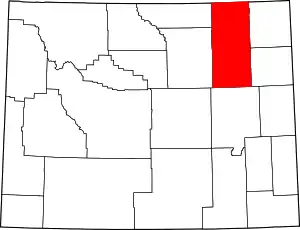
Location of Campbell County in Wyoming
There are 5 properties listed on the National Register in the county.
- This National Park Service list is complete through NPS recent listings posted January 29, 2021.[2]
| Albany - Big Horn - Campbell - Carbon - Converse - Crook - Fremont - Goshen - Hot Springs - Johnson - Laramie - Lincoln - Natrona - Niobrara - Park - Platte - Sheridan - Sublette - Sweetwater - Teton - Uinta - Washakie - Weston |
Current listings
| [3] | Name on the Register | Image | Date listed[4] | Location | City or town | Description |
|---|---|---|---|---|---|---|
| 1 | Basin Oil Field Tipi Rings |  Basin Oil Field Tipi Rings |
December 13, 1985 (#85003165) |
Address Restricted[5] |
Piney | |
| 2 | Bishop Road Site | Bishop Road Site |
December 13, 1985 (#85003202) |
Address Restricted[5] |
Piney | |
| 3 | Nine Mile Segment, Bozeman Trail | Nine Mile Segment, Bozeman Trail |
July 23, 1989 (#89000813) |
Address Restricted[5] |
Pine Tree Junction | |
| 4 | Gillette City Hall (1936) |  Gillette City Hall (1936) |
September 27, 2019 (#100004422) |
400 S. Gillette Ave. 44°17′28″N 105°30′16″W |
Gillette | |
| 5 | Gillette Post Office | 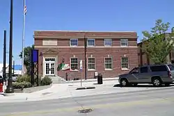 Gillette Post Office |
October 14, 2008 (#08001002) |
301 S. Gillette Ave. 44°17′31″N 105°30′15″W |
Gillette |
See also
| Wikimedia Commons has media related to National Register of Historic Places in Campbell County, Wyoming. |
References
- The latitude and longitude information provided in this table was derived originally from the National Register Information System, which has been found to be fairly accurate for about 99% of listings. Some locations in this table may have been corrected to current GPS standards.
- "National Register of Historic Places: Weekly List Actions". National Park Service, United States Department of the Interior. Retrieved on January 29, 2021.
- Numbers represent an alphabetical ordering by significant words. Various colorings, defined here, differentiate National Historic Landmarks and historic districts from other NRHP buildings, structures, sites or objects.
- The eight-digit number below each date is the number assigned to each location in the National Register Information System database, which can be viewed by clicking the number.
- Some listings on the NRHP are highly sensitive sites and may be subject to looting or vandalism. The NRHP lists this site as "Address Restricted."
| Topics | |
|---|---|
| Lists by state |
|
| Lists by insular areas | |
| Lists by associated state | |
| Other areas | |
| Related | |
| |
Municipalities and communities of Campbell County, Wyoming, United States | ||
|---|---|---|
| City | | |
| Town | ||
| CDPs | ||
| Unincorporated communities | ||
| ||
This article is issued from Wikipedia. The text is licensed under Creative Commons - Attribution - Sharealike. Additional terms may apply for the media files.