Malkapur, Buldhana district
Malkapur is a city and municipality in the Buldhana district of Maharashtra, India. It is also a tehsil seat for surrounding 64 villages.
Malkapur | |
|---|---|
City | |
 Malkapur | |
| Coordinates: 20.885°N 76.2°E | |
| Country | |
| State | Maharashtra |
| District | Buldhana |
| Area | |
| • Total | 30.80 km2 (11.89 sq mi) |
| Elevation | 255 m (837 ft) |
| Population (2018)[1] | |
| • Total | 27,879 |
| • Density | 280/km2 (700/sq mi) |
| Language | |
| • Official | Marathi |
| Time zone | UTC+5:30 (IST) |
| PIN | 443101 |
| Telephone code | 07267 |
| Vehicle registration | MH 28 |
| Sex ratio | 0.9333 ♂/♀ |
| Literacy | 85% |
History
Prince Mohammad Malik Khan founded the town of Malkapur around the 13th century, and named it after his daughter, Princess Malika. He built the six gates like a fort. Their names are Mangal Darwaza, Mughal Darwaza, Bada Darwaza, and the remaining three have fallen down. The town gained its independence from the Bahamani Sultanate in 1399.[2] Malkapur is mentioned in Ain-i-Akbari as the headquarters of a paragana in the sarkar of Narnala. However, the story is improbable as no known record exists of any journey in this direction by Miran Ghani Adil Khan, a Faruqi prince of the period.
1761, the town was rich enough to pay Rs. 60,000 to the army of Raghunathrao, who later became a ruling Peshwa from 1773–74, for exemption from plunder. The Nizams used to keep a force of about 20,000 men in this frontier district of their dominions. Daulatrav Shinde and Raghuji Bhosle were encamped near Malkapur when the British envoy Colonel Collins, after presenting General Lord Wellesley's ultimatum, quit Shinde's camp in 1803.
Demographics
According to the 2018 census,[3] Malkapur has a population of 278,794. Males constitute 51% of the population and females 49%. Malkapur has an average literacy rate of 82%, higher than the national average of 75%. The male literacy is 89% and female literacy is 75%. In Malkapur, 20% of the population is under 6 years of age.
Transport
Malkapur is located on the Hajira - Kolkata National Highway 6, which is a part of the Asian Highway 46 from Kharagpur to Dhule.Malkapur railway station lies on the Howrah-Nagpur-Mumbai line.[4] Malkapur bus station is on Buldhana road. A boat facility is also available at Nalganga river
Politics
- Member Loksabha (Raver Region) : Raksha Khadse (Bhartiya Janta Party)
- Member Vidhansabha (Malkapur and Nandura Region) : Shri. Ekade Rajesh Panditrao(Indian National Congress)
Economy
Malkapur is one of the largest cotton producers in the area. In the British era, it was known as the "White gold of Vidarbha". Malkapur has a vast paper industry and the primary paper suppliers to Mumbai are in Malkapur. Malkapur has many Dal mills, and a major agricultural industry specializing in Mahyco and Ankur seeds, chemical plants, and a fruit ripening chamber. Malkapur is a well-known grain and cloth market due to its proximity to Madhya Pradesh. It is one of the major producers of red chillies.
References
- https://data.gov.in/catalog/villagetown-wise-primary-census-abstract-2011-maharashtra. Missing or empty
|title=(help) - "Malkapur, India - Discover World". www.discoverworld.com. Retrieved 26 March 2018.
- https://data.gov.in/catalog/villagetown-wise-primary-census-abstract-2011-maharashtra. Missing or empty
|title=(help) - Running, Train. "MKU/Malkapur railway station". train running status. Train running status. Retrieved 22 June 2017.
Places adjacent to Malkapur, Buldhana district | ||||||||||
|---|---|---|---|---|---|---|---|---|---|---|
| ||||||||||
Buldhana district topics | ||
|---|---|---|
| Subdivisions and tehsils | 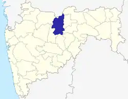 | |
| Cities, towns and villages |
| |
| Railway stations | ||
| Roads | ||
| Historical places | ||
| Geography | ||
| Lok Sabha constituencies | ||
| Vidhan Sabha constituencies |
| |
| Religious | ||
| People |
| |
| See Also |
| |
| Topics | |||||||||||||
|---|---|---|---|---|---|---|---|---|---|---|---|---|---|
| Regions | |||||||||||||
| Divisions and Districts |
| ||||||||||||
| Million-plus cities in Maharashtra | |||||||||||||
| Other cities with municipal corporations | |||||||||||||
Portal:India | |||||||||||||