Andres Bonifacio Avenue, Quezon City
The Andres Bonifacio Avenue, also known as A. Bonifacio Avenue, is a 3.784-kilometer (2.351 mi), national secondary road running from Blumentritt Road in Manila to the North Luzon Expressway and Epifanio de los Santos Avenue at Balintawak Interchange located in Quezon City in a north-south direction.
.svg.png.webp) | |
|---|---|
| A. Bonifacio Avenue | |
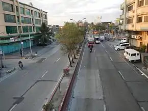 Bonifacio Avenue looking north towards the intersection of Del Monte Avenue in La Loma, Quezon City | |
| Route information | |
| Maintained by Department of Public Works and Highways – Quezon City 1st District Engineering Office[1] | |
| Length | 3.784 km[2] (2.351 mi) |
| Component highways |
|
| Major junctions | |
| North end | |
| South end | |
| Location | |
| Major cities | Manila, Quezon City |
| Highway system | |
| |
Etymology
The road is named after the Filipino revolutionary and Supremo of the Katipunan, Andres Bonifacio alongside other similarly named roads located in Metro Manila like as the one in Marikina and in Intramuros.
Route description
The road starts at the Balintawak Interchange in Quezon City and continues until the intersection with Del Monte Avenue and Mayon Street where it makes a westward turn and continues until arriving at the intersection with Blumentritt Road at the city's boundary with Manila. A segment of Skyway Stage 3 currently runs above the avenue's segment from Sgt. Rivera and 5th Avenues (C-3) to the Balintawak Interchange.
Adjacent to the Balintawak Interchange is Ayala Land's Cloverleaf complex and its shopping mall, Ayala Malls Cloverleaf.
Intersections
| Province | City/Municipality | km | mi | Destinations | Notes |
|---|---|---|---|---|---|
| Quezon City | Balintawak Cloverleaf, northern terminus. Continues north as | ||||
| Sto. Cristo Street | Northbound only. | ||||
| Skyway | A. Bonifacio Exit of Skyway Stage 3; future northbound entrance.[3] | ||||
| Dorotea Road | Southbound only. | ||||
| Bignay Street | Northbound only. | ||||
| 11th Avenue | Southbound only. | ||||
| Balingasa Road | Northbound only. | ||||
| Marvex Drive | Unsignaled intersection. | ||||
| Bo Galino Street | Southbound only. | ||||
| Selecta Drive | Unsignaled intersection. | ||||
| P. Gonzales Street | Southbound only. Accessible only to small vehicles & pedestrians. | ||||
| 7th Avenue | Traffic light intersection. | ||||
| J. Pineda Street | Northbound only. | ||||
| Ligaya Street | Southbound only. | ||||
| 6th Avenue | Southbound only. | ||||
| Mithi Street | Northbound only. | ||||
| Traffic light interchange. Westbound access to Grace Park West, Navotas & Malabon; Eastbound access to Del Monte, Galas & Sta. Mesa districts. | |||||
| Dome Street | Access to opposite segments provided by nearby U-turn slots/intersections. | ||||
| Mauban Street | Traffic light intersection. | ||||
| G. Roxas Street | Northbound only. | ||||
| Binhagan Street | No right turn from A. Bonifacio Avenue. | ||||
| Mayon Avenue, Pag-asa Street, Del Monte Avenue | Traffic light intersection. Access to | ||||
| Agudo Street | Southbound only. | ||||
| Apo Street | Unsignaled intersection. | ||||
| Sta. Catalina Street | Unsignaled intersection. U-turn not allowed. | ||||
| Binuang Street | Northbound only. | ||||
| Magnas Street | Northbound only. | ||||
| Scout Oscar M. Alcaraz (Morong) Street | Unsignaled intersection. U-turn not allowed. | ||||
| Wakat Street | Northbound only. | ||||
| Mayo Street | Unsignaled intersection. | ||||
| Malaya Street | Northbound only. | ||||
| Lunas Street | Northbound only. | ||||
| Malindang Street | Unsignaled intersection. | ||||
| Ipo Street | Northbound only. | ||||
| General Tinio Street | Unsignaled intersection. | ||||
| Abao Street | Northbound only. | ||||
| Bulusan Street | Northbound only. | ||||
| Labo Street | Unsignaled intersection. | ||||
| Isarog Street | Northbound only. | ||||
| Iriga Street | Unsignaled intersection. | ||||
| Dr. Alejos Street | Northbound only. | ||||
| Iba Street | Northbound only. | ||||
| Mariveles Street | Unsignaled intersection. | ||||
| Quezon City—Manila boundary | Calavite Street, | Southern terminus. Right turn only from A. Bonifacio Avenue. Access to | |||
| 1.000 mi = 1.609 km; 1.000 km = 0.621 mi | |||||
References
- "Quezon City 1st". Retrieved June 22, 2020.
- "Road and Bridge Inventory". www.dpwh.gov.ph. Retrieved July 4, 2020.
- Metro Manila Skyway Stage 3 update as of September 2020. GMA News. September 7, 2020. Retrieved September 14, 2020.