Aurora Boulevard
Aurora Boulevard is a four-to-ten lane major thoroughfare in Quezon City and San Juan in Metro Manila, Philippines. It was named after Doña Aurora Quezon, the consort of Commonwealth President Manuel Luis Quezon. It is one of the major roads in the commercial district of Araneta City in Cubao. Line 2 follows the alignment of this road.
.svg.png.webp) .svg.png.webp) R-6 | |
|---|---|
 Aurora Boulevard in Araneta City, Cubao, Quezon City | |
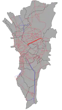 The route of Aurora Boulevard in Metro Manila. Aurora Boulevard is highlighted in red. | |
| Former name(s) | Calle Quezon San Juan Road Marikina–Ermita Avenue Highway 55 |
| Part of | |
| Namesake | Aurora Quezon |
| Location | Quezon City and San Juan, Metro Manila |
| West end | |
| Major junctions |
|
| East end | |
Route description

(2018-05-25).jpg.webp)
Aurora Boulevard is divided into two routes, the Araneta Avenue to EDSA, and EDSA to Katipunan Avenue (C-5). Most of the road is a 4-lane dual carriageway, with Line 2 having five stations above ground, while one (Katipunan station) is located underground.
Aurora Boulevard starts as a physical extension of Ramon Magsaysay Boulevard past Araneta Avenue near the Manila-Quezon City boundary. It then enters San Juan before crossing Ermitaño Creek near Broadway Centrum to return to Quezon City, this time at the New Manila district. It then intersects Gilmore Avenue, Balete Drive, and E. Rodriguez Sr. Avenue, before it meets EDSA.
Past EDSA, it passes near the Araneta City in Cubao. The road continues eastward through barangays Silangan, Quirino 3-A and Duyan-Duyan, until it ends at Katipunan Avenue (C-5) near the Quezon City-Marikina boundary. It continues eastward to Rizal province as Marcos Highway.
History

A road from Katipunan Avenue to EDSA (Epifanio de los Santos Avenue), called Calle Quezon, was built in 1900. The section from EDSA to Gilmore Avenue had been renamed San Juan Road or Highway 55. In 1910, the boulevard was extended to Infanta, Quezon as the Marikina–Infanta Highway. The portion from Gilmore to Dewey Boulevard, named Marikina-Ermita Avenue in 1955, was later reclaimed as Legarda Street, Recto Avenue, and Magsaysay Boulevard.
The western terminus was extended to Gregorio Araneta Avenue and the highway was renamed Aurora Boulevard in 1963 to honor former First Lady Aurora Quezon, the assassinated consort of President Manuel Quezon. Magnolia Ice Cream House ice cream parlor and factory,[1] was located at the corner of Aurora boulevard and Hemady street (now occupied by Robinsons Magnolia).[2]
Intersections

| Province | City/Municipality | km[3] | mi | Destinations | Notes |
|---|---|---|---|---|---|
| Quezon City | Traffic light intersection. Continues westward to Santa Mesa as | ||||
| Quezon City–San Juan boundary | Lambingan Bridge over San Juan River | ||||
| San Juan | H. Lozada Street | Traffic light intersection. | |||
| J. Ruiz Street | Unsignaled intersection. | ||||
| F. Santos Street | Eastbound only. | ||||
| San Juan–Quezon City boundary | Ermitaño Bridge over Ermitaño Creek | ||||
| Quezon City | Broadway Avenue / Valencia Street | Traffic light intersection. Access to Broadway Centrum. | |||
| Traffic light intersection. Access to Greenhills Shopping Center and St. Paul University. | |||||
| Doña Hemady Street | Traffic light intersection. | ||||
| Robinsons Magnolia Access Road | Eastbound only. Access to Robinsons Magnolia. | ||||
| Balete Drive | Traffic light intersection. | ||||
| Seattle Street | Traffic light intersection. | ||||
| Betty Go-Belmonte Street | Unsignaled intersection. | ||||
| N. Domingo Street | Eastbound only. Unsignaled intersection. | ||||
| Eulogio Rodriguez Sr. Avenue | No eastbound access. | ||||
| Traffic light intersection. Route number changes from N180 to N59. | |||||
| General Santos Street | Eastbound only. Access to Araneta City. | ||||
| General Araneta Street / Annapolis Street | Unsignaled intersection. Access to Araneta City. | ||||
| General Aguinaldo Avenue / Imperial Street | Traffic light intersection. Access to Araneta City. | ||||
| Times Square Avenue / Cambridge Street | Traffic light intersection. | ||||
| Oxford Street | Westbound only. | ||||
| General Romulo Avenue / Yale Street | Traffic light intersection. General Romulo Avenue leads to Araneta City. | ||||
| Stanford Street | Eastbound/westbound access only. Access from opposite directions via U-turn slots. | ||||
| 15th Avenue | Traffic light intersection. | ||||
| 20th Avenue | Eastbound only. Traffic light intersection. | ||||
| Ermin Garcia Street | Westbound only. | ||||
| Anonas Street | Westbound only. Traffic light intersection. | ||||
| F. Castillo Street | Eastbound only. Traffic light intersection. | ||||
| Supa Street / J.P. Rizal Street | Traffic light intersection. No traffic lights to and from Supa Street. | ||||
| Emerald Street | Eastbound only. Access to Villa Aurora. | ||||
| Traffic light intersection. Continues eastward to Antipolo as | |||||
1.000 mi = 1.609 km; 1.000 km = 0.621 mi
| |||||
References
- The Magnolia Heritage, Official website, Magnolia Ice Cream Archived 2012-06-10 at the Wayback Machine
- Official website - Robinsons Magnolia Archived 2012-09-16 at the Wayback Machine
- "North Manila". 2016 DPWH data. Department of Public Works and Highways. Archived from the original on August 13, 2017. Retrieved August 13, 2017.
| Wikimedia Commons has media related to Aurora Boulevard. |
| Buildings |
| (2017-08-13).jpg.webp) |
|---|---|---|
| Shopping centers |
| |
| Transportation | ||
| Miscellaneous | ||