Radial Road 10
Radial Road 10, more commonly referred to as R-10, is a planned network of roads and bridges that all together would form the tenth radial road of Manila in the Philippines.[2] It is the westernmost of the radial roads north of the Pasig River running north–south close to the shoreline of Manila Bay. When completed, the road would link the City of Manila with Navotas, and the northern coastal provinces of Bulacan, Pampanga, and Bataan in Central Luzon.
R-10
Radial Road 10 | |
|---|---|
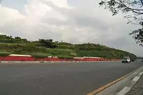 Mel Lopez Boulevard, a segment of R-10, in Tondo, Manila | |
| Route information | |
| Maintained by Department of Public Works and Highways and Metro Manila Development Authority | |
| Length | 105.0 km (65.2 mi) |
| Component highways |
|
| Major junctions | |
| South end | Roxas Bridge over Pasig River in Manila |
| |
| North end | Future: Bataan |
| Location | |
| Major cities | Manila and Navotas |
| Highway system | |
| |
At present, only the Manila–Navotas segment of the road is complete.
Route
From south to north, the road consists of the following segments:
Mel Lopez Boulevard
Between Mel Lopez Bridge (also known as Delpan Bridge and Roxas Bridge) over the Pasig River and the Maralla Bridge over the Marala Creek (Sunog Apog Creek), R-10 is known as Mel Lopez Boulevard, formerly Marcos Road.[3] It is the only segment of R-10 in the City of Manila which passes through the Manila North Harbor complex in Tondo before arriving in the city of Navotas where it continues simply as R-10.
Radial Road 10
North of the Estero de Marala, R-10 serves the Navotas Fish Port Complex and terminates at the Bangkulasi Bridge over the Tullahan River, where it continues towards South Caloocan and Quezon City as Circumferential Road 4 (C-4).
Manila–Bataan Coastal Road
A highway linking Manila and the province of Bataan has been proposed as an extension of R-10.[4][5] Similar to Radial Road 1 and its segments, Roxas Boulevard and the Manila–Cavite Expressway, the highway would run along the coast of the Manila Bay north of the Pasig River. From the current terminus of R-10 in Navotas, the road would travel north along the coastal Bulacan municipalities of Obando, Bulakan, Malolos, Paombong and Hagonoy, and northwest along the Pampanga coast of Macabebe, Masantol, Sasmuan and Lubao, and terminating in Hermosa and Dinalupihan in Bataan. The proposed highway would be built over fishponds and would also serve as flood barriers for the coastal provinces.[6]
See also
References
- "Road and Bridge Inventory". www.dpwh.gov.ph. Retrieved June 14, 2020.
- "Metro Manila Infrastructure Development" (PDF). University of the Philippines Diliman. Retrieved 30 July 2015.
- "House Bill No. 4737" (PDF). House of Representatives of the Philippines. Retrieved 5 June 2020.
- Gamboa, Rey (9 July 2013). "Numerous studies but job not done". Philippine Star. Retrieved 31 July 2015.
- "The Study of Masterplan on High Standard Highway Network Development In the Republic of the Philippines" (PDF). July 2010. Retrieved 5 June 2020.
- Balabo, Dino (21 August 2012). "Manila-Bataan coastal road pushed". Philippine Star. Retrieved 31 July 2015.