North Luzon Expressway
The North Luzon Expressway (NLEX), formerly known as the North Diversion Road and Manila North Expressway (MNEX), is an 84-kilometer (52 mi) four-to-eight lane limited-access toll expressway that connects Metro Manila to the provinces of the Central Luzon region in the Philippines. Built in the 1960s, it forms part of Expressway 1 (E1) of the Philippine expressway network and Radial Road 8 (R-8) of Metro Manila's arterial road network.
.svg.png.webp) R-8 | |
|---|---|
| North Diversion Road Marcelo H. del Pilar Superhighway Manila North Expressway | |
.png.webp) | |
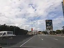
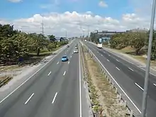
(2017-05-10).jpg.webp) NLEX northbound, just north of Paso de Blas, Valenzuela | |
| Route information | |
| Part of AH26 | |
| Maintained by NLEX Corporation | |
| Length | 84.0 km (52.2 mi) |
| Existed | 1965–present |
| Component highways |
|
| Restrictions |
|
| Major junctions | |
| North end | |
| |
| South end | |
| Location | |
| Major cities | Angeles, Caloocan, Mabalacat, Malolos, Meycauayan, San Fernando, Quezon City, Valenzuela |
| Towns | Apalit, Bocaue, Balagtas, Calumpit, Guiguinto, Marilao, Mexico, Plaridel, Pulilan, San Simon, Santo Tomas |
| Highway system | |
| |
The expressway begins in Quezon City at the Balintawak Interchange with EDSA as a continuation of A. Bonifacio Avenue. It then passes through Caloocan and Valenzuela in Metro Manila and the provinces of Bulacan and Pampanga in Central Luzon. It currently ends in Mabalacat. The segment between Santa Rita Exit in Guiguinto and the Balintawak Interchange in Quezon City is a part of the new alignment of AH26. It also has an extension in the NLEX Harbor Link project between Navotas and Valenzuela (to extend up to Quezon City when fully completed) in Metro Manila, which connects the expressway to Port of Manila.
The expressway's main segment from Quezon City to Mabalacat has a length of 84 kilometers (52 mi), while the NLEX Harbor Link project has a combined length of 21.7 kilometers (13.5 mi) including Segment 8.2 (NLEX C-5 Link), which is yet to be constructed.
Originally controlled by the Philippine National Construction Corporation (PNCC), operation and maintenance of the NLEX was transferred in 2005 to NLEX Corporation, a subsidiary of Metro Pacific Investments Corporation (a former subsidiary of the Lopez Group of Companies until 2008). A major upgrade and rehabilitation was completed in February 2005 with road now having similar qualities to a modern French tollway and other entities.
Route description
Quezon City to Mabalacat
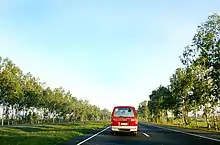
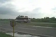
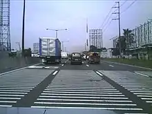
The North Luzon Tollway (NLT) or NLEX Main cuts northwards from Manila to the provinces of Bulacan and Pampanga. The expressway parallels MacArthur Highway from Quezon City to Mabalacat in Pampanga. It has 8 lanes from Balintawak Interchange to Balagtas Interchange, 6 lanes from Balagtas Interchange to San Fernando Exit, and 4 lanes from San Fernando to Santa Ines Exit. The expressways has bridges that cross seven rivers. Some portions of the expressway are lined with billboards, including its viaduct portion. Various high voltage overhead power lines, most notably the Hermosa–Duhat–Balintawak transmission line of National Grid Corporation of the Philippines (NGCP) from Smart Connect Interchange to San Fernando Exit, utilize the significant portion of the expressway route as the densely populated areas hinder acquisition of dedicated right of way.
Balintawak to Balagtas

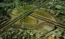
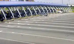
The expressway starts at Balintawak Interchange in Quezon City as a physical continuation of A. Bonifacio Avenue. A few meters after the cloverleaf is Quirino Highway, with a northbound left exit ascending into a flyover to the northeast. Past this exit, Reparo Road parallels the expressway from Quirino Highway to Eternal Gardens Memorial Park as it enters Caloocan. It then meets the northern terminus of Skyway Stage 3. The road then approaches the Balintawak toll plaza, widening to 17 lanes only serving northbound traffic. The offices of NLEX Corporation is located near the toll plaza. A toll plaza expansion, opened in 2017, is built between the northbound and southbound lanes, servicing Class 1 vehicles (cars, jeepneys, and other light vehicles).
The expressway reverts to four lanes, continues northward, crossing over Tullahan River through the Tullahan Bridge and below Gen. T. de Leon Street and passes the Smart Connect Interchange. It then passes through industrial areas and businesses within Valenzuela. The expressway's East Service Road starts paralleling the expressway before Paso de Blas Exit. The road continues on a straight route, with a Caltex service area located near the Lingunan overpass, until it enters Bulacan.
It crosses Meycauayan River and after a few meters is the Meycauayan Exit to serve its town proper. Another service road named St. Francis Service Road runs beside the expressway's southbound lanes. It passes through residential areas and institutions within the municipality, intersects with Lias Road, and continues on a straight alignment. On Marilao, there is a Petron service area and after it are the Marilao River crossing and Marilao Exit. It enters Bocaue after Marilao Exit, where Ciudad de Victoria and the Philippine Arena lies to the east. The road turns eastward to serve Bocaue toll plaza, where the southbound lanes widens to 22 lanes with 4 from a parallel road making a grand total of 26 lanes, and on the middle of it is the toll plaza expansion and road. It turns westward, passes through Bocaue Exit, Santa Maria River, and Taal Bridge, and continues on a straight alignment until Balagtas Interchange. Before it are the Petron for southbound traffic and Shell for northbound traffic. Past the Shell service area are the Tabang Spur Road and Balagtas Interchange, which was opened on March 20, 2012. The former is the former terminus of the original segment of the expressway from 1967 to 1976 before it is extended north to Dau.
Balagtas to San Fernando

The expressway narrows to three lanes per direction past Tabang Spur Road. It continues on a straight route, traversing paddy fields on the outskirts of Guiguinto, Malolos, and Pulilan. AH26 leaves NLEX at Santa Rita Exit, where it follows Maharlika Highway, also known as Cagayan Valley Road, to Baliuag and Cabanatuan.
A few meters after Pulilan Exit is the Candaba Viaduct (officially known as Pulilan-Apalit Bridge). The bridge traverses rice paddies and swampland in the municipalities of Pulilan, Calumpit, Bulacan and Apalit, Pampanga, and crosses Pampanga River before the viaduct ends. The expressway continues again on a straight alignment, passing through Apalit, San Simon, Santo Tomas, and San Fernando, and crosses Abacan and San Fernando rivers. At the vicinity of San Fernando Exit are two major malls, SM City Pampanga and Robinsons Starmills Pampanga.
San Fernando to Santa Ines
After San Fernando Exit, the expressway narrows into two lanes, both northbound and southbound. It continues as a straight roadway, passing through the rural areas of Mexico, crossing Abacan and Quitangil rivers, and traversing the eastern parts of Angeles and Mabalacat. NLEX connects with Subic–Clark–Tarlac Expressway via Clark Spur Road before the main line terminates at Sta. Ines Interchange, with a toll plaza serving the exit. The segment between SCTEX and Sta. Ines Exit used to be a two-lane road but has since widened into four lanes with a grass median.
Tabang Spur Road
| |
|---|---|
| Location | Balagtas – Guiguinto, Bulacan |
| Length | 3.36 km[1] (2.09 mi) |
Tabang Spur Road is a four-lane, 3.36-kilometer (2.09 mi) spur road in Bulacan that branches off NLEX Main at Tabang Exit in Balagtas and terminates at a partial cloverleaf interchange with MacArthur Highway and Cagayan Valley Road at Guiguinto Exit in Guiguinto. It carried the final leg of NLEX (then the North Diversion Road) until the present route was extended to Pampanga.
The road spurs off the main line at Tabang Exit in Balagtas. It then crosses the abandoned Philippine National Railways line to Cabanatuan, traverses Barangays Tuktukan, Tabe, and Malis in Guiguinto, and crosses the Guiguinto River. It then approaches the Tabang Toll Plaza, where the road expands to 12 lanes for both westbound and eastbound motorists. The operations and management offices of Tollways Management Corporation is located near the toll plaza. A Shell station is also found next to the offices, serving eastbound motorists. At the nearby unsignalized intersection past the toll plaza, it meets St. Francis Street, which serves as an alternate route to MacArthur Highway. It ends at the partial cloverleaf interchange with MacArthur Highway and Maharlika Highway and continues to the west towards Malolos as the former.
History
The original stretch of the expressway, from Balintawak Interchange up to Guiguinto Exit in Bulacan, was completed on August 4, 1968. It is a fully fenced limited-access highway that consisted of a four-lane rural divided roadway, nine twin bridges, one railroad overpass, seven underpasses, and three interchanges.
Originally a project of the Department of Public Works and Highways, the completion of the major portion of the job fell on the Construction Development Corporation of the Philippines (CDCP, the precursor to PNCC) to pioneer the toll concept of funding infrastructure.[2] It was carried out under the private financing scheme provided by Republic Act 3741.
Additional work required by the government included the construction of the Balintawak – Novaliches Interchange Complex, the Tabang Interchange, and the approach road of the underpasses.
In 1976, the NLT extension, consisting of 50.9 kilometers (31.6 mi) of concrete road, was built as part of a highways program of the International Bank for Reconstruction Development (World Bank) linking major urban centers to the production centers in the north. The project features a 4-lane limited-access highway with a five-kilometer Candaba Viaduct, a construction innovation utilizing precast beam system, 6 interchanges, 12 bridges, and overpass/underpass structures.[3]
In 1989, under the Corazon Aquino administration, the expressway was extended by another 5 kilometers (3.1 mi) from its terminus at Dau Exit to Sta. Ines Exit in Mabalacat, Pampanga.
From 2003 to February 2005, the expressway underwent a major rehabilitation. Works included the widening of the Balintawak–Tabang segment from 6 to 8 lanes and the Tabang–Sta. Rita segment from 4 to 6 lanes, asphalt overlay, and the demolition of old tollbooths. The main contractor of the rehabilitation work was Leighton Contractors (Australia) with Egis Projects, a company belonging to the French Groupe Egis as the main subcontractor for the toll, telecommunication and traffic management systems. To help maintain the safety and quality of the expressway, various rules are in effect, such as restricting the left lane to passing vehicles only and banning overloaded trucks.
After the rehabilitation, the operation and maintenance of the expressway was transferred from the state-owned Philippine National Construction Corporation (PNCC) to the Manila North Tollways Corporation (now NLEX Corporation).
On June 5, 2010, NLEX Segment 8.1 or NLEX Mindanao Avenue Link was opened. The spur road is a part of the C-5 Road North Extension and is built to provide another entry point to the expressway from Metro Manila and decongest Balintawak Interchange.
On March 18, 2015, NLEX Segment 9 or the NLEX Karuhatan Link was opened, providing continuation to Segment 8.1 that runs from the other side of the Smart Connect Interchange to MacArthur Highway.
On February 28, 2019, the main stretch of NLEX Segment 10 or the NLEX Harbor Link, from Karuhatan to C-3 Road, was opened to traffic.[4] On February 21, 2020, its C3–R10 Section was partially opened up to its Malabon exit ramp;[5] the remaining section to Radial Road 10 was opened on June 15, 2020.[6]
Future
NLEX Connector
| NLEX Connector (NLEX–SLEX Connector Road) | |
|---|---|
| Location | Caloocan – Manila |
| Length | 8.0 km[7] (5.0 mi) |
Plans for a construction of an elevated road to connect North Luzon Expressway (NLEX) and South Luzon Expressway (SLEX) has been bared long before the construction of NLEX Connector.
The government reportedly accepted the unsolicited proposal from Metro Pacific Tollways Development Corporation (MPTDC) to build the 13.24-kilometer (8.23 mi) road. MPTDC is a subsidiary of Metro Pacific Tollways Corporation (MPTC), which runs NLEX. This would later be known as the NLEX Connector Road project, the elevated expressway which will have run over the Philippine National Railways tracks from the existing Segment 10 (Harbor Link) in Caloocan to the future interchange with Skyway Stage 3 near the Polytechnic University of the Philippines (PUP) campus in Santa Mesa, Manila.[8] Construction of the project is estimated to cost ₱17 billion, but as an "all-elevated" or completely grade-separated structure, right-of-way acquisition shall be reduced to an estimated cost of only ₱2.41 billion.
Once completed, the Connector Road will have four entry and exit points: the Caloocan Interchange, C-3 Road in Caloocan, España in Sampaloc, Manila, and terminating at the Skyway Stage 3 in Santa Mesa, Manila. It broke ground on February 28, 2019 at the same time NLEX Connector was inaugurated and opened to traffic, officially indicating that the NLEX Karuhatan Link and Segment 10 are mostly complete.[4] Section 1 (Caloocan to España) is expected to be completed by 2021, while Section 2 (España to Santa Mesa) is expected to be completed in 2022.[9] Its construction takes into consideration the upcoming parallel construction of the Main Line South of the Philippine National Railways as an elevated and electrified railway.
NLEX Phase 3
NLEX Phase 3 would be a 40-kilometer (25 mi) extension with three segments from NLEX Main, originally in San Simon, Pampanga, to Dinalupihan, Bataan, connecting to Subic Freeport Expressway (NLEX Segment 7). However, the plan did not push through. It would instead start somewhere between Apalit and San Fernando in Pampanga, then will cut across Guagua and end at Dinalupihan.[10] Though the project will start tentatively from Apalit based on the concession, the new alignment has yet to be finalized.[11]
Technical specifications
- Name: North Luzon Expressway
- Concession holder: NLEX Corporation
- Operator: Tollways Management Corporation
- Length: 84 km (52 mi)
- Concession starting date: February 10, 2005
- Concession ending date: December 31, 2037
- Highway exits: 15
- Lanes: 8 lanes (4 lanes), 6 lanes (3 lanes), and 4 lanes (2 lanes)
- Toll plazas: 6
- Rest and Service Areas: 10
- Minimum Height Clearance on Underpasses: 4.27 m (14.0 ft)
Tolls
The tollway has two sections: an open section and a closed section.[12] The open section charges a flat toll based on vehicle class and is employed to reduce the number of toll barriers (and associated bottlenecks) within Metro Manila. The closed section is distance-based, charging based on the class of vehicle and distance traveled. When the expressway was modernized, an electronic toll collection system was set up for Class 1 vehicles while prepaid magnetic cards were assigned to Class 2 and 3 vehicles to speed up transactions at toll booths. These have since been replaced by a unified ETC system operated by Easytrip Services Corporation. Also, with the government's thrust towards toll road interoperability, Autosweep of the San Miguel Corporation which operates SLEX, Skyway, STAR, NAIAX, and TPLEX has been accepted as a mode of payment in NLEX since March 2018. As of November 25, 2020, all tolls (as shown below) include the 12% Value-Added Tax (VAT).[13] With the movement of the northernmost toll gate to Sta. Ines, the NLEX and SCTEX toll systems have been merged into one combined system, with tolls for all enclosed destinations listed.
| Class | Open system (Balintawak–Marilao) |
Closed system (Bocaue–Sta. Ines) |
|---|---|---|
| Class 1 (cars, motorcycles, SUVs, jeepneys) |
₱58 | ₱2.72/km |
| Class 2 (buses, light trucks) |
₱146 | ₱6.72/km |
| Class 3 (heavy trucks) |
₱175 | ₱8.06/km |
Features
(2017-03-14).jpg.webp)
- Street lights (Balintawak-San Fernando)
- Variable message signs
- Rumble strips
- Emergency telephones (every 2 km in the Balintawak-Burol segment, every 1 kilometer (0.62 mi) in the Burol-Sta. Ines segment)
- Runaway truck ramp
- Rest and service areas (privately owned and operated)
- Closed-circuit television
- Guard rails
- Impact attenuators
- Solid wall fence
- Lighting arrestors
- Car density sensors underneath road surface
- Hidden speed guns
- Electronic toll payment (class 1), prepaid account cards (class 2/3)
- Much of the expressway has been built to U.S. Interstate highway standards, featuring eight lanes through Metro Manila. As it enters the more rural area north of Manila, the expressway narrows to 6 and then 4 lanes with a grass median to separate the two carriageways.
- All signage is in English, and are nearly identical to the "big green signs" (BGS) on American expressway, including white lettering on a green background, with the exit tab in the upper-right corner (distance signs even employ a font similar—if not identical—to the Caltrans font; all other signs employ a different font).
- Like expressways in most American states, the NLEx uses a distance-based sequencing for numbering interchanges. Being a metric country, though, the system is kilometer-log rather than mile-log—exits numbered according to the distance (in kilometers) from Rizal Park in Manila, which is designated as "Kilometer Zero" in Luzon.
Technical information
Lanes
The NLEX has 8 lanes, 4 lanes in both directions from the Balintawak to Burol segment, 6 lanes with 3 lanes for both directions on the Burol to San Fernando segment and 4 lanes with 2 lanes for both directions on the Tabang Spur and San Fernando to Sta. Ines segment. Before the lane expansion project of 2016, there was even a part of the NLEX which consists of only 2 lanes, one for each direction. This segment is located after passing through the SCTEx Exit (Northbound)[14] but has since been expanded into four lanes.
Speed limit
100 km/h for cars and jeepneys, 80 km/h for trucks and buses, and 60 km/h is the minimum for all classes of vehicles. Speed limits are strictly enforced via CCTV cameras and speed guns, and speeders are usually identified as soon as they hit the tollbooth.
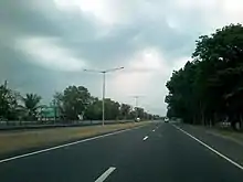
Major upgrade
.jpg.webp)
The upgrade consisted of rebuilding of roads and building new toll plazas. Launched in the beginning of 2003 and completed in February 2005, the roadway now has modern features explained above.
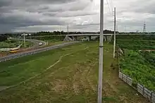
Drainage enhancement program
The entire stretch of the expressway underwent another rehabilitation regarding its drainage systems. The expressway is known to be flooded during the rainy season and the goal of the project is to fix the drainage systems within the road to prevent flooding. Within this period, certain lanes of the road were closed to the traffic. This in turn caused massive traffic jams along the road and the speed limit on the construction sites were reduced from 80/100 km/h to 60 km/h.
The program started on February 12, 2007 and finished on October 7, 2007.
Services
Emergency phones and parking bays
Emergency telephone boxes are located throughout the whole length of the expressway. Parking bays (lay-bys) are also placed on regular intervals on the expressway, for use in emergency situations.
Service areas
North Luzon Expressway has seven service areas, mostly located on the closed toll section north of Bocaue. Each service station hosts a gas station, restaurants, and a convenience store, as well as ATMs and restrooms, car repair, and lubrication services.
Exits
.jpg.webp)
Exit numbers are based on kilometer post. Exits begin at 10 because the NLEx is a logical continuation of A. Bonifacio Avenue. Rizal Park in Manila is designated as Kilometer Zero.
| Region | Province | City/Municipality | km[15] | mi | Exit | Name | Destinations | Notes |
|---|---|---|---|---|---|---|---|---|
| Metro Manila | Quezon City | 10 | 6.2 | Balintawak Cloverleaf | South end of AH26 concurrency and southern terminus; continues south as | |||
| 10 | 6.2 | Northbound exit and southbound entrance; consists of the Camachile and Old Novaliches Flyovers | ||||||
| Caloocan | 11 | 6.8 | Skyway | Northbound entrance and southbound exit; northern terminus of Skyway Stage 3[16] | ||||
| 11 | 6.8 | Libis Baesa | Libis Baesa, Potrero | Southbound exit only[16] | ||||
| 12 | 7.5 | Manila North Expressway: Balintawak toll plaza (1968–2005, demolished) | ||||||
| 12 | 7.5 | Balintawak toll plaza (northbound only) | ||||||
| 12 | 7.5 | Balintawak toll plaza expansion (northbound only; exclusively for Class 1 vehicles) | ||||||
| Valenzuela | 13 | 8.1 | 13 | Smart Connect Interchange | Cloverleaf interchange | |||
| 14 | 8.7 | Mapulang Lupa | Mapulang Lupa, Paso de Blas, Parada | Northbound exit only; demolished | ||||
| 15 | 9.3 | 15 | Paso de Blas (Valenzuela City) | Diamond interchange | ||||
| 17 | 11 | Caltex (NLEX southbound) service area | ||||||
| 17 | 11 | 17 | Lawang Bato | Lawang Bato, Punturin | Northbound entrance and exit only; entrance exclusively for Class 1 and 2 RFID users only[17] | |||
| 17 | 11 | 17 | Lingunan | Lingunan, Canumay, Lawang Bato | Southbound exit only | |||
| Central Luzon | Bulacan | Meycauayan | 19 | 12 | 19 | Libtong | Libtong | Northbound exit only |
| 20 | 12 | 20 | Meycauayan | Folded diamond interchange | ||||
| 21 | 13 | 21 | Pandayan | Pandayan | Southbound exit only | |||
| Marilao | 23 | 14 | Petron Km. 23 service area (northbound only) | |||||
| 23 | 14 | 23 | Marilao | Marilao | Northbound exit only; replaced by a new exit with the same name a few meters north | |||
| 23 | 14 | 23 | Marilao | M. Villarica Road / Patubig Road – Marilao, San Jose del Monte, Norzagaray | Folded diamond / Four-ramp parclo interchange; future link to the proposed toll road to the New Manila International Airport[18] | |||
| 24 | 15 | NLEX-C6 Interchange | Links to the proposed C6 Expressway; interchange type not yet known | |||||
| Bocaue | 26 | 16 | 26 | Ciudad de Victoria | Northbound exit only; replaced by a proper northbound-southbound exit | |||
| 26 | 16 | Ciudad de Victoria | Bocaue, Santa Maria | Partially opened link to the Ciudad de Victoria and alternate route to Bocaue and Santa Maria | ||||
| Bocaue Bypass | Southbound entry only;[19] under construction | |||||||
| 28 | 17 | Bocaue toll plaza (southbound only) North end of barrier toll system. South end of closed road toll system. | ||||||
| 28 | 17 | Bocaue toll plaza expansion (southbound only) North end of barrier toll system. South end of closed road toll system. | ||||||
| 28 | 17 | 27 | Bocaue | Fortunato Halili Avenue – Bocaue, Santa Maria | Diamond interchange | |||
| 27 | 17 | 27 | Tambubong | Taal, Tambubong (Bocaue), Santa Maria | No southbound exit ramp | |||
| 30 | 19 | Petron Km. 30 service area (southbound only) | ||||||
| Balagtas | 30 | 19 | Balagtas-NFEx Interchange | North Food Exchange | Unopened trumpet interchange; construction temporarily stopped in 2011 due to the delays in developing the site of the project | |||
| 31 | 19 | Shell (NLEX Northbound) service area | ||||||
| 32 | 20 | 32 | Tabang (Guiguinto) | Half-Y interchange; northbound exit and southbound entrance | ||||
| 33 | 21 | 34 | Balagtas | Plaridel Bypass Road – Balagtas, Bustos, San Rafael | Half-Y interchange; northbound entry/exit and southbound entrance, southbound exit ramp under construction | |||
| Guiguinto | 36 | 22 | NLEx-NLEEx Interchange | Links to the proposed provincial spur road of North Luzon East Expressway; interchange type not yet known | ||||
| 37 | 23 | Shell of Asia service area (southbound only) | ||||||
| 38 | 24 | 38 | Santa Rita | Folded diamond interchange; north end of AH26 concurrency | ||||
| Malolos | No major junctions | |||||||
| Plaridel | 42 | 26 | Petron Km. 42 service area (northbound only) | |||||
| Pulilan | 45 | 28 | 45 | Pulilan | Diamond interchange | |||
| 46 | 29 | South end of Candaba Viaduct | ||||||
| Calumpit | No major junctions | |||||||
| Pampanga | Apalit | 52 | 32 | North end of Candaba Viaduct | ||||
| 55 | 34 | Total (NLEX) service area (northbound only) | ||||||
| San Simon | 56 | 35 | 56 | San Simon | Quezon Road – San Simon, Apalit, Minalin, Santo Tomas | Diamond interchange | ||
| Santo Tomas | No major junctions | |||||||
| San Fernando | 62 | 39 | Caltex Mega Station (southbound only) | |||||
| 65 | 40 | 65 | San Fernando | Half-partial cloverleaf and half-diamond interchange; southbound ramps formerly a half dumbbell interchange | ||||
| Mexico | 71 | 44 | Petron Km. 71 Lakeshore (northbound only) | |||||
| 72 | 45 | 72 | Mexico (closed) | Mexico, Lakeshore Estate | Half parclo interchange (demolished); replaced by a current exit few meters north | |||
| 72 | 45 | 72 | Mexico | Mexico-Calulut Road – Mexico, Dalisdis (Mexico), Panipuan (San Fernando) | Trumpet interchange | |||
| 77 | 48 | Shell service station (southbound only) | ||||||
| Angeles | 81 | 50 | 81 | Angeles | Angeles, Magalang | Parclo interchange (1984–2005, demolished); replaced by a current exit few meters north | ||
| 81 | 50 | 81 | Angeles | Angeles, Magalang | Trumpet interchange | |||
| Mabalacat | 82 | 51 | Dau toll plaza (demolished) | |||||
| 83 | 52 | 83 | Dau | Trumpet interchange | ||||
| 85 | 53 | 85 | SCTEX | Half T/Half Trumpet/Half Y interchange; future trumpet interchange; northbound exit and southbound entrance; north end of R-8 concurrency | ||||
| 87 | 54 | Sta. Ines toll plaza | ||||||
| 88 | 55 | 88 | Santa Ines | Trumpet interchange; northern end of expressway | ||||
1.000 mi = 1.609 km; 1.000 km = 0.621 mi
| ||||||||
Tabang Spur Road
.jpg.webp)
The entire route is located in Bulacan.
| City/Municipality | km | mi | Exit | Name | Destinations | Notes | ||
|---|---|---|---|---|---|---|---|---|
| Guiguinto | 36 | 22 | 36 | Guiguinto | Western terminus & end of expressway; continues west as | |||
| 36 | 22 | St. Francis Street | T-Intersection | |||||
| 36 | 22 | Shell service station (eastbound only) | ||||||
| 36 | 22 | Tabang toll plaza | ||||||
| 34 | 21 | Tabe | Tabe | Access for westbound motorists only [20] | ||||
| Balagtas | 32 | 20 | 32 | Eastern terminus | ||||
1.000 mi = 1.609 km; 1.000 km = 0.621 mi
| ||||||||
NLEX Connector
Also known as the NLEX–SLEX Connector Road, it is under construction.[21]
| Province | City/Municipality | km | mi | Exit | Name | Destinations | Notes |
|---|---|---|---|---|---|---|---|
| Caloocan | Caloocan Interchange | Northern terminus; continues north as | |||||
| C-3 Road | Northbound exit and southbound entrance | ||||||
| Manila | España toll plaza | ||||||
| España | |||||||
| Santa Mesa | Skyway | Southern terminus; future connection with Skyway | |||||
1.000 mi = 1.609 km; 1.000 km = 0.621 mi
| |||||||
In popular culture
- The expressway was featured in the music video to the song "Toll Gate" by the band Hale.
- It was also featured in the movie Sa North Diversion Road in 2005, based on Tony Perez's stage play of the same name. It was created by Dennis Marasigan.
- From June 6–17, 2007, On North Diversion Road, the play written by Tony Perez, was performed at The Arts House, Singapore, by young & W!LD, an actor training division of Singapore's W!LD RICE Theatre.[22]
References
- "Tabang Spur Road, Province of Bulacan". geoview.info. Retrieved May 22, 2020.
- Rama, Michelle (February 23, 2016). "A history of forgetting". Rappler. Retrieved September 14, 2018.
- https://pncc.ph/projects_slex.htm
- Unite, Betheena (February 28, 2020). "Harbor Link Segment 10 finally opens". Manila Bulletin. Retrieved May 22, 2020.
- Rey, Aika (February 22, 2020). "NLEX Harbor Link Malabon Exit open to motorists". Rappler. Retrieved May 22, 2020.
- "NLEX opens latest Harbor Link section". CNN Philippines. June 15, 2020. Retrieved June 15, 2020.
- Camus, Miguel R. (October 28, 2019). "2nd NLEx-SLEx link set for construction". Philippine Daily Inquirer. Retrieved May 22, 2020.
- "DPWH inspects NLEX Connector construction along PNR ROW, NLEX awards main works contract to DMCI". NLEX Corporation. November 5, 2019. Retrieved August 5, 2020.
- Abadilla, Emmie V. (January 21, 2021). "NLEX Connector Road to reach España in 2021 – Villar". Manila Bulletin.
- Mercurio, Richmond (May 14, 2019). "NLEX revives plan to extend expressway to Bataan". The Philippine Star. Retrieved May 22, 2020.
- Mercurio, Richmond (February 10, 2020). "NLEX pushes P20 billion Phase 3 plan". The Philippine Star. Retrieved May 22, 2020.
- "Toll Table". Manila North Tollways Corporation. Retrieved September 14, 2018.
- "TRB approves add-on tolls for NLEX effective November 25". NLEX Corporation. November 21, 2020. Retrieved November 25, 2020.
- "MNTC to start P2.6-B NLEX road-widening project this month". Manila North Tollways Corporation. Retrieved September 14, 2018.
- "Road and Bridge Inventory". www.dpwh.gov.ph. Retrieved June 14, 2020.
- Rey, Aika (December 28, 2020). "Skyway Stage 3 opens on December 29". Rappler. Retrieved January 8, 2020.
- "#NLEXMotoristAdvisory Valenzuela Lawang Bato Northbound Entry is now open! As we care about everyone's safety, the entry point requires contactless transactions through RFID to help curb the spread of COVID-19". Facebook. August 31, 2020. Retrieved October 16, 2020.
- "Proposed canal system with ring road along its banks will serves as a flood mitigation to channel run-off water to the Manila Bay". Facebook. May 23, 2020.
- Rey, Aika (August 8, 2018). "LOOK: Proposed road network projects in Bulacan". Rappler.
- "Tabe Exit (closed)". Wikimapia.
- Lopez, Melissa Luz (November 5, 2019). "Work begins for NLEX-SLEX Connector road". CNN Philippines. Retrieved May 17, 2020.
- "Archived copy". Archived from the original on February 16, 2006. Retrieved March 26, 2006.CS1 maint: archived copy as title (link)
External links
| Wikimedia Commons has media related to North Luzon Expressway. |
| Existing |
| |||||||||||||
|---|---|---|---|---|---|---|---|---|---|---|---|---|---|---|
| Proposed |
| |||||||||||||
| Under construction | ||||||||||||||
See also: Philippine highway network | ||||||||||||||

| Expressways |
| ||||||
|---|---|---|---|---|---|---|---|
| National roads |
| ||||||