Boule-d'Amont
Boule-d'Amont (Catalan: Bula d'Amunt) is a commune in the Pyrénées-Orientales department in southern France.
Boule-d'Amont
Bula d'Amunt | |
|---|---|
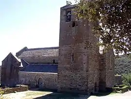 The Serrabone Priory and church | |
Location of Boule-d'Amont 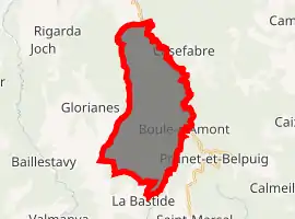
| |
 Boule-d'Amont  Boule-d'Amont | |
| Coordinates: 42°34′50″N 2°36′51″E | |
| Country | France |
| Region | Occitanie |
| Department | Pyrénées-Orientales |
| Arrondissement | Prades |
| Canton | Le Canigou |
| Intercommunality | Roussillon Conflent |
| Government | |
| • Mayor (2014–2020) | Yann Oheix |
| Area 1 | 23.22 km2 (8.97 sq mi) |
| Population (2017-01-01)[1] | 55 |
| • Density | 2.4/km2 (6.1/sq mi) |
| Time zone | UTC+01:00 (CET) |
| • Summer (DST) | UTC+02:00 (CEST) |
| INSEE/Postal code | 66022 /66130 |
| Elevation | 234–1,348 m (768–4,423 ft) (avg. 483 m or 1,585 ft) |
| 1 French Land Register data, which excludes lakes, ponds, glaciers > 1 km2 (0.386 sq mi or 247 acres) and river estuaries. | |
Geography
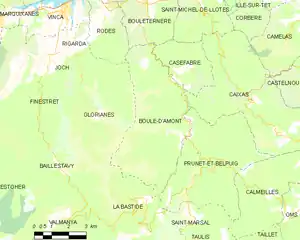
Localisation
Boule-d'Amont is located in the canton of Le Canigou and in the arrondissement of Prades.
Map of Boule-d'Amont and its surrounding communes
Neighbouring communes
Places adjacent to Boule-d'Amont | |
|---|---|

Government and politics
- Mayors
| Mayor | Term start | Term end |
|---|---|---|
| Fulcran MAZOLLIER | 1977 | 1983 |
| Gérard Llense | 1983 | 2014 |
| Yann Oheix | 2014 |
Population
|
|
References
- "Populations légales 2017". INSEE. Retrieved 6 January 2020.
| Wikimedia Commons has media related to Boule-d'Amont. |
| Authority control |
|
|---|
This article is issued from Wikipedia. The text is licensed under Creative Commons - Attribution - Sharealike. Additional terms may apply for the media files.