Estavar
Estavar is a commune in the Pyrénées-Orientales department in southern France.
Estavar | |
|---|---|
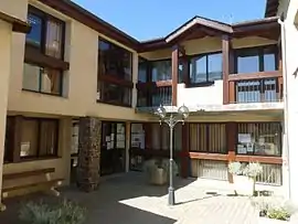 The town hall in Estavar | |
 Coat of arms | |
Location of Estavar 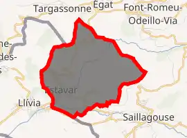
| |
 Estavar  Estavar | |
| Coordinates: 42°28′17″N 1°59′53″E | |
| Country | France |
| Region | Occitanie |
| Department | Pyrénées-Orientales |
| Arrondissement | Prades |
| Canton | Les Pyrénées catalanes |
| Intercommunality | Pyrénées Cerdagne |
| Government | |
| • Mayor (2014-2020) | Laurent Leygue |
| Area 1 | 9.24 km2 (3.57 sq mi) |
| Population | 472 |
| • Density | 51/km2 (130/sq mi) |
| Time zone | UTC+01:00 (CET) |
| • Summer (DST) | UTC+02:00 (CEST) |
| INSEE/Postal code | 66072 /66800 |
| Elevation | 1,200–1,659 m (3,937–5,443 ft) (avg. 1,293 m or 4,242 ft) |
| 1 French Land Register data, which excludes lakes, ponds, glaciers > 1 km2 (0.386 sq mi or 247 acres) and river estuaries. | |
Geography
Localisation
Estavar is located in the canton of Les Pyrénées catalanes and in the arrondissement of Prades.
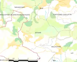
Map of Estavar and its surrounding communes
Neighbouring communes
Places adjacent to Estavar | |
|---|---|

Population
| Year | Pop. | ±% p.a. |
|---|---|---|
| 1968 | 178 | — |
| 1975 | 206 | +2.11% |
| 1982 | 281 | +4.54% |
| 1990 | 358 | +3.07% |
| 1999 | 409 | +1.49% |
| 2007 | 470 | +1.75% |
| 2012 | 408 | −2.79% |
| 2017 | 472 | +2.96% |
| Source: INSEE[2] | ||
References
- "Populations légales 2017". INSEE. Retrieved 6 January 2020.
- Population en historique depuis 1968, INSEE
| Wikimedia Commons has media related to Estavar. |
| Authority control |
|---|
This article is issued from Wikipedia. The text is licensed under Creative Commons - Attribution - Sharealike. Additional terms may apply for the media files.