Fontpédrouse
Fontpédrouse (French pronunciation: [fɔ̃pedʁuz] (![]() listen); Catalan: Fontpedrosa) is a commune in the Pyrénées-Orientales department in southern France.
listen); Catalan: Fontpedrosa) is a commune in the Pyrénées-Orientales department in southern France.
Fontpédrouse
Fontpedrosa | |
|---|---|
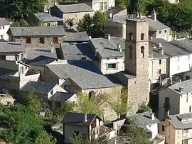 The church in Fontpédrouse | |
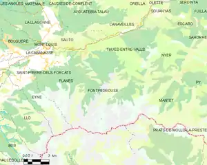
Location of Fontpédrouse 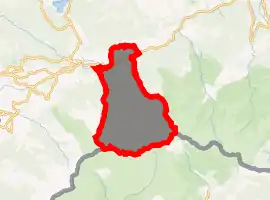
| |
 Fontpédrouse  Fontpédrouse | |
| Coordinates: 42°30′46″N 2°10′51″E | |
| Country | France |
| Region | Occitanie |
| Department | Pyrénées-Orientales |
| Arrondissement | Prades |
| Canton | Les Pyrénées catalanes |
| Government | |
| • Mayor (2020–2026) | Chantal Calvet |
| Area 1 | 64.35 km2 (24.85 sq mi) |
| Population (2017-01-01)[1] | 123 |
| • Density | 1.9/km2 (5.0/sq mi) |
| Time zone | UTC+01:00 (CET) |
| • Summer (DST) | UTC+02:00 (CEST) |
| INSEE/Postal code | 66080 /66360 |
| Elevation | 880–2,865 m (2,887–9,400 ft) (avg. 1,062 m or 3,484 ft) |
| 1 French Land Register data, which excludes lakes, ponds, glaciers > 1 km2 (0.386 sq mi or 247 acres) and river estuaries. | |
Geography
Fontpédrouse is located in the canton of Les Pyrénées catalanes and in the arrondissement of Prades.
Map of Fontpédrouse and its surrounding communes
History
The commune of Prats-Saint-Thomas is merged into Fontpédrouse on 26 June 1822.[2]
Part of the hamlets of Prats-Saint-Thomas are destroyed in December 1932 because of heavy rains which caused several landslides.[3]
Population
| Year | Pop. | ±% p.a. |
|---|---|---|
| 1968 | 188 | — |
| 1975 | 147 | −3.45% |
| 1982 | 108 | −4.31% |
| 1990 | 138 | +3.11% |
| 1999 | 123 | −1.27% |
| 2007 | 123 | +0.00% |
| 2012 | 133 | +1.58% |
| 2017 | 123 | −1.55% |
| Source: INSEE[4] | ||
References
- "Populations légales 2017". INSEE. Retrieved 6 January 2020.
- (in French) Jean-Pierre Pélissier, Paroisses et communes de France : dictionnaire d'histoire administrative et démographique, vol. 66 : Pyrénées-Orientales, Paris, CNRS, 1986
- (in French) Fabricio Cardenas, Vieux papiers des Pyrénées-Orientales, Pluies diluviennes en décembre 1932, 3 february 2014
- Population en historique depuis 1968, INSEE
| Wikimedia Commons has media related to Fontpédrouse. |
| Authority control |
|
|---|
This article is issued from Wikipedia. The text is licensed under Creative Commons - Attribution - Sharealike. Additional terms may apply for the media files.