Les Cluses
Les Cluses is a commune in the Pyrénées-Orientales department in southern France.
Les Cluses | |
|---|---|
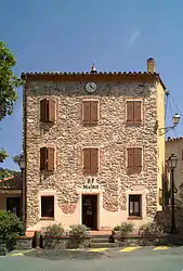 The town hall in Les Cluses | |
Location of Les Cluses 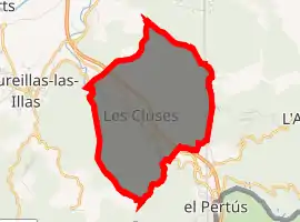
| |
 Les Cluses  Les Cluses | |
| Coordinates: 42°29′13″N 2°50′21″E | |
| Country | France |
| Region | Occitanie |
| Department | Pyrénées-Orientales |
| Arrondissement | Céret |
| Canton | Vallespir-Albères |
| Intercommunality | Vallespir |
| Government | |
| • Mayor (2014–2020) | Alexandre Puignau |
| Area 1 | 8.91 km2 (3.44 sq mi) |
| Population (2017-01-01)[1] | 242 |
| • Density | 27/km2 (70/sq mi) |
| Demonym(s) | Clusiens |
| Time zone | UTC+01:00 (CET) |
| • Summer (DST) | UTC+02:00 (CEST) |
| INSEE/Postal code | 66063 /66400 |
| Elevation | 103–368 m (338–1,207 ft) |
| 1 French Land Register data, which excludes lakes, ponds, glaciers > 1 km2 (0.386 sq mi or 247 acres) and river estuaries. | |
Geography
Localisation
Les Cluses is located in the canton of Vallespir-Albères and in the arrondissement of Céret.
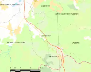
Map of Les Cluses and its surrounding communes
Neighbouring communes
Places adjacent to Les Cluses | |
|---|---|

Population
| Year | Pop. | ±% p.a. |
|---|---|---|
| 1968 | 67 | — |
| 1975 | 115 | +8.02% |
| 1982 | 148 | +3.67% |
| 1990 | 165 | +1.37% |
| 1999 | 219 | +3.20% |
| 2007 | 243 | +1.31% |
| 2012 | 260 | +1.36% |
| 2017 | 242 | −1.42% |
| Source: INSEE[2] | ||
References
- "Populations légales 2017". INSEE. Retrieved 6 January 2020.
- Population en historique depuis 1968, INSEE
| Wikimedia Commons has media related to Les Cluses. |
| Authority control |
|---|
This article is issued from Wikipedia. The text is licensed under Creative Commons - Attribution - Sharealike. Additional terms may apply for the media files.
