Thuir
Thuir (French pronunciation: [tɥiʁ] (![]() listen); Occitan and Catalan: Tuïr, Catalan pronunciation: [tuˈiɾ]) is a commune in the Pyrénées-Orientales department in southern France.
listen); Occitan and Catalan: Tuïr, Catalan pronunciation: [tuˈiɾ]) is a commune in the Pyrénées-Orientales department in southern France.
Thuir
Tuïr | |
|---|---|
.jpg.webp) The town hall in Thuir | |
.svg.png.webp) Coat of arms | |
Location of Thuir 
| |
 Thuir  Thuir | |
| Coordinates: 42°37′59″N 2°45′26″E | |
| Country | France |
| Region | Occitanie |
| Department | Pyrénées-Orientales |
| Arrondissement | Céret |
| Canton | Les Aspres |
| Intercommunality | Aspres |
| Government | |
| • Mayor (2020–2026) | René Olive |
| Area 1 | 19.90 km2 (7.68 sq mi) |
| Population (2017-01-01)[1] | 7,635 |
| • Density | 380/km2 (990/sq mi) |
| Time zone | UTC+01:00 (CET) |
| • Summer (DST) | UTC+02:00 (CEST) |
| INSEE/Postal code | 66210 /66300 |
| Elevation | 78–243 m (256–797 ft) (avg. 99 m or 325 ft) |
| 1 French Land Register data, which excludes lakes, ponds, glaciers > 1 km2 (0.386 sq mi or 247 acres) and river estuaries. | |
Geography
Thuir is located southwest of Perpignan, in the canton of Les Aspres and in the arrondissement of Perpignan. It is situated in a plain between the natural zones of the Aspres and the Riberal.
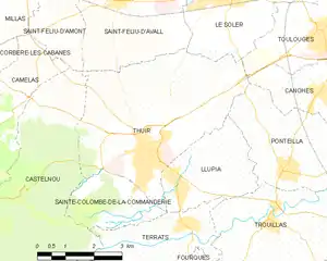
Map of Thuir and its surrounding communes
Population
| Year | Pop. | ±% p.a. |
|---|---|---|
| 1968 | 4,192 | — |
| 1975 | 6,023 | +5.31% |
| 1982 | 6,356 | +0.77% |
| 1990 | 6,638 | +0.54% |
| 1999 | 7,257 | +1.00% |
| 2007 | 7,415 | +0.27% |
| 2012 | 7,189 | −0.62% |
| 2017 | 7,635 | +1.21% |
| Source: INSEE[2] | ||
References
- "Populations légales 2017". INSEE. Retrieved 6 January 2020.
- Population en historique depuis 1968, INSEE
External links
![]() Media related to Thuir at Wikimedia Commons
Media related to Thuir at Wikimedia Commons
| Authority control |
|
|---|
This article is issued from Wikipedia. The text is licensed under Creative Commons - Attribution - Sharealike. Additional terms may apply for the media files.