Llupia
Llupia (French pronunciation: [jypja] (![]() listen); Catalan: Llupià) is a commune in the Pyrénées-Orientales department in southern France.
listen); Catalan: Llupià) is a commune in the Pyrénées-Orientales department in southern France.
Llupia
Llupià | |
|---|---|
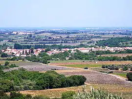 A general view of Llupia | |
 Coat of arms | |
Location of Llupia 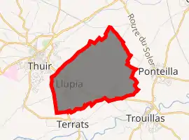
| |
 Llupia  Llupia | |
| Coordinates: 42°37′18″N 2°46′11″E | |
| Country | France |
| Region | Occitanie |
| Department | Pyrénées-Orientales |
| Arrondissement | Perpignan |
| Canton | Les Aspres |
| Intercommunality | Perpignan Méditerranée Métropole |
| Government | |
| • Mayor (2020–2026) | Roger Rigall |
| Area 1 | 6.88 km2 (2.66 sq mi) |
| Population (2017-01-01)[1] | 1,943 |
| • Density | 280/km2 (730/sq mi) |
| Time zone | UTC+01:00 (CET) |
| • Summer (DST) | UTC+02:00 (CEST) |
| INSEE/Postal code | 66101 /66300 |
| Elevation | 88–140 m (289–459 ft) (avg. 104 m or 341 ft) |
| 1 French Land Register data, which excludes lakes, ponds, glaciers > 1 km2 (0.386 sq mi or 247 acres) and river estuaries. | |
Geography
Llupia is located in the canton of Les Aspres and in the arrondissement of Perpignan.
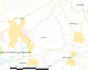
Map of Llupia and its surrounding communes
Toponymy
The historical name in Catalan is Llupià.
Government and politics
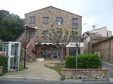
Town hall in Llupia
.jpg.webp)
Ruins of the hamlet "Vilarmila", near Llupia, France, Romanesque church (11th ctry.) "Sainte-Marie de Vilarmila" in the background.
Mayors
| Mayor | Term start | Term end |
|---|---|---|
| Roger Rigall | 2001 |
Population
| Year | Pop. | ±% p.a. |
|---|---|---|
| 1968 | 282 | — |
| 1975 | 399 | +5.08% |
| 1982 | 931 | +12.87% |
| 1990 | 1,253 | +3.78% |
| 1999 | 1,734 | +3.68% |
| 2007 | 1,820 | +0.61% |
| 2012 | 1,960 | +1.49% |
| 2017 | 1,943 | −0.17% |
| Source: INSEE[2] | ||
References
- "Populations légales 2017". INSEE. Retrieved 6 January 2020.
- Population en historique depuis 1968, INSEE
| Wikimedia Commons has media related to Llupia. |
| Authority control |
|
|---|
This article is issued from Wikipedia. The text is licensed under Creative Commons - Attribution - Sharealike. Additional terms may apply for the media files.