Montferrer
Montferrer is a commune in the Pyrénées-Orientales department in southern France.
Montferrer | |
|---|---|
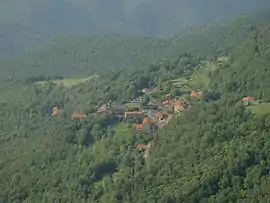 A general view of Montferrer | |
 Coat of arms | |
Location of Montferrer 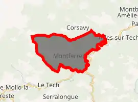
| |
 Montferrer  Montferrer | |
| Coordinates: 42°26′20″N 2°34′05″E | |
| Country | France |
| Region | Occitanie |
| Department | Pyrénées-Orientales |
| Arrondissement | Céret |
| Canton | Le Canigou |
| Intercommunality | Haut Vallespir |
| Government | |
| • Mayor (2020–2026) | Jean-Marie Gourgues[1] |
| Area 1 | 21.95 km2 (8.47 sq mi) |
| Population (2017-01-01)[2] | 188 |
| • Density | 8.6/km2 (22/sq mi) |
| Time zone | UTC+01:00 (CET) |
| • Summer (DST) | UTC+02:00 (CEST) |
| INSEE/Postal code | 66116 /66150 |
| Elevation | 308–1,608 m (1,010–5,276 ft) (avg. 820 m or 2,690 ft) |
| 1 French Land Register data, which excludes lakes, ponds, glaciers > 1 km2 (0.386 sq mi or 247 acres) and river estuaries. | |
Geography
Montferrer is located in the canton of Le Canigou and in the arrondissement of Céret.
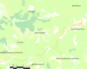
Map of Montferrer and its surrounding communes
Population
| Year | Pop. | ±% p.a. |
|---|---|---|
| 1968 | 215 | — |
| 1975 | 260 | +2.75% |
| 1982 | 226 | −1.98% |
| 1990 | 353 | +5.73% |
| 1999 | 221 | −5.07% |
| 2007 | 202 | −1.12% |
| 2012 | 191 | −1.11% |
| 2017 | 188 | −0.32% |
| Source: INSEE[3] | ||
References
- "Répertoire national des élus: les maires". data.gouv.fr, Plateforme ouverte des données publiques françaises (in French). 2 December 2020. Retrieved 7 December 2020.
- "Populations légales 2017". INSEE. Retrieved 6 January 2020.
- Population en historique depuis 1968, INSEE
| Wikimedia Commons has media related to Montferrer. |
| Authority control |
|---|
This article is issued from Wikipedia. The text is licensed under Creative Commons - Attribution - Sharealike. Additional terms may apply for the media files.