Serralongue
Serralongue (Catalan: Serrallonga) is a commune in the Pyrénées-Orientales department in southern France.
Serralongue | |
|---|---|
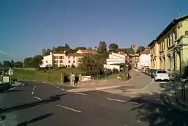 The junction of Paul Santena road and Abdon Poggi road, in Serralongue | |
Location of Serralongue 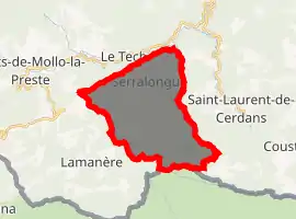
| |
 Serralongue  Serralongue | |
| Coordinates: 42°23′54″N 2°33′23″E | |
| Country | France |
| Region | Occitanie |
| Department | Pyrénées-Orientales |
| Arrondissement | Céret |
| Canton | Le Canigou |
| Intercommunality | Haut Vallespir |
| Government | |
| • Mayor (2008–2014) | Jean-Marie Bosch |
| Area 1 | 23.04 km2 (8.90 sq mi) |
| Population (2017-01-01)[1] | 226 |
| • Density | 9.8/km2 (25/sq mi) |
| Time zone | UTC+01:00 (CET) |
| • Summer (DST) | UTC+02:00 (CEST) |
| INSEE/Postal code | 66194 /66230 |
| Elevation | 478–1,407 m (1,568–4,616 ft) (avg. 714 m or 2,343 ft) |
| 1 French Land Register data, which excludes lakes, ponds, glaciers > 1 km2 (0.386 sq mi or 247 acres) and river estuaries. | |
Geography
Serralongue is located in the canton of Le Canigou and in the arrondissement of Céret.
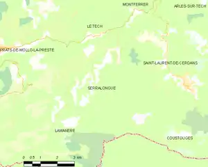
Map of Serralongue and its surrounding communes
Population
| Year | Pop. | ±% p.a. |
|---|---|---|
| 1968 | 244 | — |
| 1975 | 206 | −2.39% |
| 1982 | 205 | −0.07% |
| 1990 | 210 | +0.30% |
| 1999 | 238 | +1.40% |
| 2007 | 258 | +1.01% |
| 2012 | 227 | −2.53% |
| 2017 | 226 | −0.09% |
| Source: INSEE[2] | ||
References
- "Populations légales 2017". INSEE. Retrieved 6 January 2020.
- Population en historique depuis 1968, INSEE
| Wikimedia Commons has media related to Serralongue. |
| Authority control |
|---|
This article is issued from Wikipedia. The text is licensed under Creative Commons - Attribution - Sharealike. Additional terms may apply for the media files.