Chandel district
Chandel district (Pron:/ˌtʃænˈdɛl/) is one of the 16 districts of Manipur state in northeastern India. As of 2011 it is the second least populous district in the state, after Tamenglong.[1]
Chandel district | |
|---|---|
District | |
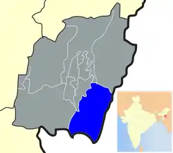 Location of Chandel district in Manipur | |
| Nickname(s): Kankhupam | |
| Coordinates: 24°19′N 93°59′E | |
| Country | |
| State | Manipur |
| Founded by | Pakan tribes |
| Headquarters | Chandel |
| Area | |
| • Total | 521 km2 (201 sq mi) |
| Population (2011) | |
| • Total | 144,182 |
| • Density | 21.83/km2 (56.5/sq mi) |
| Languages | |
| • Official | English, Anal (Pakan) Lamkang (Pakan) and Kukish languages |
| Time zone | UTC+5:30 (IST) |
| ISO 3166 code | IN-MN-BI |
| Vehicle registration | MN |
| Website | chandel |
Economy
In 2006 the Ministry of Panchayati Raj named Chandel one of the country's 250 most backward districts (out of a total of 640).[2] It is one of the three districts in Manipur currently receiving funds from the Backward Regions Grant Fund Programme (BRGF).[2]
Demographics
According to the 2011 census Chandel district has a population of 144,182,[1] roughly equal to the nation of Saint Lucia.[3] This gives it a ranking of 602nd in India (out of a total of 640).[1] The district has a population density of 43 inhabitants per square kilometre (110/sq mi) .[1] Its population growth rate over the decade 2001-2011 was 21.72%.[1] Chandel has a sex ratio of 932 females for every 1000 males,[1] and a literacy rate of 70.85%.[1]
Languages
Languages spoken include Anal (Pakan), Thadou Vaiphei, Zou, Lamkang and Meitei language in the Headquarter. Anāl, Lamkang, Moyon and Monsang tribe are dominant in the district headquarter and Aimol, a Sino-Tibetan tongue with less than 2500 speakers, written in the Latin script;[4] and Anal, which is also Sino-Tibetan and spoken by approximately 14,000 Indians, and more in Myanmar (and which should not be confused with the Anus language).[5]
Flora and fauna
In 1989, Chandel [originally Tengnoupal district] became home to the Yangoupokpi-Lokchao Wildlife Sanctuary, which has an area of 185 km2 (71.4 sq mi).[6]
References
- "District Census 2011". Census2011.co.in. 2011. Retrieved 30 September 2011.
- Ministry of Panchayati Raj (8 September 2009). "A Note on the Backward Regions Grant Fund Programme" (PDF). National Institute of Rural Development. Archived from the original (PDF) on 5 April 2012. Retrieved 27 September 2011.
- US Directorate of Intelligence. "Country Comparison:Population". Retrieved 1 October 2011.
Saint Lucia 161,557 July 2011 est.
- M. Paul Lewis, ed. (2009). "Aimol: A language of India". Ethnologue: Languages of the World (16th ed.). Dallas, Texas: SIL International. Retrieved 28 September 2011.
- M. Paul Lewis, ed. (2009). "Anal: A language of India". Ethnologue: Languages of the World (16th ed.). Dallas, Texas: SIL International. Retrieved 28 September 2011.
- Indian Ministry of Forests and Environment. "Protected areas: Manipur". Archived from the original on 9 October 2011. Retrieved 25 September 2011.
External links
Places adjacent to Chandel district | ||||||||||
|---|---|---|---|---|---|---|---|---|---|---|
| ||||||||||
| State symbols | |
|---|---|
| Topics | |
| Languages | |
| Administration |
|
| Districts | |
| Municipal Corporation | |
| Municipalities | |
| Proposed Municipalities | |
| Town Councils | |
| Minor Townships | |
| Sport | |