Darrang district
Darrang (Pron: ˌdəˈræŋ or dæˈræŋ) is an administrative district in the state of Assam in India. The district headquarters are located at Mangaldoi. The district occupies an area of 1585 km2.
Darrang district | |
|---|---|
District of Assam | |
 Swahid Stambha, Patharighat | |
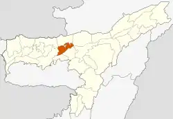 Darrang district's location in Assam | |
| Country | |
| State | Assam |
| Division | North Assam |
| Headquarters | Mangaldoi |
| Area | |
| • Total | 1,585 km2 (612 sq mi) |
| Population (2011) | |
| • Total | 928,500 |
| • Density | 590/km2 (1,500/sq mi) |
| Time zone | UTC+05:30 (IST) |
| ISO 3166 code | IN-AS |
| Website | http://darrang.gov.in/ |
History
No definitive records about Darrang are available for the pre-medieval period. According to Maheswar Neog, the Darrang became famous only after the middle Age i.e., up-rising of the king Nara Narayan. It perhaps formed a part of the ancient kingdom of Kamarupa and with its decline, Darrang at different times might have been under the rule of the Chutia Kingdom,Bodo-Kachari people and Baro-Bhuyan.[1]
In the 16th century, Darrang was subject to the Koch king Kamata kingdom, Nara Narayan, and on the division of his dominion among his heirs, Darrang became a part of Koch Hajo. Early in the 17th century the raja Bali Narayan invoked the aid of the Ahoms of Upper Assam against the Mughal invaders; after his defeat and death in 1637 the Ahoms dominated the whole district. About 1785 the Darrang rajas took advantage of the decay of the Ahom kingdom to try and re-establish their independence, but they were defeated by a British expedition in 1792, and in 1826 Darrang, with the rest of Assam, passed under British control.[2]
On 28 January, 1894, there was a peasant's uprising against the increased land revenue by the British Raj in Patharighat, a village in Darrang district. In the British response that followed, 140 peasants belonging to both hindu and muslim communities died from bullet wounds and another 150 were injured.[3][4]
In 1984 Sonitpur district was formed from part of Darrang.[5] This was repeated on 14 June 2004 with the creation of Udalguri district.[5]
Geography
Darrang district occupies an area of 1,585 square kilometres (612 sq mi).[6]
National protected area
- Orang National Park(Part)
Divisions
There are four Assam Legislative Assembly constituencies in this district: Kalaigaon, Sipajhar, Mangaldoi, and Dalgaon.[7] Mangaldoi is designated for scheduled castes.[7] All four are in the Mangaldoi Lok Sabha constituency.[8]
Demographics
According to the 2011 census Darrang district has a population of 928,500,[9] roughly equal to the nation of Fiji[10] or the US state of Delaware.[11] This gives it a ranking of 463rd in India (out of a total of 640).[9] The district has a population density of 586 inhabitants per square kilometre (1,520/sq mi) .[9] Its population growth rate over the decade 2001-2011 was 22.19%.[9] Darrang has a sex ratio of 954 females for every 1000 males,[9] and a literacy rate of 63.08%.[9] 93.9% of the population live in rural areas while 6.1% live in urban areas.[12]Poverty rate of the district stands at 45.5%.[13]
597,392 (64.34%) are Muslims, 327,322 (35.25%) are Hindus and 16,880 (0.18%) are Christians.[14]
| Year | Pop. | ±% p.a. |
|---|---|---|
| 1901 | 99,002 | — |
| 1911 | 98,758 | −0.02% |
| 1921 | 110,391 | +1.12% |
| 1931 | 139,089 | +2.34% |
| 1941 | 188,189 | +3.07% |
| 1951 | 233,607 | +2.19% |
| 1961 | 310,321 | +2.88% |
| 1971 | 404,961 | +2.70% |
| 1991 | 618,653 | +2.14% |
| 2001 | 759,858 | +2.08% |
| 2011 | 928,500 | +2.02% |
| source:[15] | ||
Religions
In Darrang district, as per the 2011 census record, Islam is most followed religion with 597,392 adherents i.e (64.34%), while Hinduism is followed by 327,322 i.e 35.25% of the district population.
Flora and fauna
It is home to Orang National Park, which it shares with Sonitpur district. Orang was established in 1999 and has an area of 79 km2 (30.5 sq mi).[17] Orang national park is now part of Udalguri and Sonitpur districts.[18]
References
- "Darrang,Assam,India". darrang.nic.in. Retrieved 22 October 2020.
-
 One or more of the preceding sentences incorporates text from a publication now in the public domain: Chisholm, Hugh, ed. (1911). "Darrang". Encyclopædia Britannica. 7 (11th ed.). Cambridge University Press. p. 837.
 - "Patharughat martyrs yet to get recognition". The Assam Tribune Online. Retrieved 22 October 2020.
- Barua, Deepali, 1944- (1994). Urban history of India : a case study (1st ed.). New Delhi, India: Mittal Publications. p. 149. ISBN 81-7099-538-8. OCLC 31711121.CS1 maint: multiple names: authors list (link)
- Law, Gwillim (25 September 2011). "Districts of India". Statoids. Retrieved 11 October 2011.
- Srivastava, Dayawanti et al. (ed.) (2010). "States and Union Territories: Assam: Government". India 2010: A Reference Annual (54th ed.). New Delhi, India: Additional Director General, Publications Division, Ministry of Information and Broadcasting (India), Government of India. p. 1116. ISBN 978-81-230-1617-7.CS1 maint: extra text: authors list (link)
- "List of Assembly Constituencies showing their Revenue & Election District wise break - up" (PDF). Chief Electoral Officer, Assam website. Archived from the original (PDF) on 22 March 2012. Retrieved 26 September 2011.
- "List of Assembly Constituencies showing their Parliamentary Constituencies wise break - up" (PDF). Chief Electoral Officer, Assam website. Archived from the original (PDF) on 22 March 2012. Retrieved 26 September 2011.
- "District Census 2011". Census2011.co.in. 2011. Retrieved 30 September 2011.
- US Directorate of Intelligence. "Country Comparison:Population". Retrieved 1 October 2011.
Fiji 883,125 July 2011 est.
- "2010 Resident Population Data". U. S. Census Bureau. Archived from the original on 19 October 2013. Retrieved 30 September 2011.
Delaware 897,934
- "Darrang,Assam,India". darrang.nic.in. Retrieved 22 October 2020.
- "ASSAM HDR, 2014: POVERTY RATIO IS THE HIGHEST AMONG THE SCHEDULED TRIBES". nezine.com. Retrieved 22 October 2020.
- "Demographic Features of the District". Archived from the original on 7 March 2009. Retrieved 19 October 2009.
- Decadal Variation In Population Since 1901
- https://www.sentinelassam.com/amp/breaking-news/barpetas-bengali-speaking-population-rises-to-twice-as-that-of-assamese-speaking-people/
- Indian Ministry of Forests and Environment. "Protected areas: Assam". Archived from the original on 23 August 2011. Retrieved 25 September 2011.
- "Orang National Park", Wikipedia, 8 November 2020, retrieved 15 November 2020
External links
Places adjacent to Darrang district | ||||||||||
|---|---|---|---|---|---|---|---|---|---|---|
| ||||||||||