National Register of Historic Places listings in Grand County, Utah
This is a list of the National Register of Historic Places listings in Grand County, Utah.
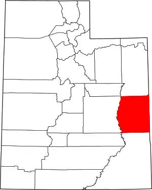
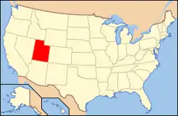
Location of Grand County in Utah
This is intended to be a complete list of the properties and districts on the National Register of Historic Places in Grand County, Utah, United States. Latitude and longitude coordinates are provided for many National Register properties and districts; these locations may be seen together in a map.[1]
There are 23 properties and districts listed on the National Register in the county, including 1 National Historic Landmark.
- This National Park Service list is complete through NPS recent listings posted February 5, 2021.[2]
Current listings
Including those in Arches National Park, the current listings are:
| [3] | Name on the Register[4] | Image | Date listed[5] | Location | City or town | Description |
|---|---|---|---|---|---|---|
| 1 | Apache Motel |  Apache Motel |
February 19, 2008 (#08000062) |
166 South 400 East 38°34′15″N 109°32′34″W |
Moab | |
| 2 | Ballard-Sego Coal Mine Historic District | 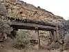 Ballard-Sego Coal Mine Historic District |
October 13, 2017 (#100001335) |
Address Restricted |
Sego | |
| 3 | Courthouse Wash Pictographs | 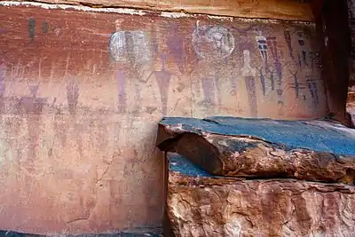 Courthouse Wash Pictographs |
April 1, 1976 (#76000207) |
One mile (1.6 km) northwest of Moab in Arches National Park on U.S. Route 191 (formerly U.S. Route 163) 38°36′26″N 109°34′47″W |
Arches National Park | |
| 4 | Dalton Wells CCC Camp-Moab Relocation Center | 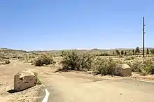 Dalton Wells CCC Camp-Moab Relocation Center |
May 2, 1994 (#94000366) |
U.S. Route 191, approximately 13 miles (21 km) north of Moab 38°42′46″N 109°41′58″W |
Moab | Little survives except for pylons which once held the entrance sign and cottonwood trees planted by camp workers. |
| 5 | Desolation Canyon | Desolation Canyon |
November 24, 1968 (#68000057) |
Along the Green River in western Grand County between Ouray and Green River[6] 39°30′01″N 110°01′19″W |
Green River | Split between Emery, Grand, Carbon, and Uintah counties |
| 6 | Dewey Bridge | 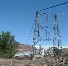 Dewey Bridge |
July 12, 1984 (#84002179) |
East of State Route 128 over the Colorado River 38°48′43″N 109°18′09″W |
Dewey | Destroyed by fire in April 2008[7] |
| 7 | Elk Mountain Mission Fort Site |  Elk Mountain Mission Fort Site |
June 15, 1978 (#78002661) |
Immediately northwest of Moab off U.S. Route 191 38°35′19″N 109°33′45″W |
Moab | |
| 8 | Johnson Ranch House | June 28, 2018 (#100002636) |
Hastings Road 21 miles (34 km), northwest of Crescent Junction 39°04′59″N 110°03′37″W |
Crescent Junction vicinity | ||
| 9 | Julien Inscription Panel | October 6, 1988 (#88001184) |
Dark Angel vicinity, Arches National Park 38°49′23″N 109°39′00″W |
Moab | ||
| 10 | Denis Julien Inscription | Denis Julien Inscription |
May 23, 1991 (#91000617) |
Mouth of Hell Roaring Canyon, Green River Canyon, Canyonlands National Park 38°33′49″N 109°59′02″W |
Moab | |
| 11 | Moab Cabin |  Moab Cabin |
February 14, 1980 (#80003906) |
56 South 100 East 38°34′22″N 109°32′46″W |
Moab | |
| 12 | Moab LDS Church |  Moab LDS Church |
November 28, 1980 (#80003907) |
65 North 200 East 38°34′27″N 109°32′43″W |
Moab | |
| 13 | Old Spanish Trail | October 6, 1988 (#88001181) |
Arches National Park Visitor Center vicinity 38°36′44″N 109°37′14″W |
Moab | ||
| 14 | Pinhook Battleground |  Pinhook Battleground |
March 1, 1982 (#82004125) |
East of Moab 38°34′31″N 109°18′55″W |
Moab | |
| 15 | Ringhoffer Inscription | October 6, 1988 (#88001185) |
Tower Arch, Arches National Park 38°47′25″N 109°41′17″W |
Moab | ||
| 16 | Robidoux Inscription | July 23, 1982 (#82004124) |
West side of Westwater Creek in Book Cliffs, where East Canyon meets the main canyon 39°16′34″N 109°17′12″W |
Cisco | ||
| 17 | Rock House-Custodian's Residence | 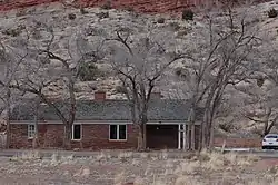 Rock House-Custodian's Residence |
October 6, 1988 (#88001186) |
Arches National Park Visitor Center vicinity 38°37′04″N 109°36′55″W |
Moab | |
| 18 | John Henry Shafer House |  John Henry Shafer House |
May 2, 2001 (#01000472) |
530 South 400 East 38°33′54″N 109°32′36″W |
Moab | |
| 19 | Star Hall |  Star Hall |
May 14, 1993 (#93000416) |
159 East Center Street 38°34′25″N 109°32′48″W |
Moab | |
| 20 | Arthur Taylor House |  Arthur Taylor House |
February 28, 1980 (#80003908) |
1266 North U.S. Route 191 38°35′34″N 109°33′46″W |
Moab | |
| 21 | Thompson Wash Rock Art District |  Thompson Wash Rock Art District |
August 1, 1980 (#80003909) |
Address Restricted 39°01′05″N 109°42′37″W |
Sego | While the National Park Service indicates that the address is restricted for this historic district, the Bureau of Land Management (which refers to the area as the Sego Canyon Rock Art Interpretive Site) provides coordinates and directions |
| 22 | Orlando W. Warner House | September 20, 1977 (#77001304) |
1010 South Mill Creek Drive 38°33′45″N 109°31′57″W |
Moab | Adobe house from c.1890, and fruit warehouse. Not visible from road. | |
| 23 | Wolfe Ranch Historical District | 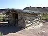 Wolfe Ranch Historical District |
November 20, 1975 (#75000167) |
North of Moab in Arches National Park 38°44′15″N 109°31′19″W |
Moab |
See also
References
- The latitude and longitude information provided in this table was derived originally from the National Register Information System, which has been found to be fairly accurate for about 99% of listings. Some locations in this table may have been corrected to current GPS standards.
- "National Register of Historic Places: Weekly List Actions". National Park Service, United States Department of the Interior. Retrieved on February 5, 2021.
- Numbers represent an alphabetical ordering by significant words. Various colorings, defined here, differentiate National Historic Landmarks and historic districts from other NRHP buildings, structures, sites or objects.
- "National Register Information System". National Register of Historic Places. National Park Service. April 24, 2008.
- The eight-digit number below each date is the number assigned to each location in the National Register Information System database, which can be viewed by clicking the number.
- Location and coordinates derived from its GNIS entry; the NRIS lists the site as "Address unknown"
- Dewey Bridge Fire 4-06-2008, photograph
External links
![]() Media related to National Register of Historic Places in Grand County, Utah at Wikimedia Commons
Media related to National Register of Historic Places in Grand County, Utah at Wikimedia Commons
 | |||
| Topics | |
|---|---|
| Lists by state |
|
| Lists by insular areas | |
| Lists by associated state | |
| Other areas | |
| Related | |
| |
Municipalities and communities of Grand County, Utah, United States | ||
|---|---|---|
| City | Map of Utah highlighting Grand County | |
| Town | ||
| CDP | ||
| Unincorporated community | ||
| Indian reservation | ||
| Ghost towns | ||
| Footnotes | ‡This populated place also has portions in an adjacent county or counties | |
| ||
This article is issued from Wikipedia. The text is licensed under Creative Commons - Attribution - Sharealike. Additional terms may apply for the media files.