National Register of Historic Places listings in San Juan County, Utah
This is a list of the National Register of Historic Places listings in San Juan County, Utah.
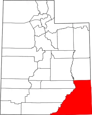
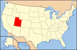
Location of San Juan County in Utah
This is intended to be a complete list of the properties and districts on the National Register of Historic Places in San Juan County, Utah, United States. Latitude and longitude coordinates are provided for many National Register properties and districts; these locations may be seen together in a map.[1]
There are 38 properties and districts listed on the National Register in the county, including 1 National Historic Landmark.
- This National Park Service list is complete through NPS recent listings posted January 29, 2021.[2]
Current listings
| [3] | Name on the Register[4] | Image | Date listed[5] | Location | City or town | Description |
|---|---|---|---|---|---|---|
| 1 | Joseph Frederick Adams House |  Joseph Frederick Adams House |
October 24, 1985 (#85003390) |
Approximately 150 N. 700 East 37°17′04″N 109°33′00″W |
Bluff | House built from red stone blocks; renovated since listing. |
| 2 | Alkali Ridge | 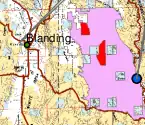 Alkali Ridge |
October 15, 1966 (#66000740) |
Along County Road 204 (Alkali Point Rd.), south of Monticello[6] 37°40′50″N 109°22′40″W |
Monticello | A major proto-Pueblo archaeological site[4] |
| 3 | Aneth Terrace Archeological District | August 1, 1980 (#80003937) |
Address Restricted[7] |
Aneth | ||
| 4 | Big Westwater Ruin | July 16, 1980 (#80003938) |
Address Restricted[7] |
Blanding | ||
| 5 | Bluff Historic District |  Bluff Historic District |
November 2, 1995 (#95001273) |
Roughly bounded by Main St., U.S. Route 191, 2nd E. St., and the bluffs 37°17′16″N 109°33′03″W |
Bluff | |
| 6 | Butler Wash Archeological District | 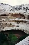 Butler Wash Archeological District |
July 11, 1981 (#81000584) |
Address Restricted[7] |
Blanding | |
| 7 | Carhart Pueblo | July 7, 2015 (#15000401) |
Address Restricted[7] |
Monticello | ||
| 8 | Cave Springs Cowboy Camp |  Cave Springs Cowboy Camp |
October 7, 1988 (#88001233) |
Cave Springs vicinity 38°09′34″N 109°45′12″W |
Moab | In the Needles district of Canyonlands National Park |
| 9 | James Bean Decker House |  James Bean Decker House |
August 4, 1983 (#83003180) |
189 N. 300 East 37°17′07″N 109°33′27″W |
Bluff | House built by Mormon pioneers to hold large family. |
| 10 | Coal Bed Village Site | March 26, 2018 (#100002234) |
Address Restricted[7] |
Blanding vicinity | ||
| 11 | Defiance House | December 20, 1978 (#78000347) |
Address Restricted[7] |
Blanding | ||
| 12 | Edge of Cedars Indian Ruin |  Edge of Cedars Indian Ruin |
August 12, 1971 (#71000853) |
West of Blanding 37°37′48″N 109°29′20″W |
Blanding | Part of the Edge of the Cedars State Park Museum |
| 13 | Goulding's Trading Post | 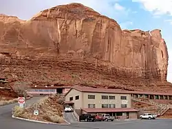 Goulding's Trading Post |
October 20, 1980 (#80003941) |
Off State Route 47 37°00′24″N 110°12′09″W |
Gouldings | A lodge, trading post, and museum located just north of the Arizona–Utah border, adjacent to the Navajo Tribal Park in Monument Valley. |
| 14 | Grand Gulch Archeological District |  Grand Gulch Archeological District |
June 14, 1982 (#82004154) |
Address Restricted[7] |
Blanding | |
| 15 | Hole-in-the-Rock Trail |  Hole-in-the-Rock Trail |
August 9, 1982 (#82004792) |
A trail commencing at Escalante and terminating at Bluff 37°25′18″N 110°39′51″W |
Escalante | Split between Garfield, Kane, and San Juan counties |
| 16 | Hyland Hotel | 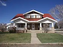 Hyland Hotel |
July 28, 1994 (#94000785) |
116 S. 100 West 37°52′14″N 109°20′38″W |
Monticello | A Craftsman Style bungalow |
| 17 | Indian Creek State Park | 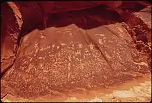 Indian Creek State Park |
March 15, 1976 (#76001833) |
14 miles (23 km) north of Monticello 37°59′18″N 109°31′00″W |
Monticello | Also known as Newspaper Rock State Historic Monument since 1961[8] |
| 18 | Frederick Isaac and Mary M. Jones House |  Frederick Isaac and Mary M. Jones House |
August 14, 2003 (#03000154) |
117 E. 200 South 37°52′N 109°20′W |
Monticello | |
| 19 | Julien Inscription | October 7, 1988 (#88001248) |
Lower Red Lake vicinity 38°09′16″N 109°55′32″W |
Moab | Rock-carved graffito reportedly left by French-American trapper Denis Julien | |
| 20 | Kirk's Cabin Complex | 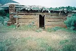 Kirk's Cabin Complex |
October 7, 1988 (#88001252) |
Upper Salt Walsh 37°59′16″N 109°44′27″W |
Moab | A log cabin and corrals built circa 1890, located in present-day Canyonlands National Park |
| 21 | Lost Canyon Cowboy Camp | 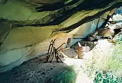 Lost Canyon Cowboy Camp |
October 7, 1988 (#88001232) |
Lost Canyon vicinity 38°08′13″N 109°45′32″W |
Moab | |
| 22 | Moon House Complex | 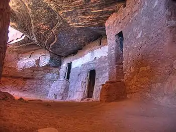 Moon House Complex |
November 20, 2017 (#100001830) |
Address Restricted |
Blanding vicinity | |
| 23 | Murphy Trail and Bridge | .jpg.webp) Murphy Trail and Bridge |
October 7, 1988 (#88001236) |
Murphy Point vicinity 38°20′37″N 109°52′15″W |
Moab | Livestock trail located in what is now Canyonlands National Park; the original bridge was replaced a decade after the site was NRHP-listed |
| 24 | Natural Bridges Archeological District |  Natural Bridges Archeological District |
August 3, 2004 (#04000784) |
Address Restricted[7] |
Blanding | |
| 25 | Neck and Cabin Springs Grazing Area | December 18, 2009 (#09001108) |
Grand View Point Rd. 38°25′09″N 109°50′04″W |
Moab | ||
| 26 | Jens Nielson House |  Jens Nielson House |
February 22, 1982 (#82004155) |
600 E. Black Locust Ave. 37°17′05″N 109°32′23″W |
Bluff | |
| 27 | Oljato Trading Post |  Oljato Trading Post |
June 20, 1980 (#80003939) |
Southwest of Blanding 37°02′11″N 110°19′03″W |
Blanding | |
| 28 | Owachomo Bridge Trail | 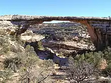 Owachomo Bridge Trail |
February 2, 1989 (#88001166) |
Armstrong Canyon 37°34′49″N 110°00′49″W |
Blanding | |
| 29 | Nancy Patterson Site | November 21, 1980 (#80004495) |
Address Restricted[7] |
Blanding | ||
| 30 | Poncho House | October 10, 1975 (#75001821) |
Address Restricted[7] |
Mexican Hat | ||
| 31 | Rainbow Bridge Traditional Cultural Property |  Rainbow Bridge Traditional Cultural Property |
March 27, 2017 (#100000816) |
Near Lake Powell 37°04′38″N 110°57′51″W |
Navajo Mountain | |
| 32 | Lemuel H. Redd, Jr., House | 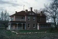 Lemuel H. Redd, Jr., House |
May 18, 1983 (#83003181) |
300 E. Mulberry Ave. 37°17′06″N 109°33′16″W |
Bluff | Substantial house built in 1900, a step up from earlier log houses in the area. |
| 33 | St. Christopher's Episcopal Mission |  St. Christopher's Episcopal Mission |
November 18, 2002 (#02001042) |
Mission Road (SR-162), east of Bluff 37°17′06″N 109°30′49″W |
Bluff | |
| 34 | Salt Creek Archeological District | March 31, 1975 (#75000164) |
Address Restricted[7] |
Monticello | ||
| 35 | Sand Island Petroglyph Site | July 11, 1981 (#81000585) |
Address Restricted[7] |
Bluff | ||
| 36 | John Albert Scorup House |  John Albert Scorup House |
April 13, 1983 (#83003182) |
210 N. 700 East 37°17′09″N 109°32′57″W |
Bluff | |
| 37 | Swallow's Nest |  Swallow's Nest |
February 23, 1996 (#96000164) |
2 N. Grayson Parkway 37°37′30″N 109°28′18″W |
Blanding | One-room sandstone building on the Nicklovis Ranch, built in 1925 |
| 38 | Westwater Canyon Archeological District | September 4, 1980 (#80003940) |
Address Restricted[7] |
Blanding |
See also
References
- The latitude and longitude information provided in this table was derived originally from the National Register Information System, which has been found to be fairly accurate for about 99% of listings. Some locations in this table may have been corrected to current GPS standards.
- "National Register of Historic Places: Weekly List Actions". National Park Service, United States Department of the Interior. Retrieved on January 29, 2021.
- Numbers represent an alphabetical ordering by significant words. Various colorings, defined here, differentiate National Historic Landmarks and historic districts from other NRHP buildings, structures, sites or objects.
- "National Register Information System". National Register of Historic Places. National Park Service. April 24, 2008.
- The eight-digit number below each date is the number assigned to each location in the National Register Information System database, which can be viewed by clicking the number.
- Location derived from the GNIS feature record for a historical marker on Alkali Ridge (USGS maps show this location in an area marked as "Alkali Point"); the NRIS lists the site as "Address Restricted"
- Some listings on the NRHP are highly sensitive sites and may be subject to looting or vandalism. The NRHP lists this site as "Address Restricted."
- "Newspaper Rock". Markers and Monuments Database. Utah Department of Heritage and Arts. Archived from the original on 2013-04-03. Retrieved 2013-03-02.
External links
![]() Media related to National Register of Historic Places in San Juan County, Utah at Wikimedia Commons
Media related to National Register of Historic Places in San Juan County, Utah at Wikimedia Commons
 | |||
| Topics | |
|---|---|
| Lists by state |
|
| Lists by insular areas | |
| Lists by associated state | |
| Other areas | |
| Related | |
| |
Municipalities and communities of San Juan County, Utah, United States | ||
|---|---|---|
| Cities | Map of Utah highlighting San Juan County | |
| Towns | ||
| CDPs | ||
| Unincorporated communities | ||
| Indian reservations | ||
| Ghost towns | ||
| Footnotes | ‡This populated place also has portions in an adjacent county or counties | |
| ||
This article is issued from Wikipedia. The text is licensed under Creative Commons - Attribution - Sharealike. Additional terms may apply for the media files.