National Register of Historic Places listings in Utah County, Utah
This is a list of the National Register of Historic Places listings in Utah County, Utah.
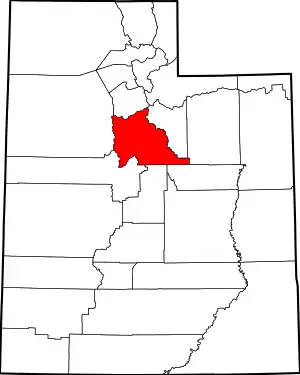
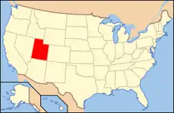
Location of Utah County in Utah
This is intended to be a complete list of the properties and districts on the National Register of Historic Places in Utah County, Utah, United States. Latitude and longitude coordinates are provided for many National Register properties and districts; these locations may be seen together in a map.[1]
There are 176 properties and districts listed on the National Register in the county, including 1 National Historic Landmark. Another 15 sites in the county were once listed, but have since been removed.
- This National Park Service list is complete through NPS recent listings posted January 29, 2021.[2]
Current listings
| [3] | Name on the Register[4] | Image | Date listed[5] | Location | City or town | Description |
|---|---|---|---|---|---|---|
| 1 | George and Temperance Adams House | .png.webp) George and Temperance Adams House |
December 30, 1999 (#99001628) |
196 West 400 South 40°17′25″N 111°41′58″W |
Orem | Late Victorian style home built in 1895, expanded in 1903. Brick upon adobe with detail showing economic prosperity in Orem. |
| 2 | John Alma Adams House | June 9, 1987 (#87000825) |
625 East 200 South 40°21′42″N 111°43′34″W |
Pleasant Grove | ||
| 3 | William D. Alexander House | 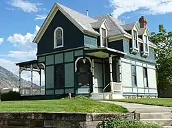 William D. Alexander House |
July 28, 1983 (#83003195) |
91 West 200 South 40°13′51″N 111°39′33″W |
Provo | Asserted to be the only period example of Stick Style architecture in the state. |
| 4 | Dr. Samuel H. Allen House and Carriage House | 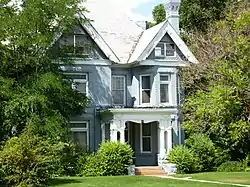 Dr. Samuel H. Allen House and Carriage House |
May 18, 1979 (#79002515) |
135 East 200 North 40°14′12″N 111°39′19″W |
Provo | |
| 5 | Alpine City Hall |  Alpine City Hall |
December 19, 1991 (#91001820) |
20 North Main Street 40°27′12″N 111°46′36″W |
Alpine | |
| 6 | Alpine LDS Church Meetinghouse |  Alpine LDS Church Meetinghouse |
May 24, 1990 (#90000794) |
50 North Main Street 40°27′14″N 111°46′37″W |
Alpine | |
| 7 | American Fork Cemetery Rock Wall |  American Fork Cemetery Rock Wall |
October 7, 1994 (#94001207) |
600 North 100 East 40°23′21″N 111°47′47″W |
American Fork | |
| 8 | American Fork City Hall | 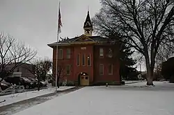 American Fork City Hall |
April 7, 1994 (#94000298) |
31 Church Street 40°22′39″N 111°47′53″W |
American Fork | |
| 9 | American Fork Historic District | 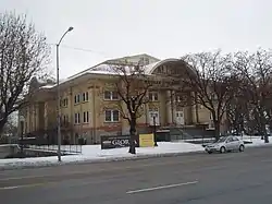 American Fork Historic District |
December 10, 1998 (#98001447) |
Roughly along 100 South from 300 West to 200 East 40°22′29″N 111°47′59″W |
American Fork | |
| 10 | American Fork Presbyterian Church | 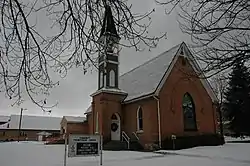 American Fork Presbyterian Church |
May 23, 1980 (#80003975) |
75 North 100 East 40°22′41″N 111°47′44″W |
American Fork | |
| 11 | American Fork Second Ward Meetinghouse | 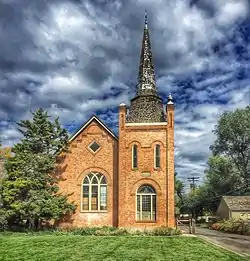 American Fork Second Ward Meetinghouse |
March 10, 1992 (#92000101) |
130 West 100 South 40°22′32″N 111°48′05″W |
American Fork | |
| 12 | American Fork Third Ward Meetinghouse |  American Fork Third Ward Meetinghouse |
December 20, 2002 (#02001554) |
198 West 300 North 40°23′01″N 111°48′09″W |
American Fork | |
| 13 | Ashton-Driggs House |  Ashton-Driggs House |
April 14, 1972 (#72001261) |
119 East Battle Creek Drive (200 South) 40°21′42″N 111°44′13″W |
Pleasant Grove | |
| 14 | Thomas Austin House |  Thomas Austin House |
July 26, 1982 (#82004168) |
427 East 500 North 40°23′39″N 111°50′32″W |
Lehi | |
| 15 | Bank of American Fork |  Bank of American Fork |
March 9, 1993 (#93000065) |
1 East Main Street 40°22′37″N 111°47′51″W |
American Fork | |
| 16 | Barrett-Homer-Larsen Farmstead | .png.webp) Barrett-Homer-Larsen Farmstead |
January 5, 2016 (#15000960) |
63 North 400 West 40°17′54″N 111°42′20″W |
Orem | |
| 17 | David and Drusilla Baxter House |  David and Drusilla Baxter House |
June 11, 1998 (#98000653) |
206 West 1600 North 40°19′37″N 111°42′01″W |
Orem | |
| 18 | Beck No. 2 Mine | March 14, 1979 (#79003483) |
Burristan Pass Road 39°56′38″N 112°05′48″W |
Dividend | ||
| 19 | George Angus and Martha Ansil Beebe House | 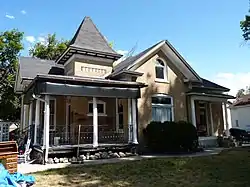 George Angus and Martha Ansil Beebe House |
October 31, 1980 (#80003979) |
489 West 100 South 40°13′56″N 111°39′58″W |
Provo | |
| 20 | Beers House-Hotel |  Beers House-Hotel |
April 7, 1994 (#94000296) |
65 North 100 East 40°21′54″N 111°44′16″W |
Pleasant Grove | |
| 21 | Roswell Darius Bird, Sr., House |  Roswell Darius Bird, Sr., House |
November 28, 1980 (#80003977) |
115 South Main Street 40°07′46″N 111°34′40″W |
Mapleton | |
| 22 | John E. Booth House | 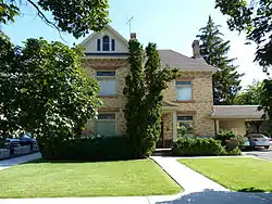 John E. Booth House |
February 11, 1982 (#82004171) |
59 West 500 North 40°14′25″N 111°39′32″W |
Provo | |
| 23 | William and Ann Bringhurst House |  William and Ann Bringhurst House |
January 5, 1998 (#97001567) |
306 South 200 West 40°09′45″N 111°36′49″W |
Springville | |
| 24 | George M. Brown House |  George M. Brown House |
December 1, 1982 (#82001759) |
284 East 100 North 40°14′06″N 111°39′10″W |
Provo | |
| 25 | Stephen and Mary Bunnell House | 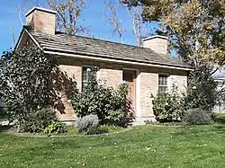 Stephen and Mary Bunnell House |
October 22, 1996 (#96001171) |
970 South 800 West on the campus of Utah Valley University 40°16′48″N 111°42′55″W |
Orem | Torn down in 2012, some of the materials rebuilt into a smaller replica |
| 26 | Caffrey and Davis Furniture Company-Senior Hotel |  Caffrey and Davis Furniture Company-Senior Hotel |
January 5, 1998 (#97001578) |
296 South Main Street 40°09′48″N 111°36′37″W |
Springville | |
| 27 | Camp Floyd Site |  Camp Floyd Site |
November 11, 1974 (#74001939) |
Off North 18150 West 40°15′26″N 112°06′14″W |
Fairfield | |
| 28 | Camp Williams Hostess House/Officers' Club |  Camp Williams Hostess House/Officers' Club |
April 1, 1985 (#85000816) |
810 Officer Street 40°26′03″N 111°55′19″W |
Camp W. G. Williams | |
| 29 | Carter-Terry-Call House |  Carter-Terry-Call House |
June 11, 1998 (#98000658) |
815 East 800 South 40°16′57″N 111°40′31″W |
Orem | |
| 30 | Cedar Fort School | 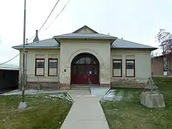 Cedar Fort School |
April 6, 2000 (#00000357) |
40 East Center Street 40°19′37″N 112°06′19″W |
Cedar Fort | |
| 31 | Charcoal Kilns | March 14, 1979 (#79003491) |
Homansville Canyon 39°58′25″N 112°04′00″W |
Dividend | ||
| 32 | Delbert and Ora Chipman House | 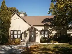 Delbert and Ora Chipman House |
January 25, 1995 (#94001563) |
317 East Main Street 40°22′25″N 111°47′21″W |
American Fork | |
| 33 | Henry & Elizabeth Parker Chipman House | 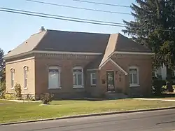 Henry & Elizabeth Parker Chipman House |
February 1, 2010 (#09001293) |
846 East 300 North 40°22′58″N 111°46′30″W |
American Fork | |
| 34 | Christeele Acres Historic District | December 30, 1999 (#99001626) |
Roughly bounded by South State Street, East 900 South, South 450 East, and East 1010 South 40°16′46″N 111°41′06″W |
Orem | ||
| 35 | Clark-Taylor House | 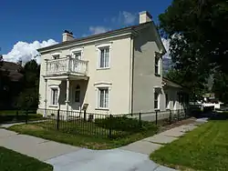 Clark-Taylor House |
October 7, 1975 (#75001829) |
306 North 500 West 40°14′17″N 111°39′59″W |
Provo | |
| 36 | Clinger-Booth House | 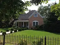 Clinger-Booth House |
June 11, 1998 (#98000660) |
468 South Main Street 40°17′19″N 111°41′42″W |
Orem | |
| 37 | Harvey H. Cluff House |  Harvey H. Cluff House |
August 4, 1982 (#82004172) |
174 North 100 East 40°14′10″N 111°39′21″W |
Provo | |
| 38 | Thomas and Elizabeth Coddington House |  Thomas and Elizabeth Coddington House |
January 18, 2018 (#100001982) |
190 North 300 East 40°22′50″N 111°47′26″W |
American Fork | |
| 39 | Alexander and Nellie P. Cordner House | 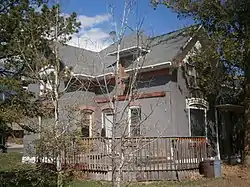 Alexander and Nellie P. Cordner House |
June 11, 1998 (#98000649) |
415 South 400 East 40°17′22″N 111°41′06″W |
Orem | |
| 40 | William James and Edna Cordner House | 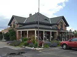 William James and Edna Cordner House |
June 11, 1998 (#98000647) |
440 South State Street 40°17′21″N 111°41′28″W |
Orem | |
| 41 | Cordner-Calder House | 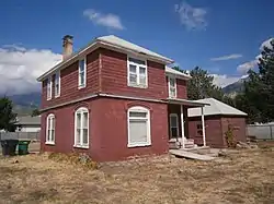 Cordner-Calder House |
June 11, 1998 (#98000648) |
305 South 900 East 40°17′29″N 111°40′22″W |
Orem | |
| 42 | Crandall Houses |  Crandall Houses |
January 19, 1983 (#83003196) |
112 and 136 East 200 North 40°10′09″N 111°36′28″W |
Springville | |
| 43 | William J. and Lizzie Cullimore House | 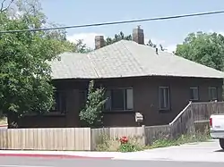 William J. and Lizzie Cullimore House |
June 11, 1998 (#98000643) |
396 West 1600 North 40°19′40″N 111°42′17″W |
Orem | |
| 44 | Thomas R. Cutler Mansion |  Thomas R. Cutler Mansion |
July 12, 1984 (#84002427) |
150 East State Street 40°23′45″N 111°50′42″W |
Lehi | |
| 45 | Dallin House |  Dallin House |
March 31, 1994 (#94000346) |
253 South 300 East 40°09′45″N 111°36′11″W |
Springville | |
| 46 | Charles E. Davies House |  Charles E. Davies House |
August 4, 1982 (#82004173) |
388 West 300 North 40°14′17″N 111°39′52″W |
Provo | |
| 47 | Joshua Davis House |  Joshua Davis House |
June 11, 1998 (#98000642) |
1888 South Main Street. 40°15′46″N 111°41′39″W |
Orem | |
| 48 | Roe A. and Louise R. Deal House |  Roe A. and Louise R. Deal House |
January 5, 1998 (#97001568) |
39 East 200 North 40°09′52″N 111°36′34″W |
Springville | |
| 49 | Deal-Mendenhall Hall |  Deal-Mendenhall Hall |
January 5, 1998 (#97001569) |
163 East 200 North 40°10′12″N 111°36′24″W |
Springville | |
| 50 | Cecil I. and Mildred H. Dimick House |  Cecil I. and Mildred H. Dimick House |
June 11, 1998 (#98000638) |
575 West 800 North 40°18′43″N 111°42′33″W |
Orem | |
| 51 | Christopher F. Dixon, Jr., House | 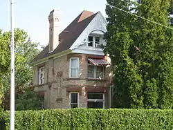 Christopher F. Dixon, Jr., House |
November 7, 1977 (#77001319) |
248 North Main Street 40°02′46″N 111°43′52″W |
Payson | |
| 52 | John Dixon House | 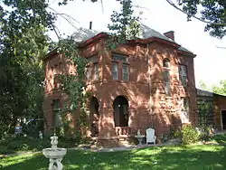 John Dixon House |
February 17, 1978 (#78002701) |
218 North Main Street 40°02′45″N 111°43′53″W |
Payson | |
| 53 | Samuel Douglass House | 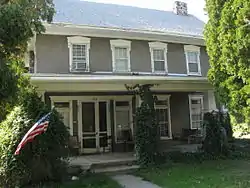 Samuel Douglass House |
August 21, 1992 (#92001059) |
215 North Main Street 40°02′45″N 111°43′54″W |
Payson | |
| 54 | Frederick and Della Dunn House |  Frederick and Della Dunn House |
August 3, 1990 (#90001142) |
145 North Main Street 40°10′09″N 111°36′37″W |
Springville | |
| 55 | Dunn-Binnall House & Farmstead |  Dunn-Binnall House & Farmstead |
February 1, 2010 (#09001294) |
352 North 200 East 40°23′02″N 111°47′33″W |
American Fork | |
| 56 | Dr. Elmo and Rhea Eddington House | 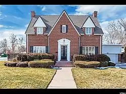 Dr. Elmo and Rhea Eddington House |
December 4, 1998 (#98001459) |
617 North 100 East 40°23′46″N 111°50′46″W |
Lehi | |
| 57 | Simon P. Eggertsen, Sr., House |  Simon P. Eggertsen, Sr., House |
September 13, 1977 (#77001321) |
390 South 500 West 40°13′43″N 111°40′01″W |
Provo | |
| 58 | Eureka Lilly Headframe |  Eureka Lilly Headframe |
March 14, 1979 (#79003487) |
Dividend Road 39°57′09″N 112°04′07″W |
Dividend | |
| 59 | Fairfield District School | _Schoolhouse.jpg.webp) Fairfield District School |
August 6, 1987 (#87000992) |
59 North Church Street 40°15′42″N 112°05′24″W |
Fairfield | |
| 60 | Joseph H. Frisby House |  Joseph H. Frisby House |
July 13, 1984 (#84002428) |
209 North 400 West 40°14′12″N 111°39′58″W |
Provo | |
| 61 | Fugal Blacksmith Shop |  Fugal Blacksmith Shop |
April 7, 1994 (#94000297) |
Approximately 680 North 400 East 40°22′15″N 111°43′54″W |
Pleasant Grove | |
| 62 | Fugal Dugout House |  Fugal Dugout House |
March 27, 1986 (#86000611) |
630 North 400 East 40°22′14″N 111°43′55″W |
Pleasant Grove | |
| 63 | Roy H. and Florence B. Gappmayer House | 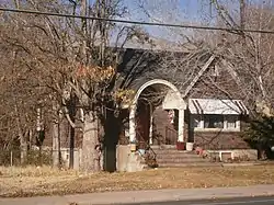 Roy H. and Florence B. Gappmayer House |
June 11, 1998 (#98000672) |
95 East 1200 South 40°16′31″N 111°41′32″W |
Orem | |
| 64 | Ira W. Gardner House |  Ira W. Gardner House |
July 28, 1977 (#77001323) |
10 North Main Street 40°03′17″N 111°40′20″W |
Salem | |
| 65 | James H. and Rhoda H. Gardner House |  James H. and Rhoda H. Gardner House |
December 4, 1998 (#98001454) |
187 East 300 North 40°23′30″N 111°50′47″W |
Lehi | |
| 66 | Charles T.H. Goode House | June 9, 1987 (#87000826) |
1215 East Main Street 40°22′33″N 111°46′05″W |
American Fork | ||
| 67 | Samuel I. and Olena J. Goodwin House |  Samuel I. and Olena J. Goodwin House |
December 4, 1998 (#98001453) |
80 West 400 North 40°23′34″N 111°50′59″W |
Lehi | |
| 68 | Samuel Green House |  Samuel Green House |
June 9, 1987 (#87000827) |
264 East 200 South 40°21′40″N 111°44′07″W |
Pleasant Grove | |
| 69 | John Hafen House | 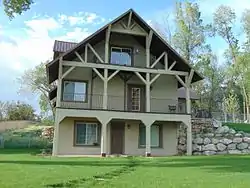 John Hafen House |
July 23, 1982 (#82004182) |
1002 South Main Street 40°09′14″N 111°36′33″W |
Springville | |
| 70 | Alfred William Harper House |  Alfred William Harper House |
June 9, 1987 (#87000828) |
125 West 400 North 40°20′40″N 111°43′01″W |
Lindon | |
| 71 | Harrington Elementary School | 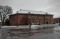 Harrington Elementary School |
March 4, 1993 (#93000064) |
50 North Center Street 40°22′40″N 111°47′50″W |
American Fork | |
| 72 | James and Emily Herbert House |  James and Emily Herbert House |
January 18, 2018 (#100001983) |
388 W Main Street 40°22′37″N 111°48′31″W |
American Fork | |
| 73 | Hines Mansion | 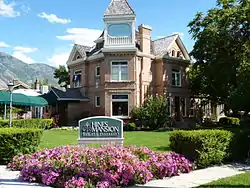 Hines Mansion |
July 12, 1978 (#78002702) |
125 South 400 West 40°14′03″N 111°39′51″W |
Provo | |
| 74 | Lars and Agnes Jensen House | 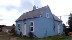 Lars and Agnes Jensen House |
December 30, 1999 (#99001627) |
87 North 800 West 40°17′55″N 111°42′54″W |
Orem | |
| 75 | Mont and Harriet Johnson House |  Mont and Harriet Johnson House |
January 5, 1998 (#97001570) |
153 East 400 North 40°10′22″N 111°36′25″W |
Springville | |
| 76 | Peter Axel Johnson House |  Peter Axel Johnson House |
October 22, 1984 (#84000164) |
1075 North 100 East 40°22′30″N 111°44′21″W |
Pleasant Grove | |
| 77 | Johnson-Hansen House |  Johnson-Hansen House |
December 1, 1994 (#94001346) |
485 East 400 South 40°13′43″N 111°38′50″W |
Provo | |
| 78 | Johnson-Kearns Hotel |  Johnson-Kearns Hotel |
January 5, 1998 (#97001571) |
94 West 200 South 40°09′52″N 111°36′40″W |
Springville | |
| 79 | David H. Jones House |  David H. Jones House |
October 24, 1985 (#85003392) |
143 South Main Street 40°06′29″N 111°38′54″W |
Spanish Fork | |
| 80 | T.R. Kelly House |  T.R. Kelly House |
December 9, 1983 (#83003972) |
164 West 200 South 40°09′51″N 111°36′46″W |
Springville | |
| 81 | Nephi and Annie Kindred House | 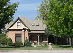 Nephi and Annie Kindred House |
January 5, 1998 (#97001573) |
188 West Center Street 40°10′01″N 111°36′46″W |
Springville | |
| 82 | Knight Block | 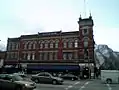 Knight Block |
December 2, 1977 (#77001322) |
1-13 East Center Street and 20-24 North University Avenue 40°14′03″N 111°39′27″W |
Provo | |
| 83 | Jesse Knight House | 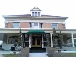 Jesse Knight House |
July 23, 1982 (#82004174) |
185 East Center Street 40°14′02″N 111°39′16″W |
Provo | |
| 84 | Knight-Finch House | 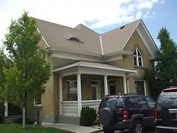 Knight-Finch House |
June 11, 1998 (#98000673) |
212 South State Street 40°17′35″N 111°41′34″W |
Orem | |
| 85 | Knight-Allen House | 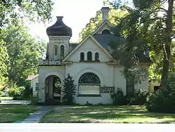 Knight-Allen House |
July 23, 1982 (#82004175) |
390 East Center Street 40°14′00″N 111°39′04″W |
Provo | |
| 86 | Knight-Mangum House | 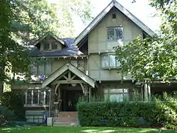 Knight-Mangum House |
July 23, 1982 (#82004176) |
381 East Center Street 40°14′02″N 111°39′04″W |
Provo | |
| 87 | Christian and Sarah Knudsen House |  Christian and Sarah Knudsen House |
December 4, 1998 (#98001458) |
123 South Center Street 40°23′11″N 111°50′56″W |
Lehi | |
| 88 | Lakeview Tithing Office |  Lakeview Tithing Office |
January 25, 1985 (#85000289) |
1675 North Geneva Road 40°15′21″N 111°42′35″W |
Provo | |
| 89 | Christen Larsen House |  Christen Larsen House |
July 13, 1987 (#87001178) |
990 North 400 East 40°22′29″N 111°43′54″W |
Pleasant Grove | |
| 90 | Neils Peter Larsen House | 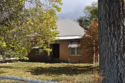 Neils Peter Larsen House |
June 9, 1987 (#87000829) |
1146 North 100 East 40°22′35″N 111°44′18″W |
Pleasant Grove | |
| 91 | Lehi City Hall | 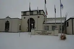 Lehi City Hall |
March 1, 1982 (#82004169) |
51 North Center Street 40°23′19″N 111°50′56″W |
Lehi | |
| 92 | Lehi Main Street Historic District | 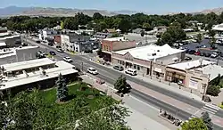 Lehi Main Street Historic District |
December 10, 1998 (#98001450) |
Roughly along Main Street, between 200 West and Center Street, and 51 North Center Street 40°23′17″N 111°51′00″W |
Lehi | |
| 93 | Lehi North Branch Meetinghouse |  Lehi North Branch Meetinghouse |
December 4, 1998 (#98001455) |
1190 North 500 West 40°23′34″N 111°51′19″W |
Lehi | |
| 94 | Lehi Roller Mills | 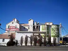 Lehi Roller Mills |
May 26, 1994 (#94000535) |
700 East Main Street 40°23′21″N 111°50′08″W |
Lehi | |
| 95 | Lehi Ward Tithing Barn-Centennial Hall | 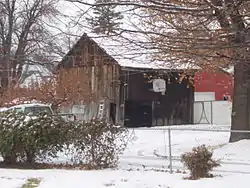 Lehi Ward Tithing Barn-Centennial Hall |
December 4, 1998 (#98001456) |
651 North 200 East, rear 40°23′45″N 111°50′42″W |
Lehi | |
| 96 | Lewis Terrace | April 7, 1983 (#83003197) |
68-82 North 700 East 40°14′34″N 111°39′22″W |
Provo | ||
| 97 | John S. and Izola Lewis House | 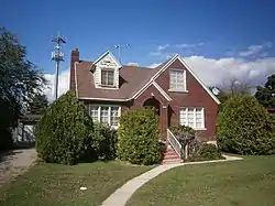 John S. and Izola Lewis House |
June 11, 1998 (#98000671) |
343 East 720 South 40°17′04″N 111°41′12″W |
Orem | |
| 98 | Lime Kilns | March 14, 1979 (#79003490) |
Homansville Canyon 39°58′40″N 112°04′37″W |
Dividend | ||
| 99 | Loveless House |  Loveless House |
September 9, 2010 (#10000729) |
509 East 800 South 40°16′57″N 111°40′59″W |
Orem | Orem, Utah MPS |
| 100 | Maeser School | 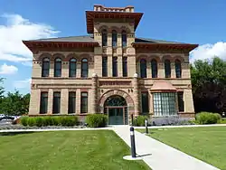 Maeser School |
July 26, 1982 (#82004177) |
150 South 500 East 40°13′52″N 111°38′57″W |
Provo | |
| 101 | McBride-Sims Garage | 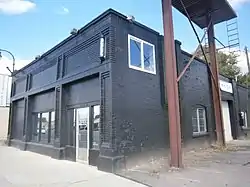 McBride-Sims Garage |
June 11, 1998 (#98000664) |
600 North State Street 40°18′30″N 111°41′56″W |
Orem | |
| 102 | William H. and Sarah D. Meneray House |  William H. and Sarah D. Meneray House |
January 5, 1998 (#97001574) |
190 South 200 West 40°09′52″N 111°36′49″W |
Springville | |
| 103 | Harry B. Merrihew Drugstore |  Harry B. Merrihew Drugstore |
July 23, 1982 (#82004170) |
100 West and Main Street 40°23′16″N 111°51′10″W |
Lehi | |
| 104 | David Morgan House |  David Morgan House |
February 19, 1982 (#82004167) |
Center Street and 200 South 39°56′54″N 111°54′01″W |
Goshen | |
| 105 | Moyle House and Indian Tower | 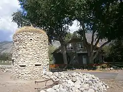 Moyle House and Indian Tower |
December 23, 1992 (#92001689) |
606 East 770 North 40°27′52″N 111°45′58″W |
Alpine | |
| 106 | Ami and Amanda Oakley House |  Ami and Amanda Oakley House |
January 5, 1998 (#97001575) |
219 East 400 North 40°10′21″N 111°36′20″W |
Springville | |
| 107 | Old Goshen Site | August 26, 1980 (#80003976) |
Address Restricted[6] |
Goshen | ||
| 108 | Olmsted Station Powerhouse |  Olmsted Station Powerhouse |
June 26, 1972 (#72001262) |
1018 North 1630 East 40°18′57″N 111°39′14″W |
Orem | |
| 109 | Joseph Olpin House |  Joseph Olpin House |
November 7, 1977 (#77001320) |
510 Locust Avenue 40°21′28″N 111°43′41″W |
Pleasant Grove | |
| 110 | Lars and Christina Olsen House | 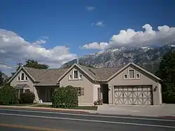 Lars and Christina Olsen House |
June 11, 1998 (#98000669) |
417 South 800 East 40°17′22″N 111°40′50″W |
Orem | |
| 111 | Milan and Margaret Packard House | 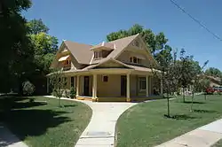 Milan and Margaret Packard House |
January 5, 1998 (#97001576) |
110 West 100 South 40°09′56″N 111°36′43″W |
Springville | |
| 112 | Payson Historic District | 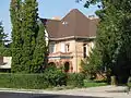 Payson Historic District |
July 3, 2007 (#07000666) |
Roughly bounded by 500 North, 300 East, 500 South, and 400 West 40°02′37″N 111°43′56″W |
Payson | The district includes the Christopher Dixon house (pictured) and the John Dixon and Samuel Douglass houses as contributing properties. |
| 113 | Payson Presbyterian Church | 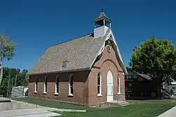 Payson Presbyterian Church |
March 27, 1986 (#86000610) |
160 South Main Street 40°02′07″N 111°43′54″W |
Payson | |
| 114 | People's Co-op Building |  People's Co-op Building |
December 4, 1998 (#98001457) |
151 East State Street 40°23′50″N 111°50′47″W |
Lehi | |
| 115 | Peteetneet School |  Peteetneet School |
May 30, 1990 (#90000795) |
50 North 500 East 40°02′36″N 111°43′24″W |
Payson | |
| 116 | Pleasant Grove Historic District |  Pleasant Grove Historic District |
December 13, 1995 (#95001434) |
Roughly bounded by 100 North, 500 South, 300 East, and 100 West 40°21′43″N 111°44′17″W |
Pleasant Grove | |
| 117 | Pleasant Grove School | 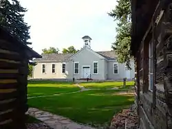 Pleasant Grove School |
February 20, 1980 (#80003978) |
65 South 100 East 40°21′48″N 111°44′14″W |
Pleasant Grove | |
| 118 | Pleasant Grove Tithing Office | 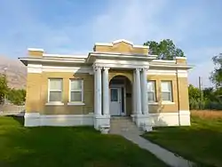 Pleasant Grove Tithing Office |
January 25, 1985 (#85000288) |
7 South 300 East 40°21′50″N 111°44′04″W |
Pleasant Grove | |
| 119 | Pleasant Grove Town Hall | 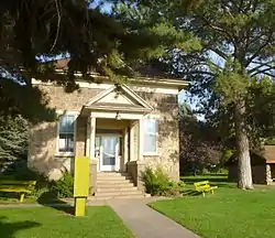 Pleasant Grove Town Hall |
June 27, 1985 (#85001391) |
107 South 100 East 40°21′44″N 111°44′15″W |
Pleasant Grove | |
| 120 | Provo Canyon Guard Quarters |  Provo Canyon Guard Quarters |
June 12, 1986 (#86001291) |
Off U.S. Route 189 40°20′23″N 111°36′44″W |
Provo Canyon | |
| 121 | Provo Downtown Historic District |  Provo Downtown Historic District |
May 1, 1980 (#80003980) |
Center Street and University Avenue 40°14′00″N 111°39′32″W |
Provo | |
| 122 | Provo East Central Historic District |  Provo East Central Historic District |
November 24, 1998 (#98000281) |
Roughly bounded by 100 East, 600 East, 500 North, and 500 South 40°14′01″N 111°39′09″W |
Provo | |
| 123 | Provo Tabernacle | 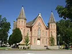 Provo Tabernacle |
September 9, 1975 (#75001830) |
50 South University Avenue 40°13′58″N 111°39′30″W |
Provo | |
| 124 | Provo Third Ward Chapel and Amusement Hall | 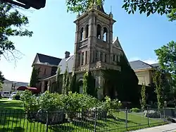 Provo Third Ward Chapel and Amusement Hall |
April 2, 1979 (#79002518) |
105 North 500 West 40°14′08″N 111°40′01″W |
Provo | |
| 125 | Provo West Co-op |  Provo West Co-op |
July 13, 1984 (#84002429) |
450 West Center Street 40°14′03″N 111°39′56″W |
Provo | |
| 126 | William H. Ray House | 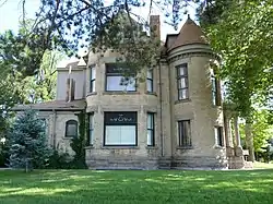 William H. Ray House |
July 23, 1982 (#82004178) |
415 South University Avenue 40°13′41″N 111°39′27″W |
Provo | |
| 127 | Recreation Center for the Utah State Hospital | .jpg.webp) Recreation Center for the Utah State Hospital |
April 9, 1986 (#86000746) |
1300 East Center Street 40°14′01″N 111°37′50″W |
Provo | |
| 128 | Henry T. and Rebecca Reynolds House |  Henry T. and Rebecca Reynolds House |
January 5, 1998 (#97001577) |
270 West 200 South 40°09′52″N 111°36′53″W |
Springville | |
| 129 | John T. and Henry T. Reynolds, Jr., House |  John T. and Henry T. Reynolds, Jr., House |
June 27, 1985 (#85001393) |
101 East 200 South 40°09′51″N 111°36′28″W |
Springville | |
| 130 | Thomas A. Richins House |  Thomas A. Richins House |
June 9, 1987 (#87000831) |
405 North 500 East 40°22′06″N 111°43′47″W |
Pleasant Grove | |
| 131 | William D. Roberts House | 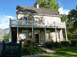 William D. Roberts House |
July 24, 1984 (#84002430) |
212 North 500 West 40°14′12″N 111°39′58″W |
Provo | |
| 132 | Santaquin Junior High School | 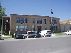 Santaquin Junior High School |
April 1, 1985 (#85000817) |
75 West 100 South 39°58′26″N 111°46′26″W |
Santaquin | |
| 133 | Silver Row | 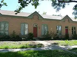 Silver Row |
August 4, 1982 (#82004179) |
621-645 West 100 North 40°14′06″N 111°40′08″W |
Provo | |
| 134 | Robert and Mary Ann Singleton House |  Robert and Mary Ann Singleton House |
January 18, 2018 (#100001984) |
740 East 50 South 40°22′32″N 111°46′41″W |
American Fork | |
| 135 | Thomas and Eliza Jane Singleton House |  Thomas and Eliza Jane Singleton House |
January 18, 2018 (#100001985) |
778 East 50 South 40°22′33″N 111°46′36″W |
American Fork | |
| 136 | Alfred and Rosy Skinner House | 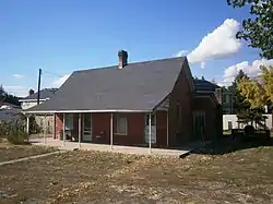 Alfred and Rosy Skinner House |
June 11, 1998 (#98000662) |
232 West 800 South 40°16′57″N 111°42′02″W |
Orem | |
| 137 | Hannah Maria Libby Smith House |  Hannah Maria Libby Smith House |
February 14, 1980 (#80003981) |
315 East Center Street 40°14′02″N 111°39′07″W |
Provo | |
| 138 | John Y. and Emerette C. Smith House |  John Y. and Emerette C. Smith House |
December 4, 1998 (#98001452) |
518 North 100 East 40°23′39″N 111°50′47″W |
Lehi | |
| 139 | Warren B. Smith House |  Warren B. Smith House |
June 19, 1979 (#79002513) |
589 East Main Street 40°22′37″N 111°46′55″W |
American Fork | |
| 140 | Reed Smoot House |  Reed Smoot House |
October 14, 1975 (#75001831) |
183 East 100 South 40°13′58″N 111°39′16″W |
Provo | |
| 141 | Spanish Fork High School Gymnasium |  Spanish Fork High School Gymnasium |
April 1, 1985 (#85000819) |
300 South Main Street 40°06′20″N 111°39′16″W |
Spanish Fork | |
| 142 | Springville Carnegie Library |  Springville Carnegie Library |
December 13, 1991 (#91001821) |
175 South Main Street 40°09′51″N 111°36′36″W |
Springville | |
| 143 | Springville High School Art Gallery | 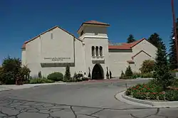 Springville High School Art Gallery |
April 9, 1986 (#86000750) |
126 East 400 South 40°09′39″N 111°36′28″W |
Springville | |
| 144 | Springville High School Mechanical Arts Building |  Springville High School Mechanical Arts Building |
May 14, 1993 (#93000415) |
443 South 200 East 40°09′37″N 111°36′22″W |
Springville | |
| 145 | Springville Historic District |  Springville Historic District |
January 21, 2004 (#03000157) |
Roughly bounded by 400 North, 400 East, 800 South, Main Street, 400 South, and 400 West 40°10′19″N 111°36′43″W |
Springville | |
| 146 | Springville Presbyterian Church | 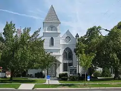 Springville Presbyterian Church |
October 24, 1980 (#80003983) |
251 South 200 East 40°09′47″N 111°36′21″W |
Springville | |
| 147 | Stagecoach Inn |  Stagecoach Inn |
May 14, 1971 (#71000857) |
18035 West 1540 North 40°15′41″N 112°05′34″W |
Fairfield | |
| 148 | Startup Candy Factory |  Startup Candy Factory |
October 28, 1983 (#83003973) |
534 South 100 West 40°13′34″N 111°39′35″W |
Provo | |
| 149 | Stewart-Hills House | 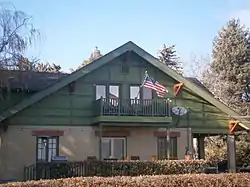 Stewart-Hills House |
January 21, 2004 (#03001483) |
275 East 2000 South 40°15′40″N 111°41′16″W |
Orem | |
| 150 | James P. and Lydia Strang House |  James P. and Lydia Strang House |
January 5, 1998 (#97001579) |
293 East 400 North 40°10′23″N 111°36′15″W |
Springville | |
| 151 | Superintendent's Residence at the Utah State Hospital | 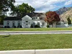 Superintendent's Residence at the Utah State Hospital |
April 9, 1986 (#86000748) |
1079 East Center Street 40°14′02″N 111°38′20″W |
Provo | |
| 152 | George Taylor, Jr., House |  George Taylor, Jr., House |
August 9, 1983 (#83004185) |
187 North 400 West 40°14′06″N 111°39′54″W |
Provo | |
| 153 | Thomas N. Taylor House |  Thomas N. Taylor House |
July 23, 1982 (#82004180) |
342 North 500 West 40°14′18″N 111°40′03″W |
Provo | |
| 154 | Timpanogos Cave Historic District | 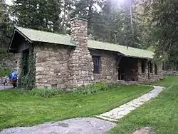 Timpanogos Cave Historic District |
October 13, 1982 (#82001760) |
2038 Alpine Loop Road 40°26′25″N 111°42′44″W |
American Fork | |
| 155 | Timpanogos Cooperative Marketing Association Building |  Timpanogos Cooperative Marketing Association Building |
July 5, 2008 (#08000385) |
380 South Orem Boulevard 40°17′25″N 111°41′40″W |
Orem | |
| 156 | Tintic Standard Reduction Mill | 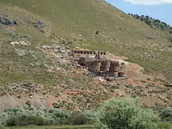 Tintic Standard Reduction Mill |
September 13, 1978 (#78002700) |
Off U.S. Route 6 39°57′26″N 111°51′10″W |
Genola | |
| 157 | John R. Twelves House | 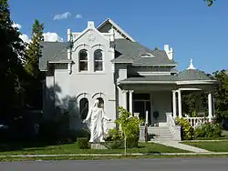 John R. Twelves House |
July 23, 1982 (#82004181) |
287 East 100 North 40°14′07″N 111°39′10″W |
Provo | |
| 158 | Upper American Fork Hydroelectric Power Plant Historic District | 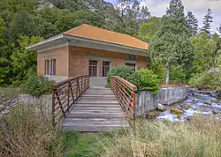 Upper American Fork Hydroelectric Power Plant Historic District |
April 20, 1989 (#89000278) |
Alpine Loop Road 40°26′16″N 111°43′22″W |
Highland | |
| 159 | US Post Office-Springville Main |  US Post Office-Springville Main |
November 27, 1989 (#89002000) |
309 South Main Street 40°09′44″N 111°36′35″W |
Springville | |
| 160 | U. S. Post Office |  U. S. Post Office |
September 5, 2017 (#100001573) |
88 West 100 North 40°14′07″N 111°39′36″W |
Provo | Also known as the J. Will Robinson Federal Building |
| 161 | Utah Southern Railroad Depot |  Utah Southern Railroad Depot |
June 8, 1994 (#94000536) |
222 East State Street 40°23′48″N 111°50′45″W |
Lehi | |
| 162 | Utah State Training School Amphitheater and Wall |  Utah State Training School Amphitheater and Wall |
October 7, 1994 (#94001206) |
Roughly 845 East 700 North 40°23′39″N 111°46′31″W |
American Fork | |
| 163 | Veterans Memorial Building |  Veterans Memorial Building |
April 14, 1994 (#94000299) |
53 North Center Street 40°22′41″N 111°47′54″W |
American Fork | |
| 164 | Edward Wadley House |  Edward Wadley House |
June 9, 1987 (#87000832) |
2445 North Canyon Road 40°23′25″N 111°44′23″W |
Pleasant Grove | |
| 165 | Patrick L. and Rose O. Ward House |  Patrick L. and Rose O. Ward House |
January 5, 1998 (#97001580) |
511 South Main Street 40°09′35″N 111°36′34″W |
Springville | |
| 166 | Alvin and Grace Washburn House |  Alvin and Grace Washburn House |
December 30, 1999 (#99001629) |
753 North 100 West 40°18′41″N 111°41′53″W |
Orem | |
| 167 | Water Lily Shaft | March 14, 1979 (#79003489) |
North of Dividend 39°59′04″N 112°03′13″W |
Pinon Creek Canyon | ||
| 168 | Thomas and Mary Webb House |  Thomas and Mary Webb House |
December 4, 1998 (#98001451) |
388 North 200 East 40°23′33″N 111°50′42″W |
Lehi | |
| 169 | Peter Wentz House |  Peter Wentz House |
April 26, 1978 (#78002703) |
575 North University Avenue 40°14′28″N 111°39′30″W |
Provo | |
| 170 | Jacob Hanmer White House |  Jacob Hanmer White House |
June 9, 1987 (#87000833) |
599 East 100 South 40°21′46″N 111°43′39″W |
Pleasant Grove | |
| 171 | Joseph and Margaret Wilkinson House |  Joseph and Margaret Wilkinson House |
October 16, 2013 (#13000843) |
318 South 800 West 40°17′30″N 111°42′54″W |
Orem | Part of the Orem, Utah MPS |
| 172 | Wood-Harrison House |  Wood-Harrison House |
January 19, 1983 (#83003198) |
310 South 300 West 40°09′44″N 111°36′56″W |
Springville | |
| 173 | Yankee Headframe | March 14, 1979 (#79003484) |
Burriston Pass Road 39°56′52″N 112°05′49″W |
East Tintic Mountains | ||
| 174 | Yard-Groesbeck House |  Yard-Groesbeck House |
January 5, 1998 (#97001581) |
157 West 200 South 40°09′51″N 111°36′44″W |
Springville | |
| 175 | Brigham Young Academy |  Brigham Young Academy |
January 1, 1976 (#76001839) |
550 North University Avenue 40°14′28″N 111°39′24″W |
Provo | Now the Provo City Library |
| 176 | William Friend Young House |  William Friend Young House |
June 9, 1987 (#87000834) |
550 East 500 North 40°22′08″N 111°43′42″W |
Pleasant Grove |
Former listings
| [3] | Name on the Register | Image | Date listed | Date removed | Location | City or town | Summary |
|---|---|---|---|---|---|---|---|
| 1 | Big Hill Shaft Headframe | 1979 (#79003486) | December 4, 1991 | Dividend Road 39°57′14″N 112°04′37″W |
Dividend | ||
| 2 | Davis-Ercanbrack Farmstead | October 2, 1998 (#98001213) | July 23, 2018 | 2044 South Main Street 40°15′37″N 111°41′40″W |
Orem | ||
| 3 | Dividend Miner's Dry | 1979 (#79003488) | December 4, 1991 | Dividend Road 39°57′19″N 112°03′44″W |
Dividend | ||
| 4 | Hotel Roberts |  Hotel Roberts |
July 26, 1979 (#79002516) | April 28, 2005 | 192 South University Avenue |
Provo | Historic Mission-style hotel built in 1882 that served as a landmark and center of Provo social activity for much of the early 20th century. Demolished in 2004. |
| 5 | Jacob Houtz House | August 25, 1978 (#78002704) | October 27, 1982 | 980 North Main Street |
Springville | ||
| 6 | Iron Blossom No. 3 Mine | 1979 (#79003479) | December 4, 1991 | Burristan Pass Road 39°55′52″N 112°05′45″W |
East Tintic Mountains (east of Mammoth |
||
| 7 | Benjamin Bullock Kimball House | December 4, 1985 (#85003042) | May 15, 2001 | 1705 South State Street |
Provo | ||
| 8 | Lehi Commercial and Savings Bank-Lehi Hospital |  Lehi Commercial and Savings Bank-Lehi Hospital |
December 17, 1998 (#98001537) | March 26, 2018 | 206 East State Street 40°23′46″N 111°50′42″W |
Lehi | Demolished in 2009 |
| 9 | Lehi Fifth Ward Meetinghouse | 1992 (#92001688) | May 15, 2001 | 121 N. 100 East |
Lehi | ||
| 10 | Nunn Power Plant | December 13, 1979 (#79002517) | April 28, 2005 | Off U.S. Route 189 |
Provo Canyon | ||
| 11 | Spanish Fork Fire Station | April 1, 1985[7] (#85000818) | October 22, 1996 | 365 North Main Street |
Spanish Fork | ||
| 12 | Spanish Fork National Guard Armory | April 9, 1986[8] (#86000749) | October 22, 1996 | 360 North Main Street |
Spanish Fork | ||
| 13 | Stratton House-Orem City Hall |  Stratton House-Orem City Hall |
June 11, 1998 (#98000674) | September 3, 2009 | 870 West Center Street 40°17′53″N 111°42′57″W |
Orem | |
| 14 | James E. and Albert Talmage House | February 20, 1980 (#80003982) | December 28, 1994 | 345 East 400 North |
Provo | ||
| 15 | Verd's Fruit Market Complex | September 9, 2010 (#10000731) | March 13, 2017 | 1320 North State Street 40°19′17″N 111°42′16″W |
Orem | Orem, Utah MPS |
See also
References
- The latitude and longitude information provided in this table was derived originally from the National Register Information System, which has been found to be fairly accurate for about 99% of listings. Some locations in this table may have been corrected to current GPS standards.
- "National Register of Historic Places: Weekly List Actions". National Park Service, United States Department of the Interior. Retrieved on January 29, 2021.
- Numbers represent an alphabetical ordering by significant words. Various colorings, defined here, differentiate National Historic Landmarks and historic districts from other NRHP buildings, structures, sites or objects.
- "National Register Information System". National Register of Historic Places. National Park Service. April 24, 2008.
- The eight-digit number below each date is the number assigned to each location in the National Register Information System database, which can be viewed by clicking the number.
- Some listings on the NRHP are highly sensitive sites and may be subject to looting or vandalism. The NRHP lists this site as "Address Restricted."
- Weekly Register Lists, 1985, p.47
- Weekly Register List, 1986, page 48
External links
![]() Media related to National Register of Historic Places in Utah County, Utah at Wikimedia Commons
Media related to National Register of Historic Places in Utah County, Utah at Wikimedia Commons
 | |||
| Topics | |
|---|---|
| Lists by state |
|
| Lists by insular areas | |
| Lists by associated state | |
| Other areas | |
| Related | |
| |
Municipalities and communities of Utah County, Utah, United States | ||
|---|---|---|
| Cities | Map of Utah highlighting Utah County | |
| Towns | ||
| CDPs | ||
| Unincorporated communities |
| |
| Indian reservation | ||
| Ghost towns | ||
| Footnotes | ‡This populated place also has portions in an adjacent county or counties | |
| ||
This article is issued from Wikipedia. The text is licensed under Creative Commons - Attribution - Sharealike. Additional terms may apply for the media files.