National Register of Historic Places listings in Cache County, Utah
This is a list of the National Register of Historic Places listings in Cache County, Utah.
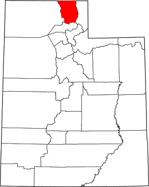
Location of Cache County in Utah
This is intended to be a complete list of the properties and districts on the National Register of Historic Places in Cache County, Utah, United States. Latitude and longitude coordinates are provided for many National Register properties and districts; these locations may be seen together in a map.[1]
There are 75 properties and districts listed on the National Register in the county. Another 5 sites in the county were once listed, but have since been removed.
- This National Park Service list is complete through NPS recent listings posted February 5, 2021.[2]
Current listings
| [3] | Name on the Register | Image | Date listed[4] | Location | City or town | Description |
|---|---|---|---|---|---|---|
| 1 | George Washington Baker House |  George Washington Baker House |
February 10, 1983 (#83004416) |
115 N. 100 West 41°42′37″N 111°58′44″W |
Mendon | |
| 2 | Samuel Baker House | March 31, 1983 (#83004417) |
150 W. 200 North 41°42′45″N 111°58′50″W |
Mendon | Stone house with vernacular Greek Revival styling, built in 1870s. | |
| 3 | Heber K. and Rachel H. Bankhead House |  Heber K. and Rachel H. Bankhead House |
March 21, 1997 (#97000261) |
185 E. 800 South 41°37′20″N 111°55′49″W |
Wellsville | |
| 4 | William & Elizabeth Barrett Farmstead | 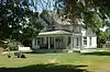 William & Elizabeth Barrett Farmstead |
February 19, 2008 (#08000057) |
20 S. 100 West 41°42′27″N 111°58′42″W |
Mendon | |
| 5 | Bell-Johnson House |  Bell-Johnson House |
October 8, 2004 (#04001118) |
12 N. 200 East 41°55′30″N 111°48′05″W |
Richmond | |
| 6 | Benson Elementary School | April 1, 1985 (#85000798) |
3440 N. 3000 West 41°47′45″N 111°54′17″W |
Benson | Demolished between 1993 and 2002 | |
| 7 | George Bradshaw House and Joshua Salisbury/George Bradshaw Barn |  George Bradshaw House and Joshua Salisbury/George Bradshaw Barn |
November 19, 1982 (#82004846) |
73 S. Center St. 41°38′16″N 111°56′05″W |
Wellsville | |
| 8 | James and Amy Burnham Farmstead | 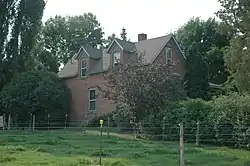 James and Amy Burnham Farmstead |
October 8, 2004 (#04001120) |
533 S. State St. 41°54′46″N 111°48′27″W |
Richmond | |
| 9 | Carl F. and Sophia Christensen House |  Carl F. and Sophia Christensen House |
October 8, 2004 (#04001121) |
208 N. 200 East 41°55′38″N 111°48′06″W |
Richmond | |
| 10 | Clarkston Tithing Granary | 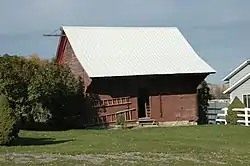 Clarkston Tithing Granary |
January 25, 1985 (#85000250) |
10212 N. 8700 West 41°55′12″N 112°03′11″W |
Clarkston | Granary building. This was moved a few blocks in 2018. |
| 11 | Crockett House |  Crockett House |
April 27, 2009 (#09000017) |
82 Crockett Ave. 41°44′04″N 111°48′44″W |
Logan | |
| 12 | Douglas General Mercantile |  Douglas General Mercantile |
August 4, 1982 (#82004113) |
100 S. Main St. 41°50′03″N 111°49′54″W |
Smithfield | |
| 13 | David Eccles House | 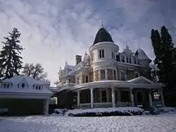 David Eccles House |
July 30, 1976 (#76001811) |
250 W. Center St. 41°43′52″N 111°50′26″W |
Logan | |
| 14 | Elite Hall | 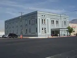 Elite Hall |
August 4, 2003 (#03000736) |
98 W. Main St. 41°38′04″N 111°51′25″W |
Hyrum | |
| 15 | Samuel and Lana Ewing House | 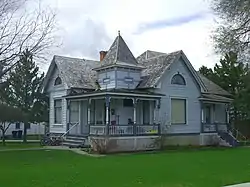 Samuel and Lana Ewing House |
January 28, 1994 (#93001576) |
107 S. 100 East 41°50′02″N 111°49′46″W |
Smithfield | |
| 16 | Forster Hotel | 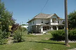 Forster Hotel |
February 19, 2008 (#08000058) |
176 N. 100 West 41°42′40″N 111°58′41″W |
Mendon | |
| 17 | James Gardner House | 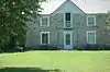 James Gardner House |
February 11, 1982 (#82004111) |
173 N. Main St. 41°42′39″N 111°58′34″W |
Mendon | |
| 18 | Soren Hanson House |  Soren Hanson House |
February 11, 1982 (#82004109) |
166 W. Main St. 41°38′04″N 111°51′33″W |
Hyrum | |
| 19 | Martin Harris Gravesite |  Martin Harris Gravesite |
November 28, 1980 (#80003890) |
8400 W. 11000 North 41°55′53″N 112°02′20″W |
Clarkston | |
| 20 | Hatch's Camp | December 27, 2006 (#06001192) |
8.3 miles (13.4 km) east from the mouth of Logan Canyon 41°46′32″N 111°38′57″W |
Cache National Forest | ||
| 21 | Hendricks Confectionery Building | 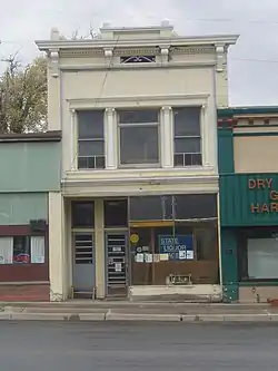 Hendricks Confectionery Building |
October 8, 2004 (#04001122) |
19 W. Main St. 41°55′21″N 111°48′31″W |
Richmond | |
| 22 | Lafayette and Elizabeth W. Hendricks House | 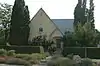 Lafayette and Elizabeth W. Hendricks House |
October 8, 2004 (#04001123) |
109 S. State St. 41°55′13″N 111°48′27″W |
Richmond | |
| 23 | William S. and Margaret R. Hendricks House |  William S. and Margaret R. Hendricks House |
October 8, 2004 (#04001124) |
112 W. Main St. 41°55′23″N 111°48′40″W |
Richmond | |
| 24 | Hobson-Hill House |  Hobson-Hill House |
October 8, 2004 (#04001125) |
108 S. 100 West 41°55′13″N 111°48′40″W |
Richmond | |
| 25 | Home Economics/Commons Building | 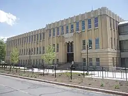 Home Economics/Commons Building |
April 1, 1985 (#85000800) |
Off U.S. Route 89 on the Utah State University campus 41°44′25″N 111°48′40″W |
Logan | |
| 26 | Howell-Theurer House | 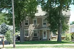 Howell-Theurer House |
October 18, 1979 (#79002490) |
30 S. 100 East 41°38′16″N 111°55′49″W |
Wellsville | Boyhood home of Joseph Howell |
| 27 | Hyrum First Ward Meetinghouse | 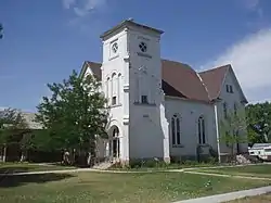 Hyrum First Ward Meetinghouse |
February 15, 1980 (#80003891) |
290 S. Center St. 41°37′41″N 111°51′19″W |
Hyrum | |
| 28 | John P. and Sarah James House |  John P. and Sarah James House |
January 28, 1994 (#93001578) |
210 W. 9000 South 41°34′06″N 111°50′17″W |
Paradise | |
| 29 | Morgan A. and Clarissa R. Knapp House |  Morgan A. and Clarissa R. Knapp House |
October 8, 2004 (#04001126) |
106 S. 100 East 41°55′13″N 111°48′19″W |
Richmond | |
| 30 | John E. Lee House |  John E. Lee House |
February 11, 1982 (#82004108) |
123 W. Center St. 41°28′33″N 111°29′32″W |
Hyde Park | |
| 31 | Lewiston Community Building | 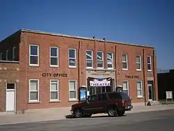 Lewiston Community Building |
April 1, 1985 (#85000799) |
29 S. Main St. 41°58′31″N 111°51′20″W |
Lewiston | |
| 32 | Lewiston Tithing Office and Granary |  Lewiston Tithing Office and Granary |
January 25, 1985 (#85000252) |
81 E. 800 South 41°57′42″N 111°51′14″W |
Lewiston | |
| 33 | Logan Center Street Historic District | 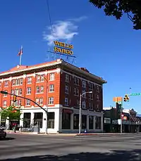 Logan Center Street Historic District |
April 26, 1979 (#79002488) |
Roughly bounded by 200 North, 200 South, 200 East, and 600 West 41°43′56″N 111°50′18″W |
Logan | |
| 34 | Logan Fish Hatchery Caretaker's Residence | Logan Fish Hatchery Caretaker's Residence |
April 1, 1985 (#85000801) |
1469 W. 200 North 41°44′10″N 111°52′08″W |
Logan | |
| 35 | Logan High School Gymnasium | August 7, 1985 (#85001844) |
162 W. 100 South 41°43′44″N 111°50′16″W |
Logan | ||
| 36 | Logan LDS Sixth Ward Church | 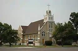 Logan LDS Sixth Ward Church |
July 17, 1979 (#79002489) |
395 S. Main St. 41°43′27″N 111°50′06″W |
Logan | |
| 37 | Logan Municipal Slaughterhouse | 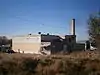 Logan Municipal Slaughterhouse |
April 1, 1985 (#85000802) |
265 N. 600 West 41°44′13″N 111°50′59″W |
Logan | |
| 38 | Logan Tabernacle | .jpg.webp) Logan Tabernacle |
October 10, 1975 (#75001800) |
Bounded by Center, 1st North, Main, and 1st East Sts. 41°43′56″N 111°50′00″W |
Logan | |
| 39 | Logan Temple | 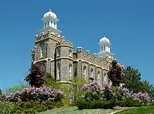 Logan Temple |
November 20, 1975 (#75001801) |
Between 2nd and 3rd East and 1st and 2nd North 41°44′03″N 111°49′38″W |
Logan | |
| 40 | Logan Temple Barn | 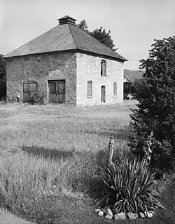 Logan Temple Barn |
December 19, 1985 (#85003199) |
368 E. 200 North 41°44′06″N 111°49′27″W |
Logan | |
| 41 | McMurdie-White Farmstead |  McMurdie-White Farmstead |
September 28, 2005 (#05001106) |
395 W. 9000 South 41°34′10″N 111°50′47″W |
Paradise | |
| 42 | Mendon Station | 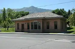 Mendon Station |
February 19, 2008 (#08000059) |
95 N. Main St. 41°42′34″N 111°58′34″W |
Mendon | |
| 43 | Louis Edgar and Clara H. Merrill House |  Louis Edgar and Clara H. Merrill House |
October 8, 2004 (#04001127) |
244 W. Main St. 41°55′23″N 111°48′53″W |
Richmond | |
| 44 | Samuel Crowthers Mitton House |  Samuel Crowthers Mitton House |
November 19, 1982 (#82004847) |
242 E. Main St. 41°38′18″N 111°55′36″W |
Wellsville | |
| 45 | Hattie Merrill Morrison Farmstead | 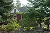 Hattie Merrill Morrison Farmstead |
October 8, 2004 (#04001128) |
1367 S. State St. 41°53′48″N 111°48′34″W |
Richmond | |
| 46 | Muir House |  Muir House |
April 4, 2008 (#08000060) |
145 S. Main St. 41°42′17″N 111°58′36″W |
Mendon | |
| 47 | Newton Reservoir | November 30, 1973 (#73001860) |
3 miles (4.8 km) north of Newton 41°54′36″N 112°00′18″W |
Newton | ||
| 48 | Old Main, Utah State University | 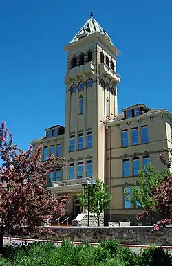 Old Main, Utah State University |
February 23, 1972 (#72001258) |
Utah State University campus 41°44′27″N 111°48′47″W |
Logan | |
| 49 | Erick Lehi and Ingrid Larsen Olson House | 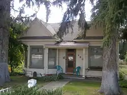 Erick Lehi and Ingrid Larsen Olson House |
March 8, 1997 (#97000225) |
490 E. 600 South 41°43′18″N 111°49′19″W |
River Heights | |
| 50 | Paradise Tithing Office | 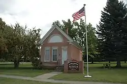 Paradise Tithing Office |
January 25, 1985 (#85000253) |
8970 S. 200 West 41°34′09″N 111°50′14″W |
Paradise | |
| 51 | Martin and Martha Pond Farmstead | 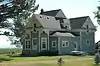 Martin and Martha Pond Farmstead |
November 17, 1997 (#97001308) |
320 S. 800 West 41°58′13″N 111°52′11″W |
Lewiston | |
| 52 | Providence Historic District | 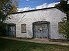 Providence Historic District |
November 9, 2007 (#07001169) |
Roughly bounded by 200 N., 400 E., 500 S., and 200 W. 41°42′18″N 111°48′56″W |
Providence | |
| 53 | Providence LDS Chapel and Meetinghouse |  Providence LDS Chapel and Meetinghouse |
February 11, 1982 (#82004112) |
10 S. Main St. 41°42′28″N 111°49′00″W |
Providence | |
| 54 | Richmond Carnegie Library | 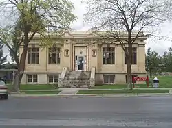 Richmond Carnegie Library |
October 25, 1984 (#84000147) |
38 W. Main St. 41°55′23″N 111°48′32″W |
Richmond | |
| 55 | Richmond City Grandstand & Baseball Field |  Richmond City Grandstand & Baseball Field |
April 29, 2005 (#04001130) |
Approximately 50 S. State St. 41°55′17″N 111°48′34″W |
Richmond | |
| 56 | Richmond Community Building | 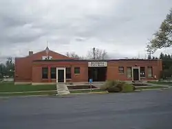 Richmond Community Building |
April 9, 1986 (#86000731) |
6 W. Main St. 41°55′23″N 111°48′30″W |
Richmond | |
| 57 | Richmond Interurban Depot |  Richmond Interurban Depot |
May 16, 2002 (#02000508) |
196 W. Main St. 41°54′51″N 111°48′48″W |
Richmond | |
| 58 | Richmond Relief Society Hall |  Richmond Relief Society Hall |
June 7, 1996 (#96000589) |
15 E. Main St. 41°55′31″N 111°48′27″W |
Richmond | |
| 59 | Richmond Tithing Office | 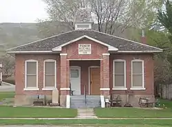 Richmond Tithing Office |
January 25, 1985 (#85000256) |
31 S. State St. 41°55′20″N 111°48′27″W |
Richmond | |
| 60 | Zial Riggs House | 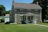 Zial Riggs House |
February 11, 1982 (#82004114) |
94 S. 100 East 41°38′13″N 111°55′49″W |
Wellsville | |
| 61 | River Heights Sinclair Station |  River Heights Sinclair Station |
June 12, 2017 (#100001077) |
594 S. 400 East 41°43′18″N 111°49′32″W |
River Heights | |
| 62 | Sigma Chi Fraternity House | 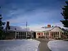 Sigma Chi Fraternity House |
September 15, 2005 (#05001038) |
705 N. 800 East 41°44′42″N 111°48′52″W |
Logan | |
| 63 | William McNeil Smith House |  William McNeil Smith House |
February 11, 1982 (#82004110) |
116 S. 100 East 41°43′44″N 111°49′53″W |
Logan | |
| 64 | Smithfield Public Library | 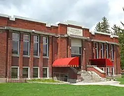 Smithfield Public Library |
February 17, 1981 (#81000580) |
25 N. Main St. 41°50′14″N 111°49′13″W |
Smithfield | |
| 65 | Smithfield Tabernacle-Youth Center | 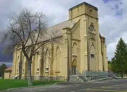 Smithfield Tabernacle-Youth Center |
January 17, 2017 (#100000509) |
25 N. Main St. 41°50′13″N 111°49′59″W |
Smithfield | |
| 66 | Smithfield Tithing Office |  Smithfield Tithing Office |
January 25, 1985 (#85000258) |
35 W. Center St. 41°50′13″N 111°49′58″W |
Smithfield | |
| 67 | Tony Grove Ranger Station Historic District | 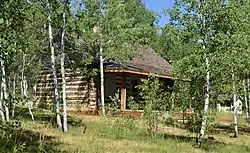 Tony Grove Ranger Station Historic District |
April 13, 1992 (#92000338) |
U.S. Route 89, 23 miles (37 km) northeast of Logan in the Wasatch-Cache National Forest 41°53′08″N 111°33′59″W |
Cache National Forest | |
| 68 | S. Milton and Alba C. Webb House |  S. Milton and Alba C. Webb House |
October 8, 2004 (#04001131) |
143 S. State St. 41°55′11″N 111°48′27″W |
Richmond | |
| 69 | Wellsville Relief Society Meeting House | 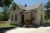 Wellsville Relief Society Meeting House |
February 13, 1989 (#88003439) |
67 S. Center St. 41°38′17″N 111°56′02″W |
Wellsville | |
| 70 | Wellsville Tabernacle |  Wellsville Tabernacle |
November 26, 1980 (#80003893) |
75 S. 100 East 41°38′15″N 111°55′55″W |
Wellsville | |
| 71 | James F. & Mary Jane Whitney House | 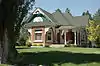 James F. & Mary Jane Whitney House |
February 19, 2008 (#08000061) |
195 W. 100 North 41°42′38″N 111°58′51″W |
Mendon | |
| 72 | Whittier School | 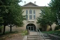 Whittier School |
September 8, 2000 (#00001066) |
290 N. 400 East 41°44′12″N 111°49′24″W |
Logan | |
| 73 | James G. Willie House | 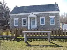 James G. Willie House |
April 13, 1983 (#83004418) |
97 N. 100 West 41°42′35″N 111°58′44″W |
Mendon | |
| 74 | Women's Residence Hall |  Women's Residence Hall |
April 9, 1986 (#86000735) |
Utah State University 41°44′27″N 111°48′31″W |
Logan | |
| 75 | Ferdinand Zollinger, Jr. House |  Ferdinand Zollinger, Jr. House |
July 16, 1992 (#92000892) |
193 N. 100 East 41°42′42″N 111°48′53″W |
Providence |
Former listings
| [3] | Name on the Register | Image | Date listed | Date removed | Location | City or town | Summary |
|---|---|---|---|---|---|---|---|
| 1 | Holley-Globe Grain and Milling Company Elevator | 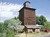 Holley-Globe Grain and Milling Company Elevator |
October 24, 1985 (#85003386) | September 10, 2020 | 100 North and Center St. 41°38′11″N 111°51′14″W |
Hyrum | |
| 2 | Hyrum Stake Tithing Office | 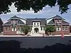 Hyrum Stake Tithing Office |
January 25, 1985 (#85000251) | March 29, 2018 | 26 W. Main St. 41°38′04″N 111°51′18″W |
Hyrum | |
| 3 | Lindquist Hall | March 27, 1980 (#80003892) | April 17, 1986 | 201 N. 100 East |
Logan | ||
| 4 | Mendon Elementary School | April 1, 1985 (#85000803) | February 1, 1995 | Off State Route 23 41°42′29″N 111°58′34″W |
Mendon | ||
| 5 | Plant Auto Company Building |  Plant Auto Company Building |
October 8, 2004 (#04001129) | March 26, 2018 | 38 S. 200 West (State Route 91) 41°55′20″N 111°48′51″W |
Richmond | No longer standing, this one-part Victorian Eclectic commercial block was built in 1916 and housed the first automobile repair shop in Richmond |
See also
References
- The latitude and longitude information provided in this table was derived originally from the National Register Information System, which has been found to be fairly accurate for about 99% of listings. Some locations in this table may have been corrected to current GPS standards.
- "National Register of Historic Places: Weekly List Actions". National Park Service, United States Department of the Interior. Retrieved on February 5, 2021.
- Numbers represent an alphabetical ordering by significant words. Various colorings, defined here, differentiate National Historic Landmarks and historic districts from other NRHP buildings, structures, sites or objects.
- The eight-digit number below each date is the number assigned to each location in the National Register Information System database, which can be viewed by clicking the number.
External links
![]() Media related to National Register of Historic Places in Cache County, Utah at Wikimedia Commons
Media related to National Register of Historic Places in Cache County, Utah at Wikimedia Commons
 | |||
| Topics | |
|---|---|
| Lists by state |
|
| Lists by insular areas | |
| Lists by associated state | |
| Other areas | |
| Related | |
| |
Municipalities and communities of Cache County, Utah, United States | ||
|---|---|---|
| Cities | Map of Utah highlighting Cache County | |
| Towns | ||
| CDPs | ||
| Unincorporated community | ||
| Ghost town | ||
| ||
This article is issued from Wikipedia. The text is licensed under Creative Commons - Attribution - Sharealike. Additional terms may apply for the media files.