National Register of Historic Places listings in Zion National Park
This is a list of the National Register of Historic Places listings in Zion National Park.
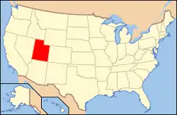
This is intended to be a complete list of the properties and districts on the National Register of Historic Places (NRHP) in Zion National Park, Utah, United States. The locations of National Register properties and districts for which the latitude and longitude coordinates are included below, may be seen in a Google map.[1]
There are 29 properties and districts listed on the National Register in the park, 25 located within Washington County and three within Kane County. The latter three are structures at the East Entrance to the park. A small portion of the park extends north into Iron County but includes no National Register-listed places. The town closest by any practical route to all of these is Springdale, Utah. (See also National Register of Historic Places listings in Washington County, Utah and National Register of Historic Places listings in Kane County, Utah.)
This list is sorted alphabetically. Discussion of most of these, organized by type of property instead, is also provided in the following article: Historical buildings and structures of Zion National Park.
- This National Park Service list is complete through NPS recent listings posted January 29, 2021.[2]
Current listings
| [3] | Name on the Register | Image | Date listed[4] | Location | Description | |
|---|---|---|---|---|---|---|
| 1 | Angels Landing Trail-West Rim Trail | .jpg.webp) Angels Landing Trail-West Rim Trail |
February 14, 1987 (#86003707) |
South of Scout Lookout across the Virgin River and Refrigerator Canyon 37°16′06″N 112°56′58″W |
||
| 2 | Cable Creek Bridge |  Cable Creek Bridge |
February 16, 1996 (#96000053) |
Floor of the Valley Rd. at milepost 4.48, south of Weeping Rock Parking Area entrance 37°16′13″N 112°56′19″W |
||
| 3 | Cable Mountain Draw Works |  Cable Mountain Draw Works |
May 24, 1978 (#78000281) |
North of Springdale in Zion National Park 37°15′57″N 112°55′59″W |
||
| 4 | Canyon Overlook Trail | 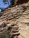 Canyon Overlook Trail |
February 14, 1987 (#86003722) |
Across the highway from the parking area at the eastern end of the Zion-Mt. Carmel Tunnel to a point directly above the Great Arch of Zion 37°12′49″N 112°56′54″W |
||
| 5 | Crawford Irrigation Canal |  Crawford Irrigation Canal |
July 7, 1987 (#86003732) |
Western bank of the Virgin River from 1 mile (1.6 km) north of the Virgin River bridge to the base of the Virgin River Formation and .5 miles (0.80 km) up Oak Creek 37°12′40″N 112°59′33″W |
Springdale | |
| 6 | East Entrance Checking Station |  East Entrance Checking Station |
February 14, 1987 (#86003711) |
Island in middle of State Route 9 37°14′01″N 112°52′06″W |
Also included in National Register of Historic Places listings in Kane County, Utah | |
| 7 | East Entrance Residence | 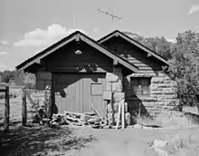 East Entrance Residence |
February 14, 1987 (#86003712) |
Eastern entrance 150 feet north of State Route 9 37°14′01″N 112°52′41″W |
Also included in National Register of Historic Places listings in Kane County, Utah | |
| 8 | East Entrance Sign | 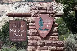 East Entrance Sign |
July 7, 1987 (#86003710) |
East Entrance Checking Station on northern and southern sides of State Route 9 37°14′07″N 112°52′07″W |
Also included in National Register of Historic Places listings in Kane County, Utah | |
| 9 | East Rim Trail | 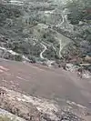 East Rim Trail |
July 7, 1987 (#86003723) |
Between Weeping Rock Parking Area and Observation Point 37°16′42″N 112°55′45″W |
||
| 10 | Emerald Pools Trail | 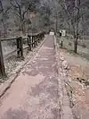 Emerald Pools Trail |
February 14, 1987 (#86003725) |
Footbridge across the highway from Utah Parks Lodge proceeding west to the Lower Emerald Pool 37°14′58″N 112°57′16″W |
||
| 11 | Flanigan Ditch |  Flanigan Ditch |
January 12, 1998 (#97001630) |
Zion National Park 37°12′53″N 112°58′28″W |
||
| 12 | Floor of the Valley Road | 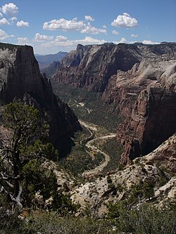 Floor of the Valley Road |
February 16, 1996 (#96000048) |
From its junction with the Zion-Mt. Carmel Highway along the North Fork of the Virgin River in Zion National Park 37°15′20″N 112°57′17″W |
||
| 13 | Gateway to the Narrows Trail |  Gateway to the Narrows Trail |
July 7, 1987 (#86003726) |
Temple of Sinawava at the end of Zion Canyon Scenic Dr. to a point 1 mile north on the Virgin River 37°17′48″N 112°56′42″W |
||
| 14 | Grotto Camping Ground North Comfort Station |  Grotto Camping Ground North Comfort Station |
February 14, 1987 (#86003705) |
Grotto Picnic Area near Grotto Residence, east of Scenic Dr. 37°15′33″N 112°56′33″W |
||
| 15 | Grotto Camping Ground South Comfort Station |  Grotto Camping Ground South Comfort Station |
February 14, 1987 (#86003704) |
Grotto Picnic Area near Grotto Residence, east of Scenic Dr. 37°15′31″N 112°56′27″W |
||
| 16 | Grotto Trail | 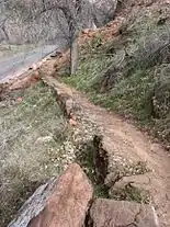 Grotto Trail |
February 14, 1996 (#86003914) |
Zion National Park, 120 feet north of Zion Lodge extending south 0.2 miles parallel to the eastern side of Zion Canyon Scenic Dr. 37°15′01″N 112°57′26″W |
||
| 17 | Hidden Canyon Trail | 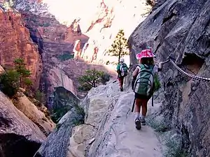 Hidden Canyon Trail |
February 14, 1987 (#86003731) |
Hidden Canyon junction on the East Rim Trail to the mouth of Hidden Canyon 37°16′01″N 112°55′50″W |
||
| 18 | Museum-Grotto Residence | .jpg.webp) Museum-Grotto Residence |
February 14, 1987 (#86003721) |
Southeast of Grotto Picnic Area 37°15′28″N 112°57′03″W |
||
| 19 | Oak Creek Historical District |  Oak Creek Historical District |
July 7, 1987 (#86003706) |
Off State Route 9 along bank of Oak Creek 37°12′40″N 112°59′10″W |
||
| 20 | Oak Creek Irrigation Canal |  Oak Creek Irrigation Canal |
July 7, 1987 (#86003738) |
Western side of the North Fork of the Virgin River, 1/8 miles north of the Virgin River Bridge to the northern side of Watchman Campground Entrance Rd. 37°12′09″N 112°59′28″W |
||
| 21 | Parunuweap Canyon Archeological District |  Parunuweap Canyon Archeological District |
November 7, 1996 (#96001235) |
Address Restricted |
||
| 22 | Pine Creek Irrigation Canal |  Pine Creek Irrigation Canal |
July 7, 1987 (#86003734) |
Eastern bank of the Virgin River 0.25 miles north of the Virgin River bridge to the southwestern end of the Watchman Residential Loop 37°12′06″N 112°58′40″W |
||
| 23 | Pine Creek Residential Historic District |  Pine Creek Residential Historic District |
July 7, 1987 (#86003736) |
Western side of State Route 9 500 feet south of the bridge over the Virgin River 37°12′59″N 112°58′32″W |
||
| 24 | South Campground Amphitheater |  South Campground Amphitheater |
February 14, 1987 (#86003717) |
South Campground 37°12′12″N 112°58′55″W |
||
| 25 | South Campground Comfort Station |  South Campground Comfort Station |
February 14, 1987 (#86003708) |
South Campground at the northern end of the campsite loop 37°12′14″N 112°58′21″W |
||
| 26 | South Entrance Sign | 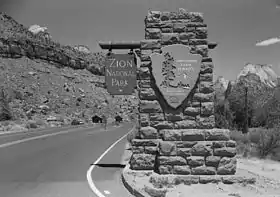 South Entrance Sign |
February 14, 1987 (#86003713) |
South Entrance 37°12′04″N 112°59′22″W |
||
| 27 | Zion Lodge Historic District | 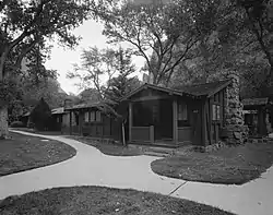 Zion Lodge Historic District |
August 24, 1982 (#82001718) |
North of Springdale in Zion National Park; also west of State Route 9 on the eastern and western sides of The Zion Canyon Scenic Drive near Birch Creek 37°15′01″N 112°57′17″W |
Second set of boundaries represents a boundary increase | |
| 28 | Zion Nature Center-Zion Inn | 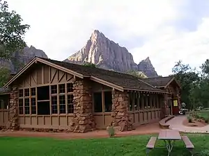 Zion Nature Center-Zion Inn |
February 14, 1987 (#86003719) |
North of South Campground facilities 37°12′21″N 112°58′25″W |
||
| 29 | Zion – Mount Carmel Highway | 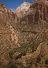 Zion – Mount Carmel Highway |
July 7, 1987 (#86003709) |
Along Utah State Route 9 between Springdale and Mount Carmel Junction 37°13′19″N 112°55′58″W |
Also included in the National Register of Historic Places listings in Kane County, Utah and National Register of Historic Places listings in Washington County, Utah |
See also
References
- The latitude and longitude information provided in this table was derived originally from the National Register Information System, which has been found to be fairly accurate for about 99% of listings. Some locations in this table may have been corrected to current GPS standards.
- "National Register of Historic Places: Weekly List Actions". National Park Service, United States Department of the Interior. Retrieved on January 29, 2021.
- Numbers represent an alphabetical ordering by significant words. Various colorings, defined here, differentiate National Historic Landmarks and historic districts from other NRHP buildings, structures, sites or objects.
- The eight-digit number below each date is the number assigned to each location in the National Register Information System database, which can be viewed by clicking the number.
External links
![]() Media related to National Register of Historic Places in Zion National Park at Wikimedia Commons
Media related to National Register of Historic Places in Zion National Park at Wikimedia Commons
- National Register of Historic Places Inventory - Nomination Form Form: Multiple Resources for Zion National Park. National Park Service 1987 https://npgallery.nps.gov/NRHP/GetAsset/NRHP/64000878_text

