National Register of Historic Places listings in Washington County, Utah
This is a list of the National Register of Historic Places listings in Washington County, Utah.
This is intended to be a complete list of the properties and districts on the National Register of Historic Places in Washington County, Utah, United States. Latitude and longitude coordinates are provided for many National Register properties and districts; these locations may be seen together in a map.[1]
There are 78 properties and districts listed on the National Register in the county. Of these, 25 are located within Zion National Park and are described in National Register of Historic Places listings in Zion National Park. This list covers the 52 others. One other site in the county was once listed, but has since been removed.
- This National Park Service list is complete through NPS recent listings posted January 29, 2021.[2]
Current listings
Besides those included in Zion National Park, the current listings are:
| [3] | Name on the Register[4] | Image | Date listed[5] | Location | City or town | Description |
|---|---|---|---|---|---|---|
| 1 | Wallace Blake House | 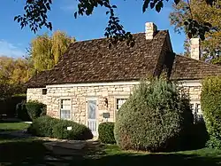 Wallace Blake House |
November 14, 1978 (#78002709) |
South of St. George 37°02′49″N 113°36′15″W |
St. George | |
| 2 | Bradshaw House-Hotel |  Bradshaw House-Hotel |
September 26, 1991 (#91001443) |
85 S. Main St. 37°10′31″N 113°17′13″W |
Hurricane | |
| 3 | William F. Butler House |  William F. Butler House |
July 13, 1984 (#84002433) |
168 S. 300 West 37°06′19″N 113°35′21″W |
St. George | |
| 4 | Herbert & Lillian Christensen House | December 27, 2019 (#100004812) |
980 Zion Park Blvd. 37°11′18″N 113°00′03″W |
Springdale | ||
| 5 | Robert D. Covington House | 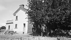 Robert D. Covington House |
April 20, 1978 (#78002711) |
200 N. 200 East 37°08′05″N 113°30′20″W |
Washington | |
| 6 | Crawford Irrigation Canal | 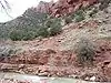 Crawford Irrigation Canal |
July 7, 1987 (#86003732) |
Western bank of the Virgin River from 1 mile (1.6 km) north of the Virgin River bridge to the base of the Virgin River Formation and .5 miles (0.80 km) up Oak Creek 37°12′40″N 112°59′33″W |
Springdale | |
| 7 | Deseret Telegraph and Post Office | 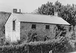 Deseret Telegraph and Post Office |
February 23, 1972 (#72001263) |
On State Route 9 37°09′39″N 113°02′34″W |
Rockville | |
| 8 | Enterprise Meetinghouse | May 14, 1993 (#93000410) |
Approximately 24 S. Center St. 37°34′23″N 113°43′16″W |
Enterprise | ||
| 9 | Thomas Forsyth House | 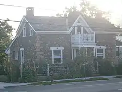 Thomas Forsyth House |
February 11, 1982 (#82004184) |
111 N. Toquerville Boulevard 37°15′11″N 113°17′06″W |
Toquerville | |
| 10 | Fort Harmony Site | 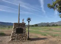 Fort Harmony Site |
November 16, 1979 (#79003493) |
East of New Harmony and west of I-15 37°28′51″N 113°14′34″W |
New Harmony | |
| 11 | Fort Pearce | 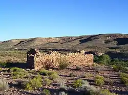 Fort Pearce |
November 20, 1975 (#75001834) |
Warner Valley Rd., 12 miles (19 km) southeast of Washington off Interstate 15 37°00′28″N 113°24′41″W |
Washington | |
| 12 | George and Bertha Graff House | 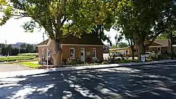 George and Bertha Graff House |
December 4, 1998 (#98001461) |
2865 Santa Clara Dr. 37°07′56″N 113°39′01″W |
Santa Clara | |
| 13 | Grafton Historic District | 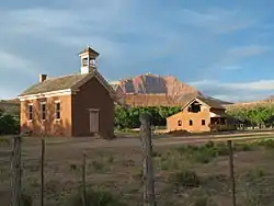 Grafton Historic District |
September 9, 2010 (#10000732) |
Beginning at Hall and Grafton Ditch and the Grafton to Rockville Rd.[6] 37°10′00″N 113°05′06″W |
Rockville | |
| 14 | Hans George Hafen House | 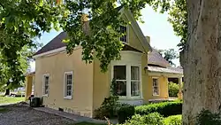 Hans George Hafen House |
December 4, 1998 (#98001462) |
3003 Santa Clara Dr. 37°07′57″N 113°39′10″W |
Santa Clara | |
| 15 | Jacob Hamblin House | 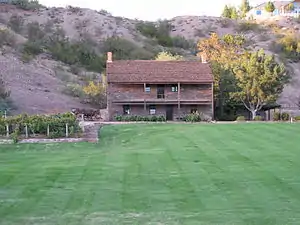 Jacob Hamblin House |
March 11, 1971 (#71000860) |
3400 Hamblin Dr. 37°08′00″N 113°39′36″W |
Santa Clara | |
| 16 | Hurricane Canal | 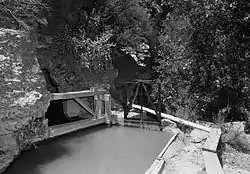 Hurricane Canal |
August 29, 1977 (#77001324) |
East of Hurricane 37°10′45″N 113°15′59″W |
Hurricane | |
| 17 | Hurricane Historic District | 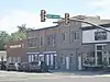 Hurricane Historic District |
August 4, 1995 (#95000980) |
Roughly bounded by 300 South, 200 West, State St. and the Hurricane Canal 37°10′26″N 113°17′19″W |
Hurricane | |
| 18 | Hurricane Library-City Hall | 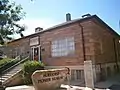 Hurricane Library-City Hall |
September 26, 1991 (#91001444) |
35 W. State St. 37°10′35″N 113°17′17″W |
Hurricane | |
| 19 | Hurricane-LaVerkin Bridge | 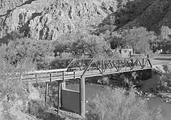 Hurricane-LaVerkin Bridge |
April 14, 1995 (#95000413) |
East of State Route 9 over the Virgin River 37°11′22″N 113°16′13″W |
Hurricane | |
| 20 | Samuel and Elizabeth Isom House | 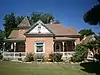 Samuel and Elizabeth Isom House |
March 4, 1993 (#93000063) |
188 S. 100 West 37°10′26″N 113°17′21″W |
Hurricane | |
| 21 | James Jepson, Jr., House | June 22, 2000 (#00000732) |
15 E. Jepson St. 37°11′59″N 113°11′08″W |
Virgin | ||
| 22 | Thomas Judd House | 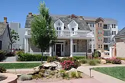 Thomas Judd House |
January 31, 1978 (#78002710) |
76 West Tabernacle Street, rear 37°06′32″N 113°35′04″W |
St. George | Originally at 269 S. 200 East, moved in 1986 |
| 23 | Lemuel and Mary Ann Leavitt House | 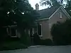 Lemuel and Mary Ann Leavitt House |
February 12, 1999 (#99000215) |
1408 N. Quail St. 37°07′58″N 113°39′18″W |
Santa Clara | |
| 24 | Leeds CCC Camp Historic District | 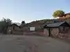 Leeds CCC Camp Historic District |
March 4, 1993 (#93000062) |
96 West Mulberry 37°14′05″N 113°22′00″W |
Leeds | |
| 25 | Leeds Tithing Office | 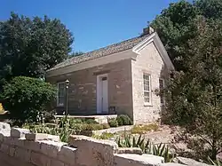 Leeds Tithing Office |
January 25, 1985 (#85000291) |
15 North Main Street 37°14′11″N 113°21′44″W |
Leeds | |
| 26 | Main Building of Dixie College |  Main Building of Dixie College |
June 19, 1980 (#80003988) |
86 South Main Street 37°06′25″N 113°34′58″W |
St. George | |
| 27 | Mountain Meadows Historic Site | 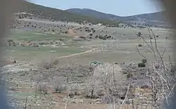 Mountain Meadows Historic Site |
August 28, 1975 (#75001833) |
7 miles (11 km) south of Enterprise on State Route 18 37°28′57″N 113°38′10″W |
Enterprise | |
| 28 | Mountain Meadows Massacre Site | 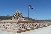 Mountain Meadows Massacre Site |
June 23, 2011 (#11000562) |
West of State Route 18, approximately 3 miles (4.8 km) north of Central 37°28′32″N 113°38′37″W |
Central vicinity | Comprises approximately 760 acres (3.1 km2) within the 3,000-acre (12 km2) Mountain Meadows Historic Site[7] |
| 29 | Naegle Winery |  Naegle Winery |
February 20, 1980 (#80003990) |
110 South Toquer Boulevard 37°14′55″N 113°17′02″W |
Toquerville | |
| 30 | Old Washington County Courthouse | 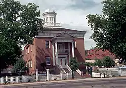 Old Washington County Courthouse |
September 22, 1970 (#70000634) |
85 East 100 North 37°06′39″N 113°34′50″W |
St. George | |
| 31 | Pine Valley Chapel and Tithing Office | 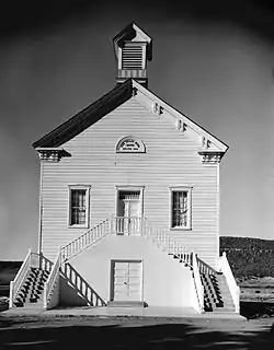 Pine Valley Chapel and Tithing Office |
April 16, 1971 (#71000859) |
Main and Grass Valley streets 37°23′39″N 113°30′56″W |
Pine Valley | |
| 32 | Orson Pratt House | 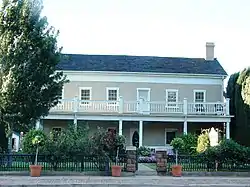 Orson Pratt House |
August 11, 1983 (#83003199) |
76 West Tabernacle Street 37°06′31″N 113°35′01″W |
St. George | |
| 33 | Frederick and Anna Maria Reber House | 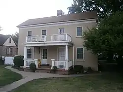 Frederick and Anna Maria Reber House |
December 4, 1998 (#98001448) |
2988-2990 Santa Clara Drive 37°07′59″N 113°39′09″W |
Santa Clara | |
| 34 | Frederick, Jr., and Mary F. Reber House | 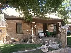 Frederick, Jr., and Mary F. Reber House |
February 12, 1999 (#99000214) |
3334 Hamblin Drive 37°08′01″N 113°39′32″W |
Santa Clara | |
| 35 | Rockville Bridge | 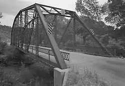 Rockville Bridge |
August 4, 1995 (#95000982) |
150 South Bridge Road over the East Fork of the Virgin River 37°09′30″N 113°02′16″W |
Rockville | |
| 36 | St. George Elementary School | April 1, 1985 (#85000820) |
120 South 100 West 37°06′28″N 113°35′06″W |
St. George | ||
| 37 | St. George Social Hall |  St. George Social Hall |
April 3, 1991 (#91000360) |
212 North Main Street 37°06′43″N 113°34′56″W |
St. George | |
| 38 | St. George Tabernacle | .jpg.webp) St. George Tabernacle |
May 14, 1971 (#71000862) |
Junction of Tabernacle and Main streets 37°06′29″N 113°34′58″W |
St. George | |
| 39 | St. George Temple | 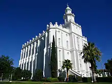 St. George Temple |
November 7, 1977 (#77001325) |
Bounded by 200 East, 300 East, 400 South, and 500 South 37°06′02″N 113°34′38″W |
St. George | |
| 40 | Santa Clara Hydroelectric Power Plants Historic District | April 21, 1989 (#89000281) |
Off State Route 18 on the Santa Clara River 37°18′25″N 113°42′40″W |
Gunlock and Veyo | ||
| 41 | Santa Clara Relief Society House | 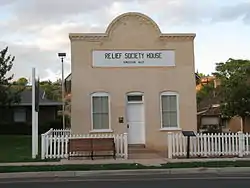 Santa Clara Relief Society House |
February 2, 1994 (#93001577) |
Approximately 3036 West Santa Clara Drive 37°07′59″N 113°39′10″W |
Santa Clara | |
| 42 | Santa Clara Tithing Granary | 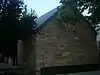 Santa Clara Tithing Granary |
December 4, 1998 (#98001460) |
3105 Santa Clara Drive 37°07′58″N 113°39′18″W |
Santa Clara | |
| 43 | Shem Dam | March 13, 2017 (#100000759) |
Address restricted[8] |
Ivins vicinity | ||
| 44 | Southern Paiute Archeological District | June 11, 1982 (#82004185) |
Address restricted[8] |
Washington | ||
| 45 | Emanuel and Ursella Stanworth House |  Emanuel and Ursella Stanworth House |
December 17, 1992 (#92001692) |
198 South Main Street 37°10′26″N 113°17′15″W |
Hurricane | |
| 46 | John Steele House | 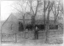 John Steele House |
April 7, 1988 (#88000401) |
263 North Toquerville Boulevard 37°15′20″N 113°17′08″W |
Toquerville | |
| 47 | Toquerville Hall | January 17, 2020 (#100004878) |
212 North Toquerville Blvd. 37°15′17″N 113°17′06″W |
Toquerville | ||
| 48 | Washington Cotton Factory | 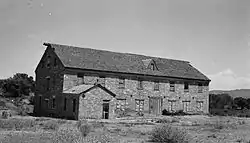 Washington Cotton Factory |
April 16, 1971 (#71000864) |
385 Telegraph Street 37°07′45″N 113°30′53″W |
Washington | |
| 49 | Washington Relief Society Hall | 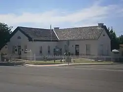 Washington Relief Society Hall |
August 27, 1980 (#80003991) |
100 West Telegraph Street 37°07′48″N 113°30′41″W |
Washington | |
| 50 | Washington School | 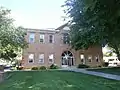 Washington School |
November 23, 1980 (#80003992) |
25 East Telegraph Street 37°07′50″N 113°30′34″W |
Washington | Now a museum |
| 51 | Wells Fargo and Company Express Building | 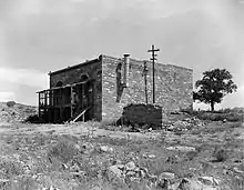 Wells Fargo and Company Express Building |
March 11, 1971 (#71000861) |
Wells Fargo Road 37°15′11″N 113°22′00″W |
Silver Reef | |
| 52 | Woodward School | 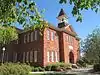 Woodward School |
November 23, 1980 (#80003989) |
100 West and Tabernacle streets 37°06′28″N 113°35′02″W |
St. George | |
| 53 | Brigham Young Winter Home and Office | 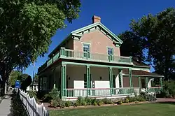 Brigham Young Winter Home and Office |
February 22, 1971 (#71000863) |
Corner of 200 North and 100 West 37°06′41″N 113°35′06″W |
St. George |
Former listing
| [3] | Name on the Register | Image | Date listed | Date removed | Location | City or town | Summary |
|---|---|---|---|---|---|---|---|
| 1 | Old Hurricane High School | April 9, 1986 (#86000752) | April 28, 2005 | 34 S. 100 West |
Hurricane | Demolished in 2004 |
See also
References
- The latitude and longitude information provided in this table was derived originally from the National Register Information System, which has been found to be fairly accurate for about 99% of listings. Some locations in this table may have been corrected to current GPS standards.
- "National Register of Historic Places: Weekly List Actions". National Park Service, United States Department of the Interior. Retrieved on January 29, 2021.
- Numbers represent an alphabetical ordering by significant words. Various colorings, defined here, differentiate National Historic Landmarks and historic districts from other NRHP buildings, structures, sites or objects.
- "National Register Information System". National Register of Historic Places. National Park Service. April 24, 2008.
- The eight-digit number below each date is the number assigned to each location in the National Register Information System database, which can be viewed by clicking the number.
- Geocode coords derived from National Register nomination form Archived 2010-06-23 at the Wayback Machine.
- "Mountain Meadows Massacre Site NRHP Nomination Form" (PDF). Retrieved August 1, 2011.
- Federal and state laws and practices restrict general public access to information regarding the specific location of this resource. In some cases, this is to protect archeological sites from vandalism, while in other cases it is restricted at the request of the owner. See: Knoerl, John; Miller, Diane; Shrimpton, Rebecca H. (1990), Guidelines for Restricting Information about Historic and Prehistoric Resources, National Register Bulletin, National Park Service, U.S. Department of the Interior, OCLC 20706997.
External links
![]() Media related to National Register of Historic Places in Washington County, Utah at Wikimedia Commons
Media related to National Register of Historic Places in Washington County, Utah at Wikimedia Commons
 | |||
| Topics | |
|---|---|
| Lists by state |
|
| Lists by insular areas | |
| Lists by associated state | |
| Other areas | |
| Related | |
| |
Municipalities and communities of Washington County, Utah, United States | ||
|---|---|---|
| Cities | Map of Utah highlighting Washington County | |
| Towns | ||
| CDPs | ||
| Unincorporated communities | ||
| Ghost towns | ||
| Indian reservation | ||
| Footnotes | ‡This populated place also has portions in an adjacent county or counties | |
| ||