National Register of Historic Places listings in Salt Lake City
This is a list of the National Register of Historic Places listings in Salt Lake City, Utah.

This is intended to be a complete list of the properties and districts on the National Register of Historic Places in Salt Lake City, Utah, United States. Latitude and longitude coordinates are provided for many National Register properties and districts; these locations may be seen together in an online map.[1]
There are more than 350 properties and districts listed on the National Register in Salt Lake County, including 6 National Historic Landmarks. 224 of these sites, including 4 National Historic Landmarks, are located in Salt Lake City, and are listed here; the remaining sites, including 2 National Historic Landmarks, are listed separately. Another 17 sites in the city were once listed, but have since been removed.
- This National Park Service list is complete through NPS recent listings posted January 29, 2021.[2]
Current listings
| [3] | Name on the Register[4] | Image | Date listed[5] | Location | Neighborhood | Description |
|---|---|---|---|---|---|---|
| 1 | 19th Ward Meetinghouse and Relief Society Hall |  19th Ward Meetinghouse and Relief Society Hall |
May 28, 1976 (#76001820) |
168 W. 500 North 40°46′49″N 111°53′42″W |
Capitol Hill | |
| 2 | Altadena Apartments | Altadena Apartments |
January 27, 2010 (#09001291) |
310 S. 300 East 40°45′45″N 111°52′58″W |
Central City | |
| 3 | Fortunato Anselmo House |  Fortunato Anselmo House |
May 21, 1979 (#79002499) |
164 S. 900 East 40°45′56″N 111°51′54″W |
Central City | |
| 4 | George Arbuckle House |  George Arbuckle House |
February 12, 1982 (#82004130) |
747 E. 1700 South 40°44′02″N 111°52′08″W |
Sugar House | |
| 5 | Armista Apartments |  Armista Apartments |
October 20, 1989 (#89001736) |
555 E. 100 South 40°46′04″N 111°52′02″W |
Central City | |
| 6 | Francis Armstrong House | 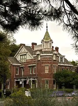 Francis Armstrong House |
May 23, 1980 (#80003914) |
667 E. 100 South 40°46′03″N 111°52′16″W |
Central City | |
| 7 | Ashby Apartments |  Ashby Apartments |
November 16, 2006 (#06001067) |
358 E. 100 South 40°46′01″N 111°52′49″W |
Central City | |
| 8 | Avenues Historic District |  Avenues Historic District |
August 27, 1980 (#80003915) |
Roughly bounded by 1st and 9th Aves. and State and Virginia Sts. 40°46′23″N 111°52′10″W |
Avenues | |
| 9 | B'nai Israel Temple | 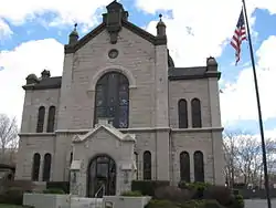 B'nai Israel Temple |
November 16, 1978 (#78002666) |
249 S. 400 East 40°45′48″N 111°52′42″W |
Central City | |
| 10 | Charles Baldwin House | 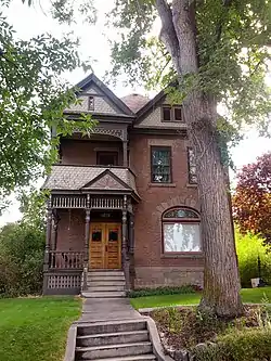 Charles Baldwin House |
February 11, 1982 (#82004131) |
229 S. 1200 East 40°45′52″N 111°51′21″W |
University | |
| 11 | Simon Bamberger House |  Simon Bamberger House |
May 30, 1975 (#75001814) |
623 E. 100 South 40°46′03″N 111°52′19″W |
Central City | Simon Bamberger was governor of Utah 1917–1921. |
| 12 | Jeremiah Beattie House |  Jeremiah Beattie House |
July 7, 1983 (#83004421) |
655 E. 200 South 40°45′55″N 111°52′19″W |
Central City | |
| 13 | Beehive House | 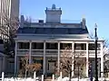 Beehive House |
February 26, 1970 (#70000626) |
67 E. South Temple St. 40°46′11″N 111°53′19″W |
Downtown | |
| 14 | William F. Beer Estate | 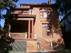 William F. Beer Estate |
December 6, 1977 (#77001306) |
181 B St. and 222 4th Ave. 40°46′24″N 111°52′52″W |
Avenues | |
| 15 | Ebenezer Beesley House |  Ebenezer Beesley House |
July 16, 1979 (#79002500) |
80 W. 300 North 40°46′35″N 111°53′34″W |
Capitol Hill | |
| 16 | Belvedere Apartments |  Belvedere Apartments |
May 8, 2012 (#12000271) |
29 S. State St. 40°46′07″N 111°53′17″W |
Downtown | Salt Lake City Multiple Property Submission |
| 17 | Howard and Marian Bennion House |  Howard and Marian Bennion House |
August 27, 2013 (#13000640) |
2136 E. Hubbard Ave. 40°44′55″N 111°49′49″W |
Foothill | |
| 18 | Benworth-Chapman Apartments and Chapman Cottages |  Benworth-Chapman Apartments and Chapman Cottages |
December 30, 2004 (#04001417) |
227 S. 400 East 40°45′51″N 111°52′45″W |
Central City | |
| 19 | Bertolini Block | 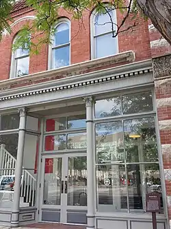 Bertolini Block |
September 29, 1976 (#76001822) |
143½ W. 200 South 40°45′53″N 111°53′41″W |
Downtown | |
| 20 | Best-Cannon House |  Best-Cannon House |
October 3, 1980 (#80003916) |
1146 S. 900 East 40°44′42″N 111°51′32″W |
9th and 9th | |
| 21 | Bigelow Apartments |  Bigelow Apartments |
December 30, 2004 (#04001418) |
225 S. 400 East 40°45′50″N 111°52′43″W |
Central City | |
| 22 | Booth-Parsons House |  Booth-Parsons House |
May 9, 2012 (#12000272) |
1884 S. 900 East 40°43′45″N 111°51′56″W |
Sugar House | |
| 23 | Boulevard Gardens Historic District |  Boulevard Gardens Historic District |
December 31, 2018 (#100003268) |
Roughly bounded by Quayle Ave., Main and W. Temple Sts. 40°43′53″N 111°53′33″W |
Ballpark | |
| 24 | Broadway Hotel |  Broadway Hotel |
August 17, 1982 (#82004132) |
222 W. 300 South 40°45′47″N 111°53′49″W |
Downtown | |
| 25 | Building at Rear, 537 West 200 South |  Building at Rear, 537 West 200 South |
December 27, 1982 (#82004849) |
Rear, 537 W. 200 South 40°45′52″N 111°54′21″W |
Central City West | |
| 26 | Building at 561 West 200 South |  Building at 561 West 200 South |
December 27, 1982 (#82004848) |
561 W. 200 South 40°45′54″N 111°54′24″W |
Central City West | |
| 27 | George M. Cannon House | 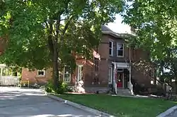 George M. Cannon House |
July 18, 1983 (#83004419) |
720 E. Ashton Ave. 40°43′10″N 111°52′11″W |
Sugar House | |
| 28 | Capitol Building | 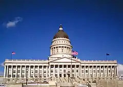 Capitol Building |
October 11, 1978 (#78002667) |
Capitol Hill 40°46′38″N 111°53′17″W |
Capitol Hill | |
| 29 | Capitol Hill Historic District |  Capitol Hill Historic District |
August 2, 1982 (#82004135) |
Roughly bounded by Beck, Main and Wall Sts., 300 North, Victory Rd., and Capitol Blvd.; also roughly bounded by 300 North, 400 West, 800 North, Wall St., and 200 West 40°46′43″N 111°53′33″W |
Capitol Hill | Second set of boundaries represents a boundary increase |
| 30 | Cathedral of the Madeleine | 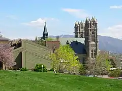 Cathedral of the Madeleine |
March 11, 1971 (#71000845) |
331 E. South Temple St. 40°46′12″N 111°52′52″W |
Avenues | |
| 31 | Centennial Home |  Centennial Home |
September 7, 2001 (#01000960) |
307 Virginia St. 40°46′31″N 111°51′06″W |
Avenues | |
| 32 | Central Warehouse | 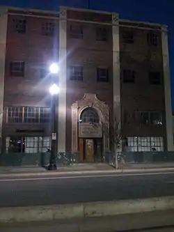 Central Warehouse |
August 17, 1982 (#82004136) |
520 W. 200 South 40°45′55″N 111°54′20″W |
Central City West | |
| 33 | Chapman Branch Library | 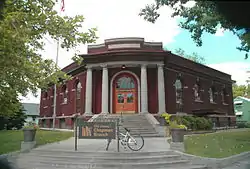 Chapman Branch Library |
January 20, 1980 (#80003918) |
577 S. 900 West 40°45′24″N 111°54′58″W |
Poplar Grove | |
| 34 | Isaac Chase Mill | 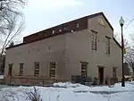 Isaac Chase Mill |
June 15, 1970 (#70000627) |
Liberty Park, 600 East 40°44′36″N 111°52′25″W |
Liberty Wells | |
| 35 | City Creek Canyon Historic District |  City Creek Canyon Historic District |
March 12, 1980 (#80003919) |
Bounded by Capitol Boulevard, A St., 4th Ave. and Canyon Rd. 40°46′49″N 111°52′59″W |
City Creek Canyon | |
| 36 | Isaac C. and Dorothy S. Clark House |  Isaac C. and Dorothy S. Clark House |
January 11, 2002 (#01001452) |
1430 E. Federal Way 40°46′05″N 111°50′57″W |
Federal Heights | |
| 37 | Clift Building |  Clift Building |
August 17, 1982 (#82004139) |
272 S. Main St. 40°45′47″N 111°53′27″W |
Downtown | |
| 38 | Cluff Apartments |  Cluff Apartments |
October 20, 1989 (#89001739) |
1270–1280 E. 200 South 40°45′53″N 111°51′12″W |
University | |
| 39 | Henry A. and Tile S. Cohn House |  Henry A. and Tile S. Cohn House |
August 5, 1996 (#96000871) |
1369 E. Westminster Ave. 40°43′46″N 111°51′02″W |
Sugar House | |
| 40 | Congregation Montefiore Synagogue |  Congregation Montefiore Synagogue |
June 27, 1985 (#85001395) |
355 S. 300 East 40°45′41″N 111°52′53″W |
Central City | |
| 41 | Congregation Sharey Tzedek Synagogue | 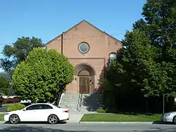 Congregation Sharey Tzedek Synagogue |
June 27, 1985 (#85001396) |
833 S. 200 East 40°45′04″N 111°53′03″W |
Central City | |
| 42 | Continental Bank Building |  Continental Bank Building |
December 27, 1982 (#82004850) |
200 S. Main St. 40°45′53″N 111°53′27″W |
Downtown | |
| 43 | Converse Hall | 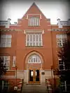 Converse Hall |
April 20, 1978 (#78002685) |
1840 S. 1300 East 40°43′55″N 111°51′14″W |
Sugar House | The oldest building at Westminster College |
| 44 | Cornell Apartments |  Cornell Apartments |
October 20, 1989 (#89001741) |
101 S. 600 East 40°46′01″N 111°52′25″W |
Central City | |
| 45 | Corona Apartments |  Corona Apartments |
October 20, 1989 (#89001742) |
335 S. 200 East 40°45′43″N 111°53′03″W |
Central City | |
| 46 | Council Hall | 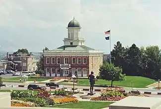 Council Hall |
May 14, 1971 (#71000846) |
Capitol Hill at head of State St. 40°46′33″N 111°53′13″W |
Capitol Hill | |
| 47 | Almon A. Covey House | 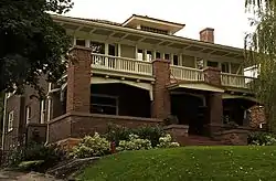 Almon A. Covey House |
October 3, 1980 (#80003920) |
1211 E. 100 South 40°46′03″N 111°51′21″W |
University | |
| 48 | Hyrum T. Covey House | 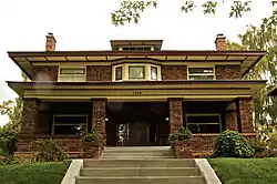 Hyrum T. Covey House |
October 3, 1980 (#80003921) |
1229 E. 100 South 40°46′03″N 111°51′19″W |
University | |
| 49 | Cramer House |  Cramer House |
August 17, 1982 (#82004140) |
241 Floral St. 40°45′50″N 111°53′13″W |
Central City | |
| 50 | Crown Cleaning and Dyeing Company Building |  Crown Cleaning and Dyeing Company Building |
July 11, 2003 (#03000633) |
1989 S. 1100 East 40°43′40″N 111°51′31″W |
Sugar House | |
| 51 | William Culmer House | 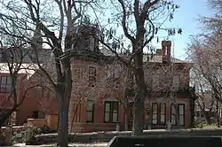 William Culmer House |
April 18, 1974 (#74001935) |
33 C St. 40°46′14″N 111°52′43″W |
Avenues | Now the Sacred Heart Center of the Roman Catholic Diocese of Salt Lake City |
| 52 | Byron Cummings House |  Byron Cummings House |
October 13, 1983 (#83003949) |
936 E. 1700 South 40°44′00″N 111°51′49″W |
Perkins Addition | |
| 53 | Genevieve & Alexander Curtis House |  Genevieve & Alexander Curtis House |
September 9, 2010 (#10000730) |
1119 E. Westminster Ave. 40°43′46″N 111°51′32″W |
Sugar House | |
| 54 | Daft Block |  Daft Block |
May 28, 1976 (#76001823) |
128 S. Main St. 40°45′59″N 111°53′26″W |
Downtown | |
| 55 | Davis Deaconess Home |  Davis Deaconess Home |
January 24, 1995 (#94001583) |
347 S. 400 East 40°45′41″N 111°52′44″W |
Central City | |
| 56 | Denver and Rio Grande Railroad Station | 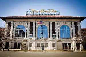 Denver and Rio Grande Railroad Station |
September 25, 1975 (#75001815) |
300 South and Rio Grande 40°45′46″N 111°54′14″W |
Central City West | |
| 57 | Devereaux House | 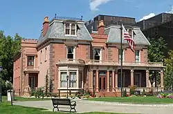 Devereaux House |
March 11, 1971 (#71000847) |
334 W. South Temple St. 40°46′13″N 111°54′02″W |
Downtown | |
| 58 | Harper J. Dininny House |  Harper J. Dininny House |
October 13, 1983 (#83003950) |
925 E. Logan Ave. 40°44′04″N 111°51′49″W |
Perkins Addition | |
| 59 | Henry Dinwoodey House | 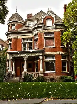 Henry Dinwoodey House |
July 24, 1974 (#74001936) |
411 E. 100 South 40°46′04″N 111°52′42″W |
Central City | |
| 60 | Eagles Building |  Eagles Building |
September 30, 2019 (#100004480) |
404 S West Temple St. 40°45′37″N 111°53′38″W |
Downtown | |
| 61 | Exchange Place Historic District | 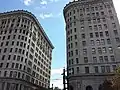 Exchange Place Historic District |
August 10, 1978 (#78002669) |
Exchange Place and S. Main St. 40°45′38″N 111°53′22″W |
Downtown | |
| 62 | J. Leo Fairbanks House |  J. Leo Fairbanks House |
April 26, 1984 (#84002198) |
1228 Bryan Ave. 40°44′08″N 111°51′19″W |
Sugar House | |
| 63 | Felt Electric |  Felt Electric |
August 17, 1982 (#82004141) |
165 S. Regent St. 40°45′55″N 111°53′20″W |
Downtown | |
| 64 | Fifth Ward Meetinghouse | 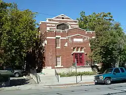 Fifth Ward Meetinghouse |
December 8, 1978 (#78002670) |
740 S. 300 West 40°45′11″N 111°54′00″W |
Central City West | |
| 65 | Firestation No. 8 | 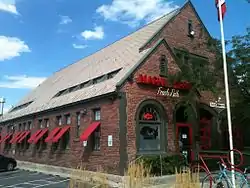 Firestation No. 8 |
July 28, 1983 (#83004423) |
258 S. 1300 East 40°45′49″N 111°51′13″W |
University | Built in 1930 to serve the east bench area; now a restaurant. |
| 66 | First Church of Christ, Scientist |  First Church of Christ, Scientist |
July 30, 1976 (#76001824) |
352 E. 300 South 40°45′45″N 111°52′49″W |
Central City | |
| 67 | First Methodist Episcopal Church | 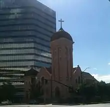 First Methodist Episcopal Church |
January 24, 1995 (#94001582) |
200 S. 200 East 40°45′53″N 111°53′06″W |
Central City | |
| 68 | First National Bank |  First National Bank |
May 24, 1976 (#76001825) |
163 S. Main St. 40°45′56″N 111°53′24″W |
Downtown | |
| 69 | First Security Bank Building |  First Security Bank Building |
September 28, 2005 (#05001107) |
405 S. Main St. 40°45′36″N 111°53′23″W |
Downtown | The first International Style building in Utah, built in 1955 |
| 70 | Albert Fisher Mansion and Carriage House | 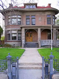 Albert Fisher Mansion and Carriage House |
October 8, 2008 (#83004675) |
1206 W. 200 South 40°45′55″N 111°55′33″W |
Poplar Grove | |
| 71 | Ford Motor Company Service Building |  Ford Motor Company Service Building |
November 2, 2000 (#00001302) |
280 S. 400 West 40°45′47″N 111°54′08″W |
Central City West | |
| 72 | Forest Dale Historic District | 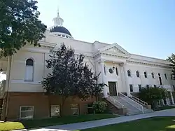 Forest Dale Historic District |
April 23, 2009 (#09000241) |
Roughly bounded by 700 East, Interstate 80, Commonwealth Ave., and 900 East 40°43′20″N 111°52′05″W |
Sugar House | |
| 73 | Fort Douglas |  Fort Douglas |
June 15, 1970 (#70000628) |
Fort Douglas Military Reservation 40°45′52″N 111°49′58″W |
Foothill | |
| 74 | J. A. Fritsch Block |  J. A. Fritsch Block |
July 30, 1976 (#76001826) |
158 E. 200 South 40°45′53″N 111°53′07″W |
Central City | |
| 75 | W.P. Fuller Paint Company Office and Warehouse |  W.P. Fuller Paint Company Office and Warehouse |
September 15, 2005 (#05001037) |
404 W. 400 South 40°45′40″N 111°54′08″W |
Central City West | |
| 76 | George and Ellen Furgis House |  George and Ellen Furgis House |
July 7, 2015 (#15000399) |
2474 East 9th South Cir. 40°44′59″N 111°49′13″W |
Foothill | |
| 77 | General Engineering Company Building |  General Engineering Company Building |
January 21, 1980 (#80003922) |
159 W. Pierpont Ave. 40°45′49″N 111°53′44″W |
Downtown | |
| 78 | Gibbs-Thomas House | 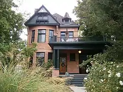 Gibbs-Thomas House |
July 12, 1984 (#84002202) |
137 N. West Temple St. 40°46′22″N 111°53′36″W |
Capitol Hill | |
| 79 | Gilmer Park Historic District |  Gilmer Park Historic District |
March 28, 1996 (#96000314) |
Roughly bounded by 1100 East, 900 South, 1300 East, and Harvard Ave. 40°44′48″N 111°51′21″W |
East Central | |
| 80 | Greenwald Furniture Company Building |  Greenwald Furniture Company Building |
December 27, 1982 (#82004851) |
35 W. 300 South 40°45′45″N 111°53′29″W |
Downtown | |
| 81 | Nels G. Hall House |  Nels G. Hall House |
October 3, 1980 (#80003923) |
1340 2nd Ave. 40°46′18″N 111°50′56″W |
Federal Heights | |
| 82 | Nephi J. Hansen House |  Nephi J. Hansen House |
December 9, 1999 (#99001562) |
1797 S. 1400 East 40°43′51″N 111°51′00″W |
Sugar House | |
| 83 | Harris Apartments |  Harris Apartments |
September 24, 1991 (#91001445) |
836 S. 500 East 40°45′03″N 111°52′34″W |
Central City | |
| 84 | William Hawk Cabin |  William Hawk Cabin |
December 29, 1978 (#78002671) |
458 N. 300 West 40°46′54″N 111°53′53″W |
Capitol Hill | |
| 85 | Henderson Block | 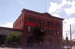 Henderson Block |
January 30, 1978 (#78002672) |
375 W. 200 South 40°45′52″N 111°54′05″W |
Central City West | |
| 86 | Thomas and Mary Hepworth House |  Thomas and Mary Hepworth House |
April 21, 2000 (#00000404) |
725 W. 200 North 40°46′25″N 111°54′40″W |
Fairpark | |
| 87 | Herald Building | 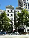 Herald Building |
July 30, 1976 (#76001827) |
165–169 S. Main St. 40°45′56″N 111°53′24″W |
Downtown | |
| 88 | Highland Park Historic District |  Highland Park Historic District |
April 23, 1998 (#98000405) |
Roughly bounded by Parkway Ave., 1500 East, 2700 South, and Elizabeth St. 40°42′56″N 111°51′07″W |
Sugar House | |
| 89 | Lewis S. Hills House |  Lewis S. Hills House |
August 18, 1977 (#77001307) |
126 S. 200 West 40°46′00″N 111°53′47″W |
Downtown | |
| 90 | Lewis S. Hills House |  Lewis S. Hills House |
August 3, 1990 (#90001141) |
425 E. 100 South 40°46′03″N 111°52′41″W |
Central City | |
| 91 | Hollywood Apartments |  Hollywood Apartments |
April 7, 1994 (#94000302) |
234 E. 100 South 40°46′01″N 111°53′02″W |
Central City | |
| 92 | Holy Trinity Greek Orthodox Church | 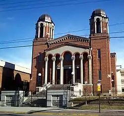 Holy Trinity Greek Orthodox Church |
July 8, 1975 (#75001816) |
279 S. 200 West 40°45′49″N 111°53′54″W |
Downtown | |
| 93 | Hotel Utah | 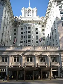 Hotel Utah |
January 3, 1978 (#78002673) |
South Temple and Main St. 40°46′11″N 111°53′23″W |
Downtown | Now the Joseph Smith Memorial Building |
| 94 | Hotel Victor |  Hotel Victor |
August 17, 1982 (#82004143) |
155 W. 200 South 40°45′53″N 111°53′42″W |
Downtown | |
| 95 | Immanuel Baptist Church | 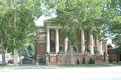 Immanuel Baptist Church |
December 12, 1978 (#78002668) |
401 E. 200 South 40°45′55″N 111°52′45″W |
Central City | |
| 96 | Independent Order of Odd Fellows Hall |  Independent Order of Odd Fellows Hall |
November 7, 1977 (#77001308) |
39 W. Market St. 40°45′41″N 111°53′30″W |
Downtown | Originally at 26 W. Market St., moved in August 2009 |
| 97 | Irving Junior High School |  Irving Junior High School |
December 22, 1978 (#78002674) |
1179 E. 2100 South 40°43′34″N 111°51′25″W |
Sugar House | |
| 98 | Ivanhoe Apartments |  Ivanhoe Apartments |
October 20, 1989 (#89001738) |
417 E. 300 South 40°45′47″N 111°52′41″W |
Central City | |
| 99 | Japanese Church of Christ |  Japanese Church of Christ |
August 17, 1982 (#82004144) |
268 W. 100 South 40°46′03″N 111°53′54″W |
Downtown | |
| 100 | John W. Judd House | 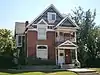 John W. Judd House |
October 13, 1983 (#83003952) |
918 E. Logan Ave. 40°44′03″N 111°51′50″W |
Perkins Addition | |
| 101 | Judge Building |  Judge Building |
December 26, 1979 (#79002502) |
8 E. 300 South 40°45′46″N 111°53′24″W |
Downtown | |
| 102 | Emanuel Kahn House | 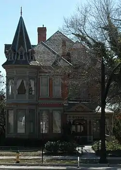 Emanuel Kahn House |
July 21, 1977 (#77001309) |
678 E. South Temple St. 40°46′09″N 111°52′15″W |
Central City | Now the Anniversary Inn bed and breakfast |
| 103 | Karrick Block |  Karrick Block |
June 16, 1976 (#76001828) |
236 S. Main St. 40°45′49″N 111°53′26″W |
Downtown | |
| 104 | Kearns Building |  Kearns Building |
August 17, 1982 (#82004145) |
132 S. Main St. 40°45′58″N 111°53′27″W |
Downtown | |
| 105 | Thomas Kearns Mansion and Carriage House | 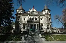 Thomas Kearns Mansion and Carriage House |
February 26, 1970 (#70000631) |
603 E. South Temple St. 40°46′11″N 111°52′23″W |
Avenues | Serves as the Utah Governor's Mansion |
| 106 | David Keith Mansion and Carriage House | 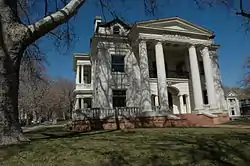 David Keith Mansion and Carriage House |
May 14, 1971 (#71000849) |
529 E. South Temple St. 40°46′11″N 111°52′30″W |
Avenues | |
| 107 | Keith-O'Brien Building |  Keith-O'Brien Building |
August 16, 1977 (#77001310) |
242–256 S. Main St. 40°45′49″N 111°53′27″W |
Downtown | |
| 108 | Albert H. Kelly House |  Albert H. Kelly House |
July 20, 1983 (#83004420) |
418 S. 200 West 40°45′36″N 111°53′49″W |
Downtown | |
| 109 | John B. Kelly House |  John B. Kelly House |
July 20, 1983 (#83003172) |
422 S. 200 West 40°45′36″N 111°53′49″W |
Downtown | |
| 110 | Keyser-Cullen House |  Keyser-Cullen House |
December 9, 1999 (#99001561) |
941 E. 500 South 40°45′32″N 111°51′48″W |
Central City | |
| 111 | Malcolm and Elizabeth Keyser House |  Malcolm and Elizabeth Keyser House |
September 12, 2008 (#08000881) |
381 E. 11th Ave. 40°46′57″N 111°52′41″W |
Avenues | |
| 112 | Ladies Literary Club Clubhouse |  Ladies Literary Club Clubhouse |
October 11, 1978 (#78002675) |
850 E. South Temple St. 40°46′10″N 111°51′58″W |
Central City | |
| 113 | John C. and Mary Landenberger House |  John C. and Mary Landenberger House |
January 26, 2005 (#04001567) |
58 N. Virginia St. 40°46′14″N 111°51′07″W |
Federal Heights | |
| 114 | James and Susan R. Langton House |  James and Susan R. Langton House |
November 19, 1982 (#82001750) |
648 E. 100 South 40°46′01″N 111°52′19″W |
Central City | |
| 115 | Harold B. and Fern Lee House |  Harold B. and Fern Lee House |
March 29, 2018 (#100002276) |
1208 South 900 West 40°44′34″N 111°55′01″W |
Glendale | |
| 116 | Lefler-Woodman Building |  Lefler-Woodman Building |
December 17, 1992 (#92001687) |
859 E. 900 South 40°45′00″N 111°51′55″W |
9th and 9th | |
| 117 | Dr. David and Juanita Lewis House |  Dr. David and Juanita Lewis House |
November 29, 2001 (#01001283) |
1403 E. Westminster Ave. 40°43′45″N 111°51′01″W |
Sugar House | |
| 118 | Liberty Park |  Liberty Park |
December 11, 1980 (#80003926) |
Roughly bounded by 500 East, 700 East, 900 South, and 1300 South 40°44′45″N 111°52′26″W |
Liberty Wells | |
| 119 | Liberty Wells Historic District |  Liberty Wells Historic District |
April 21, 2010 (#10000210) |
Roughly bounded by 700 East, State St., 1300 South, and 2100 South; also bounded by State St., 900 South, 500 East, and 1300 South 40°44′01″N 111°52′47″W |
Liberty Wells | Originally listed as "Wells Historic District"; second set of boundaries represents the Liberty Wells Historic District boundary increase of January 27, 2012 |
| 120 | Lincoln Arms Apartments |  Lincoln Arms Apartments |
October 20, 1989 (#89001737) |
242 E. 100 South 40°46′01″N 111°52′59″W |
Central City | |
| 121 | Lollin Block |  Lollin Block |
August 18, 1977 (#77001311) |
238 S. Main St. 40°45′51″N 111°53′27″W |
Downtown | |
| 122 | Henry Luce House |  Henry Luce House |
October 13, 1983 (#83003953) |
921 E. 1700 South 40°44′01″N 111°51′50″W |
Perkins Addition | |
| 123 | Walter C. Lyne House |  Walter C. Lyne House |
March 9, 1979 (#79003495) |
1135 E. South Temple St. 40°46′11″N 111°51′28″W |
Avenues | |
| 124 | Mabry-Van Pelt House |  Mabry-Van Pelt House |
October 13, 1983 (#83003954) |
946 E. 1700 South 40°44′00″N 111°51′47″W |
Perkins Addition | |
| 125 | Millard F. Malin House |  Millard F. Malin House |
July 7, 1983 (#83003173) |
233 S. 400 East 40°45′51″N 111°52′45″W |
Central City | |
| 126 | James G. McAllister House |  James G. McAllister House |
December 17, 1982 (#82001751) |
306 Douglas St. 40°45′45″N 111°51′17″W |
University | |
| 127 | McCornick Building |  McCornick Building |
August 24, 1977 (#77001312) |
10 W. 100 South 40°46′03″N 111°53′26″W |
Downtown | |
| 128 | Alfred W. McCune Mansion |  Alfred W. McCune Mansion |
June 13, 1974 (#74001937) |
200 N. Main St. 40°46′26″N 111°53′24″W |
Capitol Hill | |
| 129 | J. G. McDonald Chocolate Company Building |  J. G. McDonald Chocolate Company Building |
March 29, 1978 (#78002676) |
155–159 W. 300 South 40°45′45″N 111°53′44″W |
Downtown | |
| 130 | McIntyre Building |  McIntyre Building |
July 15, 1977 (#77001313) |
68–72 S. Main St. 40°46′04″N 111°53′26″W |
Downtown | |
| 131 | McIntyre House |  McIntyre House |
July 17, 1978 (#78002677) |
259 7th Ave. 40°46′39″N 111°52′54″W |
Avenues | |
| 132 | Joseph and Marie N. McRae House |  Joseph and Marie N. McRae House |
December 20, 2002 (#02001555) |
452 E. 500 South 40°45′30″N 111°52′38″W |
Central City | |
| 133 | Frederick A.E. Meyer House |  Frederick A.E. Meyer House |
July 7, 1983 (#83003174) |
929 E. 200 South 40°45′55″N 111°51′49″W |
Central City | |
| 134 | Alexander Mitchell House |  Alexander Mitchell House |
October 13, 1983 (#83003955) |
1620 S. 1000 East 40°44′03″N 111°51′43″W |
Perkins Addition | |
| 135 | Richard Vaughen Morris House |  Richard Vaughen Morris House |
April 29, 1980 (#80003929) |
314 Quince St. 40°46′34″N 111°53′40″W |
Capitol Hill | |
| 136 | Morrison-Merrill Lumber Company Office and Warehouse |  Morrison-Merrill Lumber Company Office and Warehouse |
December 17, 1998 (#98001534) |
205 N. 400 West 40°46′26″N 111°54′07″W |
Capitol Hill | |
| 137 | Mountain States Telephone and Telegraph Co. Garage |  Mountain States Telephone and Telegraph Co. Garage |
November 24, 1998 (#98000827) |
1075 E. Hollywood Ave. 40°43′39″N 111°51′36″W |
Sugar House | |
| 138 | William A. Nelden House |  William A. Nelden House |
October 19, 1978 (#78002678) |
1172 E. 100 South 40°46′01″N 111°51′23″W |
University | |
| 139 | Harlan and Marie Nelson House | January 4, 2021 (#100006014) |
2785 East Lancaster Dr. 40°44′15″N 111°48′39″W |
East Bench | ||
| 140 | Nelson-Beesley House |  Nelson-Beesley House |
June 20, 1980 (#80003931) |
533 11th Ave. 40°46′56″N 111°52′22″W |
Avenues | |
| 141 | Carl M. Neuhausen House |  Carl M. Neuhausen House |
October 3, 1980 (#80003932) |
1265 E. 100 South 40°46′04″N 111°51′15″W |
University | |
| 142 | New York Hotel | 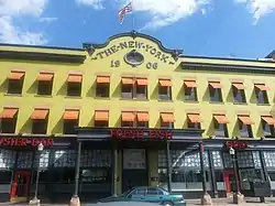 New York Hotel |
March 10, 1980 (#80003933) |
42 Post Office Pl. 40°45′42″N 111°53′31″W |
Downtown | |
| 143 | Old Clock at Zion's First National Bank |  Old Clock at Zion's First National Bank |
December 27, 1982 (#82001752) |
Southwestern corner of 100 South and Main St. 40°46′01″N 111°53′27″W |
Downtown | |
| 144 | Old Pioneer Fort Site |  Old Pioneer Fort Site |
October 15, 1974 (#74001938) |
400 South and 200 West 40°45′43″N 111°54′01″W |
Downtown | |
| 145 | Oquirrh School | 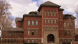 Oquirrh School |
December 4, 2008 (#08001156) |
350 S. 400 East 40°45′41″N 111°52′50″W |
Central City | |
| 146 | Oregon Shortline Railroad Company Building | 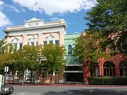 Oregon Shortline Railroad Company Building |
June 23, 1976 (#76001829) |
126–140 Pierpont Ave. 40°45′51″N 111°53′39″W |
Downtown | |
| 147 | Frank M. Orem House | 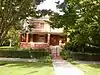 Frank M. Orem House |
August 5, 1983 (#83003175) |
274 S. 1200 East 40°45′48″N 111°51′24″W |
University | |
| 148 | Orpheum Theatre |  Orpheum Theatre |
September 30, 1976 (#76002257) |
46 W. 200 South 40°45′55″N 111°53′32″W |
Downtown | |
| 149 | Ottinger Hall | 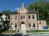 Ottinger Hall |
April 16, 1971 (#71000851) |
233 Canyon Rd. 40°46′32″N 111°53′07″W |
City Creek Canyon | |
| 150 | Pacific Northwest Pipeline Building |  Pacific Northwest Pipeline Building |
January 24, 2011 (#10001159) |
315 E. 200 South 40°45′56″N 111°52′54″W |
Central City | Built in 1958 in International Style, it was the Salt Lake City Public Safety Building from 1979 to 2013. |
| 151 | Lowell and Emily Parrish House |  Lowell and Emily Parrish House |
October 19, 2018 (#100003044) |
701 N I St. 40°47′07″N 111°52′18″W |
Avenues | |
| 152 | Peter Pan Apartments |  Peter Pan Apartments |
September 12, 2008 (#08000880) |
445 E. 300 South 40°45′45″N 111°52′41″W |
Central City | |
| 153 | Park Hotel |  Park Hotel |
December 17, 1992 (#92001690) |
422–432 W. 300 South 40°45′47″N 111°54′10″W |
Central City West | |
| 154 | Clifford R. Pearsall House |  Clifford R. Pearsall House |
October 13, 1983 (#83003957) |
950 E. Logan Ave. 40°44′03″N 111°51′46″W |
Perkins Addition | |
| 155 | Piccardy Apartments |  Piccardy Apartments |
September 12, 2008 (#08000879) |
115 S. 300 East 40°46′00″N 111°52′56″W |
Central City | |
| 156 | Peery Hotel |  Peery Hotel |
February 17, 1978 (#78002679) |
270–280 S. West Temple, 102–120 W. 300 South 40°45′47″N 111°53′36″W |
Downtown | |
| 157 | John Platts House |  John Platts House |
August 25, 1972 (#72001259) |
364 Quince St. 40°46′40″N 111°53′39″W |
Capitol Hill | |
| 158 | John and Margaret Price House |  John and Margaret Price House |
January 7, 2015 (#14001140) |
2691 E. St. Mary's Way 40°44′34″N 111°48′49″W |
Foothill | |
| 159 | Lorenzo and Emma Price House and Barn |  Lorenzo and Emma Price House and Barn |
August 6, 1998 (#98001016) |
1205 E. 1300 South 40°44′31″N 111°51′20″W |
East Central | |
| 160 | Lewis A. Ramsey House |  Lewis A. Ramsey House |
May 28, 1999 (#99000621) |
128 S. 1000 East 40°45′59″N 111°51′44″W |
Central City | |
| 161 | Richardson-Bower Building |  Richardson-Bower Building |
July 11, 2003 (#03000636) |
1019 E. 2100 South 40°43′32″N 111°51′41″W |
Sugar House | |
| 162 | Edward and Harriet Rosenbaum House | April 7, 2020 (#100005175) |
1428 East Circle Way 40°46′22″N 111°50′49″W |
Federal Heights | ||
| 163 | Rowland Hall-St. Mark's School |  Rowland Hall-St. Mark's School |
July 26, 1979 (#79002504) |
205 1st Ave. 40°46′17″N 111°52′55″W |
Avenues | Now the Madeleine Choir School |
| 164 | Jonathan C. and Eliza K. Royle House |  Jonathan C. and Eliza K. Royle House |
January 3, 1983 (#83003176) |
635 E. 100 South 40°46′03″N 111°52′21″W |
Central City | |
| 165 | Eliza Gray Rumel House |  Eliza Gray Rumel House |
July 7, 1983 (#83003177) |
358 S. 500 East 40°45′41″N 111°52′35″W |
Central City | |
| 166 | St. Mark's Episcopal Cathedral | 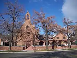 St. Mark's Episcopal Cathedral |
September 22, 1970 (#70000630) |
231 E. 100 South 40°46′04″N 111°53′00″W |
Central City | |
| 167 | Salt Lake City and County Building | 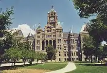 Salt Lake City and County Building |
June 15, 1970 (#70000629) |
451 Washington Sq. 40°45′35″N 111°53′09″W |
Central City | |
| 168 | Salt Lake City East Side Historic District | Salt Lake City East Side Historic District |
August 22, 1996 (#96000940) |
Roughly bounded by South Temple, 1100 East, 400 South, University Ave., 900 South, and 500 East 40°45′31″N 111°52′05″W |
Central City | Originally the Central City Historic District, a two-block wide strip from South Temple to 900 South; boundaries greatly increased in 2001 and 2003, the last of which included a name change[6] |
| 169 | Salt Lake City Public Library | 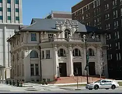 Salt Lake City Public Library |
August 7, 1979 (#79002505) |
15 S. State St. 40°46′07″N 111°53′13″W |
Downtown | Housed the Hansen Planetarium 1965–2003, O.C. Tanner Jewelry since 2009 |
| 170 | Salt Lake Country Club and Golf Course |  Salt Lake Country Club and Golf Course |
July 7, 2015 (#15000400) |
2375 South 900 East 40°43′07″N 111°51′55″W |
Sugar House | |
| 171 | Salt Lake Engineering Works-Bogue Supply Company Building |  Salt Lake Engineering Works-Bogue Supply Company Building |
August 14, 2003 (#03000156) |
741 W. 400 South 40°45′37″N 111°54′46″W |
Central City West | |
| 172 | Salt Lake Hardware Company Warehouse |  Salt Lake Hardware Company Warehouse |
October 4, 2001 (#01001082) |
155 N. 400 West 40°46′19″N 111°54′09″W |
Capitol Hill | |
| 173 | Salt Lake Northwest Historic District | 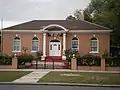 Salt Lake Northwest Historic District |
March 29, 2001 (#01000320) |
Roughly bounded by 1100 West, 600 North, 500 West, and North Temple 40°46′48″N 111°54′58″W |
Fairpark | |
| 174 | Salt Lake Stamp Company Building |  Salt Lake Stamp Company Building |
December 27, 1982 (#82001753) |
380 W. 200 South 40°45′55″N 111°54′08″W |
Central City West | |
| 175 | Salt Lake Stock and Mining Exchange Building |  Salt Lake Stock and Mining Exchange Building |
July 30, 1976 (#76001830) |
39 Exchange Place 40°45′42″N 111°53′21″W |
Downtown | |
| 176 | Salt Lake Union Pacific Railroad Station | 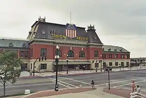 Salt Lake Union Pacific Railroad Station |
July 9, 1975 (#75001818) |
South Temple at 400 West 40°46′10″N 111°54′09″W |
Central City West | |
| 177 | Sampson Apartments |  Sampson Apartments |
January 27, 2010 (#09001292) |
276 E. 300 South 40°45′46″N 111°53′00″W |
Central City | |
| 178 | Sarah Daft Home for the Aged |  Sarah Daft Home for the Aged |
September 12, 2002 (#02001041) |
737 S. 1300 East 40°45′11″N 111°51′12″W |
Central City | |
| 179 | Seventh-day Adventist Meetinghouse and School |  Seventh-day Adventist Meetinghouse and School |
February 6, 2007 (#06000930) |
1840 S. 800 East 40°43′47″N 111°52′04″W |
Sugar House | |
| 180 | Silver Brothers' Iron Works Office and Warehouse |  Silver Brothers' Iron Works Office and Warehouse |
May 20, 1999 (#99000622) |
550 W. 700 South 40°45′16″N 111°54′20″W |
Central City West | |
| 181 | Smith Apartments | 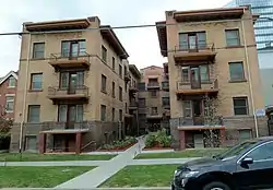 Smith Apartments |
October 20, 1989 (#89001740) |
228 S. 300 East 40°45′51″N 111°52′58″W |
Central City | |
| 182 | George Albert Smith House | 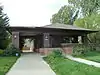 George Albert Smith House |
March 12, 1993 (#93000066) |
1302 E. Yale Ave. 40°44′44″N 111°51′11″W |
Yalecrest | |
| 183 | Smith-Bailey Drug Company Building |  Smith-Bailey Drug Company Building |
August 17, 1982 (#82004146) |
171 W. 200 South 40°45′53″N 111°53′45″W |
Downtown | |
| 184 | South Temple Historic District | 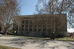 South Temple Historic District |
July 14, 1982 (#82004147) |
100 E. to 1350 E. South Temple St. 40°46′10″N 111°52′11″W |
||
| 185 | Sprague Branch of the Salt Lake City Public Library | 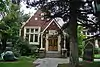 Sprague Branch of the Salt Lake City Public Library |
July 11, 2003 (#03000637) |
2131 S. Highland Dr. 40°43′30″N 111°51′30″W |
Sugar House | |
| 186 | Steiner American Building |  Steiner American Building |
September 19, 2019 (#100004393) |
505 E. South Temple 40°46′10″N 111°52′35″W |
Downtown | |
| 187 | Stratford Hotel |  Stratford Hotel |
December 27, 1982 (#82001754) |
175 E. 200 South 40°45′55″N 111°53′06″W |
Central City | |
| 188 | Sugar House LDS Ward Building |  Sugar House LDS Ward Building |
July 11, 2003 (#03000631) |
1950 S. 1200 East 40°43′40″N 111°51′24″W |
Sugar House | |
| 189 | Sugar House Monument | 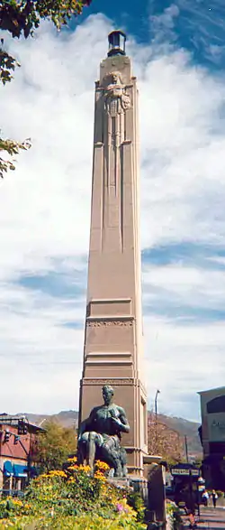 Sugar House Monument |
July 11, 2003 (#03000638) |
1100 East and 2100 South 40°43′32″N 111°51′34″W |
Sugar House | |
| 190 | Sweet Candy Company Building | 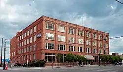 Sweet Candy Company Building |
December 28, 2000 (#00001584) |
224 S. 200 West 40°45′52″N 111°53′48″W |
Downtown | |
| 191 | Temple Square | 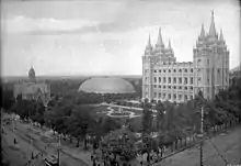 Temple Square |
October 15, 1966 (#66000738) |
Temple Square 40°46′14″N 111°53′29″W |
Downtown | |
| 192 | Tenth Ward Square |  Tenth Ward Square |
November 11, 1977 (#77001314) |
400 South and 800 East 40°45′37″N 111°52′05″W |
Central City | |
| 193 | Third Presbyterian Church Parsonage |  Third Presbyterian Church Parsonage |
May 19, 2000 (#00000522) |
1068 E. Blaine Ave. 40°43′56″N 111°51′35″W |
Sugar House | |
| 194 | Tracy Loan and Trust Company Building |  Tracy Loan and Trust Company Building |
October 10, 1978 (#78002681) |
151 S. Main St. 40°45′57″N 111°53′24″W |
Downtown | |
| 195 | Tribune Building |  Tribune Building |
July 30, 2012 (#82005108) |
137 S. Main St. 40°45′58″N 111°53′27″W |
Downtown | |
| 196 | Trinity A.M.E. Church |  Trinity A.M.E. Church |
July 30, 1976 (#76001831) |
239 E. 600 South 40°45′24″N 111°53′01″W |
Central City | |
| 197 | Twenty-Ninth Ward LDS Meetinghouse |  Twenty-Ninth Ward LDS Meetinghouse |
April 6, 2015 (#15000132) |
1102 W. 400 North 40°46′42″N 111°55′23″W |
Fairpark | |
| 198 | Frank M. and Susan E. Ulmer House |  Frank M. and Susan E. Ulmer House |
December 20, 2002 (#02001556) |
1458 S. 1300 East 40°44′16″N 111°51′12″W |
Sugar House | |
| 199 | University Neighborhood Historic District |  University Neighborhood Historic District |
December 13, 1995 (#95001430) |
Roughly bounded by 500 South, South Temple, 1100 East and University St. 40°45′50″N 111°51′20″W |
University | |
| 200 | University of Utah Circle | 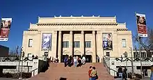 University of Utah Circle |
April 20, 1978 (#78002682) |
University of Utah campus 40°45′54″N 111°50′59″W |
University | |
| 201 | US Post Office-Sugar House |  US Post Office-Sugar House |
February 18, 1994 (#93000409) |
2155 S. Highland Dr. 40°43′27″N 111°51′30″W |
Sugar House | |
| 202 | Utah Commercial and Savings Bank Building | .jpg.webp) Utah Commercial and Savings Bank Building |
June 18, 1975 (#75001819) |
22 E. 100 South 40°46′01″N 111°53′23″W |
Downtown | |
| 203 | Utah State Fair Grounds |  Utah State Fair Grounds |
January 27, 1981 (#81000583) |
1000 West and North Temple Sts. 40°46′30″N 111°55′30″W |
Fairpark | |
| 204 | Utah State Liquor Agency No. 22 |  Utah State Liquor Agency No. 22 |
July 11, 2003 (#03000639) |
1938 S. 1100 East 40°43′41″N 111°51′31″W |
Sugar House | This building is no longer here. |
| 205 | Veterans Administration Hospital |  Veterans Administration Hospital |
June 16, 1996 (#96000630) |
401 E. 12th Ave. 40°47′04″N 111°52′40″W |
Avenues | |
| 206 | Walker Bank Building | 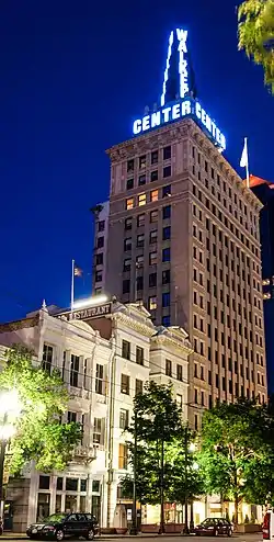 Walker Bank Building |
October 4, 2006 (#06000929) |
175 S. Main St. 40°45′55″N 111°53′24″W |
Downtown | |
| 207 | Warehouse District |  Warehouse District |
August 17, 1982 (#82004149) |
200 South and Pierpont Ave. between 300 and 400 West; also oughly bounded by I-15, US 50 S., W. Temple St., 300 West & 1000 South 40°45′47″N 111°54′10″W |
Central City West | Second set of addresses represent a boundary increase of March 22, 2016 |
| 208 | Wasatch Springs Plunge |  Wasatch Springs Plunge |
May 15, 1980 (#80003936) |
840 N. 300 West 40°47′21″N 111°53′57″W |
Capitol Hill | Housed the Children's Museum of Utah 1983–2006 |
| 209 | Charles H. Weeks House |  Charles H. Weeks House |
October 13, 1983 (#83003959) |
935 E. Logan Ave. 40°44′04″N 111°51′48″W |
Perkins Addition | |
| 210 | Western General Agency Building |  Western General Agency Building |
September 29, 2015 (#15000678) |
780 E. South Temple St. 40°46′09″N 111°52′08″W |
East Central | |
| 211 | Western Macaroni Manufacturing Company Factory |  Western Macaroni Manufacturing Company Factory |
April 7, 2015 (#15000133) |
244 S. 500 West 40°45′49″N 111°54′24″W |
Central City West | |
| 212 | Westminster College President's House |  Westminster College President's House |
September 7, 2001 (#01000961) |
1733 S. 1300 East 40°43′59″N 111°51′09″W |
Sugar House | |
| 213 | Westmoreland Place Historic District |  Westmoreland Place Historic District |
April 27, 2011 (#11000234) |
Roughly bounded by 1300 South, 1500 East, Sherman Ave. & 1600 East Sts. 40°44′27″N 111°50′48″W |
Foothill | |
| 214 | Nelson Wheeler Whipple House |  Nelson Wheeler Whipple House |
September 26, 1979 (#79002506) |
564 W. 400 North 40°46′42″N 111°54′27″W |
Fairpark | |
| 215 | John M. Whitaker House |  John M. Whitaker House |
March 30, 1978 (#78002684) |
975 Garfield Ave. 40°43′48″N 111°51′43″W |
Sugar House | |
| 216 | Woodruff Villa |  Woodruff Villa |
July 14, 1982 (#82004150) |
1622 S. 500 East 40°44′03″N 111°52′34″W |
Liberty Wells | |
| 217 | Asahel Hart Woodruff House |  Asahel Hart Woodruff House |
July 14, 1982 (#82004151) |
1636 S. 500 East 40°44′02″N 111°52′34″W |
Liberty Wells | |
| 218 | Wilford Woodruff Farm House |  Wilford Woodruff Farm House |
July 14, 1982 (#82004152) |
1604 S. 500 East 40°44′04″N 111°52′34″W |
Liberty Wells | |
| 219 | Woodruff-Riter House |  Woodruff-Riter House |
July 26, 1979 (#79002507) |
225 N. State St. 40°46′27″N 111°53′16″W |
Capitol Hill | |
| 220 | Yalecrest Historic District |  Yalecrest Historic District |
November 8, 2007 (#07001168) |
Roughly bounded by Sunnyside Ave. (840 South) to 1300 South, and 1300 East to 1800 East 40°44′48″N 111°50′43″W |
Yalecrest | |
| 221 | Thomas Yardley House |  Thomas Yardley House |
October 13, 1983 (#83003961) |
955 E. Logan Ave. 40°44′04″N 111°51′45″W |
Perkins Addition | |
| 222 | Brigham Young Complex |  Brigham Young Complex |
October 15, 1966 (#66000739) |
63–67 E. South Temple St. 40°46′11″N 111°53′17″W |
Downtown | |
| 223 | Z.C.M.I. Cast Iron Front |  Z.C.M.I. Cast Iron Front |
September 22, 1970 (#70000632) |
15 S. Main St. 40°46′08″N 111°53′24″W |
Downtown | Now part of the facade of the City Creek Center. |
| 224 | ZCMI General Warehouse |  ZCMI General Warehouse |
December 28, 2005 (#05001487) |
230 S. 500 West 40°45′52″N 111°54′19″W |
Central City West |
Former listings
| [3] | Name on the Register | Image | Date listed | Date removed | Location | Neighborhood | Summary |
|---|---|---|---|---|---|---|---|
| 1 | Amussen's Jewelry | June 3, 1976 (#76001821) | April 17, 1986 | 62 S. Main St. |
Downtown | ||
| 2 | Brigham Young Forest Farmhouse | May 14, 1971 (#71000852) | May 29, 1975 | 732 Ashton Ave. |
Sugar House | Delisted in 1975 when it was relocated to This Is the Place Heritage Park | |
| 3 | Brooks Arcade | Brooks Arcade |
August 17, 1982 (#82004133) | July 3, 2014 | 260 S. State St. 40°45′51″N 111°53′17″W |
Downtown | Largely demolished save the facade in 2001.[7] |
| 4 | Building at 592–98 West 200 South | August 17, 1982 (#82004134) | September 3, 2009 | 592-98 W. 200 South |
Central City West | ||
| 5 | Carlson Hall |  Carlson Hall |
April 12, 1996 (#96000414) | June 15, 2015 | 369 S. University St. 40°45′41″N 111°51′04″W |
University | Part of the University of Utah's S.J. Quinney College of Law |
| 6 | Clayton Building | June 17, 1982 (#82004138) | December 28, 1994 | 214 S. State St. |
Downtown | ||
| 7 | Constitution Building | September 29, 1976 (#86003018) | April 17, 1986 | 34 S. Main St. |
Downtown | ||
| 8 | Ferry Hall | October 13, 1983 (#83003951) | March 8, 1988 | 1840 S. 1300 East |
Sugar House | ||
| 9 | Granite Lumber Company Building | July 11, 2003 (#03000629) | June 15, 2015 | 1090 E. 2100 South 40°43′31″N 111°51′33″W |
Sugar House | ||
| 10 | Hotel Albert |  Hotel Albert |
August 17, 1982 (#82004142) | January 17, 2017 | 123 S. West Temple St. 40°46′00″N 111°53′35″W |
Downtown | |
| 11 | LDS First Ward Meetinghouse | April 30, 1976 (#76002258) | February 15, 1996 | 760 S. 800 East |
Central City | ||
| 12 | Redman Van and Storage Company Building |  Redman Van and Storage Company Building |
July 11, 2003 (#03000635) | February 11, 2007 | 1240 E. 2100 South |
Sugar House | |
| 13 | Albert Smith House | July 7, 1983 (#83003178) | December 28, 1994 | 349 S. 200 West |
Downtown | ||
| 14 | Tampico Restaurant | December 27, 1982 (#82001755) | February 1, 1995 | 169 Regent St. 40°45′55″N 111°53′20″W |
Downtown | ||
| 15 | Technical High School | February 19, 1980 (#80003934) | May 15, 2001 | 241 N. 300 West |
Capitol Hill | ||
| 16 | Utah Savings And Trust Company Building | May 22, 1978 (#78002683) | December 4, 1991 | 235 S. Main St. |
Downtown | ||
| 17 | Utah Slaughter Company Warehouse | August 17, 1982 (#82004148) | June 15, 2015 | 370 W. 100 South 40°46′03″N 111°54′05″W |
Central City West | No longer here; Vivint Smart Home Arena stands on this property |
See also
| Wikimedia Commons has media related to National Register of Historic Places in Salt Lake City, Utah. |
References
- The latitude and longitude information provided in this table was derived originally from the National Register Information System, which has been found to be fairly accurate for about 99% of listings. Some locations in this table may have been corrected to current GPS standards.
- "National Register of Historic Places: Weekly List Actions". National Park Service, United States Department of the Interior. Retrieved on January 29, 2021.
- Numbers represent an alphabetical ordering by significant words. Various colorings, defined here, differentiate National Historic Landmarks and historic districts from other NRHP buildings, structures, sites or objects.
- "National Register Information System". National Register of Historic Places. National Park Service. April 24, 2008.
- The eight-digit number below each date is the number assigned to each location in the National Register Information System database, which can be viewed by clicking the number.
- Broschinsky, Korral (September 19, 2002). "National Register of Historic Places Nomination: Salt Lake City East Side Historic District" (PDF). National Park Service. Retrieved September 30, 2014. Cite journal requires
|journal=(help) - http://www.slcdocs.com/Planning/HLC/2014/Brooks.pdf
 | |||
| Topics | |
|---|---|
| Lists by state |
|
| Lists by insular areas | |
| Lists by associated state | |
| Other areas | |
| Related | |
| |