National Register of Historic Places listings in Garfield County, Utah
This is a list of the National Register of Historic Places listings in Garfield County, Utah.
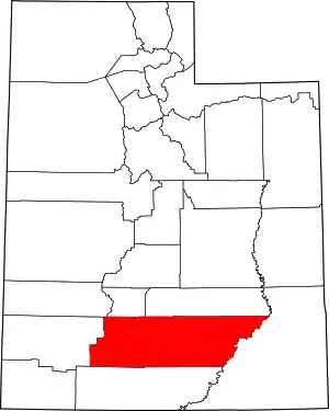
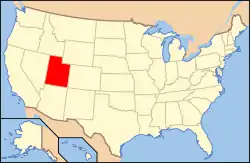
Location of Garfield County in Utah
This is intended to be a complete list of the properties and districts on the National Register of Historic Places in Garfield County, Utah, United States. Latitude and longitude coordinates are provided for many National Register properties and districts; these locations may be seen together in a map.[1]
There are 27 properties and districts listed on the National Register in the county, including 1 National Historic Landmark.
- This National Park Service list is complete through NPS recent listings posted January 29, 2021.[2]
Current listings
| [3] | Name on the Register[4] | Image | Date listed[5] | Location | City or town | Description |
|---|---|---|---|---|---|---|
| 1 | Boulder Elementary School | April 1, 1985 (#85000805) |
50 School House Ln. 37°54′32″N 111°25′22″W |
Boulder | PWA Moderne school built 1935-36 as a Public Works Administration project. | |
| 2 | Bryce Canyon Airport |  Bryce Canyon Airport |
October 19, 1978 (#78002660) |
Southeast of Panguitch off State Route 12 37°42′04″N 112°09′15″W |
Panguitch | |
| 3 | Bryce Canyon Lodge and Deluxe Cabins | Bryce Canyon Lodge and Deluxe Cabins |
May 28, 1987 (#87001339) |
State Route 63 37°37′36″N 112°10′04″W |
Bryce Canyon National Park | Expanded 1995 with regular NRHP overlay |
| 4 | Bryce Canyon Lodge Historic District | 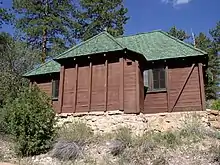 Bryce Canyon Lodge Historic District |
April 25, 1995 (#95000434) |
Bryce Canyon National Park 37°37′37″N 112°10′02″W |
Bryce Canyon National Park | Expands district around Bryce Canyon Lodge, but is not National Historic Landmark-designated |
| 5 | Bryce Canyon National Park Scenic Trails Historic District | 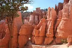 Bryce Canyon National Park Scenic Trails Historic District |
April 25, 1995 (#95000422) |
Bryce Canyon National Park 37°37′33″N 112°09′23″W |
Bryce Canyon National Park | Comprises five contiguous trails: Navajo Loop Trail, Queen's Garden Trail, Peekaboo Loop Trail, Fairyland Loop Trail, Rim Trail |
| 6 | Bryce Inn | 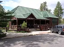 Bryce Inn |
April 25, 1995 (#95000425) |
Bryce Canyon National Park 37°38′08″N 112°09′51″W |
Bryce Canyon National Park | |
| 7 | Chaffin Camp Site | June 27, 2019 (#100004110) |
Address Restricted |
Hite vicinity | ||
| 7 | Coombs Village Site | 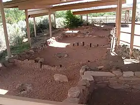 Coombs Village Site |
January 1, 1976 (#76001815) |
State Route 117 37°54′38″N 111°25′21″W |
Boulder | A partially excavated Puebloan village, now part of Anasazi Indian State Park |
| 8 | Escalante Historic District |  Escalante Historic District |
March 27, 2013 (#13000127) |
Roughly bounded by 300 North, 300 East, 300 South, 300 & 400 West Sts. 37°46′13″N 111°36′01″W |
Escalante | |
| 9 | Friendship Cove Pictograph | December 21, 1978 (#78002659) |
Address Restricted[6] |
Escalante | ||
| 10 | William Jasper, Jr., and Elizabeth Henderson House |  William Jasper, Jr., and Elizabeth Henderson House |
April 5, 2006 (#06000230) |
85 N. Main St. (Kodachrome Highway) 37°34′28″N 112°03′44″W |
Cannonville | |
| 11 | Hole-in-the-Rock Trail | 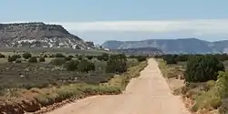 Hole-in-the-Rock Trail |
August 9, 1982 (#82004792) |
A trail commencing at Escalante and terminating at Bluff 37°25′18″N 110°39′51″W |
Escalante | Split between Garfield, Kane, and San Juan counties |
| 12 | Horse Barn |  Horse Barn |
April 25, 1995 (#95000433) |
Bryce Canyon National Park 37°37′35″N 112°10′53″W |
Bryce Canyon National Park | |
| 13 | Kolb Brothers "Cat Camp" Inscription | October 7, 1988 (#88001250) |
Big Drop #2 vicinity, Canyonlands National Park 38°04′57″N 110°02′32″W |
Moab | ||
| 14 | Loop C Comfort Station | 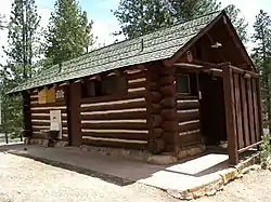 Loop C Comfort Station |
April 25, 1995 (#95000428) |
North Campground, Bryce Canyon National Park 37°38′10″N 112°09′54″W |
Bryce Canyon National Park | |
| 15 | Loop D Comfort Station | 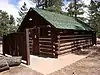 Loop D Comfort Station |
April 25, 1995 (#95000429) |
North Campground, Bryce Canyon National Park 37°38′05″N 112°09′58″W |
Bryce Canyon National Park | |
| 16 | Oak Creek Dam | September 13, 1999 (#99001091) |
Oak Creek, north of North Coleman Canyon 38°05′00″N 111°08′15″W |
Torrey | ||
| 17 | Old Administration Building | 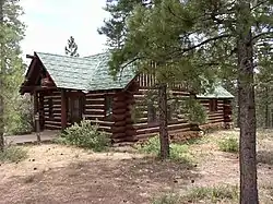 Old Administration Building |
April 24, 1995 (#95000430) |
Bryce Canyon National Park 37°37′53″N 112°09′52″W |
Bryce Canyon National Park | |
| 18 | Old National Park Service Housing Historic District | 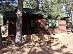 Old National Park Service Housing Historic District |
April 25, 1995 (#95000424) |
Bryce Canyon National Park 37°37′50″N 112°10′06″W |
Bryce Canyon National Park | |
| 19 | William T., Jr., and Mary Isabell R. Owens House |  William T., Jr., and Mary Isabell R. Owens House |
March 25, 1999 (#99000399) |
95 N. 100 East 37°49′26″N 112°26′00″W |
Panguitch | |
| 20 | Panguitch Carnegie Library | 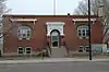 Panguitch Carnegie Library |
October 25, 1984 (#84000148) |
75 E. Center St. 37°49′23″N 112°26′01″W |
Panguitch | |
| 21 | Panguitch Historic District |  Panguitch Historic District |
November 16, 2006 (#06001068) |
Roughly bounded by 500 North, 400 East, 500 South, and 300 West 37°49′25″N 112°26′00″W |
Panguitch | |
| 22 | Panguitch Social Hall |  Panguitch Social Hall |
November 12, 1998 (#98001376) |
50 E. Center St. 37°49′21″N 112°25′58″W |
Panguitch | |
| 23 | Pole Hollow Archeological Site | July 16, 1981 (#81000581) |
Address Restricted[6] |
Panguitch | ||
| 24 | Starr Ranch | April 23, 1976 (#76001816) |
15 miles (24 km) north of Ticaboo, off SR-276 37°51′03″N 110°39′53″W |
Ticaboo | ||
| 25 | Under-the-Rim Trail | 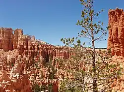 Under-the-Rim Trail |
April 25, 1995 (#95000423) |
Bryce Canyon National Park 37°33′44″N 112°12′57″W |
Bryce Canyon National Park | |
| 26 | Utah Parks Company Service Station | 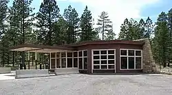 Utah Parks Company Service Station |
April 25, 1995 (#95000426) |
Bryce Canyon National Park 37°37′45″N 112°09′59″W |
Bryce Canyon National Park |
See also
References
- The latitude and longitude information provided in this table was derived originally from the National Register Information System, which has been found to be fairly accurate for about 99% of listings. Some locations in this table may have been corrected to current GPS standards.
- "National Register of Historic Places: Weekly List Actions". National Park Service, United States Department of the Interior. Retrieved on January 29, 2021.
- Numbers represent an alphabetical ordering by significant words. Various colorings, defined here, differentiate National Historic Landmarks and historic districts from other NRHP buildings, structures, sites or objects.
- "National Register Information System". National Register of Historic Places. National Park Service. April 24, 2008.
- The eight-digit number below each date is the number assigned to each location in the National Register Information System database, which can be viewed by clicking the number.
- Some listings on the NRHP are highly sensitive sites and may be subject to looting or vandalism. The NRHP lists this site as "Address Restricted."
External links
![]() Media related to National Register of Historic Places in Garfield County, Utah at Wikimedia Commons
Media related to National Register of Historic Places in Garfield County, Utah at Wikimedia Commons
 | |||
| Topics | |
|---|---|
| Lists by state |
|
| Lists by insular areas | |
| Lists by associated state | |
| Other areas | |
| Related | |
| |
Municipalities and communities of Garfield County, Utah, United States | ||
|---|---|---|
| Cities | Map of Utah highlighting Garfield County | |
| Towns | ||
| Unincorporated communities | ||
| Ghost towns | ||
| ||
This article is issued from Wikipedia. The text is licensed under Creative Commons - Attribution - Sharealike. Additional terms may apply for the media files.