National Register of Historic Places listings in Washakie County, Wyoming
This is a list of the National Register of Historic Places listings in Washakie County, Wyoming. It is intended to be a complete list of the properties and districts on the National Register of Historic Places in Washakie County, Wyoming, United States. The locations of National Register properties and districts for which the latitude and longitude coordinates are included below, may be seen in a map.[1]
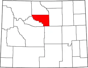
Location of Washakie County in Wyoming
There are 6 properties and districts listed on the National Register in the county.
- This National Park Service list is complete through NPS recent listings posted January 29, 2021.[2]
| Albany - Big Horn - Campbell - Carbon - Converse - Crook - Fremont - Goshen - Hot Springs - Johnson - Laramie - Lincoln - Natrona - Niobrara - Park - Platte - Sheridan - Sublette - Sweetwater - Teton - Uinta - Washakie - Weston |
Listings county-wide
| [3] | Name on the Register | Image | Date listed[4] | Location | City or town | Description |
|---|---|---|---|---|---|---|
| 1 | Ainsworth House | September 11, 1986 (#86002321) |
Spring Creek Rd. 43°47′47″N 107°18′53″W |
Big Trails | ||
| 2 | Emerson Parks House | 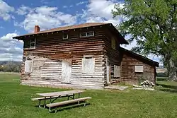 Emerson Parks House |
May 16, 2016 (#16000265) |
504 2nd St. 44°02′03″N 107°26′40″W |
Ten Sleep | |
| 3 | James T. Saban Lookout | 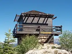 James T. Saban Lookout |
November 15, 2016 (#16000781) |
Approx..9 mi. SW. of US 16 & FS Rd. 429 44°08′58″N 107°12′09″W |
Ten Sleep | Also known as the High Park Lookout, in Bighorn National Forest, renamed in 2015 for a USFS firefighter killed in the Blackwater Fire of 1937 |
| 4 | Ten Sleep Mercantile | 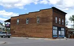 Ten Sleep Mercantile |
September 11, 1986 (#86002324) |
2nd and Pine Sts. 44°02′07″N 107°27′01″W |
Ten Sleep | |
| 5 | Worland House |  Worland House |
February 27, 1986 (#86000310) |
520 Culbertson 44°00′52″N 107°57′42″W |
Worland | |
| 6 | Worland Ranch | 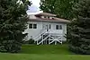 Worland Ranch |
March 5, 1992 (#92000123) |
Junction of U.S. Route 20 and Wyoming Highway 433 44°00′58″N 107°58′53″W |
Worland |
See also
| Wikimedia Commons has media related to National Register of Historic Places in Washakie County, Wyoming. |
References
- The latitude and longitude information provided in this table was derived originally from the National Register Information System, which has been found to be fairly accurate for about 99% of listings. Some locations in this table may have been corrected to current GPS standards.
- "National Register of Historic Places: Weekly List Actions". National Park Service, United States Department of the Interior. Retrieved on January 29, 2021.
- Numbers represent an alphabetical ordering by significant words. Various colorings, defined here, differentiate National Historic Landmarks and historic districts from other NRHP buildings, structures, sites or objects.
- The eight-digit number below each date is the number assigned to each location in the National Register Information System database, which can be viewed by clicking the number.
| Topics | |
|---|---|
| Lists by state |
|
| Lists by insular areas | |
| Lists by associated state | |
| Other areas | |
| Related | |
| |
Municipalities and communities of Washakie County, Wyoming, United States | ||
|---|---|---|
| City | | |
| Town | ||
| Unincorporated communities | ||
| ||
This article is issued from Wikipedia. The text is licensed under Creative Commons - Attribution - Sharealike. Additional terms may apply for the media files.