National Register of Historic Places listings in Laramie County, Wyoming
This is a list of the National Register of Historic Places listings in Laramie County, Wyoming. It is intended to be a complete list of the properties and districts on the National Register of Historic Places in Laramie County, Wyoming, United States. The locations of National Register properties and districts for which the latitude and longitude coordinates are included below, may be seen in a map.[1]
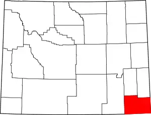
Location of Laramie County in Wyoming
There are 55 properties and districts listed on the National Register in the county, 3 of which are National Historic Landmarks. One property was listed but has since been removed.
- This National Park Service list is complete through NPS recent listings posted February 5, 2021.[2]
| Albany - Big Horn - Campbell - Carbon - Converse - Crook - Fremont - Goshen - Hot Springs - Johnson - Laramie - Lincoln - Natrona - Niobrara - Park - Platte - Sheridan - Sublette - Sweetwater - Teton - Uinta - Washakie - Weston |
Current listings
| [3] | Name on the Register | Image | Date listed[4] | Location | City or town | Description |
|---|---|---|---|---|---|---|
| 1 | Atlas Theatre | 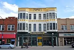 Atlas Theatre |
April 3, 1973 (#73001933) |
213 W. 16th St. 41°07′57″N 104°48′54″W |
Cheyenne | |
| 2 | Baxter Ranch Headquarters Buildings |  Baxter Ranch Headquarters Buildings |
June 14, 1979 (#79002610) |
912-922 E. 18th St. and 1810-1920 Morris Ave. 41°08′20″N 104°48′19″W |
Cheyenne | "Palatial" log house and log barn, moved from Baxter Ranch to Cheyenne, converted to housing. |
| 3 | Charles L. Beatty House |  Charles L. Beatty House |
June 28, 1990 (#90001001) |
2320 Capitol Ave. 41°08′21″N 104°49′10″W |
Cheyenne | |
| 4 | Boeing/United Airlines Terminal Building, Hangar and Fountain |  Boeing/United Airlines Terminal Building, Hangar and Fountain |
February 7, 1985 (#85000249) |
200 E. 8th Ave. 41°09′13″N 104°49′13″W |
Cheyenne | |
| 5 | Capitol North Historic District |  Capitol North Historic District |
December 10, 1980 (#80004048) |
Roughly bounded by E. 29th and E. 25th Sts. and Warren and Pioneer Aves. 41°08′32″N 104°48′33″W |
Cheyenne | |
| 6 | Castle on 19th Street |  Castle on 19th Street |
July 10, 1979 (#79002611) |
1318 E. 19th St. 41°08′29″N 104°48′04″W |
Cheyenne | |
| 7 | Cheyenne Flour Milling Company |  Cheyenne Flour Milling Company |
October 13, 2003 (#03001024) |
810-814 W. 23rd St. 41°08′11″N 104°49′35″W |
Cheyenne | |
| 8 | Cheyenne High School | 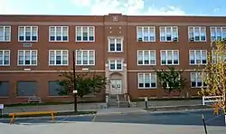 Cheyenne High School |
August 22, 2005 (#05000698) |
2810 House Ave. 41°08′41″N 104°49′09″W |
Cheyenne | |
| 9 | Cheyenne South Side Historic District |  Cheyenne South Side Historic District |
October 11, 2006 (#06000939) |
Roughly bounded by Warren Ave., Russell Ave., E. 10th St., and E. 5th St. 41°07′38″N 104°48′13″W |
Cheyenne | |
| 10 | Cheyenne Veterans Administration Hospital Historic District |  Cheyenne Veterans Administration Hospital Historic District |
May 1, 2013 (#13000239) |
2360 Pershing Blvd. 41°08′54″N 104°47′09″W |
Cheyenne | |
| 11 | Churchill Public School | .JPG.webp) Churchill Public School |
August 22, 2005 (#05000704) |
510 W. 29th St. 41°08′35″N 104°49′36″W |
Cheyenne | |
| 12 | City and County Building |  City and County Building |
November 30, 1978 (#78002828) |
19th St. and Carey Ave. 41°08′06″N 104°49′06″W |
Cheyenne | |
| 13 | Continental Oil Company | 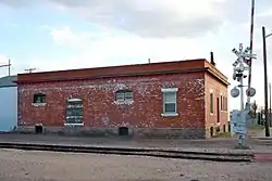 Continental Oil Company |
October 13, 2003 (#03001030) |
801 W. 19th St. 41°07′57″N 104°49′24″W |
Cheyenne | |
| 14 | Crook House | 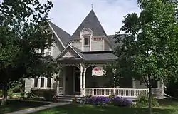 Crook House |
July 10, 1979 (#79002612) |
314 E. 21st St. 41°08′20″N 104°48′50″W |
Cheyenne | |
| 15 | Crow Creek-Cole Ranch Headquarters Historic District | July 14, 2009 (#09000565) |
1065 Happy Jack Rd. 41°10′17″N 105°05′15″W |
Cheyenne | ||
| 16 | Deming School | 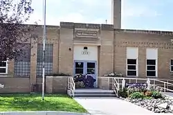 Deming School |
August 22, 2005 (#05000701) |
715 W. 5th Ave. 41°09′01″N 104°49′44″W |
Cheyenne | |
| 17 | Dereemer Ranch Historic District | November 25, 1983 (#83004290) |
East of Horse Creek 41°24′49″N 105°07′54″W |
Horse Creek | ||
| 18 | Downtown Cheyenne Historic District | 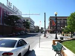 Downtown Cheyenne Historic District |
December 22, 1978 (#78003434) |
Roughly bounded by 15th and 16th Sts. and Central and Pioneer Aves.; also roughly bounded by 17th and 18th Sts., Pioneer and Carey Aves., also along Central Ave. and 17th St.; also roughly bounded by 19th St., Capital Ave., 17th St., and Carey Ave.; also roughly bounded by 18th, Carey, 16th, and Warren Sts. 41°07′55″N 104°48′56″W |
Cheyenne | Three boundary increases in 1980, 1988, and 1996. |
| 19 | Dubois Block | .JPG.webp) Dubois Block |
December 2, 2014 (#14000999) |
Bounded by W. Pershing Blvd., Dey Ave., W. 32nd St., and Cribbon Ave. 41°08′44″N 104°50′05″W |
Cheyenne | |
| 20 | Federal Office Building-Cheyenne | .JPG.webp) Federal Office Building-Cheyenne |
October 12, 2000 (#00001191) |
308 W. 21st St. 41°08′13″N 104°49′09″W |
Cheyenne | |
| 21 | Mabel Fincher School |  Mabel Fincher School |
August 22, 2005 (#05000700) |
2201 Morrie Ave. 41°08′34″N 104°48′25″W |
Cheyenne | |
| 22 | First United Methodist Church | 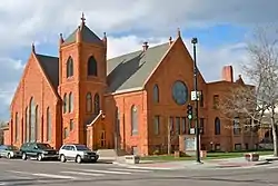 First United Methodist Church |
February 25, 1975 (#75001902) |
Northeastern corner of 18th St. and Central Ave. 41°08′07″N 104°48′53″W |
Cheyenne | |
| 23 | Fort David A. Russell | .jpg.webp) Fort David A. Russell |
October 1, 1969 (#69000191) |
Western side of Cheyenne 41°09′10″N 104°51′27″W |
Cheyenne | |
| 24 | Moreton Frewen House |  Moreton Frewen House |
April 14, 1975 (#75001904) |
506 E. 23rd St. 41°08′29″N 104°48′46″W |
Cheyenne | |
| 25 | Governor's Mansion | 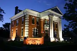 Governor's Mansion |
September 30, 1969 (#69000192) |
300 E. 21st St. 41°08′13″N 104°48′53″W |
Cheyenne | |
| 26 | Hebard Public School | Hebard Public School |
August 22, 2005 (#05000705) |
413 Seymour Ave. 41°07′32″N 104°47′59″W |
Cheyenne | |
| 27 | Hynds Lodge | Hynds Lodge |
March 23, 1984 (#84003685) |
Curt Gowdy State Park 41°11′46″N 105°15′21″W |
Cheyenne | |
| 28 | Johnson Public School | Johnson Public School |
August 22, 2005 (#05000706) |
711 Warren Ave. 41°07′34″N 104°48′28″W |
Cheyenne | |
| 29 | Keefe Row |  Keefe Row |
August 3, 1979 (#79002613) |
E. 22nd St. and Evans Ave 41°08′23″N 104°48′47″W |
Cheyenne | |
| 30 | Ferdinand Lafrentz House |  Ferdinand Lafrentz House |
July 17, 1979 (#79003679) |
2015 Warren Ave. 41°08′15″N 104°48′53″W |
Cheyenne | |
| 31 | Lakeview Historic District |  Lakeview Historic District |
August 5, 1996 (#88000560) |
Roughly bounded by 27th, Seymour, Maxwell, and Warren 41°08′31″N 104°48′52″W |
Cheyenne | |
| 32 | Laramie County Milk Producers Cooperative Association | 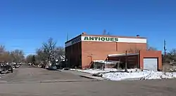 Laramie County Milk Producers Cooperative Association |
October 13, 2003 (#03001026) |
1122 W. 23rd St. 41°08′13″N 104°49′31″W |
Cheyenne | |
| 33 | Masonic Temple | 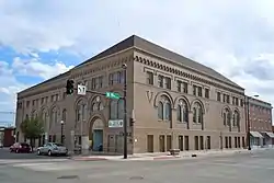 Masonic Temple |
October 25, 1984 (#84000162) |
1820 Capitol Ave. 41°08′06″N 104°49′00″W |
Cheyenne | |
| 34 | McCord-Brady Company | 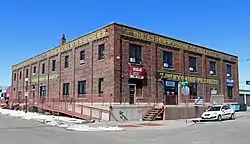 McCord-Brady Company |
October 13, 2003 (#03001028) |
1506 Thomes Ave. 41°07′51″N 104°49′05″W |
Cheyenne | |
| 35 | Lulu McCormick Junior High School |  Lulu McCormick Junior High School |
August 22, 2005 (#05000699) |
2001 Capitol Ave. 41°08′13″N 104°49′01″W |
Cheyenne | |
| 36 | McDonald Ranch | May 14, 1987 (#87000777) |
14 miles southwest of Chugwater on the southern side of the Laramie County line 41°39′17″N 105°02′03″W |
Chugwater | ||
| 37 | Moore Haven Heights Historic District |  Moore Haven Heights Historic District |
January 8, 2009 (#08001305) |
Between Bent Ave. on the west, the eastern side of Central Ave. on the east, W. 8th Ave. on the north, and W. Pershing Boulevard on the south 41°08′58″N 104°49′31″W |
Cheyenne | |
| 38 | Mt. Sinai Synagogue | September 5, 2017 (#100001575) |
2610 Pioneer Ave. 41°08′27″N 104°49′25″W |
Cheyenne | ||
| 39 | Nagle Warren Mansion |  Nagle Warren Mansion |
July 12, 1976 (#76001955) |
222 E. 17th St. 41°08′06″N 104°48′44″W |
Cheyenne | |
| 40 | Park Addition School |  Park Addition School |
August 22, 2005 (#05000703) |
1100 Richardson Court 41°08′34″N 104°49′59″W |
Cheyenne | |
| 41 | Pine Bluffs High School | Pine Bluffs High School |
March 21, 1996 (#96000228) |
Junction of 7th and Elm Sts. 41°10′42″N 104°03′59″W |
Pine Bluffs | |
| 42 | Rainsford Historic District |  Rainsford Historic District |
November 6, 1984 (#84003884) |
Roughly bounded by Morrie, 22nd, Warren, and 17th Sts. 41°08′20″N 104°48′38″W |
Cheyenne | |
| 43 | Remount Ranch | 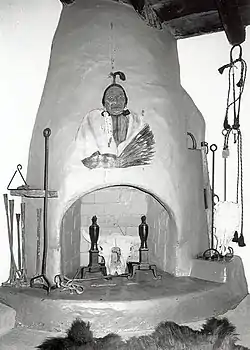 Remount Ranch |
September 19, 1990 (#90001389) |
Remount Ranch Rd., 1 mile south of U.S. Route 80 41°05′24″N 105°14′30″W |
Cheyenne | |
| 44 | St. Mark's Episcopal Church |  St. Mark's Episcopal Church |
February 26, 1970 (#70000673) |
1908 Central Ave. 41°08′09″N 104°48′57″W |
Cheyenne | |
| 45 | St. Mary's Catholic Cathedral |  St. Mary's Catholic Cathedral |
November 20, 1974 (#74002026) |
2107 Capitol Ave. 41°08′15″N 104°49′03″W |
Cheyenne | |
| 46 | Storey Gymnasium | Storey Gymnasium |
August 22, 2005 (#05000707) |
2811 House Ave. 41°08′43″N 104°49′05″W |
Cheyenne | |
| 47 | William Sturgis House |  William Sturgis House |
November 8, 1982 (#82001833) |
821 E. 17th St. 41°08′14″N 104°48′20″W |
Cheyenne | |
| 48 | Texas Oil Company | 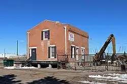 Texas Oil Company |
October 13, 2003 (#03001025) |
1122 W. 23rd St. 41°08′06″N 104°49′46″W |
Cheyenne | |
| 49 | United States Post Office and Court House | 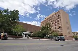 United States Post Office and Court House |
June 5, 2017 (#100001052) |
2120 Capitol Ave. 41°08′15″N 104°49′07″W |
Cheyenne | Now called the Joseph C. O'Mahoney Federal Center |
| 50 | Union Pacific Railroad Depot | .jpg.webp) Union Pacific Railroad Depot |
January 29, 1973 (#73001934) |
121 W. 15th St. 41°08′01″N 104°48′51″W |
Cheyenne | |
| 51 | Union Pacific Roundhouse, Turntable and Machine Shop | 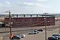 Union Pacific Roundhouse, Turntable and Machine Shop |
July 24, 1992 (#92000930) |
121 W. 15th St. 41°07′47″N 104°48′51″W |
Cheyenne | |
| 52 | Van Tassell Carriage Barn |  Van Tassell Carriage Barn |
September 13, 1978 (#78002829) |
1010 E. 16th St. 41°08′17″N 104°48′11″W |
Cheyenne | |
| 53 | Whipple-Lacey House | 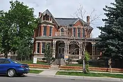 Whipple-Lacey House |
May 15, 1980 (#80004050) |
300 E. 17th St. 41°08′06″N 104°48′43″W |
Cheyenne | |
| 54 | Wyoming Fuel Company |  Wyoming Fuel Company |
October 13, 2003 (#03001029) |
720 W. 18th St. 41°07′57″N 104°49′21″W |
Cheyenne | |
| 55 | Wyoming State Capitol and Grounds | 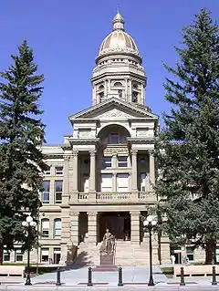 Wyoming State Capitol and Grounds |
January 29, 1973 (#73001935) |
24th St. and Capitol Ave. 41°08′25″N 104°49′11″W |
Cheyenne |
Former listings
| [3] | Name on the Register | Image | Date listed | Date removed | Location | City or town | Summary |
|---|---|---|---|---|---|---|---|
| 1 | Corlett School | August 22, 2005 (#05000702) | December 1, 2015 | 600 W. 22nd St. 41°08′12″N 104°49′25″W |
Cheyenne |
See also
| Wikimedia Commons has media related to National Register of Historic Places in Laramie County, Wyoming. |
References
- The latitude and longitude information provided in this table was derived originally from the National Register Information System, which has been found to be fairly accurate for about 99% of listings. Some locations in this table may have been corrected to current GPS standards.
- "National Register of Historic Places: Weekly List Actions". National Park Service, United States Department of the Interior. Retrieved on February 5, 2021.
- Numbers represent an alphabetical ordering by significant words. Various colorings, defined here, differentiate National Historic Landmarks and historic districts from other NRHP buildings, structures, sites or objects.
- The eight-digit number below each date is the number assigned to each location in the National Register Information System database, which can be viewed by clicking the number.
| Topics | |
|---|---|
| Lists by state |
|
| Lists by insular areas | |
| Lists by associated state | |
| Other areas | |
| Related | |
| |
Municipalities and communities of Laramie County, Wyoming, United States | ||
|---|---|---|
| City | | |
| Towns | ||
| CDPs | ||
| Unincorporated communities | ||
| ||
This article is issued from Wikipedia. The text is licensed under Creative Commons - Attribution - Sharealike. Additional terms may apply for the media files.