National Register of Historic Places listings in Weston County, Wyoming
This is a list of the National Register of Historic Places listings in Weston County, Wyoming. It is intended to be a complete list of the properties and districts on the National Register of Historic Places in Weston County, Wyoming, United States. The locations of National Register properties and districts for which the latitude and longitude coordinates are included below, may be seen in a map.[1]
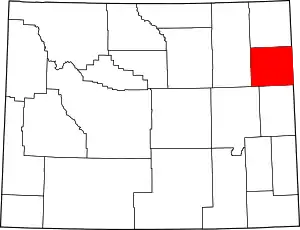
Location of Weston County in Wyoming
There are 6 properties listed on the National Register in the county.
- This National Park Service list is complete through NPS recent listings posted February 5, 2021.[2]
| Albany - Big Horn - Campbell - Carbon - Converse - Crook - Fremont - Goshen - Hot Springs - Johnson - Laramie - Lincoln - Natrona - Niobrara - Park - Platte - Sheridan - Sublette - Sweetwater - Teton - Uinta - Washakie - Weston |
Current listings
| [3] | Name on the Register | Image | Date listed[4] | Location | City or town | Description |
|---|---|---|---|---|---|---|
| 1 | Cambria Casino | 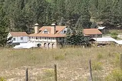 Cambria Casino |
November 18, 1980 (#80004058) |
North of Newcastle 43°57′20″N 104°11′35″W |
Newcastle | |
| 2 | Jenney Stockade Site |  Jenney Stockade Site |
September 30, 1969 (#69000198) |
Off U.S. Route 16 43°48′37″N 104°06′48″W |
Newcastle | |
| 3 | Newcastle Commercial District | 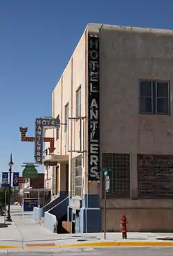 Newcastle Commercial District |
April 21, 2009 (#08001061) |
Bounded by Burlington Northern & Sante Fe Railroad tracks and West Main Street 43°51′15″N 104°12′21″W |
Newcastle | |
| 4 | US Post Office-Newcastle Main | 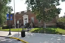 US Post Office-Newcastle Main |
May 19, 1987 (#87000791) |
West Main Street and Sumner Avenue 43°51′19″N 104°12′08″W |
Newcastle | |
| 5 | Weston County Courthouse | 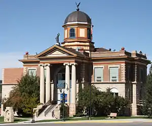 Weston County Courthouse |
September 1, 2001 (#01000930) |
1 West Main Street 43°51′28″N 104°12′09″W |
Newcastle | |
| 6 | Wyoming Army National Guard Cavalry Stable | 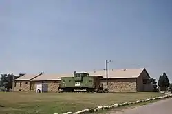 Wyoming Army National Guard Cavalry Stable |
July 7, 1994 (#94000680) |
401 Delaware Street 43°50′57″N 104°11′33″W |
Newcastle |
Former listing
| [3] | Name on the Register | Image | Date listed | Date removed | Location | City or town | Summary |
|---|---|---|---|---|---|---|---|
| 1 | Toomey's Mills | November 13, 2008 (#08001062) | December 11, 2013 | 500 West Main Street 43°51′12″N 104°12′29″W |
Newcastle |
See also
| Wikimedia Commons has media related to National Register of Historic Places in Weston County, Wyoming. |
References
- The latitude and longitude information provided in this table was derived originally from the National Register Information System, which has been found to be fairly accurate for about 99% of listings. Some locations in this table may have been corrected to current GPS standards.
- "National Register of Historic Places: Weekly List Actions". National Park Service, United States Department of the Interior. Retrieved on February 5, 2021.
- Numbers represent an alphabetical ordering by significant words. Various colorings, defined here, differentiate National Historic Landmarks and historic districts from other NRHP buildings, structures, sites or objects.
- The eight-digit number below each date is the number assigned to each location in the National Register Information System database, which can be viewed by clicking the number.
| Topics | |
|---|---|
| Lists by state |
|
| Lists by insular areas | |
| Lists by associated state | |
| Other areas | |
| Related | |
| |
Municipalities and communities of Weston County, Wyoming, United States | ||
|---|---|---|
| City | | |
| Town | ||
| CDPs | ||
| Unincorporated communities | ||
| Ghost towns | ||
| ||
This article is issued from Wikipedia. The text is licensed under Creative Commons - Attribution - Sharealike. Additional terms may apply for the media files.