Payaswini
The Payaswini or Chandragiri River, is the largest river in Kasaragod district, Kerala, India. It was named after the great Mauryan king Chandragupta Maurya.[2][3][4]
| Payaswini River Chandragiri River | |
|---|---|
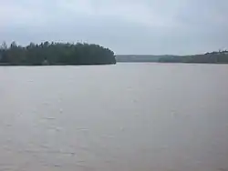 A view of the Payaswini river from Pulikunnu, Kasaragod | |
| Etymology | Chandragupta Maurya[1] |
| Location | |
| Country | India |
| State | Karnataka, Kerala |
| District | Coorg, Dakshina Kannada, Kasaragod |
| Cities | Sullia, Jalsoor, Chengala , Kasaragod |
| Physical characteristics | |
| Source | Talakaveri Wildlife Sanctuary, Karnataka |
| • location | Kodagu District, India |
| Mouth | |
• location | Arabian Sea near Thalangara, Kasaragod, India |
• elevation | 0 m (0 ft) |
| Length | 105 km (65 mi) |
| Discharge | |
| • location | mouth |
| Basin features | |
| Tributaries | |
| • left | Kudumbur River |
The 17th century Chandragiri Fort is located on the river.
The river is considered the traditional boundary between the Tulu Nadu and Malayalam regions of Kerala from the fourteenth century AD onwards; before that it was north of Kumbala. [5] The river originates in the Talakaveri Wildlife Sanctuary in the Western Ghats of Kodagu district, Karnataka. It flows through towns including Sullia, Jalsoor, Parappa, Chengala, and Kasaragod, where it flows into the Arabian Sea. In Sullia taluk, it is the major water source for domestic and agricultural purposes.
Tributaries
The Payaswini's largest tributary is the Kudumbur River, which joins the Payaswini on its left bank east of Chattanchal.[6]
References
- "Kasaragod Rivers". www.keralatourism.org. Retrieved 23 January 2021.
- "District Census Handbook - Kodagu District 2011" (PDF). Directorate of Census Operations-Karnataka. 1 October 2011. Retrieved 22 January 2021.
- "District Census Handbook - Dakshina Kannada District 2011" (PDF). Directorate of Census Operations-Karnataka. 1 October 2011. Retrieved 22 January 2021.
- "District Census Handbook - Kasaragod District 2011" (PDF). Directorate of Census Operations-Kerala. 1 October 2011. Retrieved 22 January 2021.
- Bhatt, P. Gururaja (1969). Antiquities of South Kanara. Prabhakara Press. p. 2.
- "Draft Map" (PDF). keralaczma.gov.in. 2012. Retrieved 22 January 2021.
| Wikimedia Commons has media related to Chandragiri River. |
| Rivers |
| ||||
|---|---|---|---|---|---|
| Lakes, dams and reservoirs | |||||
| Waterfalls | |||||
| Beaches | |||||
| Boats |
| ||||
| Related topics | |||||
| Hydrography of surrounding areas |
| ||||
