Warren County, Tennessee
Warren County is a county located on the Cumberland Plateau in Middle Tennessee, one of the three Grand Divisions of the U.S. state of Tennessee. As of the 2010 census, the population was 39,839.[2] Its county seat is McMinnville.[3]
Warren County | |
|---|---|
 Warren County Courthouse in McMinnville | |
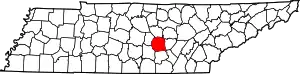 Location within the U.S. state of Tennessee | |
 Tennessee's location within the U.S. | |
| Coordinates: 35°41′N 85°47′W | |
| Country | |
| State | |
| Founded | 1807 |
| Named for | Joseph Warren[1] |
| Seat | McMinnville |
| Largest city | McMinnville |
| Area | |
| • Total | 434 sq mi (1,120 km2) |
| • Land | 433 sq mi (1,120 km2) |
| • Water | 14 sq mi (40 km2) 3%% |
| Population | |
| • Estimate (2018) | 40,878 |
| • Density | 92/sq mi (36/km2) |
| Time zone | UTC−6 (Central) |
| • Summer (DST) | UTC−5 (CDT) |
| Congressional district | 4th |
| Website | www |
Warren County comprises the McMinnville, TN Micropolitan Statistical Area.
History
Warren County was created in 1807 from a portion of White County, and named for Joseph Warren (1741–1775), a soldier in the American Revolution.[1] The revised Tennessee State Constitution of 1834 stated that no new county could be within 12 miles (19 km) of the county seat of the county from which it was formed. The boundaries of five counties formed from Warren— Grundy, Van Buren, Cannon, Coffee and DeKalb— were exactly 12 miles from Warren's county seat, McMinnville, giving the county its distinctive round shape.[1] Warren County was the site of several saltpeter mines. Saltpeter is the main ingredient of gunpowder and was obtained by leaching the earth from several local caves. Hubbards Cave, near Camp Woodlee, was a major operation. Henshaw Cave on Cardwell Mountain (now part of Cumberland Caverns) and Solomon Saltpeter Cave on Ben Lomond Mountain were relatively small mining operations. Most saltpeter mining occurred during the War of 1812 and in the Civil War.[4]
The county was largely developed for farming of such crops as tobacco and hemp. While numerous families held enslaved African Americans as workers, they were a minority of the population. Warren County citizens voted to secede from the Union before the American Civil War in February 1861 in a state referendum. Voters in Tennessee overall decided to remain in the Union in that time. But when President Abraham Lincoln demanded that Tennessee provide troops to fight against the Southern states in April 1861, this was viewed as a violation of Article 3, Section 3 of the U.S. Constitution. At a new referendum in June 1861, Warren County, along with a majority of Tennessee's counties, voted for secession. Unlike in some states, slavery was not listed as one of the reasons in Tennessee's secession proclamation.[5]
Men from Warren County and surrounding upper Cumberland region formed and served in many units in Tennessee's defense, including the 16th Tennessee Infantry led by McMinnville resident Col. John Houston Savage. The Confederate monument next to the county courthouse is dedicated in the memory of the men who served and died in the 16th and lists their names.
Men from Warren County and upper Cumberland area joined the 16th TN Infantry Regiment, among others. This is the flag of the 16th H Company. The flag is held in the Texas 'Civil War' Museum in Fort Worth TX.[6]
Geography

According to the U.S. Census Bureau, the county has a total area of 434 square miles (1,120 km2), of which 433 square miles (1,120 km2) is land and 1.4 square miles (3.6 km2) (0.3%) is water.[7] The county lies long the Eastern Highland Rim, near the Cumberland Plateau.
The Caney Fork forms part of the county's borders with White and DeKalb counties to the north. The Rocky River, a tributary of the Caney Fork, forms part of the county's eastern border with Van Buren County. The Collins River, also a tributary of the Caney Fork, flows through the county, and the Barren Fork, a tributary of the Collins, flows through McMinnville.
Cardwell Mountain is an imposing natural feature located five miles due east of McMinnville. It is an erosional remnant of the nearby Cumberland Plateau. Cardwell Mountain is noted for Cumberland Caverns, an exceptionally long cave which lies underneath the mountain.
Adjacent counties
- DeKalb County (north)
- White County (northeast)
- Van Buren County (east)
- Sequatchie County (southeast)
- Grundy County (south)
- Coffee County (southwest)
- Cannon County (northwest)
Major highways
State protected areas
- Hubbard's Cave State Natural Area
- Morrison Meadow State Natural Area
- Rock Island State Park (part)
Demographics
| Historical population | |||
|---|---|---|---|
| Census | Pop. | %± | |
| 1810 | 5,725 | — | |
| 1820 | 10,348 | 80.8% | |
| 1830 | 15,210 | 47.0% | |
| 1840 | 10,803 | −29.0% | |
| 1850 | 10,179 | −5.8% | |
| 1860 | 11,147 | 9.5% | |
| 1870 | 12,714 | 14.1% | |
| 1880 | 14,079 | 10.7% | |
| 1890 | 14,413 | 2.4% | |
| 1900 | 16,410 | 13.9% | |
| 1910 | 16,534 | 0.8% | |
| 1920 | 17,306 | 4.7% | |
| 1930 | 20,209 | 16.8% | |
| 1940 | 19,764 | −2.2% | |
| 1950 | 22,271 | 12.7% | |
| 1960 | 23,102 | 3.7% | |
| 1970 | 26,972 | 16.8% | |
| 1980 | 32,653 | 21.1% | |
| 1990 | 32,992 | 1.0% | |
| 2000 | 38,276 | 16.0% | |
| 2010 | 39,839 | 4.1% | |
| 2018 (est.) | 40,878 | [8] | 2.6% |
| U.S. Decennial Census[9] 1790-1960[10] 1900-1990[11] 1990-2000[12] 2010-2014[2] | |||

As of the census[14] of 2000, there were 38,276 people, 15,181 households, and 10,824 families residing in the county. The population density was 88 people per square mile (34/km2). There were 16,689 housing units at an average density of 39 per square mile (15/km2). The racial makeup of the county was 91.66% White, 3.16% Black or African American, 0.21% Native American, 0.42% Asian, 0.05% Pacific Islander, 3.56% from other races, and 0.94% from two or more races. 4.92% of the population were Hispanic or Latino of any race.
There were 15,181 households, out of which 31.90% had children under the age of 18 living with them, 56.20% were married couples living together, 11.20% had a female householder with no husband present, and 28.70% were non-families. 25.00% of all households were made up of individuals, and 10.50% had someone living alone who was 65 years of age or older. The average household size was 2.47 and the average family size was 2.93.
In the county, the population was spread out, with 24.20% under the age of 18, 9.10% from 18 to 24, 29.40% from 25 to 44, 23.40% from 45 to 64, and 13.90% who were 65 years of age or older. The median age was 37 years. For every 100 females there were 96.50 males. For every 100 females age 18 and over, there were 94.70 males.
The median income for a household in the county was $30,920, and the median income for a family was $37,835. Males had a median income of $28,409 versus $20,863 for females. The per capita income for the county was $15,759. About 13.00% of families and 16.60% of the population were below the poverty line, including 20.40% of those under age 18 and 17.20% of those age 65 or over.
Recreation
Rock Island State Park is located on the northeastern border with White County. This park is the site of the Tennessee Valley Authority's Great Falls Dam, includes many hiking trails, and offers whitewater rafting.
Cumberland Caverns, located east of McMinnville under Cardwell Mountain, is Tennessee's largest show cave. It is the second longest mapped cave in Tennessee with 27.6 miles (44.4 km) of passages, and displays some of the largest cave rooms in eastern North America.[15] Cumberland Caverns is the 15th longest cave in the United States.[16]
Hubbard's Cave, the largest gray bat hibernaculum in Tennessee, with over 100,000 bats, is located in the county. The cave is owned by the Nature Conservancy and it is securely gated to protect the bats, which are an Endangered Species.
Falcon Rest, an 1896 Victorian mansion in McMinnville built by local manufacturer Clay Faulkner, is listed on the National Register of Historic Places (NRHP). It is open to the public as a historic house museum.[17] His father's mansion in the same city, Falconhurst, is also on the NRHP.
Communities

City
- McMinnville (county seat)
Towns
Unincorporated communities
- Bethany
- Campaign
- Daylight
- Dibrell
- Eastside
- Fairview
- Harrison Ferry
- Irving College
- Jacksboro
- Lucky
- Newtown
- Rock Island
- Smartt
- Vervilla
- Wayside
Politics
| Year | Republican | Democratic | Third Parties |
|---|---|---|---|
| 2020 | 74.0% 11,850 | 24.5% 3,924 | 1.5% 235 |
| 2016 | 70.1% 9,540 | 26.0% 3,535 | 3.9% 537 |
| 2012 | 61.5% 8,010 | 36.5% 4,752 | 1.9% 253 |
| 2008 | 59.5% 8,562 | 38.3% 5,515 | 2.2% 323 |
| 2004 | 52.1% 7,503 | 47.3% 6,808 | 0.6% 89 |
| 2000 | 42.3% 5,552 | 56.2% 7,378 | 1.5% 201 |
| 1996 | 36.3% 4,226 | 54.9% 6,389 | 8.8% 1,018 |
| 1992 | 30.0% 3,704 | 58.2% 7,189 | 11.8% 1,462 |
| 1988 | 49.1% 4,529 | 50.4% 4,646 | 0.5% 43 |
| 1984 | 49.6% 4,811 | 49.7% 4,813 | 0.7% 67 |
| 1980 | 37.2% 3,680 | 60.8% 6,021 | 2.1% 203 |
| 1976 | 25.9% 2,364 | 73.1% 6,666 | 0.9% 85 |
| 1972 | 60.5% 3,565 | 35.9% 2,118 | 3.6% 211 |
| 1968 | 24.1% 1,858 | 26.5% 2,046 | 49.4% 3,814 |
| 1964 | 25.9% 1,754 | 74.1% 5,027 | |
| 1960 | 45.9% 2,682 | 53.4% 3,119 | 0.7% 40 |
| 1956 | 32.6% 1,954 | 66.9% 4,014 | 0.5% 30 |
| 1952 | 34.7% 1,912 | 64.7% 3,568 | 0.6% 33 |
| 1948 | 18.1% 807 | 66.5% 2,969 | 15.4% 688 |
| 1944 | 24.7% 848 | 74.7% 2,560 | 0.6% 21 |
| 1940 | 18.9% 546 | 80.5% 2,323 | 0.6% 18 |
| 1936 | 19.3% 553 | 80.3% 2,304 | 0.5% 13 |
| 1932 | 14.8% 410 | 84.1% 2,325 | 1.1% 30 |
| 1928 | 45.2% 923 | 54.4% 1,111 | 0.4% 9 |
| 1924 | 26.2% 490 | 72.4% 1,356 | 1.5% 28 |
| 1920 | 33.5% 1,010 | 65.9% 1,986 | 0.5% 16 |
| 1916 | 25.0% 624 | 74.3% 1,855 | 0.8% 19 |
| 1912 | 14.4% 339 | 74.3% 1,745 | 11.3% 266 |
References
- James Dillon, "Warren County," Tennessee Encyclopedia of History and Culture. Retrieved: 23 April 2013.
- "State & County QuickFacts". United States Census Bureau. Retrieved December 7, 2013.
- "Find a County". National Association of Counties. Retrieved 2011-06-07.
- Thomas C. Barr, Jr., "Caves of Tennessee", Bulletin 64 of the Tennessee Division of Geology, 1961, 568 pages.
- "Ordinances of Secession". Retrieved 2017-03-04.
- "2010 Census Gazetteer Files". United States Census Bureau. August 22, 2012. Retrieved April 14, 2015.
- "Population and Housing Unit Estimates". Retrieved July 20, 2019.
- "U.S. Decennial Census". United States Census Bureau. Retrieved April 14, 2015.
- "Historical Census Browser". University of Virginia Library. Retrieved April 14, 2015.
- Forstall, Richard L., ed. (March 27, 1995). "Population of Counties by Decennial Census: 1900 to 1990". United States Census Bureau. Retrieved April 14, 2015.
- "Census 2000 PHC-T-4. Ranking Tables for Counties: 1990 and 2000" (PDF). United States Census Bureau. April 2, 2001. Retrieved April 14, 2015.
- Based on 2000 census data
- "U.S. Census website". United States Census Bureau. Retrieved 2011-05-14.
- "Cumberland Caverns" by Larry E. Matthews, Second Edition, 2005, ISBN 978-0-9663547-2-0
- USA Long Cave List, October 19, 2010, by Bob Gulden.
- Falcon Rest official site. Retrieved: 23 April 2013.
- Leip, David. "Dave Leip's Atlas of U.S. Presidential Elections". uselectionatlas.org. Retrieved 2018-03-12.
External links
| Wikimedia Commons has media related to Warren County, Tennessee. |
- Warren County Government
- Warren County Chamber of Commerce
- Warren County Historical Markers
- Warren County TNGenWeb
- Warren County at Curlie
Places adjacent to Warren County, Tennessee | ||||||||||
|---|---|---|---|---|---|---|---|---|---|---|
| ||||||||||
Municipalities and communities of Warren County, Tennessee, United States | ||
|---|---|---|
| City | ||
| Towns | ||
| Unincorporated communities | ||
| ||

| Authority control |
|---|