Weakley County, Tennessee
Weakley County is a county located in the northwest of the U.S. state of Tennessee. As of the 2010 census, the population was 35,021.[2] Its county seat is Dresden,[3] and its largest city is Martin, the home of the University of Tennessee at Martin. The county was established by the Tennessee General Assembly on October 21, 1823, and is named for U. S. Congressman Robert Weakley (1764–1845).
Weakley County | |
|---|---|
 Weakley County Courthouse in Dresden | |
 Seal | |
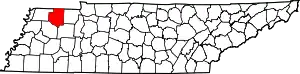 Location within the U.S. state of Tennessee | |
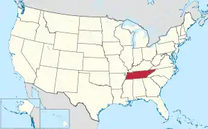 Tennessee's location within the U.S. | |
| Coordinates: 36°17′N 88°43′W | |
| Country | |
| State | |
| Founded | October 21, 1823 |
| Named for | Robert Weakley[1] |
| Seat | Dresden |
| Largest city | Martin |
| Area | |
| • Total | 582 sq mi (1,510 km2) |
| • Land | 580 sq mi (1,500 km2) |
| • Water | 1.4 sq mi (4 km2) 0.2%% |
| Population | |
| • Estimate (2018) | 33,415 |
| • Density | 60/sq mi (20/km2) |
| Time zone | UTC−6 (Central) |
| • Summer (DST) | UTC−5 (CDT) |
| Congressional district | 8th |
| Website | www |
Weakley County comprises the Martin, TN Micropolitan Statistical Area.
History
Weakley County was created in October 1823 from some of the land that the Chickasaw ceded to the United States in the Treaty of 1818. The county was named after Colonel Robert Weakley, a member of the House of Representatives, a speaker of the State Senate, and the man commissioned to treat with the Chickasaw.[4]
The county was the state's largest corn producer during the 19th century. By the latter half of the 20th century, soybeans became the county's leading crop.[1]
Geography
According to the U.S. Census Bureau, the county has a total area of 582 square miles (1,510 km2), of which 580 square miles (1,500 km2) is land and 1.4 square miles (3.6 km2) (0.2%) is water.[5] The North Fork of the Obion River flows through the northern half of the county, the Middle Fork flows across the central portion of the county, and the South Fork flows across the southern part of the county. The Obion is a tributary of the Mississippi River.
Adjacent counties
- Hickman County, Kentucky (northwest)
- Graves County, Kentucky (north)
- Henry County (east)
- Carroll County (southeast)
- Gibson County (southwest)
- Obion County (west)
State protected areas
- Bean Switch Refuge
- Big Cypress Tree State Natural Area
- Big Cypress Tree State Park
- Harts Mill Wetland Wildlife Management Area (part)
- Obion River Wildlife Management Area (part)
Demographics
| Historical population | |||
|---|---|---|---|
| Census | Pop. | %± | |
| 1830 | 4,797 | — | |
| 1840 | 9,870 | 105.8% | |
| 1850 | 14,608 | 48.0% | |
| 1860 | 18,216 | 24.7% | |
| 1870 | 20,755 | 13.9% | |
| 1880 | 24,538 | 18.2% | |
| 1890 | 28,955 | 18.0% | |
| 1900 | 32,546 | 12.4% | |
| 1910 | 31,929 | −1.9% | |
| 1920 | 31,053 | −2.7% | |
| 1930 | 29,262 | −5.8% | |
| 1940 | 29,498 | 0.8% | |
| 1950 | 27,962 | −5.2% | |
| 1960 | 24,227 | −13.4% | |
| 1970 | 28,827 | 19.0% | |
| 1980 | 32,896 | 14.1% | |
| 1990 | 31,972 | −2.8% | |
| 2000 | 34,895 | 9.1% | |
| 2010 | 35,021 | 0.4% | |
| 2018 (est.) | 33,415 | [6] | −4.6% |
| U.S. Decennial Census[7] 1790-1960[8] 1900-1990[9] 1990-2000[10] 2010-2014[2] | |||

As of the census[12] of 2000, there were 34,895 people, 13,599 households, and 9,124 families residing in the county. The population density was 60 people per square mile (23/km2). There were 14,928 housing units at an average density of 26 per square mile (10/km2). The racial makeup of the county was 90.27% White, 6.95% Black or African American, 0.15% Native American, 1.32% Asian, 0.01% Pacific Islander, 0.52% from other races, and 0.78% from two or more races. 1.15% of the population were Hispanic or Latino of any race.
There were 13,599 households, out of which 29.40% had children under the age of 18 living with them, 54.20% were married couples living together, 9.50% had a female householder with no husband present, and 32.90% were non-families. 27.00% of all households were made up of individuals, and 11.50% had someone living alone who was 65 years of age or older. The average household size was 2.38 and the average family size was 2.89.
The population was spread out, with 21.60% under the age of 18, 15.90% from 18 to 24, 26.10% from 25 to 44, 21.90% from 45 to 64, and 14.50% who were 65 years of age or older. The median age was 35 years. For every 100 females there were 94.20 males. For every 100 females age 18 and over, there were 91.10 males.
The median income for a household in the county was $30,008, and the median income for a family was $38,658. Males had a median income of $28,597 versus $20,845 for females. The per capita income for the county was $15,408. About 11.10% of families and 16.00% of the population were below the poverty line, including 16.80% of those under age 18 and 16.20% of those age 65 or over.
Media
Radio
- WWGY 99.3 "Today's Best Music with "Ace & TJ in the Morning"
- WRQR-FM 105.5 "Today's Best Music with "Ace & TJ in the Morning"
- WENK-AM 1240 "The Greatest Hits of All Time"
- WTPR-AM 710 "The Greatest Hits of All Time"
- WTPR-FM 101.7 "The Greatest Hits of All Time"
- WCMT-AM 1410 100.5FM
- WCMT-FM 101.3
- WUTM-FM 90.3
- (WCDZ FM 95.1 and 102.9FM)
- WCMT-AM 1410 "your best friend"
Education
Weakley County Schools
School District website - http://www.weakleyschools.com/
| School Name | Team Mascot | School Colors | School Website |
|---|---|---|---|
| Dresden Elementary School | Lions | Black, Gold | http://www.des.weakleyschools.com/ |
| Dresden Middle School | Lions | Black/Gold | http://www.dms.weakleyschools.com/ |
| Dresden High School | Lions | Black/Gold | http://www.dhs.weakleyschools.com/ |
| Gleason School | Bulldogs | Orange/Black | http://www.gls.weakleyschools.com/cms/One.aspx |
| Greenfield School | Yellowjackets | Black/Orange | http://www.grs.weakleyschools.com/ |
| Martin Elementary School | Chargers | Blue/White | http://www.mes.weakleyschools.com/ |
| Martin Middle School | Chargers | Blue/White | http://www.mms.weakleyschools.com/ |
| Martin Primary School | N/A | Blue/Yellow | http://www.mps.weakleyschools.com/ |
| Sharon School | Eagles | Purple/Yellow | http://www.ss.weakleyschools.com/ |
| Westview High School | Chargers | Royal Blue/Yellow Gold | http://www.whs.weakleyschools.com/ |
Communities

Cities
- Greenfield
- Martin
- McKenzie (mostly in Carroll County and a small portion in Henry County)
Unincorporated communities
- Dukedom (partial)
- Gardner
- Latham
- Palmersville
- Pillowville
- Sidonia
Politics
| Year | Republican | Democratic | Third Parties |
|---|---|---|---|
| 2020 | 75.7% 10,396 | 22.0% 3,020 | 2.3% 319 |
| 2016 | 73.9% 9,008 | 22.8% 2,772 | 3.3% 404 |
| 2012 | 69.8% 8,605 | 28.8% 3,548 | 1.5% 184 |
| 2008 | 64.7% 8,855 | 33.6% 4,596 | 1.8% 239 |
| 2004 | 57.9% 7,817 | 41.4% 5,588 | 0.7% 91 |
| 2000 | 51.6% 6,106 | 47.0% 5,570 | 1.4% 168 |
| 1996 | 41.2% 4,622 | 50.4% 5,657 | 8.3% 936 |
| 1992 | 40.4% 4,800 | 48.0% 5,691 | 11.6% 1,378 |
| 1988 | 57.1% 5,701 | 42.4% 4,239 | 0.5% 49 |
| 1984 | 57.4% 6,480 | 42.1% 4,752 | 0.5% 55 |
| 1980 | 48.2% 5,668 | 50.2% 5,910 | 1.6% 193 |
| 1976 | 29.7% 2,875 | 68.1% 6,605 | 2.2% 216 |
| 1972 | 71.5% 5,836 | 24.8% 2,027 | 3.7% 302 |
| 1968 | 30.5% 2,858 | 21.2% 1,988 | 48.3% 4,525 |
| 1964 | 34.2% 2,684 | 65.8% 5,161 | |
| 1960 | 43.7% 3,543 | 55.4% 4,488 | 1.0% 78 |
| 1956 | 36.2% 2,720 | 62.8% 4,717 | 1.0% 73 |
| 1952 | 41.8% 3,043 | 57.7% 4,198 | 0.5% 34 |
| 1948 | 27.1% 1,310 | 64.0% 3,099 | 8.9% 432 |
| 1944 | 31.7% 1,595 | 68.2% 3,434 | 0.2% 10 |
| 1940 | 24.5% 1,139 | 74.7% 3,474 | 0.8% 35 |
| 1936 | 22.0% 928 | 77.3% 3,254 | 0.7% 30 |
| 1932 | 17.1% 783 | 82.5% 3,777 | 0.4% 17 |
| 1928 | 35.3% 1,358 | 64.8% 2,495 | |
| 1924 | 26.7% 1,154 | 72.8% 3,149 | 0.6% 24 |
| 1920 | 38.3% 2,741 | 61.3% 4,395 | 0.4% 30 |
| 1916 | 32.8% 1,768 | 67.0% 3,609 | 0.1% 6 |
| 1912 | 28.4% 1,265 | 63.0% 2,810 | 8.6% 383 |
References
- Virginia Clark Vaughan, "Weakley County," Tennessee Encyclopedia of History and Culture. Retrieved: 24 April 2013.
- "State & County QuickFacts". United States Census Bureau. Retrieved December 7, 2013.
- "Find a County". National Association of Counties. Retrieved 2011-06-07.
- "About Dresden". City of Dresden. Retrieved 4 March 2018.
- "2010 Census Gazetteer Files". United States Census Bureau. August 22, 2012. Retrieved April 14, 2015.
- "Population and Housing Unit Estimates". Retrieved July 20, 2019.
- "U.S. Decennial Census". United States Census Bureau. Retrieved April 14, 2015.
- "Historical Census Browser". University of Virginia Library. Retrieved April 14, 2015.
- Forstall, Richard L., ed. (March 27, 1995). "Population of Counties by Decennial Census: 1900 to 1990". United States Census Bureau. Retrieved April 14, 2015.
- "Census 2000 PHC-T-4. Ranking Tables for Counties: 1990 and 2000" (PDF). United States Census Bureau. April 2, 2001. Retrieved April 14, 2015.
- Based on 2000 census data
- "U.S. Census website". United States Census Bureau. Retrieved 2011-05-14.
- Dresden Enterprise official site. Retrieved: 24 April 2013.
- Leip, David. "Dave Leip's Atlas of U.S. Presidential Elections". uselectionatlas.org. Retrieved 2018-03-13.
External links
| Wikimedia Commons has media related to Weakley County, Tennessee. |
- Official site
- Weakley County Chamber of Commerce
- Weakley County Schools
- Weakley County TNGenWeb
- Weakley County at Curlie
Places adjacent to Weakley County, Tennessee | ||||||||||
|---|---|---|---|---|---|---|---|---|---|---|
| ||||||||||
Municipalities and communities of Weakley County, Tennessee, United States | ||
|---|---|---|
| Cities | Weakley County map | |
| Towns | ||
| Unincorporated communities | ||
| Footnotes | ‡This populated place also has portions in an adjacent county or counties | |
| ||

| Authority control |
|---|