Lewis County, Tennessee
Lewis County is a county located in the U.S. state of Tennessee. As of the 2010 census, the population was 12,161.[2] Its county seat is Hohenwald.[3] The county is named for explorer Meriwether Lewis, who died and was buried at Grinder's Stand near Hohenwald in 1809.
Lewis County | |
|---|---|
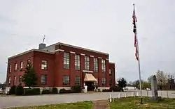 Lewis County Courthouse, April 2014 | |
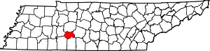 Location within the U.S. state of Tennessee | |
 Tennessee's location within the U.S. | |
| Coordinates: 35°31′N 87°29′W | |
| Country | |
| State | |
| Founded | December 23, 1843 |
| Named for | Meriwether Lewis[1] |
| Seat | Hohenwald |
| Largest city | Hohenwald |
| Area | |
| • Total | 282 sq mi (730 km2) |
| • Land | 282 sq mi (730 km2) |
| • Water | 0.4 sq mi (1 km2) 0.1%% |
| Population | |
| • Estimate (2018) | 12,086 |
| • Density | 43/sq mi (17/km2) |
| Time zone | UTC−6 (Central) |
| • Summer (DST) | UTC−5 (CDT) |
| Congressional district | 7th |
| Website | www |
History
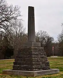
Lewis County was formed in 1843 from parts of Perry, Hickman, Lawrence, Maury and Wayne counties.[1] It was named for explorer Meriwether Lewis of the Lewis and Clark expedition.[4] Lewis's grave is located at the geographic center of the county. The bill for its creation was proposed by Powhatan Gordon in the Tennessee State Senate.[5]
On October 7, 2009, a ceremony was held at the cemetery to commemorate the bicentennial of Lewis's death. A bust of Lewis was presented to the National Park Service, which manages the site.[6]
Lewis County was the site of the Cane Creek Massacre.
Geography
According to the U.S. Census Bureau, the county has a total area of 282 square miles (730 km2), of which 282 square miles (730 km2) is land and 0.4 square miles (1.0 km2) (0.1%) is water.[7]
Adjacent counties
- Hickman County (north)
- Maury County (east)
- Lawrence County (south)
- Wayne County (southwest)
- Perry County (west)
National protected area
- Natchez Trace Parkway (part)
State protected areas
- Auntney Hollow State Natural Area
- Devil's Backbone State Natural Area
- Dry Branch State Natural Area
- Hick Hill Wildlife Management Area
- Langford Branch State Natural Area
- Laurel Hill Wildlife Management Area
- Lewis State Forest
Demographics
| Historical population | |||
|---|---|---|---|
| Census | Pop. | %± | |
| 1850 | 4,438 | — | |
| 1860 | 2,241 | −49.5% | |
| 1870 | 1,986 | −11.4% | |
| 1880 | 2,181 | 9.8% | |
| 1890 | 2,555 | 17.1% | |
| 1900 | 4,455 | 74.4% | |
| 1910 | 6,033 | 35.4% | |
| 1920 | 5,707 | −5.4% | |
| 1930 | 5,258 | −7.9% | |
| 1940 | 5,849 | 11.2% | |
| 1950 | 6,078 | 3.9% | |
| 1960 | 6,269 | 3.1% | |
| 1970 | 6,761 | 7.8% | |
| 1980 | 9,700 | 43.5% | |
| 1990 | 9,247 | −4.7% | |
| 2000 | 11,367 | 22.9% | |
| 2010 | 12,161 | 7.0% | |
| 2018 (est.) | 12,086 | [8] | −0.6% |
| U.S. Decennial Census[9] 1790-1960[10] 1900-1990[11] 1990-2000[12] 2010-2014[2] | |||

As of the census[14] of 2000, there were 11,367 people, 4,381 households, and 3,215 families residing in the county. The population density was 40 people per square mile (16/km2). There were 4,821 housing units at an average density of 17 per square mile (7/km2). The racial makeup of the county was 97.07% White, 1.45% Black or African American, 0.20% Native American, 0.18% Asian, 0.29% from other races, and 0.80% from two or more races. 1.20% of the population were Hispanic or Latino of any race.
There were 4,381 households, out of which 33.20% had children under the age of 18 living with them, 58.90% were married couples living together, 10.70% had a female householder with no husband present, and 26.60% were non-families. 23.50% of all households were made up of individuals, and 10.60% had someone living alone who was 65 years of age or older. The average household size was 2.54 and the average family size was 2.98.
In the county, the population was spread out, with 25.80% under the age of 18, 8.30% from 18 to 24, 27.40% from 25 to 44, 24.80% from 45 to 64, and 13.60% who were 65 years of age or older. The median age was 37 years. For every 100 females there were 96.90 males. For every 100 females age 18 and over, there were 91.80 males.
The median income for a household in the county was $30,444, and the median income for a family was $35,972. Males had a median income of $27,060 versus $19,847 for females. The per capita income for the county was $14,664. About 10.30% of families and 13.40% of the population were below the poverty line, including 16.60% of those under age 18 and 12.20% of those age 65 or over.
Communities
City
- Hohenwald (county seat)
Census-designated place
- Summertown (Mostly in Lawrence County)
Unincorporated communities
- Aethra
- Bachelder
- Blondy
- Buffalo Valley
- Gordonsburg
- Kimmins
- Kitchens
- Lomax Crossroads
- Metal Ford
- Napier
- Oak Grove
- Providence
- Riverside
- Ruppertown
- Salem
- Shubert
- Sweetwater
- Theodore
- Voorhies
- West Hohenwald
Politics
| Year | Republican | Democratic | Third Parties |
|---|---|---|---|
| 2020 | 79.8% 4,474 | 19.1% 1,072 | 1.1% 63 |
| 2016 | 77.6% 3,585 | 19.3% 890 | 3.2% 147 |
| 2012 | 66.4% 3,117 | 30.8% 1,447 | 2.8% 130 |
| 2008 | 61.1% 2,951 | 37.3% 1,804 | 1.6% 79 |
| 2004 | 55.8% 2,819 | 43.4% 2,192 | 0.9% 43 |
| 2000 | 46.1% 2,037 | 51.6% 2,281 | 2.3% 102 |
| 1996 | 36.1% 1,298 | 54.8% 1,971 | 9.1% 329 |
| 1992 | 29.3% 1,218 | 60.0% 2,491 | 10.7% 443 |
| 1988 | 48.0% 1,324 | 51.4% 1,419 | 0.7% 18 |
| 1984 | 52.4% 1,733 | 47.1% 1,556 | 0.5% 17 |
| 1980 | 32.5% 1,076 | 66.2% 2,190 | 1.3% 43 |
| 1976 | 20.3% 617 | 78.8% 2,391 | 0.9% 28 |
| 1972 | 47.0% 1,056 | 50.6% 1,138 | 2.4% 54 |
| 1968 | 17.9% 455 | 42.8% 1,088 | 39.3% 997 |
| 1964 | 15.8% 388 | 84.2% 2,061 | |
| 1960 | 25.1% 580 | 74.5% 1,723 | 0.4% 9 |
| 1956 | 28.2% 522 | 71.3% 1,321 | 0.6% 11 |
| 1952 | 29.1% 540 | 70.4% 1,308 | 0.6% 11 |
| 1948 | 23.3% 381 | 70.2% 1,148 | 6.5% 107 |
| 1944 | 20.9% 252 | 79.1% 955 | |
| 1940 | 21.5% 368 | 78.3% 1,343 | 0.3% 5 |
| 1936 | 23.7% 331 | 76.3% 1,068 | |
| 1932 | 14.6% 137 | 85.4% 799 | |
| 1928 | 39.4% 269 | 60.6% 414 | |
| 1924 | 36.3% 191 | 58.9% 310 | 4.8% 25 |
| 1920 | 52.3% 446 | 47.3% 403 | 0.5% 4 |
| 1916 | 51.3% 414 | 48.0% 387 | 0.7% 6 |
| 1912 | 19.5% 126 | 57.3% 370 | 23.2% 150 |
Historically, like all of secessionist Middle Tennessee, Lewis County was overwhelmingly Democratic. Although it did vote for Charles Evans Hughes in 1916 and Warren G. Harding in 1920, Lewis County would be firmly Democratic for the next six decades, being one of only two Tennessee counties to remain loyal to both Hubert Humphrey in 1968 and George McGovern in 1972. Ronald Reagan broke this Democratic sequence with a 177-vote majority over Walter Mondale in his 1984 landslide, but Lewis County would subsequently remain Democratic up to 2000. Since then, however, like all of the rural white South, it has become overwhelmingly Republican due to opposition to the Democratic Party's liberal views on social issues.[16]
Education
The county is served by Lewis County High School.
References
- Marjorie Graves, "Lewis County," Tennessee Encyclopedia of History and Culture. Retrieved: 21 October 2013.
- "State & County QuickFacts". United States Census Bureau. Archived from the original on June 7, 2011. Retrieved December 3, 2013.
- "Find a County". National Association of Counties. Retrieved 2011-06-07.
- Gannett, Henry (1905). The Origin of Certain Place Names in the United States. U.S. Government Printing Office. p. 185.
- White, John A. (June 26, 1910). "Lewis. Awful Tragedy Connected With Name of the County". The Tennessean. p. 30. Retrieved September 28, 2016 – via Newspapers.com.
The bill creating the County of Lewis was introduced by the Hon. Powhatan Gordon, of Maury County, the main purpose of the bill being to perpetuate the name of Lewis.
- "First National Memorial Service for Meriwether Lewis Archived 2011-07-12 at the Wayback Machine, 21 August 2009. Retrieved: 21 October 2013.
- "2010 Census Gazetteer Files". United States Census Bureau. August 22, 2012. Retrieved April 7, 2015.
- "Population and Housing Unit Estimates". Retrieved July 20, 2018.
- "U.S. Decennial Census". United States Census Bureau. Retrieved April 7, 2015.
- "Historical Census Browser". University of Virginia Library. Retrieved April 7, 2015.
- Forstall, Richard L., ed. (March 27, 1995). "Population of Counties by Decennial Census: 1900 to 1990". United States Census Bureau. Retrieved April 7, 2015.
- "Census 2000 PHC-T-4. Ranking Tables for Counties: 1990 and 2000" (PDF). United States Census Bureau. April 2, 2001. Retrieved April 7, 2015.
- Based on 2000 census data
- "U.S. Census website". United States Census Bureau. Retrieved 2011-05-14.
- Leip, David. "Dave Leip's Atlas of U.S. Presidential Elections". uselectionatlas.org. Retrieved 2018-03-11.
- Cohn, Nate; ‘Demographic Shift: Southern Whites’ Loyalty to G.O.P. Nearing That of Blacks to Democrats’, New York Times, April 24, 2014
External links
| Wikimedia Commons has media related to Lewis County, Tennessee. |
- Official site
- Lewis County, TNGenWeb - free genealogy resources for the county
- Lewis County at Curlie
Places adjacent to Lewis County, Tennessee | ||||||||||
|---|---|---|---|---|---|---|---|---|---|---|
| ||||||||||
Municipalities and communities of Lewis County, Tennessee, United States | ||
|---|---|---|
| City | Lewis County map | |
| Unincorporated communities | ||
| ||

| Authority control |
|---|