National Register of Historic Places listings in Wayne County, Kentucky
This is a list of the National Register of Historic Places listings in Wayne County, Kentucky.
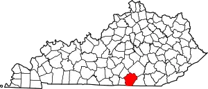
Location of Wayne County in Kentucky
It is intended to be a complete list of the properties on the National Register of Historic Places in Wayne County, Kentucky, United States. The locations of National Register properties for which the latitude and longitude coordinates are included below, may be seen in a map.[1]
There are 8 properties listed on the National Register in the county, 1 of which is a National Historic Landmark.
- This National Park Service list is complete through NPS recent listings posted February 5, 2021.[2]
Current listings
| [3] | Name on the Register | Image | Date listed[4] | Location | City or town | Description |
|---|---|---|---|---|---|---|
| 1 | Adkins-Hurt Mill | May 6, 1977 (#77000662) |
Off Kentucky Route 167 36°39′06″N 84°48′16″W |
Mount Pisgah | ||
| 2 | Battle of Mill Springs Historic Areas |  Battle of Mill Springs Historic Areas |
February 18, 1993 (#93000001) |
Three discontiguous areas: one south of Nancy, one in Mill Springs, and one to the north across the Cumberland River 36°55′29″N 84°46′47″W |
Mill Springs | |
| 3 | Fairchild House | 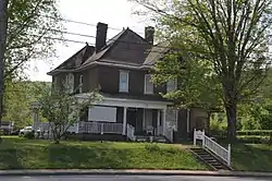 Fairchild House |
March 25, 2008 (#08000215) |
302 S. Main St. 36°49′33″N 84°51′09″W |
Monticello | |
| 4 | Hotel Breeding | 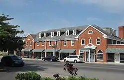 Hotel Breeding |
August 25, 1988 (#88001315) |
201-211 N. Main St. 36°49′50″N 84°50′55″W |
Monticello | |
| 5 | Mill Springs Mill | 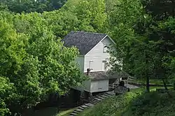 Mill Springs Mill |
April 11, 1973 (#73000858) |
Off Kentucky Route 90 36°56′03″N 84°46′44″W |
Mill Springs | |
| 6 | Monticello Historic Commercial District | October 29, 1982 (#82001577) |
Main and Columbia Sts. 36°49′46″N 84°50′57″W |
Monticello | Historic district with 11 contributing buildings. | |
| 7 | Wayne County High School |  Wayne County High School |
July 30, 2013 (#13000567) |
80 A.J. Lloyd Cir. 36°49′28″N 84°51′41″W |
Monticello | |
| 8 | West-Metcalfe House | November 17, 1977 (#77000661) |
1.75 miles south of Mill Springs off Kentucky Route 90 36°55′10″N 84°46′39″W |
Mill Springs |
See also
| Wikimedia Commons has media related to National Register of Historic Places in Wayne County, Kentucky. |
References
- The latitude and longitude information provided in this table was derived originally from the National Register Information System, which has been found to be fairly accurate for about 99% of listings. Some locations in this table may have been corrected to current GPS standards.
- "National Register of Historic Places: Weekly List Actions". National Park Service, United States Department of the Interior. Retrieved on February 5, 2021.
- Numbers represent an alphabetical ordering by significant words. Various colorings, defined here, differentiate National Historic Landmarks and historic districts from other NRHP buildings, structures, sites or objects.
- The eight-digit number below each date is the number assigned to each location in the National Register Information System database, which can be viewed by clicking the number.
| Topics | |
|---|---|
| Lists by state |
|
| Lists by insular areas | |
| Lists by associated state | |
| Other areas | |
| Related | |
| |
Municipalities and communities of Wayne County, Kentucky, United States | ||
|---|---|---|
| City | Location of Wayne County, Kentucky | |
| Unincorporated communities | ||
| Ghost town | ||
| ||
This article is issued from Wikipedia. The text is licensed under Creative Commons - Attribution - Sharealike. Additional terms may apply for the media files.