Westmoreland County, New South Wales

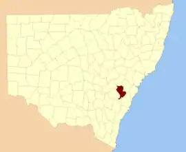
Westmoreland County was one of the original Nineteen Counties in New South Wales and is now one of the 141 Cadastral divisions of New South Wales. It is to the west of Sydney in the Blue Mountains. Coxs River is the border to the north, and the Wollondilly River to the east. Campbells River is the border in the north-east, where the county extends to near Bathurst, with the Fish River part of the border. It includes the town of Oberon, and the Kanangra-Boyd National Park.

Westmoreland
New South Wales
Location in New South Wales
Lands administrative divisions around Westmoreland:
Bathurst Roxburgh Cook
Georgiana Westmoreland Cook
Argyle Argyle Camden

Westmoreland County is named in honour of John Fane, Tenth Earl of Westmorland (1759-1841).[1] The Electoral district of Cook and Westmoreland was the first state electoral district for the area, between 1856 and 1859.

Parishes within this county

A full list of parishes found within this county; their current LGA and mapping coordinates to the approximate centre of each location is as follows:

ParishLGACoordinates
AbercornOberon Council33°59′54″S 149°55′04″E
AdderleyOberon Council33°44′54″S 149°41′04″E
AntonioCity of Lithgow30°35′54″S 149°58′04″E
BalfourOberon Council33°47′54″S 149°45′04″E
BansheaOberon Council34°02′54″S 150°02′04″E
BaringOberon Council33°42′54″S 149°43′04″E
BimlowWollondilly Shire33°58′54″S 150°23′04″E
BindoCity of Lithgow33°40′54″S 150°02′04″E
BlenheimOberon Council33°36′54″S 149°54′04″E
BoltonOberon Council33°33′54″S 149°46′04″E
BouverieUpper Lachlan Shire34°19′54″S 149°54′04″E
BulgarresOberon Council33°51′54″S 149°57′04″E
ColongWollondilly Shire34°07′54″S 150°09′04″E
CreteOberon Council33°44′54″S 149°45′04″E
CyclopsWollondilly Shire33°54′54″S 150°14′04″E
DroghedaOberon Council33°55′54″S 149°56′04″E
DuckmaloiOberon Council33°46′54″S 149°57′04″E
GanbenangCity of Lithgow33°40′54″S 150°07′04″E
GangerangOberon Council33°59′54″S 150°10′04″E
GuineacorWingecarribee Shire34°18′54″S 150°00′04″E
IreneOberon Council33°44′54″S 149°36′04″E
JenolanOberon Council33°47′54″S 150°05′04″E
JocelynOberon Council33°35′54″S 149°46′04″E
JoorilandWollondilly Shire34°11′54″S 150°15′04″E
KendaleOberon Council33°32′54″S 149°51′04″E
KonangarooOberon Council33°51′54″S 150°03′04″E
KowmungOberon Council33°57′54″S 149°52′04″E
LangdaleOberon Council33°30′54″S 149°39′04″E
LeibnitzWollondilly Shire34°12′54″S 150°08′04″E
LowtherCity of Lithgow33°35′54″S 150°06′04″E
MerlinWollondilly Shire34°01′54″S 150°14′04″E
MozartOberon Council33°47′54″S 149°51′04″E
MurruinShire34°07′54″S 150°02′04″E
NorwayOberon Council33°44′54″S 149°52′04″E
OberonOberon Council33°36′54″S 149°49′04″E
OldbuckShire34°13′54″S 150°03′04″E
SpeedwellWollondilly Shire33°55′54″S 150°17′04″E
St ColumbaShire34°11′54″S 150°00′04″E
SwatchfieldOberon Council33°51′54″S 149°43′04″E
TartarusOberon Council34°03′54″S 150°06′04″E
TerniWollondilly Shire34°02′54″S 150°18′04″E
The PeaksWollondilly Shire34°06′54″S 150°15′04″E
ThornshopeCity of Lithgow33°32′54″S 149°59′04″E
ThuratOberon Council33°56′54″S 150°04′04″E
VulcanOberon Council33°52′54″S 149°47′04″E
WingecarribeeWollondilly Shire34°03′54″S 150°22′04″E

References

  1. "Westmoreland". Geographical Names Register (GNR) of NSW. Geographical Names Board of New South Wales. Retrieved 11 August 2013.
This article is issued from Wikipedia. The text is licensed under Creative Commons - Attribution - Sharealike. Additional terms may apply for the media files.