City of Lithgow
The City of Lithgow is a local government area in the Central West region of New South Wales, Australia. The area is located adjacent to the Great Western Highway and the Main Western railway line.
| City of Lithgow New South Wales | |||||||||||||||
|---|---|---|---|---|---|---|---|---|---|---|---|---|---|---|---|
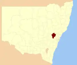 Location in New South Wales | |||||||||||||||
| Coordinates | 33°29′S 150°09′E | ||||||||||||||
| Population |
| ||||||||||||||
| • Density | 4.6341/km2 (12.002/sq mi) | ||||||||||||||
| Area | 4,551 km2 (1,757.2 sq mi) | ||||||||||||||
| Mayor | Ray Thompson (Unaligned) | ||||||||||||||
| Council seat | Lithgow[3] | ||||||||||||||
| Region | Central West | ||||||||||||||
| State electorate(s) | Bathurst | ||||||||||||||
| Federal Division(s) | Calare | ||||||||||||||
 | |||||||||||||||
| Website | City of Lithgow | ||||||||||||||
| |||||||||||||||
The Mayor of the City of Lithgow Council is Cr. Ray Thompson, who is unaligned with any political party.
Main towns and villages
The council seat is located in the city of Lithgow, the largest regional centre. The area also includes the towns and villages of Ben Bullen, Bogee, Bowenfels, Capertee, Clarence, Cullen Bullen, Dargan, Glen Alice, Glen Davis, Hampton, Hartley, Hartley Vale, Little Hartley, Marrangaroo, Meadow Flat, Newnes, Portland, Rydal, Sodwalls, Tarana, and Wallerawang.
Demographics
According to the Australian Bureau of Statistics on 2006 census night there were:[4]
- 20,981 people living in the area, making the City the 77th largest Local Government Area in New South Wales. It was equal to 0.3% of the New South Wales population of 6,827,694
- 116 more people living in the area than the previous period, giving the City the 82nd largest population growth in a Local Government Area in New South Wales. It was equal to 0.2% of the 58,753 increase in the population of New South Wales
- in percentage terms, an increase of 0.6% in the number of people over the year, the 92nd fastest growth in population of a Local Government Area in New South Wales. In New South Wales the population grew by 0.9%
- was an increase in population over the 10 years of 733 people or 3.6% (0.4% in annual average terms), the 81st highest rate of a Local Government Area in New South Wales. In New South Wales the population grew by 622,966 or 10% (1.0% in annual average terms) over the same period.
Council
Current composition and election method
Lithgow City Council is composed of nine Councillors elected proportionally as a single ward. All Councillors are elected for a fixed four-year term of office. The Mayor is elected by the Councillors at the first meeting of the Council. The most recent election was held on 10 September 2016, and the makeup of the Council is as follows:[5]
| Party | Councillors | |
|---|---|---|
| Independent and Unaligned | 9 | |
| Total | 9 | |
The current Council, elected in 2016, in order of election, is:[5]
| Councillor | Party | Notes | |
|---|---|---|---|
| Maree Statham | Unaligned | ||
| Steve Ring | Unaligned | ||
| Cass Coleman | Unaligned | ||
| Wayne McAndrew | Unaligned | ||
| Ray Thompson | Independent | Mayor | |
| Joe Smith | Independents | ||
| Stephen Lesslie | Unaligned | ||
Heritage listings
The City of Lithgow has a number of heritage-listed sites, including:
- Ben Bullen, Wallerawang-Gwabegar railway: Ben Bullen railway station[6]
- Bowenfels, Great Western Highway: Fernhill, Bowenfels[7]
- Bowenfels, via Kirkley Street: Lithgow Heavy Anti Aircraft Gun Stations and Dummy Station[8]
- Bowenfels, Main Western railway: Bowenfels railway station[9]
- Bowenfels, Main Western railway: Bowenfels rail viaducts[10]
- Hartley, Great Western Highway: Hartley historic site[11]
- Hartley, 200 Jenolan Caves Road: Military Station archaeological site[12]
- Hartley, The Old Bathurst Road: Cox's Road and Early Deviations - Hartley, Clarence Hilly Range and Mount Blaxland Precinct[13]
- Hartley Vale, Hartley Vale Road: Collits' Inn[14]
- Lithgow, Bent Street: Lithgow Valley Colliery and Pottery Site[15]
- Lithgow, Brewery Lane: Lithgow Zig Zag[16]
- Lithgow, Gas Works Lane: Lithgow Coal Stage Signal Box[17]
- Lithgow, Inch Street: Lithgow Blast Furnace[18]
- Lithgow, Jenolan Caves Road: McKanes Falls Bridge[19]
- Lithgow, Main West Line 156.334 km, James Street: Lithgow Underbridge[20]
- Lithgow, Main Western railway: Eskbank railway station, New South Wales[21]
- Lithgow, Main Western railway: Ten Tunnels Deviation[22]
- Lithgow, Railway Parade: Lithgow railway station[23]
- Lithgow, Top Points Zig Zag railway: Cooerwull railway footbridge[24]
- Marrangaroo, Main Western railway: Marrangaroo railway viaduct[25]
- Old Bowenfels, 70 Mudgee Street: Bowenfels National School Site[26]
- Portland, Carlton Road: Raffan's Mill and Brick Bottle Kilns[27]
- Portland, Williwa Street: Portland Cement Works Precinct[28]
- Rydal, Main Western railway: Rydal railway station[29]
- Rydal, Main Western railway: Rydal rail underbridges[30]
- Sodwalls, off Cuthill Road: Cox's Road and Early Deviations - Sodwalls, Fish River Descent Precinct[31]
- Tarana, Main Western railway: Tarana railway station[32]
- Wallerawang, Main Street: St John the Evangelist Church, Wallerawang[33]
- Wallerawang, Main Western railway: Coxs River railway bridges, Wallerangang[34]
- Wallerawang, Main Western railway: Wallerawang railway station[35]
- Wambool, Main Western railway: Wambool old-rail truss overbridges[36]
References
- Australian Bureau of Statistics (27 June 2017). "Lithgow (C)". 2016 Census QuickStats. Retrieved 27 November 2017.

- "3218.0 – Regional Population Growth, Australia, 2017-18". Australian Bureau of Statistics. 27 March 2019. Archived from the original on 27 March 2019. Retrieved 27 March 2019. Estimated resident population (ERP) at 30 June 2018.
- "City of Lithgow Council". Division of Local Government. Archived from the original on 10 September 2007. Retrieved 15 November 2006.
- "Regional Population Growth, Australia, 2005–06 (catalogue no.: 3218.0)". Australian Bureau of Statistics. Archived from the original on 29 June 2011. Retrieved 12 March 2007.
- "City of Lithgow Council: Summary of First Preference and Group Votes for each Candidate". Local Government Elections 2016. Electoral Commission of New South Wales. 17 September 2016. Archived from the original on 7 November 2016. Retrieved 6 November 2016.
- "Ben Bullen Railway Station group". New South Wales State Heritage Register. Office of Environment and Heritage. H01082. Retrieved 18 May 2018.
- "Fernhill". New South Wales State Heritage Register. Office of Environment and Heritage. H00225. Retrieved 18 May 2018.
- "Lithgow Heavy Anti Aircraft Gun Stations and Dummy Station". New South Wales State Heritage Register. Office of Environment and Heritage. H01862. Retrieved 18 May 2018.
- "Bowenfels Railway Station and Stationmaster's House". New South Wales State Heritage Register. Office of Environment and Heritage. H00475. Retrieved 18 May 2018.
- "Bowenfels Rail Viaducts". New South Wales State Heritage Register. Office of Environment and Heritage. H01028. Retrieved 18 May 2018.
- "Hartley Historic Site". New South Wales State Heritage Register. Office of Environment and Heritage. H00992. Retrieved 18 May 2018.
- "Military Station Archaeological Site and Burial at Glenroy". New South Wales State Heritage Register. Office of Environment and Heritage. H01840. Retrieved 18 May 2018.
- "Cox's Road and Early Deviations - Hartley, Clarence Hilly Range / Mount Blaxland Precinct". New South Wales State Heritage Register. Office of Environment and Heritage. H01957. Retrieved 18 May 2018.
- "Collits' Inn". New South Wales State Heritage Register. Office of Environment and Heritage. H00455. Retrieved 18 May 2018.
- "Lithgow Valley Colliery & Pottery Site". New South Wales State Heritage Register. Office of Environment and Heritage. H00078. Retrieved 18 May 2018.
- "Great Zig Zag Railway and Reserves". New South Wales State Heritage Register. Office of Environment and Heritage. H00542. Retrieved 18 May 2018.
- "Lithgow Coal Stage Signal Box". New South Wales State Heritage Register. Office of Environment and Heritage. H01832. Retrieved 18 May 2018.
- "Lithgow Blast Furnace". New South Wales State Heritage Register. Office of Environment and Heritage. H00548. Retrieved 18 May 2018.
- "McKanes Falls Bridge". New South Wales State Heritage Register. Office of Environment and Heritage. H01473. Retrieved 18 May 2018.
- "Lithgow (James St) Underbridge". New South Wales State Heritage Register. Office of Environment and Heritage. H01831. Retrieved 18 May 2018.
- "Eskbank Railway Station group". New South Wales State Heritage Register. Office of Environment and Heritage. H01138. Retrieved 18 May 2018.
- "Great Zig Zag Railway deviation tunnels". New South Wales State Heritage Register. Office of Environment and Heritage. H01037. Retrieved 18 May 2018.
- "Lithgow Railway Station Group and Residence". New South Wales State Heritage Register. Office of Environment and Heritage. H01833. Retrieved 18 May 2018.
- "Cooerwull Railway footbridge". New South Wales State Heritage Register. Office of Environment and Heritage. H01115. Retrieved 18 May 2018.
- "Marrangaroo railway viaduct". New South Wales State Heritage Register. Office of Environment and Heritage. H01046. Retrieved 18 May 2018.
- "Bowenfels National School Site". New South Wales State Heritage Register. Office of Environment and Heritage. H00761. Retrieved 18 May 2018.
- "Raffan's Mill and Brick Bottle Kilns Precinct". New South Wales State Heritage Register. Office of Environment and Heritage. H01738. Retrieved 18 May 2018.
- "Portland Cement Works Precinct". New South Wales State Heritage Register. Office of Environment and Heritage. H01739. Retrieved 18 May 2018.
- "Rydal Railway Station group". New South Wales State Heritage Register. Office of Environment and Heritage. H01239. Retrieved 2 June 2018.
- "Rydal rail underbridges". New South Wales State Heritage Register. Office of Environment and Heritage. H01053. Retrieved 2 June 2018.
- "Cox's Road and Early Deviations - Sodwalls, Fish River Descent Precinct". New South Wales State Heritage Register. Office of Environment and Heritage. H01958. Retrieved 18 May 2018.
- "Tarana Railway Station and yard group". New South Wales State Heritage Register. Office of Environment and Heritage. H01263. Retrieved 18 May 2018.
- "St. John the Evangelist Church". New South Wales State Heritage Register. Office of Environment and Heritage. H01702. Retrieved 18 May 2018.
- "Wallerawang rail bridges over Cox's River". New South Wales State Heritage Register. Office of Environment and Heritage. H01064. Retrieved 18 May 2018.
- "Wallerawang Railway Station and yard group". New South Wales State Heritage Register. Office of Environment and Heritage. H01282. Retrieved 18 May 2018.
- "Wambool old-rail truss overbridges". New South Wales State Heritage Register. Office of Environment and Heritage. H01065. Retrieved 18 May 2018.