Dong, Arunachal Pradesh
Dong is a small village in Dong valley of Anjaw district, Arunachal Pradesh, India.[1]
Dong | |
|---|---|
town | |
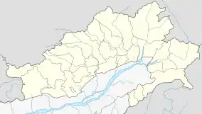 Dong Location in Arunachal Pradesh, India  Dong Dong (India) | |
| Coordinates: 28°10′12″N 97°2′30″E | |
| Country | |
| State | Arunachal Pradesh |
| District | Anjaw district |
| Elevation | 1,240 m (4,070 ft) |
| Languages | |
| • Official | English |
| Time zone | UTC+05:30 (IST) |
| ISO 3166 code | IN-AR |
| Vehicle registration | AR |
It is the easternmost village in the India, near the point where India, China and Myanmar meet as it is the location of a peak where tourists climb up to at 3 am to see the sun rise, it is not the easternmost place but it is one of the easternmost places accessible by car.[2] In 1999, it was found that dong experience the first sunrise in India. That is why it is known as "India’s Land of Rising Sun".The last village on the India-China border in Arunachal Pradesh is Kaho, India, which lies just north of Kibithu on the banks of Lohit River.
Location
Dong lies at the junction of the Lohit River and the Sati (or Sai Ti) stream at an elevation of 1,240 metres (4,070 ft). The village can be reached on foot from Walong in a 30-minute climb.[2]
Demographics
According to the 2011 Census of India, the village has 15 residents across 4 households. 6 are male and 9 are female.[1] The children go to school in Walong. The local people grow rice, makai and maize and raise pigs and chickens.[2]
Transport
The 2,000-kilometre-long (1,200 mi) proposed Mago-Thingbu to Vijaynagar Arunachal Pradesh Frontier Highway along the McMahon Line,[3][4][5][6] (will intersect with the proposed East-West Industrial Corridor Highway) and will pass through this district.[7][8][9]
See also
| State symbols | |
|---|---|
| Topics |
|
| Administration |
|
| Divisions |
|
| Districts | |
| Major Towns |
|
| Historical Places | |
Portal: India | |
| States | |
|---|---|
| Union territories | |
| |
References
Citations
- 2011 Census of India: Dong
- Gokhale 2001.
- "Top officials to meet to expedite road building along China border". Dipak Kumar Dash. timesofindia.indiatimes.com. Retrieved 27 October 2014.
- "Narendra Modi government to provide funds for restoration of damaged highways". www.dnaindia.com. Retrieved 27 October 2014.
- "Indian Government Plans Highway Along Disputed China Border". Ankit Panda. thediplomat.com. Retrieved 27 October 2014.
- "Govt planning road along McMohan line in Arunachal Pradesh: Kiren Rijiju". Live Mint. Retrieved 26 October 2014.
- http://www.tribuneindia.com/2014/20141016/nat7.jpg
- https://web.archive.org/web/20160306112247/http://arunachalpradesh.nic.in/images/state_map.jpg
- "China warns India against paving road in Arunachal". Ajay Banerjee. tribuneindia.com. Retrieved 26 October 2014.
Sources
- "Dong in Arunachal will herald millennium dawn". Rediff. 20 December 1999. Retrieved 16 December 2012.
- Gokhale, Nitin A. (20 August 2001). "Dong". Outlook India. Retrieved 16 December 2012.CS1 maint: ref=harv (link)
External links
Places adjacent to Dong, Arunachal Pradesh | ||||||||||
|---|---|---|---|---|---|---|---|---|---|---|
| ||||||||||
