Niigata (city)
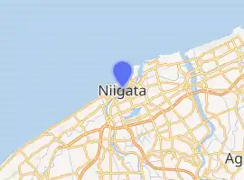
Niigata (新潟市, Niigata-shi, Japanese: [niːɡata]) is the capital and the most populous city of Niigata Prefecture located in the Chūbu region of Japan. It is the largest city on the west coast of Honshu, and the second largest city in Chūbu region after Nagoya. It faces the Sea of Japan and Sado Island.
Niigata
新潟市 | |||||||||||
|---|---|---|---|---|---|---|---|---|---|---|---|
| Niigata City | |||||||||||

| |||||||||||
 Flag  Seal | |||||||||||

| |||||||||||
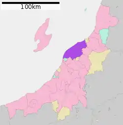 Location of Niigata in Niigata Prefecture | |||||||||||
 Niigata | |||||||||||
| Coordinates: 37°54′58″N 139°2′11″E | |||||||||||
| Country | Japan | ||||||||||
| Region | Chūbu (Kōshin'etsu) (Hokuriku) | ||||||||||
| Prefecture | Niigata | ||||||||||
| City Status | April 1, 1889 | ||||||||||
| Government | |||||||||||
| • - Mayor | Yaichi Nakahara (from November, 2018) | ||||||||||
| Area | |||||||||||
| • Designated city | 726.45 km2 (280.48 sq mi) | ||||||||||
| Population (July 1, 2019) | |||||||||||
| • Designated city | 797,591 | ||||||||||
| • Density | 1,100/km2 (2,800/sq mi) | ||||||||||
| • Metro [1] (2015) | 1,060,013 (17th) | ||||||||||
| Time zone | UTC+9 (Japan Standard Time) | ||||||||||
| Symbols | |||||||||||
| • Tree | Willow | ||||||||||
| • Flower | Tulip | ||||||||||
| • Bird | Swan | ||||||||||
| Phone number | 025-243-4894 | ||||||||||
| Address | 1-602-1 Gakkōchō-dōri, Chūō-ku, Niigata-shi, Niigata-ken 951-8550 | ||||||||||
| Website | http://www.city.niigata.lg.jp/ | ||||||||||
| Niigata | |||||
|---|---|---|---|---|---|
"Niigata" in kanji | |||||
| Japanese name | |||||
| Kanji | 新潟 | ||||
| |||||
As of 1 July 2019, the city had an estimated population of 797,591, and a population density of 1,098 persons per km2. The total area is 726.45 square kilometres (280.48 sq mi). Greater Niigata, the Niigata Metropolitan Employment Area, has a GDP of US$43.3 billion as of 2010.[2][3]
With a long history as a port town, Niigata became a free port following the Meiji Restoration. Niigata's city government was established in 1889. Mergers with nearby municipalities in 2005 allowed the city's population to jump to 810,000. The annexation of the surrounding area has also given the city the greatest rice paddy field acreage in Japan. On April 1, 2007, it became the first government-designated city on the Japan Sea coast of Honshu.
Toponymy
The place name "Niigata" was first recorded in 1520 (Eisho 17).[4] Its name in kanji can be translated as 新 "new", 潟 "lagoon", 市 "city".
However, as there is no record about the origin of the name, this had led to several theories. First "Niigata" was a large lagoon at the mouth of the Shinano river. Second it was an inland bay at the river's entrance. Third it was the name of a village that stood on an island within the estuary. Fourth it referred to another island settlement that relocated to the Furumachi district and that in turn gave its name to a nearby lagoon.[5]
History
Prehistoric and ancient
People have inhabited the Niigata area since the Jōmon period, though much of the current land was still beneath the sea at the time. According to the Nihon Shoki, a fortress was built in the area in AD 647.
Feudal period
In the 16th century, a port called Niigata was established at the mouth of the Shinano River, while a port town with the name Nuttari developed at the mouth of the Agano River. The area prospered beneath the rule of Uesugi Kenshin during the Sengoku Period.
Early modern period
A system of canals was constructed on the main island of Niigata in the 17th century. During this period, the courses of the Shinano and Agano rivers gradually changed until they poured into the Sea of Japan at the same location. As a result, Niigata prospered as a port town, serving as a port of call for Japanese trade ships traversing the Sea of Japan.
The Matsugasaki Canal was constructed in 1730 to drain the Agano River area, but in 1731, flooding destroyed the canal and caused it to become the main current of the Agano River. As a result, the volume of water flowing into the port of Niigata decreased, which in turn allowed land reclamation efforts and the development of new rice fields to proceed.
- Gallery
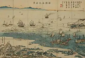 Nishiki-e "Niigata Minato no Shinkei" (View of Niigata Port), 1859
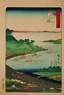 Niigata drawn by Utagawa Hiroshige in 1859
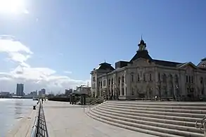 Niigata City History Museum (Minatopia)
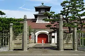 Old Niigata Customs Government Building
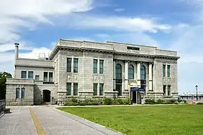 Former Daishi Bank Sumiyoshi-cho Branch
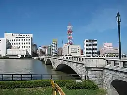
Modern period
In 1858, Niigata was designated as one of the five ports to be opened for international trade in the Japan–U.S. Treaty of Amity and Commerce. However, the shallow water level in the port delayed the actual opening to foreign ships until 1869. The port also served as a valuable base for fishermen who roamed as far north as the Kamchatka Peninsula to catch salmon and other fish.
In 1886, the first Bandai Bridge was built across the Shinano River to connect the settlements of Niigata on the east and Nuttari on the west. Niigata annexed Nuttari in 1914.
During World War II, Niigata's strategic location between the capital of Tokyo and the Sea of Japan made it a key point for the transfer of settlers and military personnel to the Asian continent, including Manchukuo.
Contemporary period
In 1945, near the end of the war, Niigata was one of four cities, together with Hiroshima, Kokura, and Nagasaki, picked as targets for the atomic bomb if Japan did not surrender. The governor of Niigata Prefecture ordered the people to evacuate as rumors of an impending bombing spread, and the city was completely deserted for days. Poor weather conditions and its distance from B-29 bases in the Mariana Islands meant that it was removed from the list of targets during deliberations; Nagasaki was bombed instead.
In 1950, construction of Niigata Station was completed, extending the downtown area from Bandai Bridge. A devastating fire in 1955 destroyed much of the downtown area, but eventually the city recovered. The Niigata Thermal Power Station Unit 1 started operation in July 1963. At that time, it was Japan's first power plant capable of using a mixture of natural gas and heavy oil.
In 1964, the old canals that flowed throughout the city were filled in to make way for more roads.
On June 16, 1964, at 13:23 Japan Standard Time an earthquake of 7.5 Richter scale struck the city, killing 29 people and causing large-scale property damage, with 1,960 totally destroyed buildings, 6,640 partially destroyed buildings, and 15,298 severely inundated by liquefaction.
In 1965, the Agano River running through Niigata was polluted with methylmercury from the chemical plant of the Showa Electrical Company. Over 690 people exhibited symptoms of Minamata disease and the outbreak became known as Niigata Minamata disease.
- Gallery
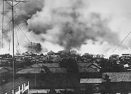 The 1955 fire of Niigata
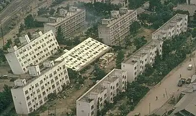 Some effects of liquefaction during the 1964 Niigata earthquake
In 1982, Shinkansen service on the Jōetsu Shinkansen line began between Niigata and Omiya, with service to Ueno added in 1985. The line was extended to Tokyo in 1991.
Big Swan Stadium in Niigata City hosted three games during the 2002 FIFA World Cup.
The 2004 Chūetsu earthquake did not cause any significant damage in Niigata City itself, allowing the city to work as a relief base.
The size and the population of Niigata city increased over the four-year period between 2001 and 2005, due to a series of municipal mergers. On April 1, 2007, Niigata City became first city on the west coast of Honshu to become a government-designated city.
In July 2007, the Chūetsu offshore earthquake, measuring 6.9 on Richter scale, rocked Niigata Prefecture. Though the earthquake was felt in the city, there was little damage, which allowed Niigata City to provide aid to the devastated areas.
In May 2008, the city hosted the 2008 G8 Labor Ministers Meeting.
On March 12, 2011, several hours after the massive 9.0 Tohoku earthquake struck off the east coast of Honshu, Niigata and Nagano Prefectures experienced an estimated magnitude 6.6 earthquake.
- Gallery
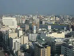
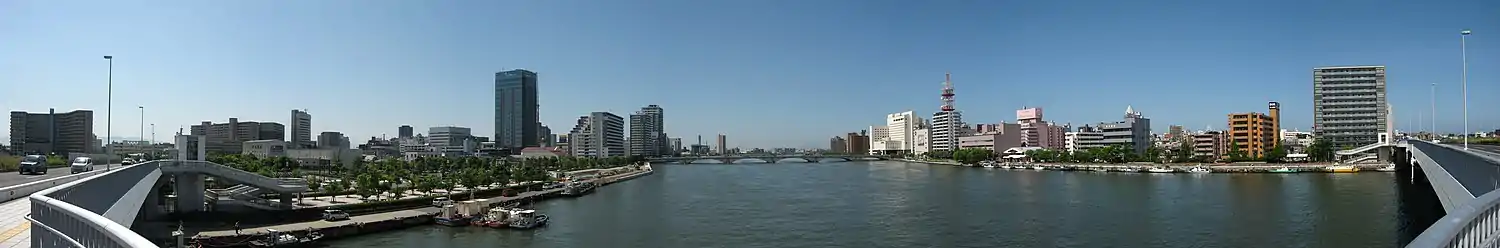
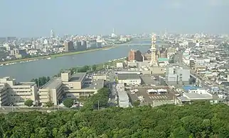 A view of Niigata City and Shinano River from observation deck of Niigata Prefecture Building (2006)
Mergers
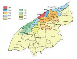
- On April 1, 1889 - the village of Sekiya was amalgamated into the town of Niigata to become the city of Niigata.
- On April 1, 1914 - The town of Nuttari (from Nakakanbara District) was amalgamated into the city of Niigata.
- On June 1, 1943 - The village of Ohgata (from Nakakanbara District) was amalgamated into the city of Niigata.
- On December 8, 1943 - The villages of Ishiyama and Toyano (both from Nakakanbara District) were amalgamated into the city of Niigata.
- On April 5, 1954 - The village of Matsugasakihama (from Kitakanbara District) was amalgamated into the city of Niigata.
- On November 1, 1954 - The villages of Nigorikawa and Minamihama (both from Kitakanbara District) and the village of Sakaiwa (from Nishikanbara District) were amalgamated into the city of Niigata.
- On May 3, 1957 - The villages of Ryokawa, Sonoki and Oheyama (all from Nakakanbara District) were amalgamated into the city of Niigata.
- On January 11, 1960 - The town of Uchino (from Nishikanbara District), and the Hamaura hamlet of the town of Toyosaka (from Kitakanbara District) were amalgamated into the city of Niigata.
- On June 1, 1961 - The villages of Nakanokoya and Akatsuka (both from Nishikanbara District) were amalgamated into the city of Niigata.
- On January 1, 2001 - The town of Kurosaki (from Nishikanbara District) was amalgamated into the city of Niigata.
- On March 21, 2005 - The city of Niitsu, Shirone and Toyosaka, the towns of Kameda, Kosudo and Yokogoshi (all from Nakakanbara District), the town of Nishikawa, and the villages of Ajikata, Iwamuro, Katahigashi, Nakanokuchi and Tsukigata (all from Nishikanbara District) were all merged into the expanded city of Niigata.
- On October 10, 2005 - The town of Maki (from Nishikanbara District) was merged into the expanded city of Niigata.
Geography
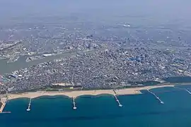
Niigata is situated on a fertile coastal plain on the Sea of Japan coast, facing Sado Island. The Shinano River and Agano River flow through the city.
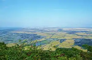
Numerous wetlands, such as the Fukushimagata wetlands, can be found within the city limits. The Sakata lagoon is registered as a wetland of international importance under the Ramsar Convention.
Niigata City's low elevation and abundant water have made flood control and land reclamation important issues for the area throughout its history.
The city is sometimes called the "City of Water" (水の都, Mizu-no-miyako) because of the two rivers that flow through it, its position next to the Japan Sea, its many wetlands, and the canals that used to run through the city. It is also sometimes referred to as the "City of Willows" (柳の都, Yanagi-no-miyako) or Ryuto (柳都) because of the willow trees that lined the old canals. In recent years, the city has been promoting itself as a "Designated City of Food and Flowers" (食と花の政令市, Shoku to hana no seireishi), highlighting its agricultural areas outside of the city center.
Climate
Niigata City features a humid subtropical climate (Cfa), but receives more yearly snowfall than cities such as Moscow, Montreal or Oslo. The climate in Niigata City is characterized by its high humidity and strong winds from the Sea of Japan. While many other parts of Niigata Prefecture tend to have heavy snow, Niigata City itself usually receives less due to its low-lying elevation and the shielding effect of Sado Island.
However, Niigata City does receive much precipitation, mostly in the form of rainfall. On average, Niigata City has 269 days of precipitation each year, about 170 days of which see rain or snowfall measuring over 1 mm.[6] The rainy season in July brings large amounts of rain, while the winter months, especially November and December, also have much precipitation.[7]
In summer, the south wind makes the weather rather hot. Typhoons usually bring strong foehn winds to this area, generally causing somewhat higher temperatures than in other parts of Japan. The weather on the west coast of Honshu tends to be better during the summer months than on the Pacific coast.
| Climate data for Niigata, Niigata (1981-2010) | |||||||||||||
|---|---|---|---|---|---|---|---|---|---|---|---|---|---|
| Month | Jan | Feb | Mar | Apr | May | Jun | Jul | Aug | Sep | Oct | Nov | Dec | Year |
| Record high °C (°F) | 15.3 (59.5) |
21.3 (70.3) |
25.1 (77.2) |
30.7 (87.3) |
32.9 (91.2) |
35.0 (95.0) |
38.5 (101.3) |
39.9 (103.8) |
37.1 (98.8) |
33.3 (91.9) |
27.2 (81.0) |
23.6 (74.5) |
39.9 (103.8) |
| Average high °C (°F) | 5.5 (41.9) |
6.0 (42.8) |
9.7 (49.5) |
16.0 (60.8) |
21.0 (69.8) |
24.5 (76.1) |
28.2 (82.8) |
30.6 (87.1) |
26.2 (79.2) |
20.3 (68.5) |
14.2 (57.6) |
8.7 (47.7) |
17.6 (63.7) |
| Daily mean °C (°F) | 2.8 (37.0) |
2.9 (37.2) |
5.8 (42.4) |
11.5 (52.7) |
16.5 (61.7) |
20.7 (69.3) |
24.5 (76.1) |
26.6 (79.9) |
22.5 (72.5) |
16.4 (61.5) |
10.5 (50.9) |
5.6 (42.1) |
13.9 (57.0) |
| Average low °C (°F) | 0.2 (32.4) |
0.1 (32.2) |
2.3 (36.1) |
7.3 (45.1) |
12.7 (54.9) |
17.6 (63.7) |
21.7 (71.1) |
23.4 (74.1) |
19.2 (66.6) |
12.8 (55.0) |
7.0 (44.6) |
2.7 (36.9) |
10.2 (50.4) |
| Record low °C (°F) | −11.7 (10.9) |
−13 (9) |
−6.4 (20.5) |
−2.5 (27.5) |
2.0 (35.6) |
6.7 (44.1) |
11.4 (52.5) |
14.5 (58.1) |
7.9 (46.2) |
3.0 (37.4) |
−1.8 (28.8) |
−9.5 (14.9) |
−13 (9) |
| Average precipitation mm (inches) | 186.0 (7.32) |
122.4 (4.82) |
112.6 (4.43) |
91.7 (3.61) |
104.1 (4.10) |
127.9 (5.04) |
192.1 (7.56) |
140.6 (5.54) |
155.1 (6.11) |
160.3 (6.31) |
210.8 (8.30) |
217.4 (8.56) |
1,821 (71.69) |
| Average snowfall cm (inches) | 91 (36) |
73 (29) |
19 (7.5) |
0 (0) |
0 (0) |
0 (0) |
0 (0) |
0 (0) |
0 (0) |
0 (0) |
2 (0.8) |
30 (12) |
217 (85) |
| Average precipitation days (≥ 0.5mm) | 23.9 | 19.7 | 17.8 | 12.9 | 11.3 | 11.2 | 13.4 | 9.5 | 13.4 | 15.8 | 19.5 | 24.2 | 192.6 |
| Average snowy days | 22.9 | 20.2 | 11.4 | 0.9 | 0.0 | 0.0 | 0.0 | 0.0 | 0.0 | 0.0 | 2.1 | 13.3 | 70.8 |
| Average relative humidity (%) | 72 | 71 | 67 | 65 | 69 | 74 | 77 | 73 | 73 | 71 | 71 | 72 | 71 |
| Mean monthly sunshine hours | 57.1 | 75.1 | 128.4 | 181.8 | 200.2 | 173.1 | 169.4 | 214.9 | 150.7 | 144.0 | 89.9 | 60.5 | 1,642.5 |
| Source: [8][9] | |||||||||||||
Wards
Niigata has a system of wards (ku) since April 1, 2007:[10] Each ward has its own "image color".
| Wards of Niigata | ||||
|---|---|---|---|---|
| Place Name | Map of Niigata | |||
| Rōmaji | Kanji | Color | ||
| 1 | Akiha Ward | 秋葉区 | ■ Floral green | 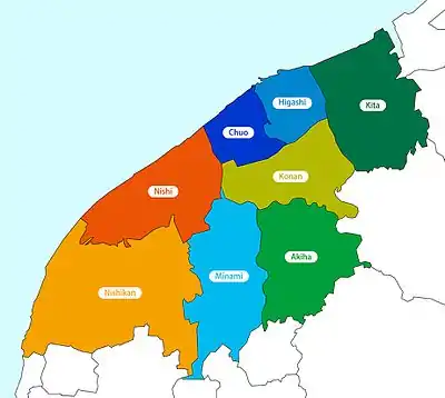 A map of Niigata's Wards |
| 2 | Chuo Ward (administrative center) | 中央区 | ■ Waterfront blue | |
| 3 | Higashi Ward | 東区 | ■ Aqua blue | |
| 4 | Kita Ward | 北区 | ■ Nature green | |
| 5 | Konan Ward | 江南区 | ■ Spring green | |
| 6 | Minami Ward | 南区 | ■ Breeze blue | |
| 7 | Nishi Ward | 西区 | ■ Sunset orange | |
| 8 | Nishikan Ward | 西蒲区 | ■ Harvest yellow | |
Adjoining communities
From the north, following Niigata's border clockwise:
- In addition Sado Island is connected by sea and air routes.
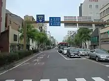
Cityscape
Transportation
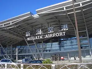
Airport
Niigata Airport is located about 6 km north of central Niigata. It handles some international destinations as well as many domestic ones. As of October 2016, the domestic destinations available are Osaka (10 times a day), Sapporo (five or six times a day), Fukuoka (three times a day), Okinawa (once or twice a day), Nagoya (three times a day), Narita (once a day) and Sado Island (three times a day).
Niigata Airport's international destinations are Harbin (twice a week), Seoul (five times a week), Shanghai (twice a week) and Vladivostok.[11]
Railway
The largest station in Niigata City is Niigata Station. It is centrally located in the Bandai area, one of the two main shopping districts in downtown Niigata. Approximately 37,000 passengers use the station daily. The Jōetsu Shinkansen, which terminates at Niigata Station, provides daily service to Tokyo. The Shin'etsu Main Line, Hakushin Line, Echigo Line, Uetsu Main Line, and Ban'etsu West Line also terminate at Niigata Station. These lines serve Myoko, Itoigawa, Akita, Sakata, and Aizuwakamatsu.
Niigata Kotsu Dentetsu Line and Kambara Dentetsu trains used to run through the city until the late 1990s; however, they no longer exist.
- JR East - Jōetsu Shinkansen
- JR East - Shin'etsu Main Line
- JR East - Hakushin Line
- JR East - Echigo Line
- Niigata - Hakusan - Sekiya - Aoyama - Kobari - Terao - Niigata Daigaku-mae - Uchino - Uchino-Nishigaoka - Echigo-Akatsuka - Echigo-Sone - Maki - Iwamuro - Yoshida
Transit bus
BRT "Bandai-bashi Line" runs through business/shopping districts in the central Niigata (Niigata Station—Bandai Bridge—Furumachi—City hall—Hakusan Station—Aoyama).
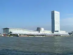
Sea port
Niigata was formerly the terminus of the Mangyongbong-92 ferry, one of the direct connections between Japan and North Korea.
.jpg.webp)
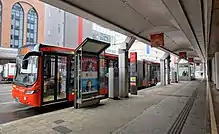 Bandai-bashi Line(BRT)
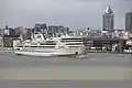 Port of Niigata
Education
Colleges and universities
- Niigata University
- Graduate Institute for Entrepreneurial Studies
- International University of Japan
- The Nippon Dental University School of Life Dentistry at Niigata
- Niigata University of International and Information Studies
- Niigata University of Pharmacy and Applied Life Sciences
- Niigata Seiryo University
- Niigata University of Health and Welfare
Local attractions
- Furumachi, Bandai City - Downtown shopping district
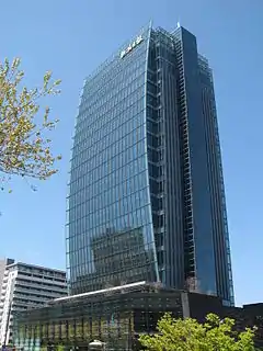
- Toki Messe, Next21, Niigata Nippo Media Ship - skyscrapers with observation decks
- Nuttari Terrace (ja:沼垂テラス)
- Pier Bandai (ja:ピアBandai)
- Niigata City History Museum (Minatopia)
- Northern Culture Museum
- Marinepia Nihonkai Aquarium (ja:マリンピア日本海)
- Fukushimagata Lagoon Park (ja:福島潟)
- Iwamuro Onsen (ja:岩室温泉)
- Niigata Prefectural Botanical Garden
- Nature Aquarium Gallery[12]
Culture
Events
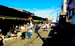
- Niigata Festival (every August) (ja:新潟まつり)
- Kambara Festival (ja:蒲原まつり)
- Niigata Comic Market
- Niigata Manga Competition
- Kurosaki Festival
Sports
- J. League (Association football)
- Albirex Niigata play at Big Swan Stadium
- bj league (Basketball)
- Niigata Albirex BB play at Toki Messe
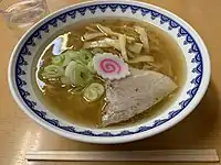
Foods
- Tare Katsudon
- Noppe (ja:のっぺ)
- Kakinomoto
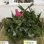
- Sasa Dango (ja:笹団子)
- Mikazuki Italian Noodle (ja:イタリアン (新潟))
- Assari-Shōyu Ramen (ja:新潟あっさり醤油ラーメン)

Notable people from Niigata
Artists and writers
- One, manga artist
- Makoto Kobayashi, manga artist
- Shinji Mizushima, manga artist
- Tadashi Nakayama, contemporary woodblock artist
- Takeshi Obata, manga artist
- Ango Sakaguchi, author
- Fujisawa Shu, writer
- Rumiko Takahashi, manga artist
- Aizu Yaichi, poet, calligrapher, and historian
Actors and voice actors
- Mina Fujii, actress
- Toshihito Ito, actor
- Masashi Mikami, actor
- Bin Shimada, voice actor
- Keiko Yokozawa, voice actor
Musicians
- Double, singer
- Yoko Ishida, singer
- Kazuya Kato, bassist
- Katsutaro Kouta, singer
- Közi, guitarist (Malice Mizer and Eve of Destiny)
- Koharu Kusumi, idol (Morning Musume, Morning Musume Tanjō 10nen Kinentai, ZYX-α and Dream Morning Musume)
- Akira Yamaoka, composer
- NGT48, Idol Unit
- Rina Sawayama, singer-songwriter and model
Others
- Takashi Amano, professional aquarist and track cyclist
- Kunio Maekawa, architect
- Yutakayama Ryota, sumo wrestler[13]
- SANADA (Seiya Sanada), professional wrestler
- Tadao Sato, film critic and film theorist
- Megumi Sato, high jumper
- Meiko Satomura, professional wrestler
- Yujiro Takahashi, professional wrestler
- Megumi Yokota, abduction victim[14]
List of mayors of Niigata City (1889 to present)
|
|
|
Sister cities
Niigata maintains sister city ties with six cities:
 Galveston, Texas, United States (1965)
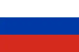 Khabarovsk, Russia (1965)
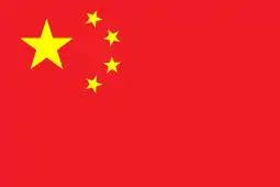 Harbin, Heilongjiang, China (1979)
- Vladivostok, Primorsky Krai, Russia (1991)
- Birobidzhan, Jewish Autonomous Oblast, Russia (Once a sister city of Toyosaka, Niigata assumed the sister city honors in 2005)
 Nantes, France (2009, shifted from friendship city since 1999)
In addition, special exchange agreements have been set up with the following:
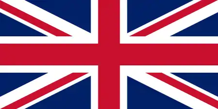 Kingston upon Hull, United Kingdom
 Ulsan, South Korea (2007)
References
- "UEA Code Tables". Center for Spatial Information Science, University of Tokyo. Retrieved January 26, 2019.
- Yoshitsugu Kanemoto. "Metropolitan Employment Area (MEA) Data". Center for Spatial Information Science, The University of Tokyo. Archived from the original on 2018-06-15. Retrieved 2016-09-29.
- Conversion rates - Exchange rates - OECD Data
- 知っておきたい新潟県の歴史編集委員会 (2010). 知っておきたい新潟県の歴史. 新潟日報事業社. ISBN 978-4861323720.
- 角川日本地名大辞典 編纂委員会 (1989). 角川日本地名大辞典 15 新潟県. (株)角川書店. ISBN 4-04-001150-3.
- 平年値(年・月ごとの値)
- Niigata City 2007 Statistical Data, published 2007
- 気象庁 / 平年値(年・月ごとの値). Japan Meteorological Agency.
- 観測史上1~10位の値( 年間を通じての値)). Japan Meteorological Agency. Retrieved 2011-12-02.
- Map Archived September 27, 2007, at the Wayback Machine
- Flight Schedule - NIIGATA AIRPORT
- "Nature Aquarium Gallery official website". Archived from the original on 2012-10-16. Retrieved 2012-09-18.
- "Yutakayama Rikishi Information". Sumo Reference. Retrieved 3 May 2018.
- "North Korea abductee: Japan parents meet grand-daughter - BBC News". Bbc.co.uk. Retrieved 2015-04-08.
External links
| Wikimedia Commons has media related to Niigata, Niigata. |
. New International Encyclopedia. 1905.
 Niigata (city) travel guide from Wikivoyage
- Official Website (in Japanese)
| Authority control |
|---|