San Pascual, Bohol
San Pascual is one of the 44 barangays of the municipality of Ubay, in the province of Bohol, Philippines.
San Pascual | |
|---|---|
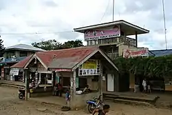 Public market, Barangay San Pascual | |
 Seal | |
| Coordinates: 9°58′10″N 124°26′11″E | |
| Country | Philippines |
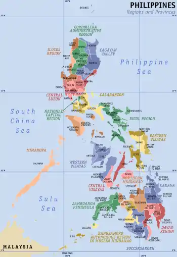
| Region | Central Visayas Region VII |
| Province | Bohol |
| District | 2nd District of Bohol |
| Municipality | Ubay |
| Urban District | I |
| Purok | 7 |
| Government | |
| • Type | Sangguniang Barangay |
| • Barangay Captain | Renato Alacida |
| • Brgy Council | |
| Area | |
| • Total | 973 ha (2,404 acres) |
| Population | |
| • Total | 3,783 |
| • Density | 390/km2 (1,000/sq mi) |
| • Voter (2013)[2] | 1,964 |
| Time zone | UTC+8 (PST) |
| ZIP code | 6315 |
| IDD : area code | +63 (0)38 |
| PSGC | 071246040 |
The barangay's total land area is 973 hectares (2,400 acres).[3] According to the 2015 census, it has a population of 3,783. [1]
San Pascual celebrates its annual fiesta on the last Saturday of April.
Location
Located on the southern part of the municipality, San Pascual is bounded to the north by Lomangog and Imelda, to the east by Biabas, to the west by Bulilis and Gabi, and to the south by the municipality of Alicia. San Pascual is 12 km (7.5 mi) from the town center, Poblacion.
Proposed conversion to a municipality
In 1990, a House Bill was introduced into Congress, for the conversion of San Pascual into a municipality, but never progressed but did not realized because it was opposed because there had been no consultation of the administration of Ubay.
Economy
People in the barangay are mostly farmers who live by planting rice, corn, coconut, banana, vegetables, coffee, cacao, fruit trees, and root crops. Some till agricultural smallholdings.
Government
There are seven puroks overseen by the elected kagawads.
Facilities and Services
The barangay has two high schools:
- San Pascual National Agricultural High School, the largest school in the municipality
- San Pascual Academy
Other barangay facilities are:
- Barangay Chapel
- Barangay Hall
- Barangay Health Center
- Barangay Market
- Barangay Stage
- Basketball Court
- Cultural Center
- Day Care Center
- Elementary School
- Footbridge
- Public Market
- Tanod Outpost
- Water and Irrigation System
- 7 Purok Salakot
References
- Census of Population (2015). "Region VII (Central Visayas)". Total Population by Province, City, Municipality and Barangay. PSA. Retrieved 20 June 2016.
- 2013 Barangay and Sangguniang Kabataan Election
- Saz, Efren B. (January 1, 2007). "A Comprehensive Assessment of the Agricultural Extension System in the Philippines: Case Study of LGU Extension in Ubay, Bohol" (PDF). Philippine Institute for Development Studies. Retrieved January 24, 2015.
External links
Places adjacent to San Pascual, Bohol | |
|---|---|