Umarkhed
Umarkhed is a Municipal council in Yavatmal district of State of Maharashtra.
Umarkhed | |
|---|---|
City | |
 Umarkhed Location in Maharashtra, India | |
| Coordinates: 19.6°N 77.7°E | |
| Country | |
| State | Maharashtra |
| District | Yavatmal |
| Government | |
| • Type | Municipal Council |
| • Body | Umarkhed Municipal Council |
| Elevation | 416 m (1,365 ft) |
| Population (2011)[1] | |
| • Total | 47,458 |
| Demonym(s) | Umarkhed wasi, Umarkhedi |
| Languages | |
| • Official | Marathi |
| Time zone | UTC+5:30 (IST) |
| Vehicle registration | MH 29 |
Geography
Umarkhed is located at 19.6°N 77.7°E.[2] It has an average elevation of 416 metres (1364 feet).
Umarkhed is a municipal town near the Painganga river. It is tehsil place. It is situated 110 km from Yavatmal and 72 km from Nanded. Umarkhed falls in Yavatmal district. It is surrounded by mountains and Ghats from three sides and a plane surface on one of its sides. During the monsoon, one can experience real treasure of nature. Sahastrakund Waterfall in Painganga River near Jewali village is 50 km away from Umarkhed. Visitors come here in August, September and October.
The town experiences both hotter summers and colder winters. The temperature rises up to 45 degrees Celsius in the summer, while in the winter it experiences temperatures of 8 to 12 degrees Celsius.
Demographics
As of 2011 India census,[3] Umarkhed had a population of 47458 . Males constitute 51.13% of the population and females 48.87%. Umarkhed has an average literacy rate of 76.16%, higher than the national average of 61.5%: male literacy is 80.19%, and female literacy is 71.94%. In Umarkhed, 13.71% of the population is under 6 years of age.
Its population in 1961 was 12,647.
Bazar day is wednesday, Near Dargah Hazrat Tatar Shah Baba(R.A)
See also
References
- http://www.censusindia.gov.in/pca/SearchDetails.aspx?Id=572999
- Falling Rain Genomics, Inc - Umarkhed
- "Census of India 2001: Data from the 2001 Census, including cities, villages and towns (Provisional)". Census Commission of India. Archived from the original on 16 June 2004. Retrieved 1 November 2008.
| Topics | |||||||||||||
|---|---|---|---|---|---|---|---|---|---|---|---|---|---|
| Regions | |||||||||||||
| Divisions and Districts |
| ||||||||||||
| Million-plus cities in Maharashtra | |||||||||||||
| Other cities with municipal corporations | |||||||||||||
Portal:India | |||||||||||||
Yavatmal district topics | ||
|---|---|---|
| History | 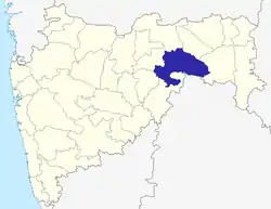 | |
| Geography | ||
| Cities and towns | ||
| Villages | ||
| Transport | ||
| Culture | ||
| Lok Sabha constituencies | ||
| Vidhan Sabha constituencies | ||
Places adjacent to Umarkhed | ||||||||||
|---|---|---|---|---|---|---|---|---|---|---|
| ||||||||||
