Diamond, Utah
Diamond is a ghost town in eastern Juab County, Utah, United States.[1] The Diamond Cemetery is listed on the National Register of Historic Places.[2]
Diamond, Utah | |
|---|---|
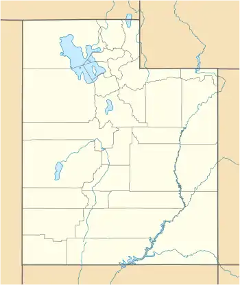 Diamond Location of Diamond within the State of Utah  Diamond Diamond (the United States) | |
| Coordinates: 39°52′54″N 112°05′51″W | |
| Country | United States |
| State | Utah |
| County | Juab |
| Settled | 1870 |
| Named for | Quartz crystals found in the area (oringinally thought to be diamonds) |
| Elevation | 6,253 ft (1,906 m) |
| Time zone | UTC-7 (Mountain (MST)) |
| • Summer (DST) | UTC-6 (MDT) |
| GNIS feature ID | 1455093[1] |
Diamond Cemetery | |
| Location | Diamond, Utah United States |
| Coordinates | 39°52′52″N 112°06′28″W |
| Area | 0.25 acres (0.10 ha) |
| NRHP reference No. | 79003474[2] |
| Added to NRHP | March 14, 1979 |
Description
The site of the former community is along the Diamond Gulch on the western slopes of the East Tintic Mountains, northwest of Sunrise Peak,[3] just east of the Tintic Valley, and about 5 miles (8.0 km) south of Eureka.[4] There are multiple abandoned mines in the surrounding area,[5] and it is considered part of (but south of the active area of) the Tintic Mining District.[6]
The community received its name from the quartz crystals found in the area that were originally thought to be diamonds.[5][7]
History
Diamond was first settled 1870 following the discovery of the "diamonds" in the area.[8] Soon after a post office was established[9] and saloons, stores, and even a school was built.[10] The population eventually grew to about 900, but after water was struck in the nearby mines the last residents moved away in 1890 and the town was abandoned. However, the post office apparently remained open until 1906.[9] The community's last house was moved in 1923.[5] All that remains are the mining tailings and a cemetery.[7]
Diamond Cemetery
The Diamond Cemetery is a small 0.25 acres (0.10 ha) property that is the only remaining remnant of the former town of Diamond (one of the earliest mining camps in the Tintic Mining District. Very little of the original cemetery remains, but at least one gravesite is still maintained and visited by the family of Amber Rose and possibly a new addition to the cemetery in 2014.[10] The cemetery was added to the National Register of Historic Places March 14, 1979.[2][11]
See also
References
- "Diamond". Geographic Names Information System. United States Geological Survey.
- "National Register Information System". National Register of Historic Places. National Park Service. July 9, 2010.
- "Sunrise Peak". Geographic Names Information System. United States Geological Survey.
- "MyTopo Maps - Diamond, Juab County, UT, USA" (Map). mytopo.com. Trimble Navigation, Ltd. Retrieved 22 Feb 2018.
- Van Cott, John W. (1990). Utah Place Names: A Comprehensive Guide to the Origins of Geographic Names: A Compilation. Salt Lake City: University of Utah Press. p. 110. ISBN 978-0-87480-345-7. OCLC 797284427. Retrieved 22 Feb 2018.
- Lindgren, Waldemar; Loughlin, G. F. "Geology and Ore Deposits of the Tintic Mining District, Utah" (PDF). Washington, D.C.: Government Printing Office. p. 15.
- Bezzant, Bob. "Diamond". ghosttowns.com. Retrieved 21 Feb 2018.
- Bagley, Will (6 Aug 2000). "Sack of Gems Made Fools Out of Many". The Salt Lake Tribune. Salt Lake City. Retrieved 23 Feb 2018 – via historytogo.com.
- Forte, Jim. "Post Offices: Utah: Juab". postalhistory.com. Retrieved 23 Feb 2018.
- scoutabout (2 Dec 2016). "Ghost Town: Diamond, Utah". expeditionutah.com. Retrieved 24 Feb 2018. Reference include several photographs of the Diamond Cemetery.
- "National Register of Historic Places Inventory/Nomination: Diamond Cemetery". National Park Service. Retrieved March 11, 2018. With photo from 1977.
External links
| Wikimedia Commons has media related to Diamond, Utah. |
Municipalities and communities of Juab County, Utah, United States | ||
|---|---|---|
| Cities | 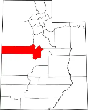 Map of Utah highlighting Juab County | |
| Towns | ||
| Unincorporated communities | ||
| Ghost towns | ||
| Indian reservation | ||
| Footnotes | ‡This populated place also has portions in an adjacent county or counties | |
| ||
 | |||
| Topics | |
|---|---|
| Lists by state |
|
| Lists by insular areas | |
| Lists by associated state | |
| Other areas | |
| Related | |
| |