National Register of Historic Places listings in Chatham County, Georgia
This is a list of properties and districts in Chatham County, Georgia that are listed on the National Register of Historic Places (NRHP).
- This National Park Service list is complete through NPS recent listings posted January 29, 2021.[1]

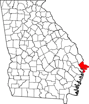
Location of Chatham County in Georgia
Current listings
| [2] | Name on the Register | Image | Date listed[3] | Location | City or town | Description |
|---|---|---|---|---|---|---|
| 1 | Edmund and Mildred Abrahams Raised Tybee Cottage | 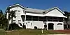 Edmund and Mildred Abrahams Raised Tybee Cottage |
January 27, 2020 (#100004900) |
4 Eighth St. 32°00′13″N 80°50′36″W |
Tybee Island | |
| 2 | Ardsley Park-Chatham Crescent Historic District | 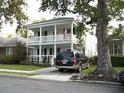 Ardsley Park-Chatham Crescent Historic District |
August 15, 1985 (#85001787) |
Roughly bounded by Ardsley Pk., Chatham Crescent, Bull St., Baldwin Pk. and Ardmore 32°02′50″N 81°05′42″W |
Savannah | |
| 3 | Atlantic Greyhound Bus Terminal |  Atlantic Greyhound Bus Terminal |
December 13, 2016 (#16000837) |
109 Martin Luther King, Jr. Blvd. 32°04′47″N 81°05′51″W |
Savannah | Now houses The Grey Bar & Restaurant. Proposed nomination form Press release |
| 4 | Bethesda Home for Boys | 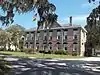 Bethesda Home for Boys |
September 12, 1973 (#73000614) |
S of Savannah at Ferguson Ave. and Bethesda Rd. 31°57′34″N 81°05′43″W |
Savannah | |
| 5 | Bonaventure Cemetery | 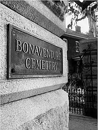 Bonaventure Cemetery |
February 2, 2001 (#01000035) |
Bonaventure Rd., 1 mi. N of US 80 32°02′38″N 81°02′44″W |
Savannah | |
| 6 | Bordley Cottage-Beach View House | _from_ESE_1.JPG.webp) Bordley Cottage-Beach View House |
June 27, 2014 (#14000345) |
1701 Butler Ave. 31°59′27″N 80°51′01″W |
Tybee Island | |
| 7 | The Carbo House | .jpg.webp) The Carbo House |
May 21, 2010 (#10000273) |
9 Tybrisa St. 31°59′31″N 80°50′53″W |
Tybee Island | Weekly boarding as of 2016 |
| 8 | Carver Village Historic District | .jpg.webp) Carver Village Historic District |
January 24, 2019 (#100003340) |
Bounded by W. Gwinnett & Endley Sts., Allen Blun, & Collat Aves. 32°04′16″N 81°07′35″W |
Savannah | |
| 9 | Central of Georgia Depot and Trainshed |  Central of Georgia Depot and Trainshed |
December 8, 1976 (#76000610) |
Martin Luther King Jr Blvd (formerly W. Broad St.) and Liberty Sts. 32°04′34″N 81°05′57″W |
Savannah | Currently the site of the Savannah History Museum |
| 10 | Central of Georgia Railroad: Savannah Shops and Terminal Facilities | 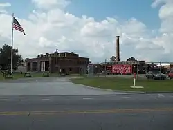 Central of Georgia Railroad: Savannah Shops and Terminal Facilities |
June 2, 1978 (#78000970) |
Martin Luther King Jr Blvd (formerly W. Broad St.) and Railroad Ave. 32°04′33″N 81°06′05″W |
Savannah | A National Historic Landmark and currently the home of the Georgia State Railroad Museum; expansion of the Central of Georgia Depot and Trainshed listing |
| 11 | Central of Georgia Railway Company Shop Property | 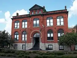 Central of Georgia Railway Company Shop Property |
March 5, 1970 (#70000199) |
Between W. Jones St. and Louisville Rd. 32°04′37″N 81°05′56″W |
Savannah | Now an extension of the SCAD Museum of Art |
| 12 | Charity Hospital | 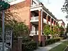 Charity Hospital |
May 2, 1985 (#85000934) |
644 W. 36th St. 32°03′37″N 81°06′29″W |
Savannah | Now Heritage Place Apartments |
| 13 | CSS Georgia (ironclad) | CSS Georgia (ironclad) |
February 10, 1987 (#86003746) |
At the bottom of the Savannah River 32°05′05″N 81°02′09″W |
Savannah | |
| 14 | Cuyler-Brownville Historic District | 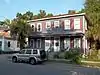 Cuyler-Brownville Historic District |
February 13, 1998 (#98000028) |
Roughly bounded by Anderson Ln., W. 31st St., Montgomery St., Victory Dr., Ogeechee Rd., and Hopkins St. 32°03′30″N 81°06′29″W |
Savannah | |
| 15 | Daffin Park-Parkside Place Historic District | 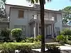 Daffin Park-Parkside Place Historic District |
May 12, 1999 (#99000554) |
Bounded by Victory Dr., Waters Ave., Bee St. and 51st Street Ln. 32°02′37″N 81°04′55″W |
Savannah | |
| 16 | Isaiah Davenport House | 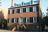 Isaiah Davenport House |
September 22, 1972 (#72000374) |
324 E. State St. 32°04′38″N 81°05′18″W |
Savannah | |
| 17 | Drayton Tower | 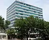 Drayton Tower |
October 16, 2013 (#13000826) |
102 E. Liberty St. 32°04′29″N 81°05′31″W |
Savannah | Originally named the Drayton Arms Apartments |
| 18 | Drouillard-Maupas House | 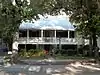 Drouillard-Maupas House |
May 13, 1991 (#91000558) |
2422 Abercorn St. 32°03′11″N 81°05′56″W |
Savannah | |
| 19 | Dutton-Waller Raised Tybee Cottage | 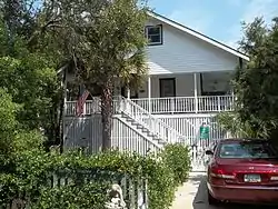 Dutton-Waller Raised Tybee Cottage |
July 24, 2008 (#08000711) |
1416 7th Ave. 31°59′44″N 80°51′13″W |
Tybee Island | |
| 20 | Eastside Historic District | 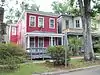 Eastside Historic District |
November 7, 2002 (#02001292) |
Roughly bounded by E. Broad (now MLK Blvd), Cedar, Gwinnett and Anderson Sts. 32°03′36″N 81°05′03″W |
Savannah | |
| 21 | Eureka Club-Farr's Point | 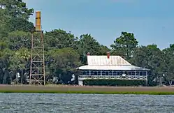 Eureka Club-Farr's Point |
July 8, 2009 (#09000491) |
2326 East Blvd. on Wilmington Island 31°58′18″N 81°00′01″W |
Savannah | |
| 22 | Fairway Oaks-Greenview Historic District | 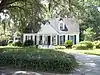 Fairway Oaks-Greenview Historic District |
March 31, 2009 (#09000184) |
Bounded approximately by DeRenne Drive, Waters Avenue, Truman Parkway, and Casey Canal, and the Live Oaks Golf Course 32°01′15″N 81°05′31″W |
Savannah | |
| 23 | Federal Building and U.S. Courthouse | 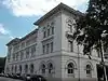 Federal Building and U.S. Courthouse |
June 7, 1974 (#74000663) |
Wright Sq. 32°04′41″N 81°05′35″W |
Savannah | |
| 24 | First Bryan Baptist Church |  First Bryan Baptist Church |
May 22, 1978 (#78000971) |
575 W. Bryan St. 32°04′55″N 81°05′57″W |
Savannah | |
| 25 | Fort James Jackson | 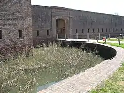 Fort James Jackson |
February 18, 1970 (#70000200) |
Islands Expwy. 32°04′55″N 81°02′10″W |
Savannah | National Historic Landmark |
| 26 | Fort Pulaski National Monument | 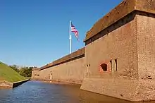 Fort Pulaski National Monument |
October 15, 1966 (#66000064) |
17 mi. W of Savannah, Cockspur Island 32°01′41″N 80°53′50″W |
Savannah | administered by the National Park Service |
| 27 | Fort Screven Historic District |  Fort Screven Historic District |
May 25, 1982 (#82002393) |
Tilton, Butler, Van Horn, Railroad and Alger Aves., and Pulaski Rd. 32°01′24″N 80°51′00″W |
Tybee Island | |
| 28 | Gordonston Historic District |  Gordonston Historic District |
October 11, 2001 (#01000741) |
Roughly bounded by Skidaway Rd., Goebel Ave., Gwinnett St., and Pennsylvania Ave. 32°03′17″N 81°03′47″W |
Savannah | |
| 29 | Green-Meldrim House |  Green-Meldrim House |
January 21, 1974 (#74000664) |
Macon and Bull Sts. 32°04′26″N 81°05′41″W |
Savannah | National Historic Landmark |
| 30 | Hill Hall at Savannah State College | _from_SE_1.JPG.webp) Hill Hall at Savannah State College |
April 23, 1981 (#81000197) |
Savannah State College campus 32°01′27″N 81°03′23″W |
Savannah | |
| 31 | W. B. Hodgson Hall |  W. B. Hodgson Hall |
March 25, 1977 (#77000413) |
501 Whitaker St. 32°04′13″N 81°05′49″W |
Savannah | |
| 32 | Isle of Hope Historic District | 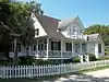 Isle of Hope Historic District |
September 7, 1984 (#84003874) |
Roughly bounded by Skidaway River, Parkersburg Rd., Island, Cornus, and Noble Glen Drs. 31°58′49″N 81°03′21″W |
Savannah | |
| 33 | J. Herbert and Julia Johnson Raised Tybee Cottage | 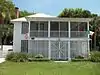 J. Herbert and Julia Johnson Raised Tybee Cottage |
May 21, 2008 (#08000441) |
1306 Jones Ave. 31°59′48″N 80°50′58″W |
Tybee Island | |
| 34 | Kensington Park-Groveland Historic District | .jpg.webp) Kensington Park-Groveland Historic District |
August 30, 2014 (#14000533) |
Roughly bounded by DeRenne & Waters Aves., Abercorn & Johnston Sts. 32°01′24″N 81°06′12″W |
Savannah[4] | |
| 35 | Laurel Grove-North Cemetery | 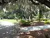 Laurel Grove-North Cemetery |
August 4, 1983 (#83000187) |
W. Anderson St. 32°03′53″N 81°06′31″W |
Savannah | |
| 36 | Laurel Grove-South Cemetery | 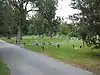 Laurel Grove-South Cemetery |
September 6, 1978 (#78000972) |
37th St. 32°03′37″N 81°06′57″W |
Savannah | |
| 37 | Lebanon Plantation | 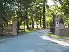 Lebanon Plantation |
November 29, 1979 (#79000704) |
SW of Savannah 32°00′22″N 81°12′38″W |
Savannah | Private property, gated |
| 38 | Juliette Gordon Low Historic District | 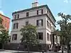 Juliette Gordon Low Historic District |
October 15, 1966 (#66000276) |
10 Oglethorpe Ave., E., 330 Drayton St., 329 Abercorn St. 32°04′37″N 81°05′33″W |
Savannah | National Historic Landmark |
| 39 | Massie Common School House | 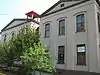 Massie Common School House |
April 13, 1977 (#77000414) |
207 E. Gordon St. 32°04′13″N 81°05′33″W |
Savannah | |
| 40 | Morgan-Ille Cottage | 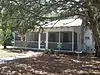 Morgan-Ille Cottage |
July 24, 2008 (#08000713) |
703 2nd Ave. 32°00′19″N 80°50′44″W |
Tybee Island | |
| 41 | Mulberry Grove Site | July 17, 1975 (#75000575) |
Address Restricted (305 S Coastal Hwy) 32°11′N 81°10′W |
Port Wentworth | Left in ruins, reportedly only a marker was left and it is missing[5] | |
| 42 | Mulherin-Righton Raised Tybee Cottage | 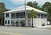 Mulherin-Righton Raised Tybee Cottage |
April 29, 2008 (#08000349) |
14 8th Pl. 32°00′10″N 80°50′39″W |
Tybee Island | |
| 43 | New Ogeechee Missionary Baptist Church | 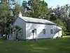 New Ogeechee Missionary Baptist Church |
August 8, 2001 (#01000854) |
751 Chevis Rd. 31°58′40″N 81°14′57″W |
Savannah | |
| 44 | Nicholsonville Baptist Church | 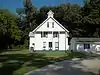 Nicholsonville Baptist Church |
May 22, 1978 (#78000969) |
White Bluff Rd. 31°57′30″N 81°08′18″W |
Nicholsonville | |
| 45 | Ossabaw Island | May 6, 1996 (#96000468) |
7 mi. S of Savannah, bounded by the Atlantic Ocean, Bear R., Ogeechee R., and St. Catherine's Sound 31°47′40″N 81°06′44″W |
Savannah | ||
| 46 | Owens-Thomas House | 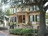 Owens-Thomas House |
May 11, 1976 (#76000611) |
124 Abercorn St. 32°04′39″N 81°05′22″W |
Savannah | National Historic Landmark |
| 47 | Pine Gardens Historic District | .jpg.webp) Pine Gardens Historic District |
November 5, 2014 (#14000890) |
Roughly bounded by Goebel Ave., Beech & Capitol Sts. 32°04′00″N 81°03′23″W |
Savannah | |
| 48 | James and Odessa Rourke, Jr., Raised Tybee Cottage | 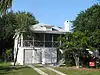 James and Odessa Rourke, Jr., Raised Tybee Cottage |
September 23, 2010 (#10000804) |
702 14th St. 31°59′49″N 80°51′10″W |
Tybee Island | |
| 49 | St. Bartholomew's Church | 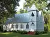 St. Bartholomew's Church |
June 17, 1982 (#82002391) |
Chevis Rd. 31°58′13″N 81°14′42″W |
Burroughs | |
| 50 | St. Philip AME Church | 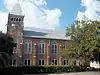 St. Philip AME Church |
August 2, 1984 (#84000959) |
613 Martin Luther King Jr Blvd (formerly W. Broad St.) 32°04′13″N 81°06′05″W |
Savannah | |
| 51 | Savannah and Ogeechee Canal | 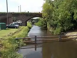 Savannah and Ogeechee Canal |
August 11, 1997 (#97000814) |
Roughly along I-95, between the Savannah and Ogeechee Rivers 32°03′40″N 81°13′18″W |
Chatham | |
| 52 | Savannah Historic District | 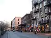 Savannah Historic District |
November 13, 1966 (#66000277) |
Bounded by E. Broad, Gwinnett, and W. Broad Sts. and the Savannah River (Broad St. is now MLK Blvd) 32°04′28″N 81°05′30″W |
Savannah | National Historic Landmark |
| 53 | Savannah Pharmacy and Fonvielle Office Building | February 20, 2013 (#13000023) |
914-918 Martin Luther King, Jr. Blvd. 32°04′02″N 81°06′08″W |
Savannah | Demolished in 2014[6] | |
| 54 | Savannah Victorian Historic District | _(Savannah%252C_Georgia).jpg.webp) Savannah Victorian Historic District |
December 11, 1974 (#74000665) |
Roughly bounded by Gwinnett, Price, Anderson, and Montgomery Sts.; also the area bounded by Gwinnett, Anderson and 31st Sts. 32°03′53″N 81°05′49″W |
Savannah | Second set of boundaries represents a boundary increase of May 20, 1982 (refnum 82002392) |
| 55 | William Scarbrough House |  William Scarbrough House |
June 22, 1970 (#70000201) |
41 Martin Luther King Jr Blvd (formerly W. Broad St.) 32°04′52″N 81°05′50″W |
Savannah | National Historic Landmark, now houses the Ships of the Sea Maritime Museum |
| 56 | Sea View Apartments |  Sea View Apartments |
April 22, 2003 (#03000286) |
7 18th St. 31°59′21″N 80°50′57″W |
Tybee Island | |
| 57 | Slotin Building |  Slotin Building |
March 24, 1983 (#83000188) |
101 Martin Luther King Jr Blvd (formerly W. Broad St.) 32°04′48″N 81°05′52″W |
Savannah | Now Bergen Hall of the Savannah College of Art and Design |
| 58 | Oliver Sturges House |  Oliver Sturges House |
July 14, 1971 (#71000271) |
27 Abercorn St. 32°04′45″N 81°05′24″W |
Savannah | |
| 59 | Telfair Academy | 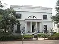 Telfair Academy |
May 11, 1976 (#76000612) |
121 Barnard St. 32°04′44″N 81°05′43″W |
Savannah | National Historic Landmark |
| 60 | Thomas Square Streetcar Historic District | 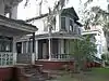 Thomas Square Streetcar Historic District |
July 29, 1997 (#97000813) |
Roughly bounded by Anderson Ln., 42nd St., Victory Dr., E. Broad St., and Martin Luther King, Jr. Blvd. 32°03′28″N 81°05′56″W |
Savannah | |
| 61 | Two Pierpont Circle | 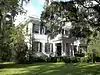 Two Pierpont Circle |
April 4, 1990 (#90000492) |
2 Pierpont Cir. 32°03′17″N 81°04′01″W |
Savannah | |
| 62 | Tybee Island Back River Historic District | 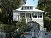 Tybee Island Back River Historic District |
August 5, 1999 (#99000928) |
Along Chatham Ave., from Tybee River to Venetian Dr. 31°59′27″N 80°51′09″W |
Tybee Island | |
| 63 | Tybee Island Strand Cottages Historic District | .jpg.webp) Tybee Island Strand Cottages Historic District |
April 2, 1999 (#98000971) |
Selected properties between Butler Ave. and Atlantic Ocean, between 12 St. and 14th St. 31°59′47″N 80°50′49″W |
Tybee Island | |
| 64 | U.S. Customhouse | 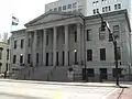 U.S. Customhouse |
May 29, 1974 (#74000666) |
1-3 E. Bay St. 32°04′50″N 81°05′28″W |
Savannah | |
| 65 | Vernonburg Historic District | 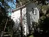 Vernonburg Historic District |
June 22, 2000 (#00000714) |
Dancy Ave., Rockwell Ave. and S. Rockwell Ave. 31°58′19″N 81°07′34″W |
Vernonburg | |
| 66 | Edgar A. Weil House | .jpg.webp) Edgar A. Weil House |
October 4, 2016 (#16000686) |
802 14th St. 31°59′49″N 80°51′14″W |
Tybee Island | |
| 67 | Wild Heron | 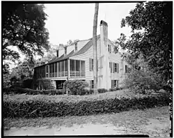 Wild Heron |
December 16, 1977 (#77000415) |
15 mi. SW of Savannah off U.S. 17; 2148 Grove Point Rd. 31°58′14″N 81°13′08″W |
Savannah | |
| 68 | Wormsloe Plantation | .jpg.webp) Wormsloe Plantation |
April 26, 1973 (#73000615) |
Isle of Hope and Long Island 31°57′53″N 81°04′14″W |
Savannah | Now a Georgia state historic site |
References
- "National Register of Historic Places: Weekly List Actions". National Park Service, United States Department of the Interior. Retrieved on January 29, 2021.
- Numbers represent an alphabetical ordering by significant words. Various colorings, defined here, differentiate National Historic Landmarks and historic districts from other NRHP buildings, structures, sites or objects.
- The eight-digit number below each date is the number assigned to each location in the National Register Information System database, which can be viewed by clicking the number.
- Kensington Park, Groveland gain historic status, by Eric Curl, Savannah Morning News, September 23, 2013
- "Mulberry Grove Marker - Historic Markers Across Georgia". Retrieved 9 March 2017.
- Curl, Eric. "Historic MLK pharmacy demolition begins". Savannah Morning News. 2014-07-30. Retrieved 2015-01-25.
| Wikimedia Commons has media related to National Register of Historic Places in Chatham County, Georgia. |
This article is issued from Wikipedia. The text is licensed under Creative Commons - Attribution - Sharealike. Additional terms may apply for the media files.