National Register of Historic Places listings in Newton County, Georgia
This is a list of properties and districts in Newton County, Georgia that are listed on the National Register of Historic Places (NRHP).
- This National Park Service list is complete through NPS recent listings posted February 5, 2021.[1]

Current listings
| [2] | Name on the Register | Image | Date listed[3] | Location | City or town | Description |
|---|---|---|---|---|---|---|
| 1 | Brick Store |  Brick Store |
April 9, 2009 (#09000186) |
U.S. Route 278 at Old Social Circle Road 33°36′07″N 83°44′42″W |
Covington | |
| 2 | Burge Farm | May 11, 2000 (#00000467) |
Roughly bounded by GA 142, Cook Rd., Morehouse Rd. and Sewell Rd. 33°32′47″N 83°43′47″W |
Newborn | ||
| 3 | Covington Historic District | August 6, 1998 (#98000969) |
Roughly Covington City S of US 278 33°35′41″N 83°51′12″W |
Covington | ||
| 4 | Covington Mills and Mill Village Historic District | April 14, 2000 (#00000370) |
Roughly bounded by Wheat, Collins and Lott Sts. and, to the north, the Covington Mills pond and Creek 33°36′19″N 83°50′50″W |
Covington | ||
| 5 | Floyd Street Historic District | December 4, 1974 (#74000699) |
Floyd St. from Elm to W of Sockwell St. 33°35′48″N 83°51′20″W |
Covington | ||
| 6 | Newborn Historic District | August 6, 1998 (#98000970) |
Roughly the entire city limits of Newborn City 33°31′09″N 83°41′45″W |
Newborn | ||
| 7 | Newton County Courthouse | 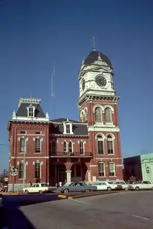 Newton County Courthouse |
September 18, 1980 (#80001216) |
Courthouse Sq. 33°35′49″N 83°51′37″W |
Covington | |
| 8 | North Covington Historic District | May 26, 2000 (#00000526) |
N. Emory and Odum Sts. and Georgia (CSX) Railroad 33°36′26″N 83°51′48″W |
Covington | ||
| 9 | Orna Villa |  Orna Villa |
January 29, 1973 (#73000636) |
1008 N. Emory St. 33°37′27″N 83°51′59″W |
Oxford | |
| 10 | Oxford Historic District |  Oxford Historic District |
June 5, 1975 (#75000603) |
College and residential district centered around Wesley St. 33°37′32″N 83°52′13″W |
Oxford | |
| 11 | Porterdale Historic District | September 17, 2001 (#01000974) |
Roughly the city limits of Porterdale north of Elm St. 33°34′23″N 83°53′45″W |
Porterdale | ||
| 12 | Salem Camp Ground | March 5, 1998 (#98000175) |
3940 Salem Rd. 33°35′10″N 83°57′54″W |
Covington | ||
| 13 | Starrsville Historic District | June 26, 1998 (#98000715) |
Jct. GA 213, Old Starsville and Dixie Rds. 33°31′44″N 83°48′35″W |
Starrsville |
References
- "National Register of Historic Places: Weekly List Actions". National Park Service, United States Department of the Interior. Retrieved on February 5, 2021.
- Numbers represent an alphabetical ordering by significant words. Various colorings, defined here, differentiate National Historic Landmarks and historic districts from other NRHP buildings, structures, sites or objects.
- The eight-digit number below each date is the number assigned to each location in the National Register Information System database, which can be viewed by clicking the number.
| Wikimedia Commons has media related to National Register of Historic Places in Newton County, Georgia. |
| Topics | |
|---|---|
| Lists by state |
|
| Lists by insular areas | |
| Lists by associated state | |
| Other areas | |
| Related | |
| |
This article is issued from Wikipedia. The text is licensed under Creative Commons - Attribution - Sharealike. Additional terms may apply for the media files.