National Register of Historic Places listings in Terrell County, Georgia
This is a list of properties and districts in Terrell County, Georgia that are listed on the National Register of Historic Places (NRHP).
- This National Park Service list is complete through NPS recent listings posted February 5, 2021.[1]

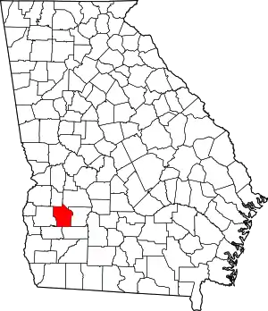
Location of Terrell County in Georgia
Current listings
| [2] | Name on the Register | Image | Date listed[3] | Location | City or town | Description |
|---|---|---|---|---|---|---|
| 1 | Bronwood Calaboose | June 22, 1982 (#82002483) |
GA 118 31°49′54″N 84°21′46″W |
Bronwood | ||
| 2 | Dawson Historic District | .jpg.webp) Dawson Historic District |
September 4, 1997 (#97001090) |
Roughly bounded by US 80, Pecan St., Seaboard Airline RR tracks, Crawford St., Thirteenth Ave., and Cent. of GA RR track 31°46′25″N 84°26′25″W |
Dawson | |
| 3 | Martin Elementary School | May 12, 2008 (#08000397) |
608 Church St. 31°49′32″N 84°21′30″W |
Bronwood | ||
| 4 | Parrott Historic District | 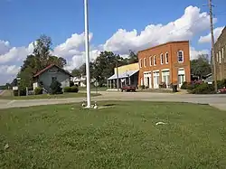 Parrott Historic District |
May 26, 2004 (#04000528) |
Roughly centered on the jct. of Main St. and GA Hwy 55/GA Hwy 520 31°53′33″N 84°30′36″W |
Parrott | |
| 5 | Sasser Commercial Historic District | 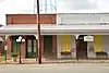 Sasser Commercial Historic District |
August 18, 1983 (#83000243) |
Address Restricted 31°43′12″N 84°20′52″W |
Sasser | |
| 6 | Terrell County Courthouse | 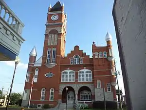 Terrell County Courthouse |
September 18, 1980 (#80001244) |
E. Lee St. 31°46′23″N 84°26′45″W |
Dawson |
Former listings
| [2] | Name on the Register | Image | Date listed | Date removed | Location | City or town | Summary |
|---|---|---|---|---|---|---|---|
| 1 | Dawson Woman's Clubhouse | 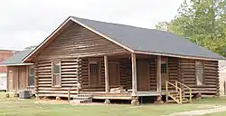 Dawson Woman's Clubhouse |
June 17, 1982 (#82002484) | October 31, 2019 | 360 6th Ave., NE, but moved to the corner of 7th Ave and Stonewall in October 2017 31°46′32″N 84°26′44″W |
Dawson | Log cabin structure built for public purpose, of the local Woman's Club. Delisted because it was moved to a nearby location. |
References
- "National Register of Historic Places: Weekly List Actions". National Park Service, United States Department of the Interior. Retrieved on February 5, 2021.
- Numbers represent an alphabetical ordering by significant words. Various colorings, defined here, differentiate National Historic Landmarks and historic districts from other NRHP buildings, structures, sites or objects.
- The eight-digit number below each date is the number assigned to each location in the National Register Information System database, which can be viewed by clicking the number.
| Wikimedia Commons has media related to National Register of Historic Places in Terrell County, Georgia. |
This article is issued from Wikipedia. The text is licensed under Creative Commons - Attribution - Sharealike. Additional terms may apply for the media files.