National Register of Historic Places listings in Catoosa County, Georgia
This is a list of properties and districts in Catoosa County, Georgia that are listed on the National Register of Historic Places (NRHP).
- This National Park Service list is complete through NPS recent listings posted February 5, 2021.[1]

Current listings
| [2] | Name on the Register | Image | Date listed[3] | Location | City or town | Description |
|---|---|---|---|---|---|---|
| 1 | Blackford-Gray House |  Blackford-Gray House |
April 4, 2007 (#07000247) |
319 Gray St. 34°58′38″N 85°08′34″W |
Graysville | |
| 2 | Catoosa County Courthouse |  Catoosa County Courthouse |
September 20, 2006 (#06000844) |
7694 Nashville St. 34°54′56″N 85°06′39″W |
Ringgold | |
| 3 | Chickamauga and Chattanooga National Military Park |  Chickamauga and Chattanooga National Military Park |
October 15, 1966 (#66000274) |
S of Chattanooga on U.S. 27 34°58′09″N 85°17′07″W |
Fort Oglethorpe | administered by the National Park Service |
| 4 | Fort Oglethorpe Historic District | Fort Oglethorpe Historic District |
April 20, 1979 (#79000702) |
U.S. 27 34°56′46″N 85°15′46″W |
Fort Oglethorpe | |
| 5 | Ringgold Commercial Historic District | .jpg.webp) Ringgold Commercial Historic District |
January 30, 1992 (#91002001) |
Nashville St. between Tennessee and Depot Sts. 34°54′56″N 85°06′30″W |
Ringgold | |
| 6 | Ringgold Depot | .JPG.webp) Ringgold Depot |
November 30, 1978 (#78000968) |
U.S. 41 34°54′55″N 85°06′28″W |
Ringgold | |
| 7 | Ringgold Gap Battlefield | 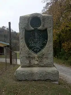 Ringgold Gap Battlefield |
March 12, 2011 (#11000079) |
White Oak Mountain, east of Ringgold and north of Interstate 75, and the northeast face of Taylor Ridge south of I-75 34°54′36″N 85°06′10″W |
Ringgold | Chickamauga-Chattanooga Civil War-Related Sites in Georgia and Tennessee MPS |
| 8 | Stone Church | .JPG.webp) Stone Church |
November 29, 1979 (#79000703) |
E of Ringgold off U.S. 76 34°54′23″N 85°04′37″W |
Ringgold | |
| 9 | Whitman-Anderson House | .JPG.webp) Whitman-Anderson House |
October 5, 1977 (#77000412) |
309 Tennessee St. 34°55′03″N 85°06′33″W |
Ringgold |
References
- "National Register of Historic Places: Weekly List Actions". National Park Service, United States Department of the Interior. Retrieved on February 5, 2021.
- Numbers represent an alphabetical ordering by significant words. Various colorings, defined here, differentiate National Historic Landmarks and historic districts from other NRHP buildings, structures, sites or objects.
- The eight-digit number below each date is the number assigned to each location in the National Register Information System database, which can be viewed by clicking the number.
| Wikimedia Commons has media related to National Register of Historic Places in Catoosa County, Georgia. |
This article is issued from Wikipedia. The text is licensed under Creative Commons - Attribution - Sharealike. Additional terms may apply for the media files.