National Register of Historic Places listings in Liberty County, Georgia
This is a list of the National Register of Historic Places listings in Liberty County, Georgia.
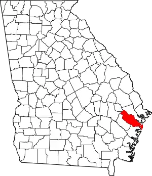
Location of Liberty County in Georgia
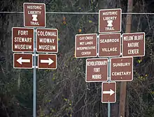
Liberty County has a "Liberty Trail" of its historic sites.
It is intended to be a complete list of the properties on the National Register of Historic Places in Liberty County, Georgia, United States. The locations of National Register properties for which the latitude and longitude coordinates are included below, may be seen in a Google map.[1]
There are 12 properties listed on the National Register in the county.
- This National Park Service list is complete through NPS recent listings posted January 29, 2021.[2]

Current listings
| [3] | Name on the Register | Image | Date listed[4] | Location | City or town | Description |
|---|---|---|---|---|---|---|
| 1 | Bacon-Fraser House | 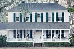 Bacon-Fraser House |
April 18, 1985 (#85000848) |
208 E. Court St. 31°50′53″N 81°35′37″W |
Hinesville | |
| 2 | Eddie Bowens Farm | Eddie Bowens Farm |
October 25, 2004 (#04001209) |
660 Trade Hill Rd. 31°44′38″N 81°19′10″W |
Seabrook | |
| 3 | Cassels' Store | 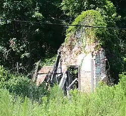 Cassels' Store |
August 5, 1983 (#83000232) |
Off U.S. Route 84 31°49′36″N 81°31′44″W |
McIntosh | Parts of the opposite wall are still standing |
| 4 | Dorchester Academy Boys' Dormitory |  Dorchester Academy Boys' Dormitory |
June 23, 1986 (#86001371) |
8787 East Oglethorpe Highway (U.S. Route 84) 31°48′02″N 81°27′56″W |
Midway | National Historic Landmark |
| 5 | Flemington Presbyterian Church |  Flemington Presbyterian Church |
June 17, 1982 (#82002449) |
Off Old Sunbury Rd. 31°52′11″N 81°34′15″W |
Flemington | |
| 6 | Fort Morris | .JPG.webp) Fort Morris |
May 13, 1970 (#70000208) |
2559 Fort Morris Road 31°46′04″N 81°16′52″W |
Midway | Fort Morris State Historic Site is a state park open to the public[5] |
| 7 | Liberty County Courthouse |  Liberty County Courthouse |
September 18, 1980 (#80001105) |
Courthouse Sq. 31°50′52″N 81°35′45″W |
Hinesville | |
| 8 | Liberty County Jail | 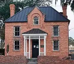 Liberty County Jail |
August 18, 1992 (#92001036) |
302 S. Main St. 31°50′44″N 81°35′47″W |
Hinesville | Historic brick jail built in 1892. |
| 9 | Midway Historic District |  Midway Historic District |
March 1, 1973 (#73000625) |
Junction of U.S. Route 17 and Martin Road 31°48′22″N 81°25′51″W |
Midway | |
| 10 | Sam Ripley Farm |  Sam Ripley Farm |
October 27, 2004 (#04001187) |
1337 Dorchester Village Rd. 31°45′39″N 81°22′12″W |
Midway | Farm established in 1926 |
| 11 | St. Catherines Island |  St. Catherines Island |
December 16, 1969 (#69000332) |
One of the barrier islands of Georgia, south of Savannah. 31°37′56″N 81°09′48″W |
South Newport | National Historic Landmark |
| 12 | Woodmanston Site | 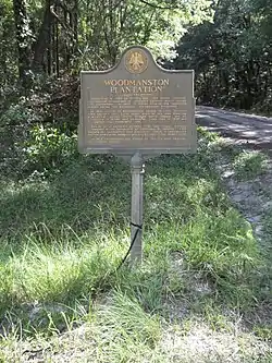 Woodmanston Site |
June 18, 1973 (#73000626) |
Southwest of Riceboro off Barrington Rd. 31°41′52″N 81°28′23″W |
Riceboro | The site is gated, but you can visit the site by appointment. |
References
- The latitude and longitude information provided in this table was derived originally from the National Register Information System, which has been found to be fairly accurate for about 99% of listings. Some locations in this table may have been corrected to current GPS standards.
- "National Register of Historic Places: Weekly List Actions". National Park Service, United States Department of the Interior. Retrieved on January 29, 2021.
- Numbers represent an alphabetical ordering by significant words. Various colorings, defined here, differentiate National Historic Landmarks and historic districts from other NRHP buildings, structures, sites or objects.
- The eight-digit number below each date is the number assigned to each location in the National Register Information System database, which can be viewed by clicking the number.
- National Park Service: Fort Morris
| Wikimedia Commons has media related to National Register of Historic Places in Liberty County, Georgia. |
This article is issued from Wikipedia. The text is licensed under Creative Commons - Attribution - Sharealike. Additional terms may apply for the media files.