National Register of Historic Places listings in Grady County, Georgia
This is a list of properties and districts in Grady County, Georgia that are listed on the National Register of Historic Places (NRHP).
- This National Park Service list is complete through NPS recent listings posted February 5, 2021.[1]

Current listings
| [2] | Name on the Register | Image | Date listed[3] | Location | City or town | Description |
|---|---|---|---|---|---|---|
| 1 | Cairo Commercial Historic District |  Cairo Commercial Historic District |
May 26, 1994 (#94000525) |
Roughly bounded by Broad St., Railroad Ave. and Martin Luther King Ave., with adjacent properties on 2nd Ave. and 1st St 30°52′37″N 84°12′32″W |
Cairo | Former Belk, Broad Ave. |
| 2 | Dickey-Birdsong Plantation | 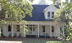 Dickey-Birdsong Plantation |
June 20, 1995 (#95000741) |
Meridian Rd., off State Route 93 west of Beachton 30°42′11″N 84°11′35″W |
Beachton | Now Birdsong Nature Center on Birdsong Rd |
| 3 | Ebenezer African Methodist Episcopal Church and School | 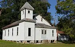 Ebenezer African Methodist Episcopal Church and School |
July 23, 2008 (#08000714) |
232 Martin Ave. 30°53′05″N 84°19′46″W |
Whigham | |
| 4 | Evergreen Congregational Church and School | 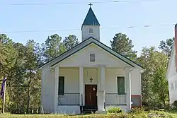 Evergreen Congregational Church and School |
October 31, 2002 (#02001260) |
497 Meridian Rd. 30°43′42″N 84°08′13″W |
Beachton | |
| 5 | Ochlocknee Missionary Baptist Church and Cemetery | 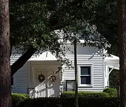 Ochlocknee Missionary Baptist Church and Cemetery |
November 17, 2010 (#10000924) |
521 U.S. Route 319 S. 30°45′26″N 84°05′33″W |
Beachton | |
| 6 | Pebble Hill Plantation | .jpg.webp) Pebble Hill Plantation |
February 23, 1990 (#90000146) |
U.S. Route 319, 4 miles southwest of Thomasville 30°46′49″N 84°03′50″W |
Thomasville | |
| 7 | Sasser Farm | September 8, 1983 (#83000230) |
Sasser Farm Rd. south of Cairo 30°47′11″N 84°14′20″W |
Cairo | ||
| 8 | Susina Plantation | 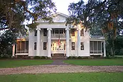 Susina Plantation |
August 12, 1970 (#70000205) |
West of Beachton on Meridian Rd. 30°43′16″N 84°10′06″W |
Beachton |
References
- "National Register of Historic Places: Weekly List Actions". National Park Service, United States Department of the Interior. Retrieved on February 5, 2021.
- Numbers represent an alphabetical ordering by significant words. Various colorings, defined here, differentiate National Historic Landmarks and historic districts from other NRHP buildings, structures, sites or objects.
- The eight-digit number below each date is the number assigned to each location in the National Register Information System database, which can be viewed by clicking the number.
| Wikimedia Commons has media related to National Register of Historic Places in Grady County, Georgia. |
| Topics | |
|---|---|
| Lists by state |
|
| Lists by insular areas | |
| Lists by associated state | |
| Other areas | |
| Related | |
| |
This article is issued from Wikipedia. The text is licensed under Creative Commons - Attribution - Sharealike. Additional terms may apply for the media files.